Arcot is a town and urban area of Ranipet district in the state of Tamil Nadu, India. Located on the southern banks of Palar River, the city straddles a trade route between Chennai and Bangalore or Salem, between the Mysore Ghat and the Javadi Hills. As of 2018, the city had a population 129,640. The sweet makkan peda is a local speciality while Arcot biryani, a rice-based traditional food, is also served here.
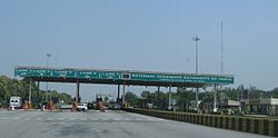
Vellore, is a sprawling city and the administrative headquarters of Vellore district in the Indian state of Tamil Nadu. It is located on the banks of the Palar River in the northeastern part of Tamil Nadu and is separated into four zones that are further subdivided into 60 wards, covering an area of 87.915 km2 and housing a population of 423,425 as reported by the 2001 census. It is located about 137.20 kilometres (85 mi) west of Chennai, and about 213.20 kilometres (132 mi) east of Bangalore. Vellore is located on the Mumbai–Chennai arm of the Golden Quadrilateral. Vellore is governed under a mayor and the Vellore Municipal Corporation. It is a part of both the Lok Sabha and state assembly constituencies of Vellore.
Kanchipuram district is one of the 38 districts in the state of Tamil Nadu in India. The area comprising the present day Kancheepuram district was earlier a part of Chingleput district. The original Chingleput district was split in 1997 into form the present day Kanchiepuram and Tiruvallur districts.

Palar is a river of southern India. It rises in the Nandi Hills in Chikkaballapura district of Karnataka state, and flows 93 kilometres (58 mi) in Karnataka, 33 kilometres (21 mi) in Andhra Pradesh and 222 kilometres (138 mi) in Tamil Nadu before reaching its confluence into the Bay of Bengal at Vayalur about 75 kilometres (47 mi) south of Chennai. It flows as an underground river for a long distance only to emerge near Bethamangala town, from where, gathering water and speed, it flows eastward down the Deccan Plateau. The Towns of Bethamangala, Santhipuram, Kuppam,Mottur, Ramanaickenpet, Vaniyambadi, Ambur, Melpatti, Gudiyatham, Pallikonda, Anpoondi, Melmonavoor, Vellore, Katpadi, Melvisharam, Arcot, Ranipet, Walajapet, Kanchipuram, Walajabad, Chengalpattu, Kalpakkam, and Lattur are located on the banks of the Palar River. Of the seven tributaries, the chief tributary is the Cheyyar River.

Walajapet is a town or municipality and a part of Ranipet district, Vellore Region, in the state of Tamil Nadu. The streets in the town form a square shape which is a unique feature of the town. It will be easy for you to reach any part of the town with this kind of infrastructure. The streets are wide and nicely structured. As of 2023, the town had a population of 63,000.
Gudiyetram, colloquially Gudiyattam is a municipality in Vellore district in the state of Tamil Nadu in India. It lies between Bangalore and Chennai and the district of Vellore is 33 km away from the town. In 2011, the town had a population of 235,672. The municipality derives its name from 'Gudiye-tram' in Tamil which means habituation of people. The ancient occupation of the people of Guidyatham was handloom weaving.
Ranipettai is a town in Tamil Nadu, India and the headquarters of Ranipet district. Ranipet is an industrial hub of greater Vellore city. It is located about 100 kilometres (62 mi) from the Chennai city center. It is a major industrial town located on NH 4 Chennai-Bangalore highway, on the northern bank of the Palar River.The estimated population is 387,000 as of 2023.

Vellore district is one of the 38 districts in the Tamil Nadu state of India. It is one of the eleven districts that form the north region of Tamil Nadu. Vellore city is the headquarters of this district. As of 2011, the district had a population of 1,614,242 with a sex ratio of 1,007 females for every 1,000 males. In 2017 Vellore district ranked eleventh in list of districts in Tamil Nadu by Human Development Index.

Ambur is a town and municipality in newly announced Tirupathur district, Vellore region of Tamil Nadu, India. It is located on the banks of the Palar River between Chennai and Bangalore. Ambur has a sizeable leather industry, and is known for its spicy biryani and for the sweet, makkhenpeda. Ambur was the site of two major military actions in the 18th century. The first was the 1749 Battle of Ambur that opened the Second Carnatic War between the Arcot State and the Mughal Empire. In 1767, the siege of Ambur took place during the First Anglo-Mysore War, with local troops and a British force successfully resisting an attack by the Kingdom of Mysore and by the Hyderabad State.

Vaniyambadi is a town in the Tirupattur district of Tamil Nadu and the headquarter for the Vaniyambadi Revenue district comprising Vaniyambadi and Ambur. It is located about 200 km from Chennai and 178 kilometer from Bengaluru. The Vaniyambadi Municipality was formed by the G.O. MS. No. 421 Local & Municipality Dept. in April 1886. In 1996 this Municipality was upgraded to Grade II Municipality by G.O. MS. NO. 118 Rural Development Local Administration Dept. dated 01.05.1996. In 1998 this Municipality was upgraded to 1st Grade.
Jolarpettai is a railway town in Tirupattur district, Tamil Nadu, India. It is a commuter rail hub in Southern Railway. It is 7 km from district Tirupattur and 18 km from Vaniyambadi.
Kalavai is a panchayat town in Ranipet district in the Indian state of Tamil Nadu. The main occupation represented in the area is farming. The town has a pond and a lake after rainy season. Villagers use the lake water and palar river for irrigation. Corporation Bank, State Bank Of India and Indian Bank are the banks that have branches in the locality. The secondary occupation is garment outlets. One government higher secondary school is also located in a nearby village.
Kaveripakkam is a town panchayat in Ranipet district in the Indian state of Tamil Nadu.
Melvisharam is a town and suburb of Vellore city in the Indian state of Tamil Nadu. It is 7 kilometres from Ranipet, 5 km from historic town of Arcot and 17 km from Vellore city.
Thammampatti is a Town Panchayat in the Gangavalli taluk of Salem District of Tamil Nadu, India. The town is located between Pachamalai and the Kolli Hills on the banks of the River Swetha bordering Tiruchirappalli district, and is known mainly for its fine wood carvings.

Mahendravadi is a historical ancient 6th Century Pallava Dynasty Town during Mahendra Varman 1, in Nemili taluk, Tamil Nadu, in northern Tamil Nadu of India.
Pernambut is a town and village headquarters also a Municipality in Vellore district in the Indian state of Tamil Nadu. The economy is dependent on leather tanning industry, earning it the nickname Leather Tanning city of Tamil Nadu. Pernambut is a municipality and headquarters of Pernambut Taluk which is an administrative division comprising 52 Revenue villages in the district of Vellore.
Karivedu is famed village is located in Ranipet district, Tamil Nadu. The initial present in the name of the village literally signifies the town Kalavai which is present nearby to the village. To discriminate karivedu from Vellore district the name is used by Karivelangadu. Karivedu is situated in between Arcot and Kalavai road. It is 15 km from Arcot and 8 km from Kalavai. It belongs to Arcot municipality and taluk. The postal pincode is 632506.
Sakkaramallur is an Indian village panchayat located in Arcot Taluk of Vellore District in the state of Tamil Nadu. Sakkaramallur is located on Right Bank of Palar River.

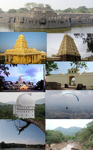
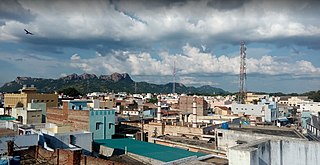
Tirupathur or Tirupattur is the headquarters of Tirupathur district in the state of Tamil Nadu in India and is one of the oldest inhabited places in the state, with a history of over 1,600 years. The town is known for an abundance of sandalwood in the surrounding hills. It is located about 89 km (55 mi) from Vellore, 85 km (53 mi) from Hosur, 60 km (37 mi) from Dharmapuri, 50 km (31 mi) from Krishnagiri, 50 km (31 mi) from Thiruvannamalai, 210 km (130 mi) from Chennai, and 125 km (78 mi) from Bangalore.