
Canals or artificial waterways are waterways or engineered channels built for drainage management or for conveyancing water transport vehicles. They carry free, calm surface flow under atmospheric pressure, and can be thought of as artificial rivers.

This is a list of the lists of islands in the world grouped by country, by continent, by body of water, and by other classifications. For rank-order lists, see the other lists of islands below.

The Panama Canal is an artificial 82 km (51 mi) waterway in Panama that connects the Atlantic Ocean with the Pacific Ocean and divides North and South America. The canal cuts across the Isthmus of Panama and is a conduit for maritime trade. One of the largest and most difficult engineering projects ever undertaken, the Panama Canal shortcut greatly reduces the time for ships to travel between the Atlantic and Pacific oceans, enabling them to avoid the lengthy, hazardous Cape Horn route around the southernmost tip of South America via the Drake Passage or Strait of Magellan.
Transportation infrastructure in Romania is the property of the state, and is administered by the Ministry of Transport and Infrastructure, Constructions and Tourism, except when operated as a concession, in which case the concessions are made by the Ministry of Administration and Interior.
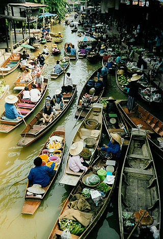
A waterway is any navigable body of water. Broad distinctions are useful to avoid ambiguity, and disambiguation will be of varying importance depending on the nuance of the equivalent word in other languages. A first distinction is necessary between maritime shipping routes and waterways used by inland water craft. Maritime shipping routes cross oceans and seas, and some lakes, where navigability is assumed, and no engineering is required, except to provide the draft for deep-sea shipping to approach seaports (channels), or to provide a short cut across an isthmus; this is the function of ship canals. Dredged channels in the sea are not usually described as waterways. There is an exception to this initial distinction, essentially for legal purposes, see under international waters.

The Danube–Black Sea Canal is a navigable canal in Romania, which runs from Cernavodă on the Danube river, via two branches, to Constanța and Năvodari on the Black Sea. Administered from Agigea, it is an important part of the waterway link between the North Sea and the Black Sea via the Rhine–Main–Danube Canal. The main branch of the canal, with a length of 64.4 km (40.0 mi), which connects the Port of Cernavodă with the Port of Constanța, was built in 1976–1984, while the northern branch, known as the Poarta Albă–Midia Năvodari Canal, with a length of 31.2 km (19.4 mi), connecting Poarta Albă and the Port of Midia, was built between 1983 and 1987.

An inland port is a port on an inland waterway, such as a river, lake, or canal, which may or may not be connected to the sea. The term "inland port" is also used to refer to a dry port.

Odžaci is a town and municipality located in the West Bačka District of the autonomous province of Vojvodina, Serbia. The town of Odžaci has a population of 8,795 people, while the population of the municipality of Odžaci is 30,196 people.

A summit-level canal is an artificial waterway connecting two separate river valleys. The term refers to a canal that rises to cross a summit then falls down the other side. The summit pound is a level stretch of water at the highest part of the canal, contained by two locks that prevent the water from flowing downstream in both directions. Since water flows out when locks open to admit boats, the summit pound must have a water supply.

The following outline is provided as an overview of and topical guide to Panama:
The following is an alphabetical list of topics related to the Republic of El Salvador.

The following is an alphabetical list of topics related to the Republic of Guatemala.
The following is an alphabetical list of topics related to Haiti.

The following is an alphabetical list of topics related to the Republic of Panamá.
The following is an alphabetical list of topics related to the Republic of Colombia.

The following is an alphabetical list of topics related to the Republic of Honduras.

The Danube is the second-longest river in Europe, after the Volga in Russia. It flows through much of Central and Southeastern Europe, from the Black Forest into the Black Sea. A large and historically important river, it was once a frontier of the Roman Empire and today connects ten European countries, running through their territories or being a border. Originating in Germany, the Danube flows southeast for 2,850 km (1,770 mi), passing through or bordering Austria, Slovakia, Hungary, Croatia, Serbia, Romania, Bulgaria, Moldova, and Ukraine. Among the many cities on the river are four national capitals: Vienna, Budapest, Belgrade and Bratislava. Its drainage basin amounts to 817 000 km² and extends into nine more countries.

Great Bačka Canal is a canal in Serbia which runs from Bezdan to Bečej. The canal is 118 km (73 mi) long and part of the Danube-Tisa-Danube Canal system. The excavation works of Great Bačka Canal began in 1794 and went on until 1801 in Bács-Bodrog County, Kingdom of Hungary. The bed of the canal is 17 m (56 ft) wide and 25 m (82 ft) wide at the top. The average depth is 3 m (9.8 ft). The water of the canal is very polluted because it runs through industrial towns, such as Vrbas, Kula and Crvenka.
Water transport in India has played a significant role in the country's economy and is indispensable to foreign trade. India is endowed with an extensive network of waterways in the form of rivers, canals, backwaters, creeks and a long coastline accessible through the seas and oceans. It has the largest carrying capacity of any form of transport and is most suitable for carrying bulky goods over long distances. It is one of the cheapest mode of transport in India, as it takes advantage of natural track and does not require huge capital investment in construction and maintenance except in the case of canals. Its fuel efficiency contributes to lower operating costs and reduced environmental impact due to carbon. India has 14500 km of inland waterways. Out of which only 5685 km are navigable by mechanized vessels.
