This article needs additional citations for verification .(March 2021) |

There exists a number of canals in Canada that are used as aqueducts, diversionary channels for power stations, and for shippings.
This article needs additional citations for verification .(March 2021) |
There exists a number of canals in Canada that are used as aqueducts, diversionary channels for power stations, and for shippings.
A natural canal exists between the Magaguadavic River and Lake Utopia outside St. George, New Brunswick.
| Canal | Province | Length | Number of locks | Start point | End point | Year opened | Year closed | Notes |
|---|---|---|---|---|---|---|---|---|
| Baillie-Grohman Canal | British Columbia | 1.5 km (0.93 mi) | Columbia River | Kootenay River | 1889 | 1902 | ||
| Coteau-du-Lac canal | Quebec | 100 m (330 ft) | 3 | 1781 | ||||
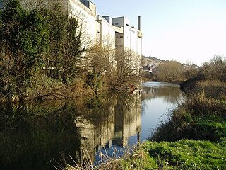
| Desjardins Canal | Ontario | Cootes Paradise | Hamilton Harbour | 1837 | 1895 | |||
| Newmarket Canal | Ontario | 16 km (9.9 mi) | 3 | Lake Simcoe | East Holland River (Newmarket) | — | — | The canal was cancelled during its construction. |
| Shubenacadie Canal | Nova Scotia | 114 km (71 mi) | 1 [note 3] | Halifax Harbour (Dartmouth) | Cobequid Bay (Maitland) | 1856 | 1871 | |
| Soulanges Canal | Quebec | 5 | 1899 | 1958 | ||||
| Welland Recreational Waterway | Ontario | Welland Canal | Welland Canal | c. 1970s | The waterway formed a part of the original alignment for the Welland Canal that passed Welland, prior to the completion of the Welland By-Pass in the 1970s. Motorboats are prohibited from the Welland Recreational Waterway. |
Parts of the Rouge River in Markham, Ontario were being planned by William Berczy in the 1790s as a navigation route between Lake Simcoe and Lake Ontario via Holland River but did not progress beyond clearing of 24 miles along the route. [1]
| Canal | Province | Start point | End point | Notes |
|---|---|---|---|---|
| Canal de l'Aqueduc | Quebec | City of Montreal pumping station (Pointe-Saint-Charles) | Open-air aqueduct canal used by the city of Montreal. | |
| Kootenay Canal | British Columbia | Kootenay River | Kootenay River | Diversionary canal for the Kootenay Canal hydroelectric plant. |
| Seton Canal | British Columbia | Seton Lake | Fraser River | Diversionary canal for the Seton Powerhouse. |

Canals or artificial waterways are waterways or engineered channels built for drainage management or for conveyancing water transport vehicles. They carry free, calm surface flow under atmospheric pressure, and can be thought of as artificial rivers.

The Erie Canal is a historic canal in upstate New York that runs east–west between the Hudson River and Lake Erie. Completed in 1825, the canal was the first navigable waterway connecting the Atlantic Ocean to the Great Lakes, vastly reducing the costs of transporting people and goods across the Appalachians. The Erie Canal accelerated the settlement of the Great Lakes region, the westward expansion of the United States, and the economic ascendancy of New York state. It has been called "The Nation's First Superhighway".

The Panama Canal is an artificial 82-kilometer (51-mile) waterway in Panama that connects the Caribbean Sea with the Pacific Ocean. It cuts across the narrowest point of the Isthmus of Panama, and is a conduit for maritime trade between the Atlantic and Pacific Oceans. Locks at each end lift ships up to Gatun Lake, an artificial fresh water lake 26 meters (85 ft) above sea level, created by damming the Chagres River and Lake Alajuela to reduce the amount of excavation work required for the canal. Locks then lower the ships at the other end. An average of 200 ML (52,000,000 US gal) of fresh water is used in a single passing of a ship. The canal is threatened by low water levels during droughts.

The St. Lawrence Seaway is a system of locks, canals, and channels in Canada and the United States that permits oceangoing vessels to travel from the Atlantic Ocean to the Great Lakes of North America, as far inland as Duluth, Minnesota, at the western end of Lake Superior. The seaway is named for the St. Lawrence River, which flows from Lake Ontario to the Atlantic Ocean. Legally, the seaway extends from Montreal, Quebec, to Lake Erie, and includes the Welland Canal. Ships from the Atlantic Ocean are able to reach ports in all five of the Great Lakes, via the Great Lakes Waterway.

The Broads is a network of mostly navigable rivers and lakes in the English counties of Norfolk and Suffolk. Although the terms "Norfolk Broads" and "Suffolk Broads" are correctly used to identify specific areas within the two counties respectively, the whole area is frequently referred to as the Norfolk Broads.

The Rideau Canal is a 202-kilometre long canal that links the Ottawa River at Ottawa with the Cataraqui River and Lake Ontario at Kingston, Ontario, Canada. Its 46 locks raise boats from the Ottawa River 83 metres upstream along the Rideau River to the Rideau Lakes, and from there drop 50 metres downstream along the Cataraqui River to Kingston.

The Trent–Severn Waterway is a 386-kilometre-long (240 mi) canal route connecting Lake Ontario at Trenton to Georgian Bay, Lake Huron, at Port Severn. Its major natural waterways include the Trent River, Otonabee River, Kawartha Lakes, Lake Simcoe, Lake Couchiching and Severn River. Its scenic, meandering route has been called "one of the finest interconnected systems of navigation in the world".

The Delaware and Raritan Canal is a canal in central New Jersey, built in the 1830s, that connects the Delaware River to the Raritan River. It was an efficient and reliable means of transportation of freight between Philadelphia and New York City, transporting anthracite coal from eastern Pennsylvania during much of the 19th and early 20th centuries. The canal allowed shippers to cut many miles off the existing route from the Pennsylvania Coal Region down the Delaware, around Cape May, and up the occasionally treacherous Atlantic Ocean coast to New York City.

The St. Marys River, sometimes written St. Mary's River, drains Lake Superior, starting at the end of Whitefish Bay and flowing 74.5 miles (119.9 km) southeast into Lake Huron, with a fall of 23 feet (7.0 m). For its entire length it is an international border, separating Michigan in the United States from Ontario, Canada.

The Welland Canal is a ship canal in Ontario, Canada, and part of the St. Lawrence Seaway and Great Lakes Waterway. The canal traverses the Niagara Peninsula between Port Weller on Lake Ontario, and Port Colborne on Lake Erie, and was erected because the Niagara River—the only natural waterway connecting the lakes—was unnavigable due to Niagara Falls. The Welland Canal enables ships to ascend and descend the Niagara Escarpment, and has followed four different routes since it opened.

The Delaware and Hudson Canal was the first venture of the Delaware and Hudson Canal Company, which would later build the Delaware and Hudson Railway. Between 1828 and 1899, the canal's barges carried anthracite coal from the mines of northeastern Pennsylvania to the Hudson River and thence to market in New York City.
The Oswego Canal is a canal in the New York State Canal System located in New York, United States. Opened in 1828, it is 23.7 miles (38.1 km) in length, and connects the Erie Canal at Three Rivers to Lake Ontario at Oswego. The canal has a depth of 14 ft (4.3 m), with seven locks spanning the 118 ft (36 m) change in elevation.

The Welland Canal has gone through many incarnations in its history. Today, five distinct canal-construction efforts are recognized. The retronym First Welland Canal is applied to the original canal, constructed from 1824 to 1829 and 1831 to 1833.

The Panama Canal expansion project, also called the Third Set of Locks Project, doubled the capacity of the Panama Canal by adding a new traffic lane, enabling more ships to transit the waterway, and increasing the width and depth of the lanes and locks, allowing larger ships to pass. The new ships, called New Panamax, are about one and a half times larger than the previous Panamax size and can carry over twice as much cargo. The expanded canal began commercial operation on 26 June 2016.
The Rother Link is a planned English canal that would connect the Chesterfield Canal at Killamarsh, via the River Rother through to the Sheffield and South Yorkshire Navigation, thus creating a new cruising ring and encouraging boats to visit the Chesterfield Canal.

The Eurasia Canal is a proposed 700-kilometre-long (430 mi) canal connecting the Caspian Sea to the Black Sea along the Kuma-Manych Depression. Currently, a chain of lakes and reservoirs and the shallow irrigation Kuma–Manych Canal are found along this route. If completed the canal would also link several landlocked countries in Asia with the open seas through the Bosphorus. If completed, the Eurasian Canal will become the second longest canal in the world after the Grand Canal in China.

The Capital Pathway, also known informally as the Bike Path, is a 220-kilometre (140 mi) recreational pathway interlinking many parks, waterways and sites in Ottawa, Ontario and Gatineau, Quebec. Most of the pathway is paved, and allows an almost continuous route through the National Capital Region.
The history of Ottawa, capital of Canada, was shaped by events such as the construction of the Rideau Canal, the lumber industry, the choice of Ottawa as the location of Canada's capital, as well as American and European influences and interactions. By 1914, Ottawa's population had surpassed 100,000 and today it is the capital of a G7 country whose metropolitan population exceeds one million.

Sault Ste. Marie is a city in Ontario, Canada. The third-largest city in Northern Ontario after Sudbury and Thunder Bay, it is located on the St. Mary's River on the Canada–US border. To the southwest, across the river, is the United States and the city of Sault Ste. Marie, Michigan. The two cities are joined by the Sault Ste. Marie International Bridge, which connects Interstate 75 on the Michigan side to Huron Street on the Ontario side. Shipping traffic in the Great Lakes system bypasses the Saint Mary's Rapids via the American Soo Locks, the world's busiest canal in terms of tonnage that passes through it, while smaller recreational and tour boats use the Canadian Sault Ste. Marie Canal.
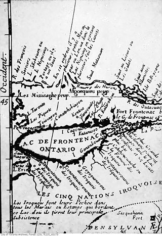
Bead Hill is an archaeological site comprising the only known remaining and intact 17th-century Seneca site in Canada. It is located on the banks of the Rouge River in Rouge Park, a national park in Toronto, Ontario. Because of its sensitive archaeological nature, it is not open to the public, nor readily identified in the park. It was designated a National Historic Site in 1991, eventually becoming a unit of the national park system in June 2019.