List of census agglomerations in British Columbia

Last updated

A census agglomeration is a census geographic unit in Canada determined by Statistics Canada. A census agglomeration comprises one or more adjacent census subdivisions that has a core population of 10,000 or greater. It is eligible for classification as a census metropolitan area once it reaches a population of 100,000. [1]

Census geographic units of Canada term used in Canada

The census geographic units of Canada are the administrative divisions defined and used by Canada's federal government statistics bureau Statistics Canada to conduct the country's five-yearly census. They exist on four levels: the top-level (first-level) divisions are Canada's provinces and territories; these are divided into second-level census divisions, which in turn are divided into third-level census subdivisions and fourth-level dissemination areas.

Canada Country in North America

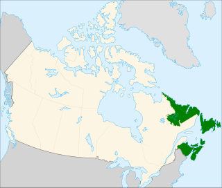
Canada is a country in the northern part of North America. Its ten provinces and three territories extend from the Atlantic to the Pacific and northward into the Arctic Ocean, covering 9.98 million square kilometres, making it the world's second-largest country by total area. Canada's southern border with the United States is the world's longest bi-national land border. Its capital is Ottawa, and its three largest metropolitan areas are Toronto, Montreal, and Vancouver. As a whole, Canada is sparsely populated, the majority of its land area being dominated by forest and tundra. Consequently, its population is highly urbanized, with over 80 percent of its inhabitants concentrated in large and medium-sized cities, many near the southern border. Canada's climate varies widely across its vast area, ranging from arctic weather in the north, to hot summers in the southern regions, with four distinct seasons.

Statistics Canada, formed in 1971, is the Government of Canada government agency commissioned with producing statistics to help better understand Canada, its population, resources, economy, society, and culture. Its headquarters is in Ottawa. The Minister responsible for Statistics Canada is the Minister of Innovation, Science and Economic Development, currently Navdeep Bains.

Contents

At the 2011 Census, the Province of British Columbia had 21 census agglomerations, [2] down from 22 in the 2006 Census. [3] The one deleted in 2011 was Kitimat. [4]

British Columbia Province of Canada

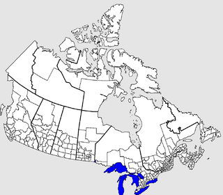
British Columbia is the westernmost province of Canada, located between the Pacific Ocean and the Rocky Mountains. With an estimated population of 5.016 million as of 2018, it is Canada's third-most populous province.

List

The following is a list of the census agglomerations within British Columbia.

Census agglomeration  [2] Area in 2011 (km²)  [2] Population in 2011  [2] Population in 2006  [3]
Kamloops 5,668.6498,75492,797
Nanaimo 1,280.8498,02192,361
Chilliwack 1,220.1292,30882,465
Prince George 17,686.5084,23283,225
Vernon 1,040.8258,58455,418
Courtenay 625.1355,21351,383
Duncan 373.6843,25241,387
Penticton 1,724.9542,36141,303
Campbell River 1,737.3736,09634,707
Parksville 81.7627,82226,518
Fort St. John 620.8026,38025,136
Port Alberni 1,728.7225,46525,343
Cranbrook 4,568.0325,03724,138
Quesnel 14,207.0422,09621,049
Williams Lake 2,656.7318,49018,760
Salmon Arm 165.5717,68316,205
Squamish 105.5917,47915,256
Powell River 800.7216,68916,537
Terrace 73.9115,56915,420
Prince Rupert 222.9413,05213,392
Dawson Creek 24.3711,58310,994

See also

Related Research Articles

Atlantic Canada Region in Canada

Atlantic Canada, also called the Atlantic provinces, is the region of Canada comprising the four provinces located on the Atlantic coast, excluding Quebec: the three Maritime provinces – New Brunswick, Nova Scotia, and Prince Edward Island – and the easternmost province of Newfoundland and Labrador. The population of the four Atlantic provinces in 2016 was about 2,300,000 on half a million km2. The provinces combined had an approximate GDP of $121.888 billion in 2011.

Calgary Metropolitan Region Metropolitan area in Alberta, Canada

The Calgary Metropolitan Region (CMR), also commonly referred to as the Calgary Region, is a conglomeration of municipalities centred on Calgary, the largest city in Alberta.

Ontario, one of the 13 provinces and territories of Canada, is located in east-central Canada. It is Canada's most populous province by a large margin, accounting for nearly 40 percent of all Canadians, and is the second-largest province in total area. Ontario is fourth-largest in total area when the territories of the Northwest Territories and Nunavut are included. It is home to the nation's capital city, Ottawa, and the nation's most populous city, Toronto.

Demographics of Alberta

Alberta has experienced a relatively high rate of growth in recent years, due in large part to its economy. Between 2003 and 2004, the province saw high birthrates, relatively high immigration, and a high rate of interprovincial migration when compared to other provinces. Approximately 81% of the population live in urban areas and only about 19% live in rural areas. The Calgary–Edmonton Corridor is the most urbanized area in Alberta and is one of Canada's four most urban regions. Many of Alberta's cities and towns have also experienced high rates of growth in recent history. From a population of 73,022 in 1901, Alberta has grown to 3,645,257 in 2011 and in the process has gone from less than 1.5% of Canada's population to 10.9%. As of July 1, 2018, Alberta's population represented 11.6% of Canada's total population of 37,058,856 making it the fourth most populated province in Canada. According to the 2018 third quarter report, Alberta's population increased by 23,096 to 4,330,206, the largest increase since the 2014 economic downturn.

Newfoundland and Labrador is a province of Canada on the country's Atlantic coast in northeastern North America. The province has an area of 405,212 square kilometres and a population in 2011 of 514,563, with approximately 95% of the provincial population residing on the Island of Newfoundland, with nearly half of the population residing on the Avalon Peninsula. People from Newfoundland and Labrador are called "Newfoundlanders," "Labradorians", or "Newfoundlanders and Labradorians".

According to the 2011 census, the City of Edmonton had a population of 812,201 residents, compared to 3,645,257 for all of Alberta, Canada. The total population of the Edmonton census metropolitan area (CMA) was 1,159,869, making it the sixth-largest CMA in Canada, while Statistics Canada estimated the CMA's 2011 population to be 1,196,342. In 2014, a municipal census indicated the city had a population of 877,926.

St. Johns metropolitan area Metropolitan Area in Newfoundland and Labrador, Canada

The St. John's metropolitan area is the most populous census metropolitan area (CMA) in the Canadian province of Newfoundland and Labrador. With a population of 205,955 in the 2016 Canadian Census, the CMA is the second largest in Atlantic Canada and the 20th largest CMA in Canada.

Demographics of Calgary

In the 2011 Census, the City of Calgary had a population of 1,096,833 residents, representing 30% of the 3,645,257 residents in all of Alberta, and 3% compared to a population of 33,476,688 in all of Canada. The total population of the Calgary census metropolitan area (CMA) was 1,214,839. Calgary is the largest city in Alberta, and the third-largest municipality and fourth-largest metropolitan area in Canada, as of 2016.

References