Roberts County is a county in the U.S. state of South Dakota. As of the 2020 census, the population was 10,280. Its county seat is Sisseton. The county was named either for S. G. Roberts of Fargo, North Dakota, or for Solomon Robar, an early local French fur trader. It was created on March 8, 1883, and fully organized by August 6 of that year. Its boundary was altered once, in 1885.

Pembina County is a county in the U.S. state of North Dakota. At the 2020 census its population was 6,844. The county seat is Cavalier.

Yellow Medicine County is a county in the state of Minnesota. Its eastern border is formed by the Minnesota River. As of the 2020 census, the population was 9,528. Its county seat is Granite Falls.

Winona County is a county in the U.S. state of Minnesota. As of the 2020 census, its population was 49,671. Its county seat is Winona. Winona County comprises the Winona, MN Micropolitan Statistical Area.

Wabasha County is a county in the U.S. state of Minnesota. As of the 2020 census, the population was 21,387. Its county seat is Wabasha.

Dakota County is the third-most populous county in the U.S. state of Minnesota, located in the east central portion of the state. As of the 2020 census, the population was 439,882. The population of Dakota County was estimated to be 443,341 in 2022. The county seat is Hastings. Dakota County is named for the Dakota Sioux tribal bands who inhabited the area.

Mendota is a city in Dakota County, Minnesota, United States. The name is a mispronunciation of the Dakota word for the location, bdóte, which in Dakota tradition is the center of the world. The word in this use means "the confluence of the Minnesota and Mississippi Rivers," and generally "mouth or junction of one river with another." The population was 198 at the 2010 census.

West St. Paul is a city in Dakota County, Minnesota, United States. The population was 20,615 at the 2020 census. It is immediately south of Saint Paul and immediately west of South St. Paul.

Dakota is a city in Winona County, Minnesota, United States. The population was 295 at the 2020 census.

Winona is a city in and the county seat of Winona County, Minnesota, United States. Located in bluff country on the Mississippi River, its most noticeable physical landmark is Sugar Loaf. The population was 25,948 at the 2020 census.

Sartell is a city in Benton and Stearns Counties in the U.S. state of Minnesota that straddles the Mississippi River. It is part of the St. Cloud Metropolitan Statistical Area. The population was 19,351 at the 2020 census, making it St. Cloud's most populous suburb and the fourth-largest city in central Minnesota, after St. Cloud, Elk River, and Willmar.

Hastings is a city mostly in Dakota County, Minnesota, of which it is the county seat, with a portion in Washington County, Minnesota, United States. It is near the confluence of the Mississippi, Vermillion, and St. Croix Rivers. The population was 22,154 at the 2020 census. It is named for the first elected governor of Minnesota, Henry Hastings Sibley.
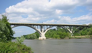
The Minnesota River is a tributary of the Mississippi River, approximately 332 miles (534 km) long, in the U.S. state of Minnesota. It drains a watershed of 14,751 square miles (38,200 km2) in Minnesota and about 2,000 sq mi (5,200 km2) in South Dakota and Iowa.

Prairie Island Indian Community is a Mdewakanton Sioux Indian reservation in Goodhue County, Minnesota, along the Mississippi River. Most of the reservation now lies within the city of Red Wing, which developed after this land was set aside.

The West North Central states form one of the nine geographic subdivisions within the United States that are officially recognized by the U.S. Census Bureau.

The Lac qui Parle River is a tributary of the Minnesota River, 118 miles (190 km) long, in southwestern Minnesota in the United States. A number of tributaries of the river, including its largest, the West Branch Lac qui Parle River, also flow in eastern South Dakota. Via the Minnesota River, the Lac qui Parle River is part of the watershed of the Mississippi River, draining an area of 1,156 square miles (2,990 km2) in an agricultural region. Slightly more than two-thirds of the Lac qui Parle watershed is in Minnesota. Lac qui parle means "lake which speaks" in the French language, and was a translation of the Sioux name for Lac qui Parle, a lake on the Minnesota River upstream of the mouth of the Lac qui Parle River.
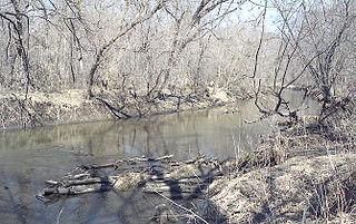
The Zumbro River is a tributary of the Mississippi River in the Driftless Area of southeastern Minnesota in the United States. It is 64.6 miles (104.0 km) long from the confluence of its principal tributaries and drains a watershed of 1,428 square miles (3,700 km2). The river's name in English is a change from its French name Rivière des Embarras due to its mouth near Pine Island in the Mississippi River; the pronunciation changed from to. The Dakota name for this river is Wapka Wazi Oju, having reference to the grove of great white pines at Pine Island.

The U.S. State of Minnesota is the northernmost state outside Alaska; its isolated Northwest Angle in Lake of the Woods is the only part of the 48 contiguous states lying north of the 49th parallel north. Minnesota is in the U.S. region known as the Upper Midwest in interior North America. The state shares a Lake Superior water border with Michigan and Wisconsin on the northeast; the remainder of the eastern border is with Wisconsin. Iowa is to the south, South Dakota and North Dakota are to the west, and the Canadian provinces of Manitoba and Ontario are to the north. With 87,014 square miles (225,370 km2), or approximately 2.26% of the United States, Minnesota is the 12th largest state.

The Cottonwood River is a tributary of the Minnesota River, 152 miles (245 km) long, in southwestern Minnesota in the United States. Via the Minnesota River, it is part of the watershed of the Mississippi River, draining an area of 1,313 square miles (3,400 km2) in an agricultural region. The river's name is a translation of the Dakota name for the river, Wáǧa Ožú Wakpá, for the cottonwood tree groves, which are common along prairie rivers. It has also been known historically as the Big Cottonwood River.