List of extreme temperatures in Portugal

Last updated

The following list presents the official temperature extremes recorded in Portugal by the Portuguese meteorological institute (IPMA) in official WMO stations.
Contents

Highest Temperatures Recorded

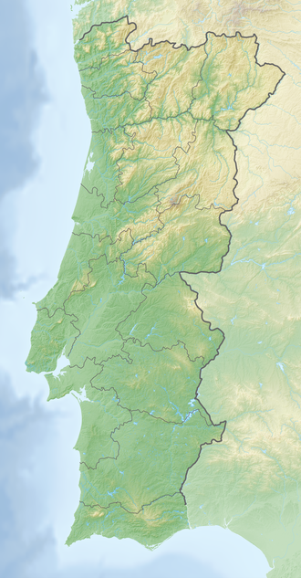
Reliefkarte Portugal.png
Red pog.svg
47.4°C
Red pog.svg
47.0°C
Red pog.svg
47.0°C
Red pog.svg
46.8°C
Red pog.svg
46.4°C
Red pog.svg
46.3°C
Red pog.svg
46.2°C
Red pog.svg
46.1°C
Red pog.svg
46.0°C
Locations where temperature has reached or surpassed 46.0 °C (114.8 °F)
Amareleja holds the record for the highest temperature recorded in Portugal at 47.4 degC (117.3 degF) Amareleja - Portugal (3648101870).jpg
Amareleja holds the record for the highest temperature recorded in Portugal at 47.4 °C (117.3 °F)
TemperatureLocationDate Recorded
47.4 °C (117.3 °F) [1] Amareleja 1 August 2003
47.0 °C (116.6 °F) [2] Pinhão 14 July 2022
47.0 °C (116.6 °F) [3] Viana do Alentejo 1 August 2003
46.8 °C (116.2 °F) [4] Alvega 4 August 2018
46.5 °C (115.7 °F) [5] Amareleja 23 July 1995
46.4 °C (115.5 °F) [6] Santarém 7 August 2023
46.3 °C (115.3 °F) [4] Santarém 4 August 2018
46.3 °C (115.3 °F) [7] Lousã 13 July 2022
46.2 °C (115.2 °F) [4] Alcácer do Sal 4 August 2018
46.2 °C (115.2 °F) [8] Amareleja 13 July 2017
46.2 °C (115.2 °F) [9] Santarém 13 July 2022
46.1 °C (115.0 °F) [4] Coruche 4 August 2018
46.0 °C (114.8 °F) [4] Pegões 4 August 2018
45.9 °C (114.6 °F) [4] Alcácer do Sal 3 August 2018
45.8 °C (114.4 °F) [4] Castro Verde (Neves-Corvo)4 August 2018
45.8 °C (114.4 °F) [8] Elvas 13 July 2017
45.8 °C (114.4 °F) [8] Reguengos de Monsaraz 13 July 2017
45.7 °C (114.3 °F) [4] Mora 2 August 2018
45.7 °C (114.3 °F) [4] Castro Verde (Neves-Corvo)1 August 2018
45.7 °C (114.3 °F) [10] Alvega 14 July 2022
45.6 °C (114.1 °F) [8] Castro Verde (Neves-Corvo)13 July 2017
45.6 °C (114.1 °F) [11] Amareleja 13 July 2022
45.5 °C (113.9 °F) [4] Setúbal 4 August 2018
45.5 °C (113.9 °F) [4] Reguengos de Monsaraz 3 August 2018
45.4 °C (113.7 °F) [4] Évora 4 August 2018
45.4 °C (113.7 °F) [1] Beja 1 August 2003
45.4 °C (113.7 °F) [4] Tomar 4 August 2018
45.4 °C (113.7 °F) [4] Avis 4 August 2018
45.4 °C (113.7 °F) [8] Portel 13 July 2017
45.4 °C (113.7 °F) [12] Mora 13 July 2022
45.4 °C (113.7 °F) [13] Pinhão 15 July 2022
45.3 °C (113.5 °F) [4] Amareleja 4 August 2018
45.3 °C (113.5 °F) [14] Santarém 31 July 1944
45.2 °C (113.4 °F) [4] Viana do Alentejo 2 August 2018
45.2 °C (113.4 °F) [4] Portel 4 August 2018
45.2 °C (113.4 °F) [4] [1] Santarém 1 August 2003
45.2 °C (113.4 °F) [15] Beja 24 July 1995
45.2 °C (113.4 °F) [4] Avis 1 August 2003
45.2 °C (113.4 °F) [16] Mirandela 14 July 2022
45.1 °C (113.2 °F) [4] Elvas 3 August 2018
45.1 °C (113.2 °F) [4] Alvalade 23 July 1995
45.0 °C (113.0 °F) [3] Mértola 23 July 1995
45.0 °C (113.0 °F) [17] Lousã 7 September 2016
45.0 °C (113.0 °F) [18] Alcácer do Sal 23 July 1995
45.0 °C (113.0 °F) [19] Viana do Alentejo 18 July 1991

Lowest Temperatures Recorded

Reliefkarte Portugal.png
Cyan pog.svg
-16.0°C
Cyan pog.svg
-16.0°C
Cyan pog.svg
-13.8°C
Cyan pog.svg
-13.3°C
Cyan pog.svg
-12.6°C
Cyan pog.svg
-12.3°C
Cyan pog.svg
-12.0°C
Locations where temperature has fell at or under −12.0 °C (10.4 °F)
Penhas da Saude - Lunahotel Serra da Estrela.jpg
Miranda do Douro.jpg
Both Penhas da Saúde and Miranda do Douro hold the record for the lowest temperature recorded in Portugal, −16.0 °C (3.2 °F)
TemperatureLocationDate Recorded
−16.0 °C (3.2 °F) [1] Penhas da Saúde 5 February 1954
−16.0 °C (3.2 °F) [20] [21] Miranda do Douro 6 January 1945
−13.8 °C (7.2 °F) [22] Lamas de Mouro Unknown
−13.3 °C (8.1 °F) [21] Penhas Douradas 11 February 1956
−13.2 °C (8.2 °F) [23] Miranda do Douro 7 March 1995
−12.9 °C (8.8 °F) [23] Penhas Douradas 1 March 2005
−12.6 °C (9.3 °F) [3] Figueira de Castelo Rodrigo 12 January 1967
−12.3 °C (9.9 °F) [24] Miranda do Douro 4 January 1971
−12.3 °C (9.9 °F) [1] Guarda*11 February 1956
−12.0 °C (10.4 °F) [1] [21] Bragança 16 January 1945
−12.0 °C (10.4 °F) [3] Figueira de Castelo Rodrigo 12 February 1983
−11.8 °C (10.8 °F) [25] Carrazeda de Ansiães 12 February 1983
−11.6 °C (11.1 °F) [21] Montalegre 5 February 1954
−11.6 °C (11.1 °F) [24] Miranda do Douro 12 February 1983
−11.6 °C (11.1 °F) [26] Bragança 12 February 1983
−11.4 °C (11.5 °F) [26] Bragança 4 January 1972
−11.2 °C (11.8 °F) [4] Penhas Douradas 14 January 1987
−10.9 °C (12.4 °F) [27] Mirandela 18 November 2007
−10.8 °C (12.6 °F) [28] Guarda 12 January 1985
−10.4 °C (13.3 °F) [23] Bragança 2 March 2005
−10.2 °C (13.6 °F) [21] [23] Guarda 1 March 2005
−10.2 °C (13.6 °F) [29] Penhas Douradas 1 March 1993
−10.0 °C (14.0 °F) [29] Penhas Douradas 11 February 1978
−9.9 °C (14.2 °F) [30] Sabugal 19 January 2017
−9.8 °C (14.4 °F) [27] Mirandela 1 November 1982
−9.8 °C (14.4 °F) [31] Mora 8 November 1997
−9.8 °C (14.4 °F) [32] Montalegre 31 January 1954
−9.5 °C (14.9 °F) [30] Sabugal 20 December 2019
−9.5 °C (14.9 °F) [32] Carrazeda de Ansiães 9 January 1985
−9.5 °C (14.9 °F) [33] Montalegre 1 January 1971
−9.5 °C (14.9 °F) [1] Viseu*14 November 1927
−9.5 °C (14.9 °F) [33] Montalegre 14 February 1983
−9.2 °C (15.4 °F) [34] Penhas Douradas 28 February 2005
−9.0 °C (15.8 °F) [31] Mora 23 January 2000
−8.8 °C (16.2 °F) [35] Penhas Douradas 27 January 2005
−8.8 °C (16.2 °F) [28] Guarda 6 March 1971
−8.7 °C (16.3 °F) [32] Miranda do Douro 11 January 2021
−8.6 °C (16.5 °F) [30] Coruche 19 January 2017
−8.6 °C (16.5 °F) [32] Lamas de Mouro 26 January 2017
−8.6 °C (16.5 °F) [36] Penhas Douradas 8 January 2009
−8.6 °C (16.5 °F) [37] Lamas de Mouro 24 February 2018
−8.5 °C (16.7 °F) [38] Penhas Douradas 13 February 2010
−8.5 °C (16.7 °F) [39] Chaves 22 January 1983
−8.5 °C (16.7 °F) [27] Bragança 18 November 2007
−8.5 °C (16.7 °F) [36] Bragança 9 January 2009
−8.4 °C (16.9 °F) [32] Guarda 19 January 2017
−8.4 °C (16.9 °F) [32] Alvalade 28 January 2005
−8.3 °C (17.1 °F) [40] Miranda do Douro 2 December 2017
−8.3 °C (17.1 °F) [32] Chaves 8 January 2021
−8.3 °C (17.1 °F) [32] Aljezur 28 January 2005
−8.3 °C (17.1 °F) [35] Alvalade 28 January 2005
−8.3 °C (17.1 °F) [41] Mirandela 4 February 2012
−8.2 °C (17.2 °F) [41] Chaves 4 February 2012
−8.2 °C (17.2 °F) [42] Bragança 17 December 2010
−8.1 °C (17.4 °F) [43] Penhas Douradas 20 December 2009
−8.1 °C (17.4 °F) [43] Bragança 20 December 2009
−8.1 °C (17.4 °F) [32] Chaves 19 January 2017
−8.1 °C (17.4 °F) [44] Fundão 18 February 1981
−8.0 °C (17.6 °F) [41] Mirandela 12 February 1983
−8.0 °C (17.6 °F) [32] Mira 17 January 1960
−8.0 °C (17.6 °F) [45] Ladoeiro 6 January 1997
−8.0 °C (17.6 °F) [25] Carrazeda de Ansiães 22 December 1990
−8.0 °C (17.6 °F) [39] Chaves 30 December 1980
−8.0 °C (17.6 °F) [1] Portalegre*11 January 1941

(*) Stations created prior to 1941 and no longer in use

Related Research Articles

<span class="mw-page-title-main">Setúbal</span> Municipality in Lisbon, Portugal

Setúbal is a city and a municipality in Portugal. The population of the entire municipality in 2014 was 118,166, occupying an area of 230.33 km2 (88.9 sq mi). The city itself had 89,303 inhabitants in 2001. It lies within the Lisbon metropolitan area, about 50 kilometres from Lisbon downtown by road.

<span class="mw-page-title-main">Santiago do Cacém</span> Municipality in Alentejo, Portugal

Santiago do Cacém is a municipality in Setúbal District in Portugal. The population in 2011 was 29,749, in an area of 1059.69 km2.

<span class="mw-page-title-main">Lages</span> Municipality in South, Brazil

Lages is a Brazilian municipality located in the central part of the state of Santa Catarina, in the region known in Portuguese as "Planalto Serrano".

<span class="mw-page-title-main">Campos dos Goytacazes</span> Municipality in Rio de Janeiro State, Brazil

Campos dos Goytacazes is a municipality located in the northern region of Rio de Janeiro State, Brazil, with a population of 483,540 inhabitants.

<span class="mw-page-title-main">Sobral, Ceará</span> Municipality in Northeast, Brazil

Sobral is a municipality in the state of Ceará, Brazil.

Alvega is a former freguesia, located in the municipality of Abrantes, in Santarém District, Portugal. In 2013, the parish merged into the new parish Alvega e Concavada. The population in 2011 was 1,499, in an area of 55.33 km².

<span class="mw-page-title-main">Monte Real</span> Civil parish in Centro, Portugal

Monte Real is a town and a former civil parish in the municipality of Leiria, Portugal. In 2013, the parish merged into the new parish Monte Real e Carvide. It covers an area of 12.23 km2 and has a population of 2,778 people. Monte Real, which in English means Royal Mount, was once a municipality, before being annexed to Leiria municipality.

<span class="mw-page-title-main">Climate of Brazil</span>

The climate in Brazil varies considerably from mostly tropical north to temperate zones south of the Tropic of Capricorn.

<span class="mw-page-title-main">Bom Jesus, Rio Grande do Sul</span> Municipality in Rio Grande do Sul, Brazil

Bom Jesus is a municipality in the state of Rio Grande do Sul, Brazil. Its population was approximately 11,309 in 2020.

<span class="mw-page-title-main">Juramento</span> Municipality in the north of the Brazilian state of Minas Gerais

Juramento is a municipality in the north of the Brazilian state of Minas Gerais. As of 2020 the population was 4,345 in a total area of 432 km2. It became a municipality in 1953.

<span class="mw-page-title-main">Carbonita</span> Municipality in Minas Gerais, Brazil

Carbonita is a municipality in the northeast of the Brazilian state of Minas Gerais. As of 2020 the population was 9,414 in a total area of 1,454 km2. The elevation of the town center is 751 meters. It is part of the IBGE statistical meso-region of Jequitinhonha and the micro-region of Capelinha. It became a municipality in 1963.

<span class="mw-page-title-main">São Joaquim</span> Municipality in South, Brazil

São Joaquim is a municipality in the state of Santa Catarina, situated in southern Brazil. Its population in 2020 was 27,139 inhabitants. Located in the Planalto Serrano, it lies 136 km from Tubarão, 81 km from Lages and 227 km from Florianópolis. The town is home to a variety of ethnic groups, including Italian, German, Portuguese, Japanese and Afro-Brazilians. There are also many people from other states in Brazil, especially from Rio Grande do Sul.

Jaguaruana is a municipality in the state of Ceará in the Northeast region of Brazil.

<span class="mw-page-title-main">Cristino Castro</span> Municipality in Nordeste, Brazil

Cristino Castro is a municipality in the state of Piauí in the Northeast region of Brazil. A significant production of cacao, latex and bananas takes place in the region.

<span class="mw-page-title-main">Taguatinga, Tocantins</span> Municipality in North Region, Brazil

Taguatinga is a municipality in the state of Tocantins in Brazil.

Las Lomitas is a city in northern Argentina. It is located in the Patiño Department in the center of Formosa Province. It has a population of 12,399 inhabitants as of the 2010 census [INDEC]. This represented a 20% increase in the population compared to the 2001 census [INDEC] which only had 10,354 inhabitants.

Lisbon and its metropolitan area feature a mild Mediterranean climate, with short, mild and rainy winters and warm to hot, dry summers. According to the Troll-Paffen climate classification, Lisbon has a warm-temperate subtropical climate. According to the Siegmund/Frankenberg climate classification, Lisbon has a subtropical climate.

<span class="mw-page-title-main">Vicente Pires</span> Administrative region in Central-West, Brazil

Vicente Pires is an administrative region in the Federal District in Brazil. It is bordered by Taguatinga to the west, Águas Claras to the south, Guará to the southeast, Brasília to the north, and Brazlândia to the northwest. According to a 2016 report, Vicente Pires has a population of 72,879. Vicente Pires is the 16th largest administrative region by population.

Porto and its metropolitan area feature a Mediterranean climate with mild wet winters and warm dry summers. According to the Troll-Paffen climate classification, Porto has a warm-temperate subtropical climate, and a subtropical climate according to Siegmund/Frankenberg. Porto is the wettest major city with a Mediterranean climate.

References

  1. 1 2 3 4 5 6 7 8 Extremes Archived 21 June 2017 at the Wayback Machine Instituto Português do Mar e da Atmosfera, IPMA
  2. "TEMPO MUITO QUENTE - 14 DE JULHO". IPMA . Retrieved 15 July 2022.
  3. 1 2 3 4 "Atlas Climático Ibérico" (PDF). IPMA, AEMET . Retrieved 23 January 2021.
  4. 1 2 3 4 5 6 7 8 9 10 11 12 13 14 15 16 17 18 19 20 21 22 "August 2018 bulletin" (PDF). IPMA . Retrieved 25 October 2020.
  5. "1971-2000 normals and extremes, Amareleja" (PDF). IPMA . Retrieved 18 January 2021.
  6. "Climate in August 2023" (PDF). Instituto Português do Mar e da Atmosfera . Retrieved 19 March 2024.
  7. "Resumo diário - rede de Estações Meteorológicas". IPMA . Retrieved 14 July 2022.
  8. 1 2 3 4 5 "August 2018 bulletin" (PDF). IPMA . Retrieved 25 October 2020.
  9. "Resumo diário - rede de Estações Meteorológicas". IPMA . Retrieved 14 July 2022.
  10. "Estações Valores Extremos". IPMA . Retrieved 15 July 2022.
  11. "Resumo diário - rede de Estações Meteorológicas". IPMA . Retrieved 14 July 2022.
  12. "Resumo diário - rede de Estações Meteorológicas". IPMA . Retrieved 14 July 2022.
  13. "Resumo diário - rede de Estações Meteorológicas". IPMA . Retrieved 25 July 2022.
  14. "Climate records - Mainland". IPMA . Retrieved 18 July 2021.
  15. "1971-2000 normals and extremes, Beja" (PDF). IPMA . Retrieved 18 January 2021.
  16. "Estações Valores Extremos". IPMA . Retrieved 15 July 2022.
  17. http://www.ipma.pt/resources.www/docs/im.publicacoes/edicoes.online/20161020/rKSkOOFibyTizmOIXUjF/cli_20160901_20160930_pcl_mm_co_pt.pdf [ bare URL PDF ]
  18. "1971-2000 normals and extremes, Alcácer do Sal" (PDF). IPMA . Retrieved 18 January 2021.
  19. "1971-2000 normals and extremes, Viana do Alentejo" (PDF). IPMA . Retrieved 18 January 2021.
  20. "January 2006 bulletin (with all time January extremes)" (PDF). IPMA . Retrieved 25 October 2020.
  21. 1 2 3 4 5 "January 2010 Bulletin (with all time lows)" (PDF). IPMA . Retrieved 18 January 2021.
  22. "Plano de Gestão da Região hidrográfica do Minho e Lima" (PDF). APA. p. 122. Retrieved 25 June 2021.
  23. 1 2 3 4 "March 2005 Bulletin" (PDF). IPMA . Retrieved 18 January 2021.
  24. 1 2 "1971-2000 normals and extremes, Miranda do Douro" (PDF). IPMA . Retrieved 18 January 2021.
  25. 1 2 "Normais Climatológicas 1971-2000, Carrazeda de Ansiães" (PDF). IPMA . Retrieved 17 July 2021.
  26. 1 2 "1971-2000 normals and extremes, Bragança" (PDF). IPMA . Retrieved 18 January 2021.
  27. 1 2 3 "November 2007 Bulletin" (PDF). IPMA . Retrieved 18 January 2021.
  28. 1 2 "1971-2010 normals, Guarda" (PDF). IPMA . Retrieved 18 January 2021.
  29. 1 2 "1971-2000 normals and extremes, Penhas Douradas" (PDF). IPMA . Retrieved 18 January 2021.
  30. 1 2 3 "January 2017 Bulletin" (PDF). IPMA . Retrieved 18 January 2021.
  31. 1 2 "Normais Climatológicas 1971-2000, Mora" (PDF). IPMA . Retrieved 18 July 2021.
  32. 1 2 3 4 5 6 7 8 9 10 "January 2021 Bulletin" (PDF). IPMA . Retrieved 20 February 2021.
  33. 1 2 "1971-2000 normals and extremes, Montalegre" (PDF). IPMA . Retrieved 18 January 2021.
  34. "February 2005 Bulletin" (PDF). IPMA . Retrieved 18 January 2021.
  35. 1 2 "January 2005 Bulletin" (PDF). IPMA . Retrieved 18 January 2021.
  36. 1 2 "January 2009 Bulletin" (PDF). IPMA . Retrieved 18 January 2021.
  37. "February 2018 Bulletin" (PDF). IPMA . Retrieved 18 January 2021.
  38. "February 2010 Bulletin" (PDF). IPMA . Retrieved 18 January 2021.
  39. 1 2 "1971-2000 normals and extremes, Chaves" (PDF). IPMA . Retrieved 18 January 2021.
  40. "December 2017 Bulletin" (PDF). IPMA . Retrieved 18 January 2021.
  41. 1 2 3 "February 2012 Bulletin" (PDF). IPMA . Retrieved 18 January 2021.
  42. "December 2010 Bulletin" (PDF). IPMA . Retrieved 18 January 2021.
  43. 1 2 "December 2009 Bulletin" (PDF). IPMA . Retrieved 18 January 2021.
  44. "Normais Climatológicas 1971-2000, Fundão" (PDF). IPMA . Retrieved 18 July 2021.
  45. "Normais Climatológicas 1971-2000, Ladoeiro" (PDF). IPMA . Retrieved 18 July 2021.