The following is a list of former primary state highways completely or mostly within the Culpeper and Northern Virginia District (VDOT Districts 7 and 9 [1] ), formerly combined as the Culpeper District, of the U.S. state of Virginia.
The following is a list of former primary state highways completely or mostly within the Culpeper and Northern Virginia District (VDOT Districts 7 and 9 [1] ), formerly combined as the Culpeper District, of the U.S. state of Virginia.
State Route 110 | |
|---|---|
| Location | Alexandria |
| Length | 0.29 mi [2] (470 m) |
| Existed | 1947–1956 |
State Route 110 was a short primary state highway in Alexandria, Virginia, United States, planned to connect U.S. Route 1 with a bridge across the Potomac River to the District of Columbia.
The roadway was to begin at Henry Street (US 1, now southbound only) just south of First Street, head east-northeast to the intersection of Washington Street (now State Route 400) and Second Street, and then run east on Second Street to the river for a total length of 0.29 miles (0.47 km). [2] The 0.16-mile (0.26 km) part on Second Street was added as a state highway connection, to be maintained by the City of Alexandria with state funding. [3] The proposed bridge site was just south of the Shepherd's Landing Bridge, a temporary rail bridge built at Third Street during World War II in case of attack on the Long Bridge to the north. [4] That rail bridge was demolished in early 1947. [5] In 1956, SR 110 was removed from the state highway system, as the proposed bridge had moved to the south (to the location of the present Woodrow Wilson Bridge). [3]
State Route 232 | |
|---|---|
| Location | Revercombs Corner-Boston |
| Existed | 1928–1943 |
State Route 232 extended east along current SR 707 from SR 27 (now SR 231) at Revercombs Corner via Slate Mills to SR 3 (now US 522) at Boston. The westernmost 1 mile (1.6 km) was added to the state highway system in 1928 as State Route 706, [6] which was extended 2.5 miles (4.0 km) in 1929, [7] 1.7 miles (2.7 km) in 1930, [8] and the remaining 2.1 miles (3.4 km) in 1932. [9] SR 706 became SR 232 in the 1933 renumbering [10] and was downgraded to secondary in 1943. [11]
State Route 233 | |
|---|---|
| Location | Morrisville-Catlett |
| Existed | 1928–1951 |
State Route 233 extended north along current SR 806 from US 17 at Morrisville via Elk Run and Bristersburg to SR 28 at Catlett. 6.6 miles (10.6 km) at the south end were added to the state highway system in 1928 as State Route 708, [12] which was extended 2.5 miles (4.0 km) in 1929, [13] 5 miles (8.0 km) in 1930, [14] and another 4.2 miles (6.8 km) past Catlett in 1932. [15] SR 708 became SR 233 in the 1933 renumbering [10] and was extended the remaining 5.4 miles (8.7 km) to SR 28 (now SR 215) near Bristow in October 1933. [16] The segment northeast of Catlett became part of a realigned SR 28 in the 1940 renumbering, [17] and the remainder was downgraded to secondary in 1949, effective completion of ongoing construction work. [18] The last mention of the route in the State Highway Commission minutes is in 1951, when a portion of old road bypassed by this construction was abandoned. [19]
State Route 242 | |
|---|---|
| Location | Culpeper-Flint Hill-Marshall |
| Existed | 1928–1948 |
State Route 242 extended north from SR 229 near Culpeper over present secondary SR 729 to Ben Venue (former El Dorado Turnpike [ citation needed ]) and Flint Hill (former Front Royal and Gaines's Cross Roads Turnpike [ citation needed ]), then turned northeast along present SR 647 (former Salem Station and Rappahannock Turnpike beyond Vernon Mills [ citation needed ]) to SR 55 near Marshall. A portion through Cresthill, Jerrys Shop, and Vernon Mills was never a primary route.
State Route 707 was created in 1928, running south from US 211 at Ben Venue to the Rappahannock-Culpeper County line. [20] It was extended south another 2.4 miles (3.9 km) in 1930 [21] and 5 miles (8.0 km) in 1932, [22] and became part of SR 49 in the 1933 renumbering. [10] Later in 1933, this portion of SR 49 was extended the rest of way to SR 29 north of Culpeper, making SR 49 continuous from Ben Venue to Culpeper (and beyond to Jefferson). [23] The road from Ben Venue northwest to Flint Hill was added to SR 49 in 1934 (1.4 miles (2.3 km)) [24] and 1935 (2.5 miles (4.0 km)). [25]
Two segments of State Route 718 [26] [27] were created in 1932, running southwest from SR 55 near Marshall for 2.9 miles (4.7 km) and east from SR 37 (now US 522) at Flint Hill for 4.8 miles (7.7 km) [28] to 0.2 miles (0.32 km) short of the Rappahannock-Fauquier County line [29] (though later maps show it reaching the line [30] ). Both pieces became SR 242 in the 1933 renumbering, [10] and the Marshall end was extended another 3⁄4 mile (1.2 km) later that year, [31] taking it to just beyond Ada. [32]
As part of the 1940 renumbering, SR 49 from Culpeper south to Powhatan became part of SR 522, and the orphaned piece north of Culpeper was renumbered as part of SR 242. [33] The original pieces of SR 242 were downgraded to secondary in 1942 (Marshall end) [34] and 1944 (Flint Hill end), [35] becoming extensions of existing SR 647. [36] Culpeper to Flint Hill survived until 1948, when it too was downgraded (to SR 729) pending completion of ongoing construction work south of Ben Venue. [37]
| County | Location | mi [34] [35] [37] | km | Destinations | Notes | ||
|---|---|---|---|---|---|---|---|
| Culpeper | | 0.00 | 0.00 | ||||
| Rappahannock | Ben Venue | 20.27 [30] | 32.62 | ||||
| Flint Hill | 24.17 | 38.90 | south end of US 522 overlap | ||||
| 24.57 [30] | 39.54 | south end of US 522 overlap | |||||
| | 29.32 | 47.19 | county line (Rappahannock River bridge) | ||||
| Gap in route | |||||||
| Fauquier | | 0.00 | 0.00 | ||||
| | 3.59 | 5.78 | |||||
| 1.000 mi = 1.609 km; 1.000 km = 0.621 mi | |||||||
State Route 243 | |
|---|---|
| Location | Burtonville-Stanardsville-southwest |
| Existed | 1930–1943 |
State Route 243 extended from US 29 at Burtonville west to US 33 near Stanardsville on current secondary SR 609 (the former Fredericksburg and Valley Plank Road [ citation needed ]), then southwest from US 33 (now US 33 Business) in Stanardsville for 4 miles (6.4 km) along current SR 622, SR 624, and SR 602 to 1⁄2 mile (0.80 km) short of Amicus. [38] The former portion was added to the state highway system in 1930 as State Route 719, [39] and the latter was added in 1932. [40] The route became SR 243 in the 1933 renumbering; [10] the part southwest of Stanardsville was downgraded to secondary in 1942, [41] partly becoming an extension of existing SR 604, [38] with the remainder joining it in 1943 [42] as an extension of existing SR 609. [38]
State Route 245 | |
|---|---|
| Location | Bluemont |
| Existed | 1931–1943 |
State Route 245 was a short spur from SR 7 to SR 734 in Bluemont, along what is now secondary SR 760. The route was added to the state highway system in 1931 as State Route 726, [43] which became SR 245 in the 1933 renumbering (at which time the description indicated that an extension to US 50 was planned). [10] In the 1940 renumbering, SR 234 was realigned at Aldie to replace all of SR 245 including the proposed extension (explicitly stated to follow SR 734). [44] In 1943 this piece of SR 234 was downgraded to secondary. [45]
State Route 246 | |
|---|---|
| Location | Hawlin-Woodville |
| Existed | 1930–1942 |
State Route 246 extended east along current SR 618 from SR 27 (now SR 231) via Hawlin to SR 3 (now US 522) at Woodville. 3.4 miles (5.5 km) at the east end were added to the state highway system in 1930 as State Route 723, [46] which was extended the rest of the way to the west end in 1932. [47] SR 723 became SR 246 in the 1933 renumbering [10] and was downgraded to secondary in 1942 [48] as an extension of existing SR 618. [30]
State Route 247 | |
|---|---|
| Location | west of Columbia |
| Existed | 1931–1943 |
State Route 247 was a short spur from SR 6 between Holmhead and Columbia south to SR 624, along a portion of current SR 656. The route was added to the state highway system in 1931 as State Route 727, [49] connecting the new alignment of SR 19 (now SR 6) to the former alignment (now SR 624).[ citation needed ] SR 727 became SR 247 in the 1933 renumbering (at which time the description indicated that an extension to US 15 south of Dixie was planned, which, if it was to use existing roads, would have followed SR 656 all the way to Bremo Bluff [50] ). [10] SR 247 was downgraded to secondary in 1943 [51] as an extension of existing SR 656. [50]
State Route 248 | |
|---|---|
| Location | Washington-northwest |
| Existed | 1932–1943 |
State Route 248 extended northwest from US 211 (now US 211 Bus.) in Washington for 1 mile (1.6 km) in the direction of Bentonville along current secondary SR 622 (no road currently connects Washington to Bentonville directly). It was added to the primary state highway system in 1932, with no number given, [52] became SR 248 in the 1933 renumbering, [10] and was downgraded to secondary in 1943 [53] as an extension of existing SR 622. [30]
State Route 275 | |
|---|---|
| Location | Mechanicsville-Potomac River |
| Existed | 1941–1954 |
State Route 275 followed the old Hillsborough and Harper's Ferry Turnpike through the Loudoun Valley, now secondary SR 671, from SR 9 at Mechanicsville north to US 340 at the Potomac River near Loudoun Heights. It was added to the primary state highway system in 1941 as an upgrade of SR 688, at the same time as the connecting segment of US 340 was added, [54] and downgraded to SR 671 in 1954. [55]
The entire route is in Loudoun County.
| Location | mi [55] | km | Destinations | Notes | |
|---|---|---|---|---|---|
| Mechanicsville | 0.00 | 0.00 | |||
| | 7.57 | 12.18 | |||
| 1.000 mi = 1.609 km; 1.000 km = 0.621 mi | |||||
State Route 335 | |
|---|---|
| Location | SR 6-Schuyler |
| Existed | 1928–1949 |
State Route 335 was a branch from SR 6 to Schuyler. It ran along current secondary SR 800 (Schuyler Road) from SR 1809 (Havenwood Lane, former SR 6) to Rockfish River Road (SR 617) in Schuyler.
The road was first added to the state highway system in 1928, when SR 19 was extended from Scottsville to Schuyler (based on mileage, it stopped short of SR 617). [56] SR 19 was moved in September 1930 onto what had been its temporary alignment, bypassing Schuyler via Faber and removing the road into Schuyler from the system for about three months. [57] In December it was restored as State Route 19Y, now extending all the way to modern SR 617. [58]
The designation changed to State Route 6Y in the 1933 renumbering (since SR 19 became SR 6) [10] and to State Route 335 in the late 1930s. [59] Due to reconstruction, SR 6 was removed from SR 1809 to its modern alignment (leaving behind SR 800) in the 1940s, and rather than extend SR 335 to meet it, the state downgraded SR 335 to secondary in April 1949. [60] The old alignments of SR 6 near Schuyler, including current SR 1809, were abandoned in August. [61]

Virginia State Route 5 is a primary state highway in the Commonwealth of Virginia. It runs between the independent cities of Richmond and Williamsburg. Between Charles City County and James City County, it crosses the Chickahominy River via the Judith Stewart Dresser Bridge, a fixed-span bridge which replaced historic Barrett's Ferry and the former drawbridge.

State Route 31 is a primary state highway in the U.S. state of Virginia. The state highway runs 24.56 miles (39.53 km) from U.S. Route 460 in Wakefield north to SR 5 and SR 199 in Williamsburg. SR 31 is the primary north–south highway of Surry County, where the highway serves the towns of Surry and Dendron. The state highway also connects Williamsburg with Jamestown. The sections of SR 31 on either side of the James River are connected by the Jamestown Ferry.

Virginia State Route 3 is a primary state highway in the U.S. state of Virginia that extends from the town of Culpeper south and eastwardly to Gloucester in Virginia's Middle Peninsula region. For many years, a portion was named "Historyland Highway".
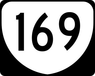
State Route 169 is a primary state highway in the U.S. state of Virginia. The state highway runs 7.41 miles (11.93 km) from Interstate 64 (I-64) and U.S. Route 60 to US 258 within the independent city of Hampton. SR 169 is a C-shaped route that connects the Hampton neighborhoods of Phoebus, Buckroe Beach, and Fox Hill.
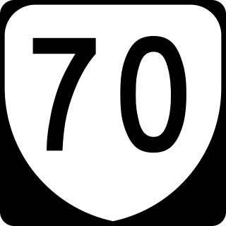
State Route 70 is a primary state highway in Lee County, Virginia, running from the Tennessee state line to U.S. Route 58 in Jonesville. Its continuation in Tennessee, also numbered State Route 70, continues south to the North Carolina state line at North Carolina Highway 208.

State Route 72 is a primary state highway in the southwest part of the U.S. state of Virginia. It runs from SR 71 in Gate City north to SR 65 at Fort Blackmore, northeast with SR 65 to Dungannon, and north via Coeburn to SR 83 near Clintwood.
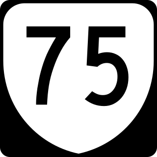
State Route 75 is a primary state highway in the southwest part of the U.S. state of Virginia, running southwest from U.S. Route 11 and U.S. Route 58 Alternate in Abingdon to Tennessee's State Route 44.

State Route 67 is a primary state highway in the southwest part of the U.S. state of Virginia. It runs from SR 80 near Honaker east to U.S. Route 460 at Raven, east concurrently with US 460 and US 460 Business into downtown Richlands, and north to SR 616 at Jewell Ridge on the Tazewell–Buchanan county line.

State Route 16 is a primary state highway in the southwest part of the U.S. state of Virginia. It runs from the North Carolina border at North Carolina Highway 16 north to the West Virginia border at West Virginia Route 16, passing through the towns of Troutdale, Marion, and Tazewell. Highway 16 is part of a three-state route 16 that connects the Charlotte region with northwestern West Virginia.

State Route 69 is a primary state highway in the U.S. state of Virginia. Known as Lead Mine Road, the state highway runs 3.59 miles (5.78 km) from SR 636 in Austinville east to U.S. Route 52 in Poplar Camp. SR 69 is the last remnant of a much longer route. At its peak from 1940 to 1945, this route ran from State Route 91 at Lodi east via St. Clair Bottom, Sugar Grove, Cedar Springs, Speedwell, Porters Crossroads, and Austinville to today's SR 69. However, it was never fully continuous; portions from Sugar Grove to Cedar Springs and west of Porters Crossroads to east of Austinville were secondary routes. The full length of this route as it existed and was planned is now part of SR 762, part of SR 660, all of SR 650, part of SR 16, all of SR 614, part of SR 749, part of US 21, part of SR 690, a small piece of SR 642, part of SR 619, part of SR 636, and SR 69.

State Route 13 is a primary state highway in the U.S. state of Virginia. Known as Old Buckingham Road, the state highway runs 24.08 miles (38.75 km) from U.S. Route 60 and SR 45 in Cumberland east to US 60 in Plain View. SR 13 parallels US 60 to the south through eastern Cumberland County and western Powhatan County and passes through the latter county's seat of Powhatan. The state highway is the only state-numbered highway in Virginia that shares a number with a U.S. Highway but does not form a state-numbered extension of that U.S. Highway. SR 13's number comes from being a segment of the original cross-state SR 13 in 1918; that highway included portions of modern US 60. In 1933, US 60 was shifted to its present corridor between Buena Vista and Richmond, replacing SR 13. Two years later, SR 13 was assigned to Old Buckingham Road when US 60 was moved to its present alignment from Cumberland to east of Powhatan.

State Route 38 is a primary state highway in the U.S. state of Virginia. Known for most of its length as Five Forks Road, SR 38 runs 7.03 miles (11.31 km) from U.S. Route 360 Business in Amelia Court House east to SR 153 at Scotts Fork.
[Rappahannock County] 706 From a point on Route 16 - 1 mile towards Slate Mills 1.00 Mile
706 Rappahannock Extension of Route 706 to a point towards Boston 2.50
[Rappahannock County] 706 Extension of Route 706 to the Culpeper Co.Line [1.74 miles, first half of Porter-Rhodes mileage]
[Culpeper County, second half of Porter-Rhodes mileage] Extension of Route 706 from the Rappahannock County Line towards Old Boston 2.10
Rappahannock County Route 232 5.40 From intersection of Route 27 to the Culpeper County Line. This road carries little traffic and is of local importance only. Traffic 1941 - 105, 1942 - 73. Culpeper County Route 232 2.20 From the Rappahannock County Line to the intersection of Route 3. This is a continuation of Rappahannock Route 232 described above. Traffic 1941 - 237, 1942 - 112.
[Fauquier County] 708 Point on Route 38 near Morrisville 6.59 Miles in the direction of Bristersburg 6.59 Miles
708 Fauquier Extension of Route 708 to a point towards Bristersburg 2.50
[Fauquier County] 708 Extension of Route 708, Bristersburg towards Prince William County Line [5.00 miles, first half of Porter-Rhodes mileage]
[Fauquier County, second half of Porter-Rhodes mileage] Extension of Route 708 in the direction of Catlett to the Prince William County Line
Prince William Ext. of Route 233 to Intersection of Route 28 5.35
233 From the Int. of Route 17 to the Int. of Route 28 via Bristersburg. Part of old Route 233 changed to 28. Description rewritten. (See Rt. 28)
Fauquier Co. Rt. 233 15.21 Route 233 from Route 28 at Catlett to Route 17 at Morrisville. This route has no primary significance, being used as a local connection between two primary routes. There has been a steady decline in the traffic volume on this road since 1941. The present traffic volume, according to the latest count, is 261 VPD. This is 97 VPD less than the 1941 count. Note: The effective date for deleting Route 233 from the Primary System will be when the present funds set for this route are expended.
[Rappahannock County] 707 Route 21 near Ben Venue 9.2 Miles South to Culpeper County Line 9.20 Miles
[Culpeper County] 707 Extension of Route 707 towards Route 28 in the direction of Culpeper [2.35 miles, first half of Porter-Rhodes mileage]
[Culpeper County, second half of Porter-Rhodes mileage] Extension of Route 707 towards Route 28 in the direction of Culpeper 5.05
Culpeper Ext. of Route 49 to Intersection of Route 29 1.64
Rappahannock 49 Ben Venue to Flint Hill 1.40
Rappahannock Route 49 from Benvenue to Flint Hill 2.50
[Fauquier County, second half of Porter-Rhodes mileage] From Route 55 near Marshall in the direction of Flint Hill 2.86; [Rappahannock County, second half of Porter-Rhodes mileage] Route 37, Flint Hill, in the direction of Fauquier County Line 3.79
Fauquier Ext. of Route 242 towards Flint Hill .73
242 From Int. of Route 29 near Culpeper, Ben Venue, Flint Hill, thence east to Int. of Route 55 near Marshall. (This is over short section of Secondary road in Fauquier Co.) Part of old Route 49 changed to 242. (See Main Rt. 522)
Fauquier Route 242-From Route 55 west of Marshall, southwest toward Flint Hill 3.59 miles
Rappahannock County Route 242 4.75 From intersection Route 522 at Flint Hill easterly 4.75 miles to the Fauquier County Line. A local stub end road that has always carried very little traffic, which in 1941 amounted to only 82 [per day].
Culpeper County Route 242 11.47 Rappahannock County Route 242 12.70 24.17 Route 242 from Route 229 north of Culpeper to Route 522 in Rappahannock County. The following deletions to be accomplished after expenditure of existing appropriations for improvement - [...] Route 242 - construction work under way south of Ben Venue on original allocation of $27,082.94.
[Greene County] 719 Near Stanardsville in a southeast direction towards Route 28 [4.00 miles, first half of Porter-Rhodes mileage]
[Greene County, second half of Porter-Rhodes mileage] Extension of Route 704[sic] from near Stanardsville towards Albemarle County Line in the general direction of Amicus 4.00
Greene Route 243- From Route 33 at Stanardsville, south to beginning of Route 604 4.00 miles
Greene County Route 243 4.00 From intersection of Route 29 to the intersection of Route 33. This is a local connecting road which has never carried much traffic. Traffic 1941 - 56, 1942 - 46.
Loudoun 726 Route 54 to Bluemont .40
234 From Int. of Route 1 at or near Dumfries via Indenpendent[ sic ] Hill and Manassas to Int. of Route 50 at or near Aldie, thence over Route 734 toward Bluemont, thence to Int. of [Route 7 near the Clarke County Line?] This Route changed to provide future extension of this route and to absorb old Route 245.
Loudoun County Route 234 0.30 From intersection of Route 7 in Bluemont southward to beginning of Route 734. A stub end road over a town street, with little traffic. Traffic 1941 - 269, 1942 - 207.
[Rappahannock County] 723 Route 37 at or near Woodville, west towards Route 16 [3.36 miles, first half of Porter-Rhodes mileage]
[Rappahannock County, second half of Porter-Rhodes mileage] Route 37, at or near Woodville-West towards Route 16 1.31
Rappahannock Route 246- From Route 522 west to connect with Route 27 4.87 Miles
Fluvanna 727 Route 19-West .50
Fluvanna County Route 247 0.60 From intersection of Route 6 west of Columbia to intersection of Route 624. A stub end road serving very little traffic, even of a local nature. Traffic 1941 - 66, 1942 - 62.
Rappahannock Washington-Northwest towards Bethlehem 1.00
Rappahannock County Route 248 1.00 From intersection of Rt. 211 in Washington, Va. to intersection of Route 622. This is a stub end road serving essentially local traffic. Traffic 1941 - 393 to 259, 1942 - 301 to 213.
Loudoun From Route 6 near Mechanicsville north over Route 688 to the proposed new Route 340 leading to Sandy Hook Bridge 7.70
Loudoun County Route 275 7.57 Route 275 from the intersection of Route 9 at Mechanicsville to the Virginia-Maryland State Line[sic].
[Nelson County] 19 Extension of Route 19 - .4 Mile to Schuyler .40 Mile; [Albemarle County] 19 Scottsville 16.55 Miles to the Nelson County Line near Schuyler 16.55 Miles
Moved by Mr. Shirley, seconded by Mr. Truxtun, that Route 19, temporarily located to run via Faber, be adopted and that a spur be thrown off into Schuyler when mileage is available. Motion carried.
[Nelson County] 19Y Albemarle County Line-Schuyler [.80 miles, first half of Porter-Rhodes mileage]; [Albemarle County] 19Y Route 19 in the direction of Schuyler [.80 miles, first half of Porter-Rhodes mileage]
Nelson Co. Rt. 335 0.85 Route 335 from Albemarle County Line to Schuyler. Route 6 has been relocated leaving this route without a primary connection on either end. Since this road is of no primary significance and connects with no primary routes, it is recommended that this route be transferred to the Secondary System. Albemarle Co. Rt. 335 0.80 Route 335 from Route 800, 0.63 miles south of Route 6, to Nelson County Line. This portion of Route 335 completes the proposed transfer discussed under Item (3) in the Lynchburg District.
... Section 6 - Old location of Route 6 from the intersection of Route 630 southeast 1.17 Mi. to the intersection of Route 335. Length 1.17 Mi.