List of motte-and-bailey castles in Belgium

Last updated

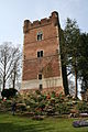
This list gives an overview of motte-and-bailey castles in Belgium with a motte that is still visible and that hasn't been completely levelled or disappeared. This list is not exhaustive.

List of motte castles in Belgium
ProvinceLocationTownNameHeritageCoordinatesImage
AntwerpBornem Bornem Den Dulft 106091 51°05′43″N4°13′48″E / 51.09532°N 4.23001°E / 51.09532; 4.23001 Bornem Kloosterstraat zonder nummer - 150861 - onroerenderfgoed.jpg
AntwerpBrecht Brecht Waterhoeve 51°21′02″N4°38′47″E / 51.35048°N 4.64652°E / 51.35048; 4.64652
AntwerpWestmeerbeek Hulshout Oud Hof ter Borgt 51°03′49″N4°50′15″E / 51.06373°N 4.83740°E / 51.06373; 4.83740 Hulshout Westmeerbeek OudHofterBorgt foto1 - 173718 - onroerenderfgoed.jpg
Antwerp Kontich KontichMotte bij Neerhoeve 13524 51°07′21″N4°26′43″E / 51.12256°N 4.44522°E / 51.12256; 4.44522
Antwerp Kontich KontichMotte van Boutersem 140145 51°08′10″N4°27′44″E / 51.13617°N 4.46230°E / 51.13617; 4.46230
AntwerpPoederlee Lille Ouden Hofberg 51°12′45″N4°50′18″E / 51.21245°N 4.83844°E / 51.21245; 4.83844
AntwerpRanst Ranst Zevenbergen 51°11′42″N4°33′23″E / 51.19505°N 4.55644°E / 51.19505; 4.55644
Brussels Boitsfort Watermael-BoitsfortHondenberg 50°47′50″N4°24′58″E / 50.79729°N 4.41621°E / 50.79729; 4.41621
East Flanders Moorsel AalstHof te Eksel 307758 50°56′37″N4°05′38″E / 50.94354°N 4.09388°E / 50.94354; 4.09388
East Flanders Teralfene AffligemAlvinneberg 50°53′23″N4°05′24″E / 50.88974°N 4.09009°E / 50.88974; 4.09009
East Flanders Beveren-Waas Beveren Singelberg 8410 51°14′07″N4°14′41″E / 51.23531°N 4.24479°E / 51.23531; 4.24479 Singelberg.jpg
East Flanders Liedekerke DenderleeuwKasteelberg 50°52′21″N4°04′43″E / 50.87239°N 4.07857°E / 50.87239; 4.07857
East Flanders Erpe Erpe-MereKasteelberg 95739 50°56′07″N3°58′33″E / 50.93515°N 3.97576°E / 50.93515; 3.97576 Erpe Kasteelberg Dorpsstraat 53.JPG
East Flanders Ertvelde EvergemHoge Wal 10965 51°10′15″N3°44′27″E / 51.17093°N 3.74088°E / 51.17093; 3.74088 Evergem Jacob Van Arteveldelaan zonder nummer Hoge wal - 231527 - onroerenderfgoed.jpg
East Flanders Heldergem HaaltertBoonhof 307844 50°53′08″N3°56′48″E / 50.88556°N 3.94663°E / 50.88556; 3.94663
East Flanders Ressegem HerzeleMotte De Wal 9251 50°53′30″N3°54′43″E / 50.89170°N 3.91194°E / 50.89170; 3.91194
East Flanders Munte MerelbekeKalvarieberg 8709 50°56′37″N3°44′30″E / 50.94360°N 3.74175°E / 50.94360; 3.74175 Merelbeke Munte Torrekensstraat Houtkant op site met motte (8) - 216630 - onroerenderfgoed.jpg
East Flanders Bevere OudenaardeHof de Bruwaan 50°51′41″N3°35′05″E / 50.86144°N 3.58462°E / 50.86144; 3.58462
East Flanders Mullem OudenaardeKlein Kasteeltje 50°53′45″N3°36′11″E / 50.89581°N 3.60319°E / 50.89581; 3.60319
East Flanders Kemzeke StekeneAlvinusberg 51°13′20″N4°03′28″E / 51.2221°N 4.0579°E / 51.2221; 4.0579
East Flanders Roborst ZwalmMotte van Roborst 11029 50°51′51″N3°45′23″E / 50.86424°N 3.75640°E / 50.86424; 3.75640 Zwalm Borstekouterstraat 58 - 380095 - onroerenderfgoed.jpg
Flemish BrabantBever Bever Burght 50°43′12″N3°55′09″E / 50.71992°N 3.91917°E / 50.71992; 3.91917
Flemish Brabant Butsel Boutersem Motte 122 50°50′25″N4°50′52″E / 50.84022°N 4.84785°E / 50.84022; 4.84785 Motte van het oud kasteel van Boutersem. - 255893 - onroerenderfgoed.jpg
Flemish BrabantDiest Diest Tafelrondemotte 553 50°59′07″N5°03′29″E / 50.98539°N 5.05819°E / 50.98539; 5.05819 Oude donjonmotte op de Warandeheuvel te Diest, nu lindenprieel in landschappelijk park - 203661 - onroerenderfgoed.jpg
Flemish Brabant Groot-Bijgaarden DilbeekDonjon 1304 50°52′24″N4°15′49″E / 50.87331°N 4.26359°E / 50.87331; 4.26359 0 Grand-Bigard - Donjon du chateau (1).JPG
Flemish BrabantGeetbets Geetbets Motte 50°53′19″N5°07′07″E / 50.88851°N 5.11848°E / 50.88851; 5.11848 Motte Geetbets.jpg
Flemish BrabantBorgt Grimbergen Senecaberg 43943 50°55′41″N4°24′32″E / 50.9280°N 4.4088°E / 50.9280; 4.4088 Borght.jpg
Flemish Brabant Sint-Agatha-Rode HuldenbergMotte 50°47′11″N4°38′09″E / 50.78644°N 4.63596°E / 50.78644; 4.63596
Flemish Brabant Waanrode KortenbergMotte 134195 50°54′47″N4°59′42″E / 50.91314°N 4.99493°E / 50.91314; 4.99493
Flemish BrabantLanden Landen Hunsberg 1301 50°44′53″N5°03′56″E / 50.74817°N 5.06568°E / 50.74817; 5.06568 Sint-Gitterdal - 203778 - onroerenderfgoed.jpg
Flemish BrabantLanden Landen Tombe van Pepijn 1296 50°44′50″N5°03′46″E / 50.74716°N 5.06267°E / 50.74716; 5.06267 Tumulus de Pepin de Landen 01.JPG
Flemish Brabant Rumsdorp Landen Motte van Rumsdorp 571 50°46′04″N5°04′34″E / 50.76788°N 5.07616°E / 50.76788; 5.07616 Landen Motte-Rumsdorp 3 - 242862 - onroerenderfgoed.jpg
Flemish Brabant Wange LandenMotte van Wange 1340 50°47′14″N5°01′48″E / 50.78715°N 5.03003°E / 50.78715; 5.03003 Landen Motte-Wange 2 - 242866 - onroerenderfgoed.jpg
Flemish BrabantLonderzeel Londerzeel Motte De Burcht 962 51°00′06″N4°18′02″E / 51.00180°N 4.30054°E / 51.00180; 4.30054 Londerzeel Burcht 7 - 32970 - onroerenderfgoed.jpg
Flemish BrabantLubbeek Lubbeek Hof ter Hove/Stakenberg 50°53′10″N4°50′45″E / 50.8860°N 4.8457°E / 50.8860; 4.8457
Flemish BrabantSint-Brixius-Rode Meise De Borcht 45663 50°57′38″N4°20′02″E / 50.96047°N 4.33390°E / 50.96047; 4.33390
Flemish BrabantMerchtem Merchtem Hunsberg 50°57′07″N4°15′55″E / 50.95189°N 4.26528°E / 50.95189; 4.26528
Flemish BrabantMerchtem Merchtem Burcht 36014 50°57′31″N4°14′05″E / 50.95873°N 4.23470°E / 50.95873; 4.23470 Merchtem Reedijk 10 ringgracht - 175801 - onroerenderfgoed.jpg
Flemish BrabantTielt Tielt-Winge Motte Butsberg 50°56′17″N4°54′56″E / 50.93797°N 4.91548°E / 50.93797; 4.91548 Motte op de Butsberg te Tielt-Winge - 372451 - onroerenderfgoed.jpg
Flemish BrabantZoutleeuw Zoutleeuw Castelberg 50°50′37″N5°07′27″E / 50.84355°N 5.12407°E / 50.84355; 5.12407 Motteheuvelzoutleeuw.JPG
Hainaut Warneton Comines-WarnetonMontagne du Château 50°45′15″N2°57′16″E / 50.75404°N 2.95432°E / 50.75404; 2.95432
HainautEnghien Enghien Motte de Brabant 55010-CLT-0016-01 50°41′37″N4°02′33″E / 50.69351°N 4.04242°E / 50.69351; 4.04242
HainautLabliau Enghien Motte 50°39′55″N3°59′14″E / 50.6652°N 3.9873°E / 50.6652; 3.9873
HainautMarcq Enghien Motte de Bornival 50°41′39″N4°00′58″E / 50.69414°N 4.01614°E / 50.69414; 4.01614
HainautPetit-Engien Enghien Motte de Strihoux 50°42′28″N4°05′08″E / 50.70774°N 4.08567°E / 50.70774; 4.08567
Hainaut Nechin Estaimpuis Château de la Royère 50°40′33″N3°16′33″E / 50.67572°N 3.27587°E / 50.67572; 3.27587 Remain of a castle - panoramio.jpg
HainautQuaregnon Quaregnon Catiau du Diable 53065-CLT-0004-01 50°26′42″N3°51′48″E / 50.4449°N 3.8634°E / 50.4449; 3.8634 Les vestiges des murailles du Catiau du Diable.JPG
HainautHoves Silly Motte féodale 55039-CLT-0007-016 50°40′14″N4°02′04″E / 50.67056°N 4.03441°E / 50.67056; 4.03441
LiègeFooz Awans Motte féodale de Fooz 62006-INV-0010-01 50°40′46″N5°26′18″E / 50.67941°N 5.43842°E / 50.67941; 5.43842 Motte feodale de Fooz Awans 02.jpg
LiègeVille-en-Hesbaye Braives Motte 50°36′58″N5°06′56″E / 50.61603°N 5.11549°E / 50.61603; 5.11549 Motte Feodale Ville-en-Hesbaye.jpg
LiègeHaneffe Donceel Montagne du Maison forte 50°38′19″N5°19′04″E / 50.63873°N 5.31768°E / 50.63873; 5.31768 Motte Montagne et douves du Maison-forte Haneffe Donceel.jpg
LiègeCelles Faimes Motte féodale 64076-CLT-0001-01 50°39′47″N5°15′36″E / 50.66318°N 5.25993°E / 50.66318; 5.25993 Celles-tumulus.JPG
LiègeLes Waleffes Faimes Motte féodale 50°38′24″N5°13′10″E / 50.64010°N 5.21942°E / 50.64010; 5.21942 Motte feodale Les Waleffes Faimes.jpg
LiègeOmal Geer Motte d’Omal 64029-CLT-0021-01 50°39′29″N5°11′49″E / 50.65812°N 5.19689°E / 50.65812; 5.19689 Motte Omal Geer.jpg
LiègeHannut Hannut Petit Bosquet 64034-CLT-0015-01 50°40′14″N5°04′34″E / 50.67058°N 5.07614°E / 50.67058; 5.07614 Petit Bosquet motte Hannut.jpg
Liège Liers Herstal Motte féodale de Liers 62051-CLT-0006-01 50°41′38″N5°33′54″E / 50.69380°N 5.56490°E / 50.69380; 5.56490 20170709 111 liers.jpg
LiègeLamine Remicourt Motte castrale de Lamine 64063-CLT-0004-01 50°41′22″N5°20′10″E / 50.68945°N 5.33610°E / 50.68945; 5.33610 Motte castrale de Lamine Remicourt 03.jpg
LiègeFize-Fontaine Villers-le-Bouillet Motte 50°35′10″N5°16′43″E / 50.58605°N 5.27849°E / 50.58605; 5.27849 Motte Ferme du Cerf Fize-Fontaine Villers-le-Bouillet 01.jpg
LiègeVieux-Waleffe Villers-le-Bouillet Motte féodale
Liège Warnant-Dreye Villers-le-BouilletFerme des Burettes 50°35′46″N5°14′02″E / 50.59605°N 5.23390°E / 50.59605; 5.23390 Montjoie Ferme des Burettes Warnant-Dreye Villers-le-Bouillet.jpg
LimburgTerkoest Alken Mot 31701 50°53′35″N5°16′44″E / 50.89312°N 5.27891°E / 50.89312; 5.27891 Alken O. L. Vrouwstraat zonder nummer - 160592 - onroerenderfgoed.jpg
Limburg Beverst BilzenSchuylenborg mot 50°53′15″N5°28′11″E / 50.88753°N 5.46970°E / 50.88753; 5.46970 Beverst Motte Schuylenborg.jpg
Limburg Grote-Spouwen BilzenHeuvel 50°50′01″N5°33′08″E / 50.83362°N 5.55233°E / 50.83362; 5.55233 Heuvel archeologische vindplaats motte Grote-Spouwen Bilzen 02.jpg
Limburg Borgloon BorgloonBurcht van Loon 1916 50°48′03″N5°20′38″E / 50.80089°N 5.34399°E / 50.80089; 5.34399 Borgloon, Speelhof, Linde op motteheuvel - 217284 - onroerenderfgoed.jpg
LimburgWaterschei Genk Motteruïne Stalengoed 50°59′14″N5°30′54″E / 50.98724°N 5.51510°E / 50.98724; 5.51510 Motruine Stalengoed Genk 01.jpg
LimburgHasselt Hasselt Henegauw 50°53′40″N5°21′03″E / 50.89432°N 5.35076°E / 50.89432; 5.35076 Hasselt Henegauw IJskelder-Mot1.jpg
Limburg Kuringen Hasselt Prinsenhof 20913 50°56′40″N5°18′31″E / 50.94437°N 5.30862°E / 50.94437; 5.30862 Prinsenhof Motte Kuringen Hasselt.jpg
Limburg Stevoort HasseltAsberg 50°54′24″N5°13′43″E / 50.90673°N 5.22867°E / 50.90673; 5.22867 Asberg motte Stevoort Hasselt2.jpg
LimburgHorpmaal Heers Motte hill 32110 50°45′22″N5°20′11″E / 50.75602°N 5.33628°E / 50.75602; 5.33628 Horpmaal-Motheuvel (2).JPG
LimburgHoeselt Hoeselt Mot 3197 50°51′06″N5°29′04″E / 50.85178°N 5.48446°E / 50.85178; 5.48446 Hoeselt De Mot.jpg
LimburgRomershoven Hoeselt Blokkes-motte 50°51′26″N5°27′46″E / 50.85718°N 5.46265°E / 50.85718; 5.46265
LimburgWerm Hoeselt Tom 50°50′03″N5°28′48″E / 50.83406°N 5.48007°E / 50.83406; 5.48007 Hoeselt-Werm-Tom.jpg
Limburg Kessenich KinrooiMotte of Kessenich 3206 51°09′02″N5°49′27″E / 51.15054°N 5.82430°E / 51.15054; 5.82430 Den Berg Kessenich (1).JPG
LimburgGellik Lanaken Motte in de Burg 3223 50°52′50″N5°36′34″E / 50.88067°N 5.60943°E / 50.88067; 5.60943
Limburg Millen RiemstToem 3643 50°47′13″N5°33′44″E / 50.78689°N 5.56235°E / 50.78689; 5.56235 Millen Toem.jpg
Limburg Brustem Sint-Truiden Torenburcht 3393 50°48′06″N5°13′03″E / 50.801667°N 5.2175°E / 50.801667; 5.2175 Brustem - Burgtoren.jpg
Limburg Zepperen Sint-TruidenNatenbampt 50°50′48″N5°15′08″E / 50.84662°N 5.25229°E / 50.84662; 5.25229 Motte Natenbampt Zepperen.jpg
LimburgKolmont Tongeren Burcht van Kolmont 37528 50°47′58″N5°25′23″E / 50.79931°N 5.42297°E / 50.79931; 5.42297 Burcht van Kolmont.jpg
LimburgMulken Tongeren Burchttoren van Mulken 37425 50°47′23″N5°26′41″E / 50.78984°N 5.44467°E / 50.78984; 5.44467 Tongeren Tempelierstoren Mulken.jpg
Limburg Rutten TongerenMot 2050 50°44′46″N5°26′47″E / 50.74600°N 5.44635°E / 50.74600; 5.44635 De Mot motteheuvel Rutten Tongeren.jpg
LimburgWellen Wellen Mot 50°51′11″N5°20′45″E / 50.85304°N 5.34570°E / 50.85304; 5.34570 Wellen Mot Houtstraat.jpg
LuxembourgHeinstert Attert Burgknapp 49°45′06″N5°43′35″E / 49.75175°N 5.72640°E / 49.75175; 5.72640
LuxembourgBouillon Bouillon Beaumont La ramonette 49°47′22″N5°03′46″E / 49.78941°N 5.06271°E / 49.78941; 5.06271
LuxembourgBuzenolÉtalleMontauban-motte 85009-CLT-0001-01 49°37′45″N5°35′39″E / 49.62913°N 5.59415°E / 49.62913; 5.59415

Vestige d'un donjon gallo-Romain sur le site de Montauban Buzenol Belgique.JPG

LuxembourgBodange Fauvillers Alt Schlass (Vieux Château) 49°51′42″N5°41′25″E / 49.8618°N 5.6904°E / 49.8618; 5.6904
LuxembourgMellier Léglise Haut-de-la-Cour-motte 84033-CLT-0001-01 49°46′06″N5°31′04″E / 49.7683°N 5.5177°E / 49.7683; 5.5177
LuxembourgMarcourt Rendeux Motte de l'Ermitage Saint-Thibaut 50°12′36″N5°31′00″E / 50.20989°N 5.51676°E / 50.20989; 5.51676
LuxembourgMirwartSaint-Hubert Mirwart Castle 84059-CLT-0006-01 50°03′17″N5°15′28″E / 50.05466°N 5.25784°E / 50.05466; 5.25784
Namur Aublain CouvinMotte féodale 50°03′57″N4°24′50″E / 50.06575°N 4.41386°E / 50.06575; 4.41386
Namur Liernu EghézéeMotte Del Rigadrie 50°35′02″N4°49′59″E / 50.58398°N 4.83313°E / 50.58398; 4.83313 Motte Del Rigadrie Liernu Eghezee.jpg
Namur Haltinne GesvesMotte 92054-CLT-0014-01 50°27′02″N5°04′30″E / 50.45058°N 5.07512°E / 50.45058; 5.07512 Motte feodale de Haltinne Gesves.jpg
NamurPetite-Hour Houyet Château de Hour 91072-INV-0226-01 50°10′14″N5°01′39″E / 50.17048°N 5.02739°E / 50.17048; 5.02739
NamurSugny Vresse-sur-Semois Tchesté de la Rotche 49°49′54″N4°53′57″E / 49.83156°N 4.89923°E / 49.83156; 4.89923
Walloon Brabant Braine-le-Château Braine-le-ChâteauLes Monts 25015-CLT-0013-01 50°41′12″N4°15′37″E / 50.68670°N 4.26038°E / 50.68670; 4.26038
Walloon BrabantNethen Grez-Doiceau Motte de Nethen 25037-CLT-0013-01 50°47′03″N4°40′32″E / 50.78429°N 4.67566°E / 50.78429; 4.67566
Walloon BrabantLasne Lasne Motte 50°41′09″N4°29′22″E / 50.6857°N 4.4894°E / 50.6857; 4.4894
West Flanders Dudzele BrugesSchottenhof 74577 51°16′30″N3°14′03″E / 51.27511°N 3.23415°E / 51.27511; 3.23415
West FlandersOostkerke Damme Hof van Lembeke 51°16′09″N3°18′16″E / 51.26920°N 3.30458°E / 51.26920; 3.30458
West FlandersOostkerke Damme Ten Doele 69603 51°17′53″N3°18′03″E / 51.29799°N 3.30083°E / 51.29799; 3.30083
West FlandersOostkerke Damme Motte ‘t Wallant 30605 51°17′08″N3°17′17″E / 51.28548°N 3.28797°E / 51.28548; 3.28797
West FlandersGistel Gistel Godelievemotte 52002 51°09′02″N2°55′35″E / 51.15045°N 2.92647°E / 51.15045; 2.92647 Abdij Ten Putte (Gistel) 20.jpg
West Flanders Loker HeuvellandGalooie-Mote 12394 50°46′40″N2°46′14″E / 50.77767°N 2.77043°E / 50.77767; 2.77043 Heuvelland Loker Douanestraat z.nr. ID201012 02 - 158835 - onroerenderfgoed.jpg
West Flanders Merkem HouthulstHoge Mote 28583 50°57′30″N2°53′39″E / 50.95826°N 2.89410°E / 50.95826; 2.89410 Zuidwallandstraat znr motte - 33897 - onroerenderfgoed.jpg
West Flanders Werken Kortemark Hogen Andjoen 11772 51°01′44″N2°57′42″E / 51.02876°N 2.96168°E / 51.02876; 2.96168 Werkenplein hooghen andjoen - 105104 - onroerenderfgoed.jpg
West Flanders Werken Kortemark Vrouwhillewal 49443 51°02′55″N2°59′00″E / 51.04863°N 2.98346°E / 51.04863; 2.98346 Steenstraat znr vrouwhillewal - 105076 - onroerenderfgoed.jpg
West Flanders Reningelst PoperingeMotte van kasteel van Reningelst 13466 50°49′00″N2°45′53″E / 50.81659°N 2.7648°E / 50.81659; 2.7648
West Flanders Spiere Spiere-HelkijnCave aux diables 13109 50°43′41″N3°20′57″E / 50.72809°N 3.34906°E / 50.72809; 3.34906
West FlandersVeurne Veurne Warandemotte 51°04′20″N2°39′37″E / 51.07231°N 2.66040°E / 51.07231; 2.66040 Veurne circulaire-burcht 1 - 243465 - onroerenderfgoed.jpg

Related Research Articles

<span class="mw-page-title-main">Motte-and-bailey castle</span> Medieval fortification

A motte-and-bailey castle is a European fortification with a wooden or stone keep situated on a raised area of ground called a motte, accompanied by a walled courtyard, or bailey, surrounded by a protective ditch and palisade. Relatively easy to build with unskilled labour, but still militarily formidable, these castles were built across northern Europe from the 10th century onwards, spreading from Normandy and Anjou in France, into the Holy Roman Empire, as well as the Low Countries it controlled, in the 11th century, when these castles were popularized in the area that became the Netherlands. The Normans introduced the design into England and Wales. Motte-and-bailey castles were adopted in Scotland, Ireland, and Denmark in the 12th and 13th centuries. By the end of the 13th century, the design was largely superseded by alternative forms of fortification, but the earthworks remain a prominent feature in many countries.

<span class="mw-page-title-main">Dunamuggy</span> Human settlement in Northern Ireland

Dunamuggy is a townland of 172 acres in County Antrim, Northern Ireland. It is situated in the civil parish of Donegore and the historic barony of Antrim Upper.

<span class="mw-page-title-main">Trecastle</span> Village in Powys, Wales

Trecastle is a village in Powys, Wales, situated on the edge of the Brecon Beacons National Park (Welsh: Parc Cenedlaethol Bannau Brycheiniog) and in the community of Llywel. The village has a population of about 200.

<i>Possession</i> (Byatt novel) 1990 Booker Prize winner

Possession: A Romance is a 1990 best-selling novel by English writer A. S. Byatt that won the 1990 Booker Prize for Fiction. The novel explores the postmodern concerns of similar novels, which are often categorised as historiographic metafiction, a genre that blends approaches from both historical fiction and metafiction.

<span class="mw-page-title-main">Pickering Castle</span> Castle in North Yorkshire, England

Pickering Castle is a motte-and-bailey fortification in Pickering, North Yorkshire, England.

<span class="mw-page-title-main">Quiéry-la-Motte</span> Commune in Hauts-de-France, France

Quiéry-la-Motte is a commune in the Pas-de-Calais department in the Hauts-de-France region of France.

<span class="mw-page-title-main">Tretower Castle</span>

Tretower Castle is a Grade I-listed ruined castle in the village of Tretower in the county of Powys, Wales. It was built around the beginning of the twelfth century as a motte and bailey castle and this was probably replaced mid-century by a stone shell keep. The castle was enlarged in the early thirteenth century, but later fell into ruin.

<span class="mw-page-title-main">Saint-André-de-Corcy</span> Commune in Auvergne-Rhône-Alpes, France

Saint-André-de-Corcy is a commune in the Ain département in eastern France.

<span class="mw-page-title-main">Sainte-Céronne-lès-Mortagne</span> Commune in Normandy, France

Sainte-Céronne-lès-Mortagne is a commune in the Orne department in north-western France.

<span class="mw-page-title-main">Igé, Orne</span> Commune in Normandy, France

Igé is a commune in the Orne department in north-western France.

<span class="mw-page-title-main">Castles in South Yorkshire</span>

While there are many castles in South Yorkshire, the majority are manor houses and motte-and-bailey which were commonly found in England after the Norman Conquest.

<span class="mw-page-title-main">La Motte-Fouquet</span> Commune in Normandy, France

La Motte-Fouquet is a commune in the Orne department in north-western France.

<span class="mw-page-title-main">Jason Motte</span> American baseball player (born 1982)

Jason Louis Motte is an American former professional baseball pitcher. He played in Major League Baseball (MLB) for the St. Louis Cardinals, Chicago Cubs, Colorado Rockies, and Atlanta Braves. The Cardinals drafted him as a catcher in 2003 and he converted to pitching in 2006. Motte played a key role in the 2011 World Series championship run, saving five postseason games. In 2012, he led the National League (NL) in saves with 42. Motte had Tommy John surgery to repair an ulnar collateral ligament injury that kept him from playing all of 2013. After returning to the Cardinals midway through the 2014 season, Motte signed a one-year, $4.5 million deal with the Cubs for 2015.

<span class="mw-page-title-main">Belfast Lower</span> Place in Northern Ireland, United Kingdom

Belfast Lower is a barony in County Antrim, Northern Ireland. To its east lies the east-Antrim coast and Belfast Lough, and it is bordered by four other baronies: Belfast Upper to the south, Carrickfergus to the east, Antrim Upper to the west; Glenarm Upper to the north. The Forth and Milewater rivers both flow through Belfast Lower, with Larne harbour also situated in the barony.

Peterborough Castle, also known as Mount Thorold and Touthill, was a medieval motte and bailey castle in Peterborough, Cambridgeshire, England.

<span class="mw-page-title-main">Waytemore Castle</span> Medieval fortress in Hertfordshire, England

Waytemore Castle is a ruined castle in the town of Bishop's Stortford in Hertfordshire, England. The remains are a Grade I listed structure.

<span class="mw-page-title-main">Rémalard en Perche</span> Commune in Normandy, France

Rémalard en Perche is a commune in the department of Orne, northwestern France. The municipality was established on 1 January 2016 by merger of the former communes of Bellou-sur-Huisne, Dorceau and Rémalard.

The motte-and-bailey fallacy is a form of argument and an informal fallacy where an arguer conflates two positions that share similarities, one modest and easy to defend and one much more controversial and harder to defend. The arguer advances the controversial position, but when challenged, insists that only the more modest position is being advanced. Upon retreating to the motte, the arguer can claim that the bailey has not been refuted or that the critic is unreasonable.