WikiMili
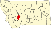
List of mountains in Broadwater County, Montana
Last updated
March 21, 2022
Map all coordinates using:
OpenStreetMap
Download coordinates as:
KML
This list is
incomplete
; you can help by
adding missing items
.
(
February 2011
)
There are at least
27 named
mountains
in
Broadwater County, Montana
.
Avalanche Butte
,
46°45′22″N
111°29′11″W
/
46.75611°N 111.48639°W
/
46.75611; -111.48639
(
Avalanche Butte
)
, el.
7,690 feet (2,340
m)
[1]
Big Mountain
,
46°16′17″N
111°43′28″W
/
46.27139°N 111.72444°W
/
46.27139; -111.72444
(
Big Mountain
)
, el.
6,558 feet (1,999
m)
[2]
Bilk Mountain
,
46°39′51″N
111°27′59″W
/
46.66417°N 111.46639°W
/
46.66417; -111.46639
(
Bilk Mountain
)
, el.
7,336 feet (2,236
m)
[3]
Black Butte
,
46°17′39″N
111°12′14″W
/
46.29417°N 111.20389°W
/
46.29417; -111.20389
(
Black Butte
)
, el.
6,604 feet (2,013
m)
[4]
Black Butte
,
46°27′53″N
111°22′38″W
/
46.46472°N 111.37722°W
/
46.46472; -111.37722
(
Black Butte
)
, el.
5,745 feet (1,751
m)
[5]
Boulder Baldy
,
46°33′22″N
111°19′37″W
/
46.55611°N 111.32694°W
/
46.55611; -111.32694
(
Boulder Baldy
)
, el.
8,937 feet (2,724
m)
[6]
Boulder Mountain
,
46°32′39″N
111°21′03″W
/
46.54417°N 111.35083°W
/
46.54417; -111.35083
(
Boulder Mountain
)
, el.
8,793 feet (2,680
m)
[7]
Cayuse Mountain
,
46°40′28″N
111°27′06″W
/
46.67444°N 111.45167°W
/
46.67444; -111.45167
(
Cayuse Mountain
)
, el.
7,064 feet (2,153
m)
[8]
Cedar Hill
,
46°05′38″N
111°24′21″W
/
46.09389°N 111.40583°W
/
46.09389; -111.40583
(
Cedar Hill
)
, el.
4,892 feet (1,491
m)
[9]
Chewh-toowh-too-peh Hill
,
46°03′59″N
111°33′57″W
/
46.06639°N 111.56583°W
/
46.06639; -111.56583
(
Chewh-toowh-too-peh Hill
)
, el.
4,419 feet (1,347
m)
[10]
Dutchie Butte
,
46°26′21″N
111°21′48″W
/
46.43917°N 111.36333°W
/
46.43917; -111.36333
(
Dutchie Butte
)
, el.
5,216 feet (1,590
m)
[11]
Frenchman Hill
,
46°11′43″N
111°45′30″W
/
46.19528°N 111.75833°W
/
46.19528; -111.75833
(
Frenchman Hill
)
, el.
6,414 feet (1,955
m)
[12]
Giant Hill
,
46°18′24″N
111°41′15″W
/
46.30667°N 111.68750°W
/
46.30667; -111.68750
(
Giant Hill
)
, el.
6,197 feet (1,889
m)
[13]
Glendale Butte
,
46°15′24″N
111°42′05″W
/
46.25667°N 111.70139°W
/
46.25667; -111.70139
(
Glendale Butte
)
, el.
5,974 feet (1,821
m)
[14]
Grassy Mountain
,
46°18′23″N
111°07′14″W
/
46.30639°N 111.12056°W
/
46.30639; -111.12056
(
Grassy Mountain
)
, el.
7,690 feet (2,340
m)
[15]
High Peak
,
46°02′53″N
111°28′01″W
/
46.04806°N 111.46694°W
/
46.04806; -111.46694
(
High Peak
)
, el.
5,607 feet (1,709
m)
[16]
Hooligans Hill
,
46°26′37″N
111°22′03″W
/
46.44361°N 111.36750°W
/
46.44361; -111.36750
(
Hooligans Hill
)
, el.
4,859 feet (1,481
m)
[17]
Lombard Hill
,
46°06′24″N
111°23′47″W
/
46.10667°N 111.39639°W
/
46.10667; -111.39639
(
Lombard Hill
)
, el.
3,976 feet (1,212
m)
[18]
Lone Mountain
,
46°07′32″N
111°38′13″W
/
46.12556°N 111.63694°W
/
46.12556; -111.63694
(
Lone Mountain
)
, el.
4,997 feet (1,523
m)
[19]
Mount Baldy
,
46°26′25″N
111°14′51″W
/
46.44028°N 111.24750°W
/
46.44028; -111.24750
(
Mount Baldy
)
, el.
9,442 feet (2,878
m)
[20]
Mount Edith
,
46°25′54″N
111°11′07″W
/
46.43167°N 111.18528°W
/
46.43167; -111.18528
(
Mount Edith
)
, el.
9,439 feet (2,877
m)
[21]
Needham Mountain
,
46°41′58″N
111°28′24″W
/
46.69944°N 111.47333°W
/
46.69944; -111.47333
(
Needham Mountain
)
, el.
6,742 feet (2,055
m)
[22]
Pilot Knob
,
46°25′27″N
111°20′13″W
/
46.42417°N 111.33694°W
/
46.42417; -111.33694
(
Pilot Knob
)
, el.
5,489 feet (1,673
m)
[23]
Sherlock Mountain
,
46°11′53″N
111°05′13″W
/
46.19806°N 111.08694°W
/
46.19806; -111.08694
(
Sherlock Mountain
)
, el.
6,604 feet (2,013
m)
[24]
Sixmile Mountain
,
46°11′41″N
111°13′28″W
/
46.19472°N 111.22444°W
/
46.19472; -111.22444
(
Sixmile Mountain
)
, el.
7,615 feet (2,321
m)
[25]
The Buttes
,
46°06′40″N
111°29′27″W
/
46.11111°N 111.49083°W
/
46.11111; -111.49083
(
The Buttes
)
, el.
4,324 feet (1,318
m)
[26]
Wall Mountain
,
46°13′02″N
111°03′47″W
/
46.21722°N 111.06306°W
/
46.21722; -111.06306
(
Wall Mountain
)
, el.
6,837 feet (2,084
m)
[27]
See also
List of mountains in Montana
List of mountain ranges in Montana
Notes
↑
"Avalanche Butte"
.
Geographic Names Information System
.
United States Geological Survey
.
↑
"Big Mountain"
.
Geographic Names Information System
.
United States Geological Survey
.
↑
"Bilk Mountain"
.
Geographic Names Information System
.
United States Geological Survey
.
↑
"Black Butte"
.
Geographic Names Information System
.
United States Geological Survey
.
↑
"Black Butte"
.
Geographic Names Information System
.
United States Geological Survey
.
↑
"Boulder Baldy"
.
Geographic Names Information System
.
United States Geological Survey
.
↑
"Boulder Mountain"
.
Geographic Names Information System
.
United States Geological Survey
.
↑
"Cayuse Mountain"
.
Geographic Names Information System
.
United States Geological Survey
.
↑
"Cedar Hill"
.
Geographic Names Information System
.
United States Geological Survey
.
↑
"Chewh-toowh-too-peh Hill"
.
Geographic Names Information System
.
United States Geological Survey
.
↑
"Dutchie Butte"
.
Geographic Names Information System
.
United States Geological Survey
.
↑
"Frenchman Hill"
.
Geographic Names Information System
.
United States Geological Survey
.
↑
"Giant Hill"
.
Geographic Names Information System
.
United States Geological Survey
.
↑
"Glendale Butte"
.
Geographic Names Information System
.
United States Geological Survey
.
↑
"Grassy Mountain"
.
Geographic Names Information System
.
United States Geological Survey
.
↑
"High Peak"
.
Geographic Names Information System
.
United States Geological Survey
.
↑
"Hooligans Hill"
.
Geographic Names Information System
.
United States Geological Survey
.
↑
"Lombard Hill"
.
Geographic Names Information System
.
United States Geological Survey
.
↑
"Lone Mountain"
.
Geographic Names Information System
.
United States Geological Survey
.
↑
"Mount Baldy"
.
Geographic Names Information System
.
United States Geological Survey
.
↑
"Mount Edith"
.
Geographic Names Information System
.
United States Geological Survey
.
↑
"Needham Mountain"
.
Geographic Names Information System
.
United States Geological Survey
.
↑
"Pilot Knob"
.
Geographic Names Information System
.
United States Geological Survey
.
↑
"Sherlock Mountain"
.
Geographic Names Information System
.
United States Geological Survey
.
↑
"Sixmile Mountain"
.
Geographic Names Information System
.
United States Geological Survey
.
↑
"The Buttes"
.
Geographic Names Information System
.
United States Geological Survey
.
↑
"Wall Mountain"
.
Geographic Names Information System
.
United States Geological Survey
.
v
t
e
Municipalities and communities of
Broadwater County, Montana
,
United States
County seat
:
Townsend
City
Townsend
Broadwater County map
CDPs
Radersburg
Spokane Creek
The Silos
Toston
Wheatland
Winston
Unincorporated
community
Lombard
Montana portal
United States portal
This page is based on this
Wikipedia article
Text is available under the
CC BY-SA 4.0
license; additional terms may apply.
Images, videos and audio are available under their respective licenses.