The Wupatki National Monument is a United States National Monument located in north-central Arizona, near Flagstaff. Rich in Native American ruins, the monument is administered by the National Park Service in close conjunction with the nearby Sunset Crater Volcano National Monument. Wupatki was listed on the National Register of Historic Places on October 15, 1966. The listing included three contributing buildings and 29 contributing structures on 35,253.2 acres (14,266.5 ha).

Lake Mead National Recreation Area is a U.S. National Recreation Area located in southeastern Nevada and northwestern Arizona. Operated by the National Park Service, Lake Mead NRA follows the Colorado River corridor from the westernmost boundary of Grand Canyon National Park to just north of the cities of Laughlin, Nevada and Bullhead City, Arizona. It includes all of the eponymous Lake Mead as well as the smaller Lake Mohave – reservoirs on the river created by Hoover Dam and Davis Dam, respectively – and the surrounding desert terrain and wilderness.

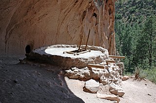
Bandelier National Monument is a 33,677-acre (13,629 ha) United States National Monument near Los Alamos in Sandoval and Los Alamos Counties, New Mexico. The monument preserves the homes and territory of the Ancestral Puebloans of a later era in the Southwest. Most of the pueblo structures date to two eras, dating between 1150 and 1600 AD.

The George Washington Birthplace National Monument is a national monument in Westmoreland County, Virginia, United States. This site was developed in the mid-17th century as a colonial tobacco plantation by Englishman John Washington. A member of the assembly, he was a great-grandfather of George Washington, general and the first United States president. George Washington was born in this house on February 22, 1732. He lived here until age three, returning later to live here as a teenager.

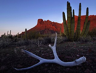
Organ Pipe Cactus National Monument is a U.S. National Monument and UNESCO biosphere reserve located in extreme southern Arizona that shares a border with the Mexican state of Sonora. The park is the only place in the United States where the organ pipe cactus grows wild. Along with organ pipe, many other types of cacti and other desert flora native to the Yuma Desert section of the Sonoran Desert region grow in the park. Organ Pipe Cactus National Monument is 517 sq mi (1,340 km2) in size. In 1976 the monument was declared a Biosphere Reserve by UNESCO, and in 1977 95% of Organ Pipe Cactus was declared a wilderness area.

Cabrillo National Monument is at the southern tip of the Point Loma Peninsula in San Diego, California, United States. It commemorates the landing of Juan Rodríguez Cabrillo at San Diego Bay on September 28, 1542. This event marked the first time a European expedition had set foot on what later became the West Coast of the United States. The site was designated as California Historical Landmark #56 in 1932. As with all historical units of the National Park Service, Cabrillo was listed on the National Register of Historic Places on October 15, 1966.

Tonto National Monument is a National Monument in the Superstition Mountains, in Gila County of central Arizona. The area lies on the northeastern edge of the Sonoran Desert ecoregion, an arid habitat with annual rainfall of about 16 inches (400 mm) here. The Salt River runs through this area, providing a rare, year-round source of water.

Alibates Flint Quarries National Monument is a U.S. National Monument in the State of Texas. For thousands of years, people came to the red bluffs above the Canadian River for flint, vital to their existence. Demand for the high quality, rainbow-hued flint is reflected in the distribution of Alibates Flint through the Great Plains and beyond. Indians of the Ice Age Clovis Culture used Alibates flint for spear points to hunt the Imperial Mammoth before the Great Lakes were formed. The flint usually lies just below the surface at ridge level in a layer up to six feet thick. The quarry pits were not very large, between 5 and 25 feet wide and 4 to 7 feet deep. Many of these quarries were exploited by the Antelope Creek people, of the Panhandle culture, between 1200 and 1450. The stone-slabbed, multi-room houses built by the Antelope Creek people have long been of interest to the public and studied by archaeologists. Today this area is protected by the U.S. National Park Service and can only be viewed by ranger-led guided tours, which must be reserved in advance.

Pompeys Pillar National Monument is a rock formation located in south central Montana, United States. Designated a National Monument on January 17, 2001, and managed by the U.S. Bureau of Land Management, it consists of only 51 acres (21 ha), making it one of the smallest National Monuments in the U.S. It was previously designated a National Historic Landmark on July 25, 1965. The new Pompeys Pillar Interpretive Center opened in 2006. Exhibits in the 5,700-square foot center relate the journey of Captain William Clark and his detachment, including Sacagawea and her son Pomp, down the Yellowstone River Valley in 1806.

Grand Canyon-Parashant National Monument is located on the northern edge of the Grand Canyon in northwest Arizona. The monument was established by Presidential Proclamation 7265 on January 11, 2000.

This is a list of properties and historic districts in Iowa that are listed on the National Register of Historic Places. There are listings in all of Iowa's 99 counties, adding up to over 2,300 total.

There are more than 1,700 properties and districts listed on the National Register of Historic Places in Florida. They are distributed through 66 of the state's 67 counties. Of these, 42 are National Historic Landmarks.

Buildings, sites, districts, and objects in California listed on the National Register of Historic Places:

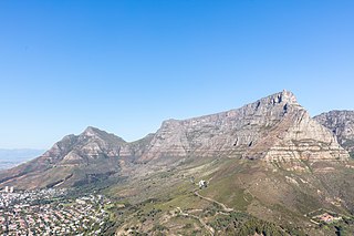
Table Mountain National Park, previously known as the Cape Peninsula National Park, is a national park in Cape Town, South Africa, proclaimed on 29 May 1998, for the purpose of protecting the natural environment of the Table Mountain Chain, and in particular the rare fynbos vegetation. The park is managed by South African National Parks. The property is included as part of the UNESCO Cape Floral Region World Heritage Site.

Beaver Lake State Park is a public recreation area located in Logan County, North Dakota, about equidistant from Napoleon and Wishek. The state park occupies 283 acres (115 ha) of land on the western shore of 968-acre (392 ha) Beaver Lake and offers hiking, boating, swimming, fishing, cabins, and campground.

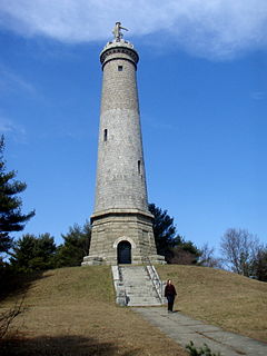
Myles Standish Monument State Reservation is a state-owned historic preserve and public recreation area in Duxbury, Massachusetts. The focus of the state park is a 116-foot granite shaft topped by a statue of Captain Myles Standish. Standish was military leader of Plymouth Colony. The park is managed by the Massachusetts Department of Conservation and Recreation.

Cesar E. Chavez National Monument is a 116-acre (47 ha) U.S. National Monument in Keene, Kern County, California located about 32 miles away from Bakersfield, California. The property was the headquarters of the United Farm Workers (UFW), and home to César Chávez from the early 1970s until his death in 1993, Chávez's gravesite is located in the property's gardens along with that of his wife, Helen Fabela Chávez. Originally developed as a headquarters and worker housing area for a quarry, it served as a tuberculosis sanitarium in the early 1900s, until its acquisition by the UFW in the early 1970s.


