Related Research Articles

Floriana, also known by its title Borgo Vilhena, is a fortified town in the Port Region area of Malta, just outside the capital city Valletta. It has a population of 2,205 as of March 2014. Floriana is the birthplace of many famous Maltese, amongst which the composer of the national anthem, 'L-Innu Malti', Robert Samut; former Bishop of Malta Dun Mauro Caruana, the poets Oliver Friggieri and Maria Grech Ganado, the writer and politician Herbert Ganado and Swedish Idol winner Kevin Borg.

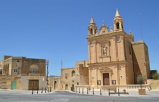
Pietà is a small harbour town in the Eastern Region of Malta, located near the outskirts of the capital city Valletta.

Victoria, also known among the native Maltese as Rabat or by its title Città Victoria, is an administrative unit of Malta, and the main town on Gozo. Victoria has a total population of 6,901, and is the most populous settlement in Gozo.

Rabat is a town in the Western Region of Malta, with a population of 11,497 as of March 2014. It adjoins the ancient capital city of Mdina, and a north-western area formed part of the Roman city of Melite until its medieval retrenchment.

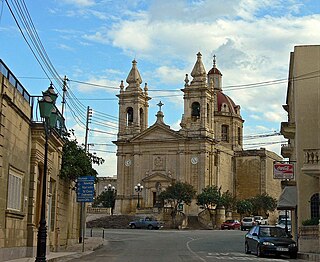
Żurrieq is a town in the Southern Region of Malta. It is one of the oldest towns in the country, and has a population of 11,823 inhabitants as of March 2014. Żurrieq is one of the 10 parishes to be documented in 1436 and is dedicated to Saint Catherine. The island of Filfla is administratively a part of the town. The town stretches from Nigret to Ħal Far. In old times the town had a border with Żejtun. The village of Qrendi used to be part of the parish of Żurrieq until 1618 when it was made into its own parish.

Safi is a village in the Southern Region of Malta, bordering Żurrieq and Kirkop. It has a population of 2,126 people as of March 2014.

San Ġwann is a town in the Northern Region of Malta, with a population of 14,244 as of 2021. Prior to its establishment as a distinct municipality, it was a fragmented community comprising parts of Birkirkara and St. Julian's. San Ġwann emerged as a new parish in 1965 and was officially recognised as a town in 1968. The Local Councils Act of 1993 identified San Gwann as a separate district with its own statutory local government authority, marking its transition from being part of the neighbouring localities. With the first San Gwann Council was elected on 16 April 1994.

Għargħur is a village in the Northern Region of Malta. It is situated on a hilltop between two valleys, and has a population of 2,768, as of March 2014.

Għasri is a village and an administrative unit of Malta, in the western part of the island of Gozo, with a population of 525 people. By population, it is the smallest village in Gozo after San Lawrenz, and the third-smallest in the Maltese Islands, after Bidnija and Mdina. Għasri, however, has a relatively large area.

Għajnsielem is a municipality on the southeastern coast of the island of Gozo in Malta, including the entire island of Comino. It has a population of 3,200 residents, and is the first Gozitan village that greets the visitor on leaving Mġarr Harbour towards the Gozitan heartland. Its name originated from the water spring, around which in 1700, Grandmaster Perellos built an arcade containing public wash basins and fresh water spouts. Attractions include Lourdes Chapel with its sharp steeple and underlying niche of Our Lady of Lourdes, Fort Chambray and the towering of Ghajnsielem Parish Church.
Munxar is an administrative unit of Malta, which lies on the southern side of the island of Gozo. As of March 2014, its population was 1,454 people.

Qala is an administrative unit of Malta, on the island of Gozo, with a population of 1,929 as of September 2019. Nearby is Ħondoq ir-Rummien, a coastline with salt pans and caves.
Sannat is an administrative unit of Malta, on the island of Gozo, with a population of 2,117 people. Ta' Sannat is in the south of Gozo, popular for its very high cliffs, ancient cart ruts, temples and dolmens, and rich fauna and flora. In 1951 The Duchess of Edinburgh of the United Kingdom visited a house called "The Lace house" located in a small square in Ta' Sannat called "Pjazza Tax-Xelina".

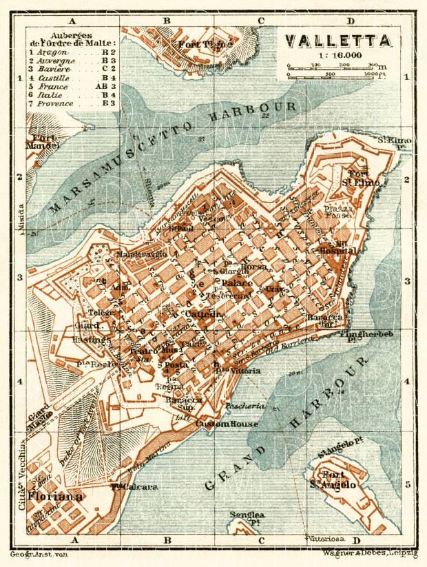
St John's Square is found in front of St John's Co-Cathedral in Valletta, the capital of Malta. It has several outdoor cafés, surrounded by a graceful arcade.

The coastline of Malta consists of bays, sandy beaches, creeks, harbours, small villages, cities, cliffs, valleys, and other interesting sites. Here, there is a list of these different natural features that are found around the coast of Malta.

In Malta, most of the main roads are in the outskirts of the localities to connect one urban area with another urban area. The most important roads are those that connect the south of the island with the northern part, like Tal-Barrani Road, Aldo Moro Street in Marsa and Birkirkara Bypass.
References
- ↑ Christopher Street in Valletta was first named "Strada della Fontana" as a spring or fountain of fresh water was struck in its vicinity whilst a well for the storage of water was being excavated during the building of Valletta. The French Republican Government altered the name to "Rue des Droits de l'Homme". The British Colonial Government then changed the name to "Strada Cristoforo"; Victor F. Denaro, The Houses of Valletta, Malta, 1967.
- ↑ Bonello, Giovanni (2000). Art in Malta - Discoveries and Recoveries Archived 2016-08-28 at the Wayback Machine . Fondazzjoni Patrimonju Malti. p. 51. ISBN 99909-959-7-4. ISBN 99909-959-8-2.
- 1 2 1929 Map of Valletta
- ↑ times of Malta
- ↑ Cilia Lacorte
- ↑ During British pre-1926 (and possibly even after that) Republic Square was known as Piazza Tesoreria not Piazza Regina. Piazza Regina was what is now known as Castille Place.
