This article details how the names of the streets in Crawley and Nedlands, Western Australia evolved along with the variations in use. The streets are within the City of Perth boundaries, which was amended in 2016 to include the University of Western Australia and Kings Park.
| Name | Suburb | Date built | Name source | Other names | Note | Image |
|---|---|---|---|---|---|---|
| Aberdare Road | Nedlands/Shenton Park (boundary-partial) [1] | Aberdare | Probably named after the Baron Aberdare (Clarence Napier Bruce) Barrister-at-Law Inner Temple 1911, served in W.W.1. 1914-19. Aberdare Road is shown on O.P. Perth 18/25 in 1883, so the above origin is not possible Named after coal mining town in South Wales, a colliery in NSW or an estate once owned by Sydney-based law firm International Investment Land and Building Co Ltd. (Williams p318) Named after coal mining town in South Wales, a colliery in NSW or an estate once owned by Sydney-based law firm International Investment Land and Building Co Ltd. (Williams p318) | |||
| Archdeacon Street | Nedlands [2] | |||||
| Australia II Drive | Crawley | By 1838 | Australia II [3] |  | ||
| Baird Avenue | Nedlands | |||||
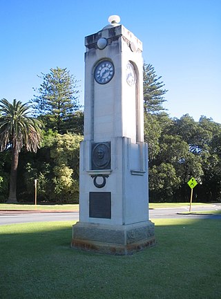
| Barcoo Avenue | Nedlands | By 1838 | ||||
| Bay Road | Nedlands/Claremont (boundary-partial) | |||||
| Bedford Street | Nedlands [4] | |||||
| Bessell Avenue | Nedlands [5] | |||||
| Betty Street | Nedlands | |||||
| Birdwood Parade | Nedlands [6] | |||||
| Blumann Lane | Nedlands | |||||
| Boronia Ave | Nedlands [7] | |||||
| Bostock Road | Nedlands | |||||
| Broadway | Nedlands/Crawley (boundary) | by 1838 | A broad way constructed by the Claremont Road Board to take trams and traffic from the old Perth – Fremantle Road to the Nedlands Baths, Nedlands Park Hotel and Nedlands Jetty in 1907. |  | ||
| Broome Street | Nedlands | |||||
| Bruce Street | Nedlands [8] | |||||
| Bulimba Road | Nedlands | By 1838 | ||||
| Burwood Street | Nedlands | |||||
| Campsie Street | Nedlands | |||||
| Carrington Street | Nedlands/Karrakata (boundary-partial) [9] | By 1838 | ||||
| Caporn Street | Crawley |  | ||||
| Clark Street | Nedlands/Crawley | |||||
| Clifton Street | Nedlands | |||||
| Cook Street | Crawley | |||||
| Cooper Street | Nedlands/Crawley | |||||
| Crawley Avenue | Crawley | Anna Crawley |  | |||
| Crossleigh Court | Nedlands | |||||
| Croydon Street | Nedlands | |||||
| Dalkeith Road | Nedlands/Karrakatta/Dalkeith | |||||
| Doonan Road | Nedlands | |||||
| Drosera Lane | Nedlands | |||||
| Edward Street | Nedlands/Crawley | |||||
| Edward Bruce Foreshore Path | Nedlands/Crawley | |||||
| Elizabeth Street | Nedlands | |||||
| Esplanade | Nedlands | |||||
| Everett Street | Crawley |  | ||||
| Fairway | Crawley | |||||
| Ferdinand Road/Street | Crawley | Now Winthrop Street circa 1917 | ||||
| Florence Road | Nedlands | |||||
| Fraseriana Lane | Nedlands | |||||
| Gairdner Drive | Nedlands | |||||
| Gallop Road | Nedlands/Dalkeith | |||||
| Gordon Street | Nedlands | |||||
| Government Road(.1) | Crawley | Now Crawley Avenue | ||||
| Government Road(.2) | Nedlands/Karrakatta | |||||
| Government Road(.3) | Formerly Nedlands, now Swanbourne after rezoning | Now Narla Road in 2018 | ||||
| Granby Crescent | Nedlands | |||||
| Hackett Drive | Crawley | Winthrop Hackett | ||||
| Hampden Lane | Nedlands | John Hampden | John Hampden was an English patriot (1594 to 1653). Road extended from Subiaco. | |||
| Hampden Road | Nedlands/Crawley | John Hampden | ||||
| Hardy Road | Nedlands | |||||
| Hibbertia Lane | Nedlands | |||||
| Hillway | Nedlands | |||||
| Hospital Avenue | Nedlands | |||||
| Jenkins Avenue | Nedlands | |||||
| Kanimbla Road | Nedlands | |||||
| Karella Street | ||||||
| Kingston Street | Nedlands | |||||
| Kings Park Avenue | Not to be confused with Kings Park Road in West Perth. |  | ||||
| Kingsway | Nedlands | Originally Highway, but renamed in 1960's to avoid confusion with Stirling Highway | ||||
| Kinninmont Avenue | Nedlands | |||||
| Kitchener Street | Nedlands | |||||
| Langham Street | Nedlands | |||||
| Laxum Lane | Nedlands | |||||
| Leopold Street | Nedlands | |||||
| Leura Street | Nedlands | By 1838 | ||||
| Loch Street | Nedlands/Claremont | |||||
| Loftus Street | Nedlands | |||||
| Loneragan Street | Nedlands | |||||
| Louise Street | Nedlands | |||||
| Lupin Hill Grove | Nedlands | |||||
| Marita Road | Nedlands | |||||
| Martin Avenue | Nedlands | |||||
| Mattner Lane | Nedlands | |||||
| Megalong Street | Nedlands | |||||
| Melvista Avenue | Nedlands/Dalkeith | |||||
| Meriwa Street | Nedlands | |||||
| Micrantha Lane | Nedlands | |||||
| Monash Avenue | Nedlands | Sir John Monash | ||||
| Mountjoy Road | Nedlands | |||||
| Mounts Bay Road | Crawley | |||||
| Myers Street | Crawley | |||||
| Napier Street | Nedlands | |||||
| Narla Road | Formerly Nedlands, Swanbourne after rezoning | Formerly Government Road(.3) | ||||
| Ord Street | Nedlands | Aboriginal for red gum favoured by Nomenclature Committee | ||||
| Park Avenue | Crawley | |||||
| Park Road | Nedlands/Crawley | |||||
| Parkway | Crawley | |||||
| Poole Avenue | Nedlands | By 1838 | ||||
| Portland Street | Nedlands | |||||
| Princess Road | Nedlands/Crawley | By 1838 | ||||
| Quadrangle Point | Nedlands | |||||
| Robinson Street | Nedlands | By 1838 | ||||
| Rockton Road | Nedlands | |||||
| Rookstone Court | Nedlands | |||||
| Smythe Road | Nedlands/Karrakatta | By 1838 | ||||
| Stanley Street | Nedlands | By 1838 | ||||
| Stirling Highway | Nedlands/Crawley | Perth-Fremantle Road [10] | ||||
| Tareena Street | Nedlands | |||||
| Taylor Road | Nedlands | |||||
| The Avenue | Nedlands/Crawley | |||||
| Thomas Street | Nedlands | |||||
| Tyrell Street | Nedlands | |||||
| Verdun Street | Nedlands | |||||
| Viewway | Nedlands | By 1838 | Was unnamed upon its creation | |||
| Village Road | Nedlands | |||||
| Vincent Street | Nedlands | |||||
| Vix Street | Nedlands/Dalkeith | |||||
| Waroonga Road | Nedlands | |||||
| Webster Street | Nedlands | |||||
| Weld Street | Nedlands | |||||
| Williams Place | Nedlands | |||||
| Williams Road | Nedlands | |||||
| Wingfield Avenue | Nedlands | |||||
| Winthrop Avenue | Nedlands/Crawley | By 1838 | Winthrop Hackett | |||
| Withnell Drive | Nedlands | By 1838 | ||||
| Wyvern Lane | Nedlands | |||||