List of waterfalls in Alaska

Last updated

Map all coordinates using: OpenStreetMap  
Download coordinates as: KML

This is a list of the (43) officially named waterfalls found in the state of Alaska in the United States, according to the United States Geological Survey Geographic Names Information System.

Contents

List of waterfalls

Waterfall (Name, Borough/Census Area, Alaska)
Latitude
Longitude
GNIS
Feature
ID #
Link
Coordinates
Elevation
Borough
or
Census area
Watercourse
Alaska Chief Falls 58.305000 N134.340000 W 1893245 58°18′18″N134°20′24″W / 58.30500°N 134.34000°W / 58.30500; -134.34000 (Alaska Chief Falls (Juneau)) 1,286 feet (392 m) Juneau Icy Gulch near confluence Gold Creek (near Lurvey Creek)
Beaver Falls (Alaska) 55.381667 N131.522778 W 1420335 55°22′54″N131°31′22″W / 55.38167°N 131.52278°W / 55.38167; -131.52278 (Beaver Falls (Ketchikan Gateway)) 1,312 feet (400 m) Ketchikan Gateway Beaver Falls Creek between Upper & Lower Silvis Lake
Bridal Veil Falls (Skagway, Alaska) 59.569444 N135.208333 W 1416669 59°34′10″N135°12′30″W / 59.56944°N 135.20833°W / 59.56944; -135.20833 (Bridal Veil Falls (Skagway)) 2,802 feet (854 m) Skagway Tributary of Captain William Moore Creek (tributary of Skagway River)
Bridal Veil Falls (Valdez-Cordova Census Area, Alaska) 61.070278 N145.893611 W 1417164 61°4′13″N145°53′37″W / 61.07028°N 145.89361°W / 61.07028; -145.89361 (Bridal Veil Falls (Valdez-Cordova)) 1,145 feet (349 m) Valdez-Cordova (CA) Tributary of Lowe River
Brooks Falls 58.555278 N155.789722 W 1399475 58°33′19″N155°47′23″W / 58.55528°N 155.78972°W / 58.55528; -155.78972 (Brooks Falls (Lake and Peninsula)) 92 feet (28 m) Lake and Peninsula Brooks River between Lake Brooks and Naknek Bay
Cheshnina Falls 61.858333 N144.116389 W 1400211 61°51′30″N144°6′59″W / 61.85833°N 144.11639°W / 61.85833; -144.11639 (Cheshnina Falls (Valdez-Cordova)) 4,610 feet (1,410 m) Valdez-Cordova (CA) Cheshnina River between Cheshnina Glacier & the Copper River
Chitistone Falls 61.547222 N142.174722 W 1400340 61°32′50″N142°10′29″W / 61.54722°N 142.17472°W / 61.54722; -142.17472 (Chitistone Falls (Valdez-Cordova)) 3,743 feet (1,141 m) Valdez-Cordova (CA) Chitistone River at Chitistone Gorge
Cynthia Falls 59.786111 N153.208611 W 1412879 59°47′10″N153°12′31″W / 59.78611°N 153.20861°W / 59.78611; -153.20861 (Cynthia Falls (Kenai Peninsula)) 604 feet (184 m) Kenai Peninsula Hardy Creek (tributary of Fitz Creek)
Ebner Falls 58.311944 N134.375833 W 1401644 58°18′43″N134°22′33″W / 58.31194°N 134.37583°W / 58.31194; -134.37583 (Ebner Falls (Juneau)) 879 feet (268 m) Juneau Unknown Watercourse
Fish Ladder 55.293056 N130.651944 W 1421940 55°17′35″N130°39′7″W / 55.29306°N 130.65194°W / 55.29306; -130.65194 (Fish Ladder (Ketchikan Gateway)) 148 feet (45 m) Ketchikan Gateway Unknown Watercourse
Fultons Falls 58.133333 N155.016667 W 1866426 58°8′0″N155°1′0″W / 58.13333°N 155.01667°W / 58.13333; -155.01667 (Fultons Falls (Kodiak Island)) 157 feet (48 m) Kodiak Island Unknown Watercourse
Golden Gate Falls 1402746 60°30′3″N160°10′13″W / 60.50083°N 160.17028°W / 60.50083; -160.17028 (Golden Gate Falls (Bethel)) 764 feet (233 m) Bethel (CA) Kisaralik River
Grindstone Falls (Alaska) 58.216667 N134.250000 W 1894606 58°13′0″N134°15′0″W / 58.21667°N 134.25000°W / 58.21667; -134.25000 (Grindstone Falls (Juneau)) 0 feet (0 m) Juneau Grindstone Creek
Hidden Falls (Alaska) 57.216389 N134.874167 W 1422574 57°12′59″N134°52′27″W / 57.21639°N 134.87417°W / 57.21639; -134.87417 (Hidden Falls (Sitka)) 66 feet (20 m) Sitka between Hidden Falls Lake and Kasnyku Bay
Horsetail Falls (Alaska) 61.068056 N145.905556 W 1417165 61°4′5″N145°54′20″W / 61.06806°N 145.90556°W / 61.06806; -145.90556 (Horsetail Falls (Valdez-Cordova)) 299 feet (91 m) Valdez-Cordova (CA) Lowe River
Kasnyku Falls 57.191111 N134.832500 W 1422971 57°11′28″N134°49′57″W / 57.19111°N 134.83250°W / 57.19111; -134.83250 (Kasnyku Falls (Sitka)) 151 feet (46 m) Sitka Between Kasnyku Lake and Waterfall Cove
Kolevokharit Koygut Falls 59.7833333 N158.5666667 W 1895213 59°47′0″N158°34′0″W / 59.78333°N 158.56667°W / 59.78333; -158.56667 (Kolevokharit Koygut Falls (Dillingham)) 666 feet (203 m) Dillingham (CA) Unnamed Stream
Liberty Falls 61.621389 N144.545000 W 1405319 61°37′17″N144°32′42″W / 61.62139°N 144.54500°W / 61.62139; -144.54500 (Liberty Falls (Valdez-Cordova)) 1,204 feet (367 m) Valdez-Cordova (CA) Liberty Creek (tributary Copper River)
Lost Rocker Falls 58.266667 N134.316667 W 1895495 58°16′0″N134°19′0″W / 58.26667°N 134.31667°W / 58.26667; -134.31667 (Lost Rocker Falls (Juneau)) 610 feet (190 m) Juneau Sheep Creek
Lower Falls (Alaska) 1405754 60°26′7″N160°5′37″W / 60.43528°N 160.09361°W / 60.43528; -160.09361 (Lower Falls (Bethel)) 876 feet (267 m) Bethel (CA) Kisaralik River
Nugget Falls 58.4272 N134.5367 WNot recorded by the GNIS 58°25′38″N134°32′12″W / 58.4272°N 134.5367°W / 58.4272; -134.5367 (Nugget Falls) 377 feet (115 m) Juneau (below Mendenhall Glacier) Nugget Creek
Nutkwa Falls 55.118611 N132.539444 W 1424029 55°7′7″N132°32′22″W / 55.11861°N 132.53944°W / 55.11861; -132.53944 (Nutkwa Falls (P. of Wales-Hyder)) 30 feet (9.1 m) Prince of Wales-Hyder (CA) between Nutkwa Inlet and Nutkwa Lagoon
Ohman Falls 60.591389 N145.583056 W 1424051 60°35′29″N145°34′59″W / 60.59139°N 145.58306°W / 60.59139; -145.58306 (Ohman Falls (Valdez-Cordova)) 407 feet (124 m) Valdez-Cordova (CA) Power Creek
Petrof Falls 59.800000 N154.950000 W 1896178 59°48′0″N154°57′0″W / 59.80000°N 154.95000°W / 59.80000; -154.95000 (Petrof Falls (Lake and Peninsula)) 220 feet (67 m) Lake and Peninsula Newhalen River
Pitchfork Falls 59.531111 N135.196389 W 1424288 59°31′52″N135°11′47″W / 59.53111°N 135.19639°W / 59.53111; -135.19639 (Pitchfork Falls (Skagway)) 2,119 feet (646 m) Skagway Outlet Stream from Goat Lake to Skagway River
Rainbow Falls (Alaska) 56.422778 N132.332778 W 1424726 56°25′22″N132°19′58″W / 56.42278°N 132.33278°W / 56.42278; -132.33278 (Rainbow Falls (Wrangell)) 535 feet (163 m) Wrangell Unknown Watercourse
Reid Falls 59.473333 N135.284722 W 1424799 59°28′24″N135°17′5″W / 59.47333°N 135.28472°W / 59.47333; -135.28472 (Reid Falls (Skagway)) 446 feet (136 m) Skagway Unknown Watercourse
Rudleston Falls 61.084167 N145.891111 W 1417163 61°5′3″N145°53′28″W / 61.08417°N 145.89111°W / 61.08417; -145.89111 (Rudleston Falls (Valdez-Cordova)) 869 feet (265 m) Valdez-Cordova (CA) Lowe River
Sahlin Falls 60.694444 N145.966944 W 1414404 60°41′40″N145°58′1″W / 60.69444°N 145.96694°W / 60.69444; -145.96694 (Sahlin Falls (Valdez-Cordova)) 210 feet (64 m) Valdez-Cordova (CA) Sahlin Creek, near its mouth at Sheep Bay
Silver Falls (Alaska) 55.979167 N130.053056 W 1414713 55°58′45″N130°3′11″W / 55.97917°N 130.05306°W / 55.97917; -130.05306 (Silver Falls (P. of Wales-Hyder)) 443 feet (135 m) Prince of Wales-Hyder (CA) Fish Creek, near Logjam Creek
Silver Salmon Falls 55.791389 N133.094722 W 1414717 55°47′29″N133°5′41″W / 55.79139°N 133.09472°W / 55.79139; -133.09472 (Silver Salmon Falls (P. of Wales-Hyder)) 108 feet (33 m) Prince of Wales-Hyder (CA) Stanley Creek (tributary Lester River)
Sockeye Falls 55.916667 N133.000000 W 1877213 55°55′0″N133°0′0″W / 55.91667°N 133.00000°W / 55.91667; -133.00000 (Sockeye Falls (Petersburg)) 151 feet (46 m) Petersburg Lyman Creek?
Suicide Falls 58.275556 N134.353611 W 1410316 58°16′32″N134°21′13″W / 58.27556°N 134.35361°W / 58.27556; -134.35361 (Suicide Falls (Juneau)) 249 feet (76 m) Juneau Cross Bay Creek (tributary of Gastineau Channel)
Sweetheart Falls 57.945278 N133.676667 W 1415133 57°56′43″N133°40′36″W / 57.94528°N 133.67667°W / 57.94528; -133.67667 (Sweetheart Falls (Juneau)) 446 feet (136 m) Juneau Sweetheart Creek between Lower Sweetheart Lake and Gilbert Bay
The Falls (Hoonah-Angoon Census Area, Alaska) 57.557778 N134.354167 W 1415239 57°33′28″N134°21′15″W / 57.55778°N 134.35417°W / 57.55778; -134.35417 (The Falls (Hoonah-Angoon)) 72 feet (22 m) Hoonah-Angoon (CA) between Salt Lake and Mitchell Bay
The Falls (Southeast Fairbanks Census Area, Alaska) 64.929444 N141.825833 W 1410799 64°55′46″N141°49′33″W / 64.92944°N 141.82583°W / 64.92944; -141.82583 (The Falls (Southeast Fairbanks)) 1,309 feet (399 m) Southeast Fairbanks (CA) Seventymile River
Thunder Bird Falls 61.442500 N149.355556 W 1416869 61°26′33″N149°21′20″W / 61.44250°N 149.35556°W / 61.44250; -149.35556 (Thunder Bird Falls (Anchorage)) 446 feet (136 m) Anchorage Thunder Bird Creek (tributary of Eklutna River)
Tikchik Falls 1896967 59°54′0″N158°8′0″W / 59.90000°N 158.13333°W / 59.90000; -158.13333 (Tikchik Falls (Dillingham)) 377 feet (115 m) Dillingham (CA) Nuyakuk River
Upper Falls (Alaska) 1411561 60°21′49″N159°56′30″W / 60.36361°N 159.94167°W / 60.36361; -159.94167 (Upper Falls (Bethel)) 1,230 feet (370 m) Bethel (CA) tributary ?
White Falls (1), (Aleutians West, Alaska) 51.786111 N176.798611 W 1419716 51°47′10″N176°47′55″W / 51.78611°N 176.79861°W / 51.78611; -176.79861 (White Falls (Aleutians West)) 0 feet (0 m) Aleutians West (CA) Unknown Watercourse
White Falls (2), (Aleutians West, Alaska) 51.784722 N175.768056 W 1897293 51°47′5″N175°46′5″W / 51.78472°N 175.76806°W / 51.78472; -175.76806 (White Falls (Aleutians West)) 0 feet (0 m)
Whiting Falls 60.990833 N144.842500 W 1415750 60°59′27″N144°50′33″W / 60.99083°N 144.84250°W / 60.99083; -144.84250 (Whiting Falls (Valdez-Cordova)) 732 feet (223 m) Valdez-Cordova (CA) tributary of Copper River
Wolf Pass Falls 55.733889 N132.856944 W 1985292 55°44′2″N132°51′25″W / 55.73389°N 132.85694°W / 55.73389; -132.85694 (Wolf Pass Falls (P. of Wales-Hyder)) 1,975 feet (602 m) Prince of Wales-Hyder (CA) Tributary of Thorne River?
Wolverine Falls (Alaska) 58.547222 N154.719444 W 1897338 58°32′50″N154°43′10″W / 58.54722°N 154.71944°W / 58.54722; -154.71944 (Wolverine Falls (Lake and Peninsula)) 771 feet (235 m) Lake and Peninsula Rainbow River (tributary of Savonoski River)

Related Research Articles

Chugach Mountains Mountains in southern Alaska

The Chugach Mountains of southern Alaska are the northernmost of the several mountain ranges that make up the Pacific Coast Ranges of the western edge of North America. The range is about 250 miles (402 km) long and 60 miles (97 km) wide, and extends from the Knik and Turnagain Arms of the Cook Inlet on the west to Bering Glacier, Tana Glacier, and the Tana River on the east. It is bounded on the north by the Matanuska, Copper, and Chitina rivers. The highest point of the Chugach Mountains is Mount Marcus Baker, at 13,094 feet (3,991 m), but with an average elevation of 4,006 feet (1,221 m), most of its summits are not especially high. Even so, its position along the Gulf of Alaska ensures more snowfall in the Chugach than anywhere else in the world, an annual average of over 1500 cm (800 in).

Geographic Names Information System Geographical database

The Geographic Names Information System (GNIS) is a database of name and locative information about more than two million physical and cultural features throughout the United States and its territories, Antarctica, and the associated states of the Marshall Islands, Federated States of Micronesia, and Palau. It is a type of gazetteer. It was developed by the United States Geological Survey (USGS) in cooperation with the United States Board on Geographic Names (BGN) to promote the standardization of feature names.

Mount Hubbard

Mount Hubbard is one of the major mountains of the Saint Elias Range. It is located on the Alaska/Yukon border; the Canadian side is within Kluane National Park and Reserve, and the American side is part of Wrangell–St. Elias National Park. The mountain was named in 1890 by U.S. Geological Survey geologist Israel Russell after Gardiner Greene Hubbard, first president of the National Geographic Society, which had co-sponsored Russell's expedition.

Selawik River River in Alaska, United States

The Selawik River is a stream, 140 miles (230 km) long, in the northwestern part of the U.S. state of Alaska. Originating in the Purcell Mountains near the Zane Hills, it flows generally west through the Selawik National Wildlife Refuge to Selawik Lake, which empties into the Kotzebue Sound in the Chukchi Sea. The river is approximately at the latitude of the Arctic Circle.

Mount Griggs

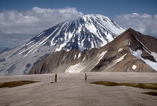
Mount Griggs, formerly known as Knife Peak Volcano, is a stratovolcano, which lies 10 km behind the volcanic arc defined by other Katmai group volcanoes. Although no historic eruptions have been reported from Mount Griggs, vigorously active fumaroles persist in a summit crater and along the upper southwest flank. The fumaroles on the southwest flank are the hottest, and some of the flank fumaroles can roar so loudly that they can be heard from the valley floor. The slopes of Mount Griggs are heavily mantled by fallout from the 1912 eruption of Novarupta volcano. The summit consists of three concentric craters, the lowest and largest of which contains a recent summit cone topped by two craters. The volume of the volcanic edifice is estimated at about 25 cubic kilometers (6.0 cu mi). Isotopic analysis indicates that the source of Griggs' magma is distinct from the other Katmai volcanoes.

Birch Creek (Yukon River tributary) River in Alaska, United States

Birch Creek is a 150-mile (240 km) tributary of the Yukon River in the U.S. state of Alaska. Beginning at the confluence of Ptarmigan and Eagle creeks near Porcupine Dome, it flows southwest, then south under the Steese Highway and into the Steese National Conservation Area. It then turns east, then north, again passing under the Steese Highway and entering the Yukon Flats National Wildlife Refuge. Turning northwest, it ends where it splits into two distributaries, Lower Mouth Birch Creek and Upper Mouth Birch Creek, near Birch Creek, Alaska. The distributaries flow into the Yukon River at separate locations downstream of Fort Yukon.

Sheenjek River River in Alaska, United States

The Sheenjek River is a 200-mile (320 km) tributary of the Porcupine River in the U.S. state of Alaska. It begins in the eastern part of the Brooks Range and flows southward to meet the larger river northeast of Fort Yukon.

Israel Russell

Israel Cook Russell, LL.D. was an American geologist and geographer who explored Alaska in the late 19th century.

Henry Gannett American geographer

Henry Gannett was an American geographer who is described as the "father of mapmaking in America." He was the chief geographer for the United States Geological Survey essentially from its founding until 1902. He was also a founding member and president of the National Geographic Society.

Mount Bona

Mount Bona is one of the major mountains of the Saint Elias Mountains in eastern Alaska, and is the fifth-highest independent peak in the United States. It is either the tenth- or eleventh-highest peak in North America. Mount Bona and its adjacent neighbor Mount Churchill are both large ice-covered stratovolcanoes. Bona has the distinction of being the highest volcano in the United States and the fourth-highest in North America, outranked only by the three highest Mexican volcanoes, Pico de Orizaba, Popocatépetl, and Iztaccíhuatl. Its summit is a small stratovolcano on top of a high platform of sedimentary rocks.

Geikie Glacier flows northeast to Mercer Bay, at the southwest end of Cumberland West Bay, South Georgia. It was first charted by the Swedish Antarctic Expedition, 1901–04, under Otto Nordenskiöld, who named it after Sir Archibald Geikie, a noted Scottish geologist and Director-General of the Geological Survey of Great Britain, 1882–1901.

The Wulik River is a stream, about 80 miles (130 km) long, in the northwestern part of the U.S. state of Alaska. Originating in the De Long Mountains in the North Slope Borough, it flows southwest to Kivalina Lagoon in the Chukchi Sea, east of Kivalina. It heads in the De Long Mountains, which is 5 miles north of Sheep Mountain, and it is 42 miles northwest of Noatak.

Alfred Hulse Brooks American geologist

Alfred Hulse Brooks was an American geologist who served as chief geologist for Alaska for the United States Geological Survey from 1903 to 1924. He is credited with discovering that the biggest mountain range in Arctic Alaska, now called the Brooks Range, was separate from the Rocky Mountains. He also took many photographs of local communities. A collection of the images is held at Yale University.

Mount Isto is the highest peak in the Brooks Range, Alaska, USA. Located in the eastern Brooks Range, in what are known as the Romanzof Mountains, Mount Isto is 5 miles (8.0 km) south of Mount Hubley, the second tallest peak in the Brooks Range. Mount Isto is within the Arctic National Wildlife Refuge and was named in 1966 for Reynold E. (Pete) Isto, a civil engineer for the U.S. Geological Survey. In 2014, new measurement technology established that Mount Isto is the highest peak in the Brooks Range. Previously, Mount Chamberlin was believed to be the tallest, but it is now ranked third.

The Echelmeyer Ice Stream, formerly known as Ice Stream F, is a glaciological feature of the West Antarctic Ice Sheet. It is an ice stream flowing west to the Shirase Coast to the north of the MacAyeal Ice Stream, and is one of several major ice streams draining from Marie Byrd Land into the Ross Ice Shelf. The ice streams were investigated and mapped by U.S. Antarctic Research Program personnel in a number of field seasons from 1983–84 and originally named Ice Stream A, B, C, etc., according to their position from south to north.

Alaska was an unincorporated town in Morgan and Owen counties, in the U.S. state of Indiana.

References

    General references

    • "USGS GNIS Falls in Alaska". United States Board on Geographic Names, United States Geological Survey, United States Department of the Interior.