WikiMili
Lists of cities in Central America
Last updated
September 09, 2025
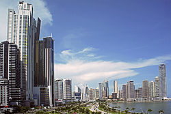
Panama City
, capital of Panama
This is a
list of lists of cities in Central America
.
Contents
Lists of cities in Central America
By country
See also
Lists of cities in Central America
List of largest cities in Central America
By country
Cantons of Costa Rica
List of cities in El Salvador
List of cities in Panama
List of municipalities in Belize
List of places in Guatemala
Municipalities of Honduras
Municipalities of Nicaragua
List of Nicaraguan cities by population
See also
Central America portal
Lists portal
List of cities in Mexico
Lists of cities
v
t
e
Lists of cities in the Americas
Sovereign
states
Antigua and Barbuda
Argentina
Bahamas
Barbados
Belize
Bolivia
Brazil
Canada
Chile
Colombia
Costa Rica
Cuba
Dominica
Dominican Republic
Ecuador
El Salvador
Grenada
Guatemala
Guyana
Haiti
Honduras
Jamaica
Mexico
Nicaragua
Panama
Paraguay
Peru
Saint Kitts and Nevis
Saint Lucia
Saint Vincent and the Grenadines
Suriname
Trinidad and Tobago
United States
Uruguay
Venezuela
Dependencies
and
territories
Anguilla
Aruba
Bermuda
Bonaire
British Virgin Islands
Cayman Islands
Curaçao
Falkland Islands
French Guiana
Greenland
Guadeloupe
Martinique
Montserrat
Puerto Rico
Saba
Saint Barthélemy
Saint Martin
Saint Pierre and Miquelon
Sint Eustatius
Sint Maarten
South Georgia and the South Sandwich Islands
Turks and Caicos Islands
U.S. Virgin Islands
North America
Central America
Caribbean
South America
This article includes a city-related
list of lists
.
This page is based on this
Wikipedia article
Text is available under the
CC BY-SA 4.0
license; additional terms may apply.
Images, videos and audio are available under their respective licenses.