Liwiec

Last updated
Liwiec
Wyszkow liwiec2.jpg
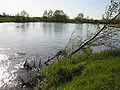
Liwiec near Kamieńczyk
Location
Country Poland
Physical characteristics
Mouth  
  location
Bug
  coordinates
52°36′04″N21°33′30″E / 52.60111°N 21.55833°E / 52.60111; 21.55833
Length142 km (88 mi)
Basin size2,763 km2 (1,067 sq mi)
Discharge 
  average12.1 m3/s (430 cu ft/s)
Basin features
Progression BugNarewVistulaBaltic Sea

The Liwiec (or Liw) is a river in Poland, and a tributary of the Bug River.

Contents

Course

The Liwiec flows in the plains of Southern Podlaskie Voivodeship and central Masovian Voivodeship. It is 142 kilometres long and drains 2,763 square kilometres of watershed. [1]

The source of the Liwiec is located to the north-west of Międzyrzec Podlaski near Siedlce and crosses Wyszków, Liw, Węgrów, and Stara Wieś.

Its lower estuary and confluence with the Bug River is located near the towns of Wyszków and Kamieńczyk.

It has a Natura 2000 EU Special Protection Area region.

See also

Related Research Articles

<span class="mw-page-title-main">Pilica (river)</span> River in Poland

The Pilica is a river in central Poland, and the longest left tributary of the Vistula river, with a length of 333 kilometres. All 9,258 km2 of its basin area is in Poland.

<span class="mw-page-title-main">Narew</span> River in Poland, Belarus

The Narew is a 499-kilometre (310 mi) river primarily in north-eastern Poland. It is also a tributary of the river Vistula. The Narew is one of Europe's few braided rivers, the term relating to the twisted channels resembling braided hair. Around 57 kilometres (35 mi) of the river flows through western Belarus.

<span class="mw-page-title-main">Bug (river)</span> Major European river

The Bug or Western Bug is a major river in Eastern Europe that flows through Belarus (border), Poland, and Ukraine, with a total length of 774 kilometres (481 mi). A tributary of the Narew, the Bug forms part of the border between Belarus and Poland for 178 kilometres (111 mi) and part of the border between Ukraine and Poland for 185 kilometres (115 mi).

<span class="mw-page-title-main">Liw, Poland</span> Village in Masovian Voivodeship, Poland

Liw is a village in the administrative district of Gmina Liw, within Węgrów County, Masovian Voivodeship, in east-central Poland. It lies on the river Liwiec, approximately 5 kilometres (3 mi) west of Węgrów and 68 km (42 mi) east of Warsaw.

<span class="mw-page-title-main">Mrzeżyno</span> Place in West Pomeranian Voivodeship, Poland

Mrzeżyno is a village with a fishing seaport in northwestern Poland, situated near the estuary of the Rega river, on the coast of the Baltic Sea in the historic region of Pomerania. Administratively it is located in Gmina Trzebiatów, Gryfice County, West Pomeranian Voivodeship. It is also a health resort with many pensions, campsites and a spa, and it has a popular beach. It lies approximately 10 kilometres (6 mi) north of Trzebiatów, 27 km (17 mi) north of Gryfice, and 94 km (58 mi) north-east of the regional capital Szczecin.

<span class="mw-page-title-main">Gmina Liw</span> Gmina in Masovian Voivodeship, Poland

Gmina Liw is a rural gmina in Węgrów County, Masovian Voivodeship, in east-central Poland. It takes its name from the village of Liw. The administrative seat of the gmina is the town of Węgrów, although the town is not part of the territory of the gmina.

Lower Odra Valley Landscape Park is a designated Polish Landscape Park protected area, located in West Pomeranian Voivodeship of northwestern Poland.

<span class="mw-page-title-main">Janów Forests Landscape Park</span> Park in southeast Poland

Janów Forests Landscape Park,, is a Polish Landscape Park designated protected area in southeastern Poland.

<span class="mw-page-title-main">Nida Landscape Park</span>

Nida Landscape Park is a Polish Landscape Park designated protected area, located in Świętokrzyskie Voivodeship of south-central Poland. Within the Solec Basin, gypsum outcrops are common, forming rocky cliffs. Examples of karst formations include numerous caves, ponors, wywierzyski, karst lakes and rock gates. They are found in the vicinity of Gacek, Wiślica and Busk-Zdrój. There are karst gullies in Gorysławice. The karst forms found in Nadnidziański Park are unique in the country. Among the most valuable are large-crystalline (glassy) gypsums. The crystals of which they are composed reach a length of 3.5 meters.

<span class="mw-page-title-main">Warta Landscape Park</span>

Warta Landscape Park is a protected area in west-central Poland, established in 1995, covering an area of 134.28 square kilometres (51.85 sq mi) along a stretch of the Warta river west of Konin.

Pogórze Przemyskie Landscape Park is a protected area in south-eastern Poland.

<span class="mw-page-title-main">Knyszyn Forest Landscape Park</span> Protected forest area in Poland

Knyszyn Forest Landscape Park, also known as Puszcza Knyszyńska Landscape Park is a protected area in Knyszyn Forest which is located Podlaskie Voivodeship of northeastern Poland.

<span class="mw-page-title-main">Puszcza Solska Landscape Park</span> Park in Poland

Puszcza Solska Landscape Park, also known as Solska Forest Landscape Park, is a Polish Landscape Park protected area in southeastern Poland.

Seven Island Lake Nature Reserve is a nature reserve established in 1956 around Oświn Lake in north-eastern Poland, close to the border with the Kaliningrad Oblast of Russia.

<span class="mw-page-title-main">Świdwie</span>

Świdwie is a lake in north-western Poland, and is the site of a nature reserve and a Ramsar site.

Wyszków is a village in the administrative district of Gmina Liw, within Węgrów County, Masovian Voivodeship, in east-central Poland. It lies approximately 12 kilometres (7 mi) south of Węgrów and 69 km (43 mi) east of Warsaw.

Kamieńczyk is a village in the administrative district of Gmina Wyszków, within Wyszków County, Masovian Voivodeship, in east-central Poland. It lies approximately 7 kilometres (4 mi) east of Wyszków and 57 km (35 mi) north-east of Warsaw.

Słopsk is a village in the administrative district of Gmina Zabrodzie, within Wyszków County, Masovian Voivodeship, in east-central Poland. It lies approximately 13 kilometres (8 mi) south-west of Wyszków and 41 km (25 mi) north-east of Warsaw. It lies near where the Fiszor river stems from the Bug River.

<span class="mw-page-title-main">Liw Castle</span> Historic site in Masovian Voivodeship, Poland

Liw Castle - a ruin of a Gothic ducal castle raised in the fifteenth century as a guarding stronghold in the town of Liw. The castle is located in Liw, Masovian Voivodeship; in Poland.

The Fiszor is a river of Wyszków County in the Masovian Voivodeship of eastern central Poland, a left tributary of the Bug River. It is 27.16 kilometres long and flows through Choszczowe, Mostówka, in the vicinity of Niegów and the village of Młynarze in Gmina Wyszków district. It flows into the Bug near the village of Słopsk, which is roughly 25 kilometres (16 mi) northeast by air from the northern outskirts of Warsaw.

References