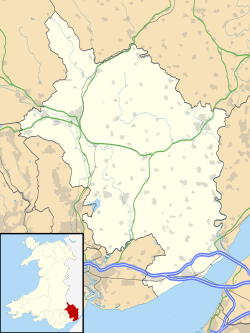
Llancayo

Last updated

Llancayo Mill in course of restoration, 2008 Llancayo Mill.jpg
Llancayo Mill in course of restoration, 2008

Llancayo is a village in Monmouthshire, south east Wales, United Kingdom. It is located two miles north of Usk on the B4598 road to Abergavenny, in the community of Gwehelog Fawr.

Contents

History and amenities

Llancayo Mill is situated in fields visible from the road. It was built around 1813 [1] and destroyed by fire by about 1830. [2] The local story is that the miller left the mill gears engaged when he went to market, and when the wind changed direction the mechanism overheated, igniting the surrounding timber. [3] [4] A Monmouthshire poet, Myfanwy Haycock, wrote a poem about the now disused windmill. It has now been fully restored, with working sails, for use as a "luxury retreat". [5]

The River Usk flows close by.

Related Research Articles

Folly Tower, Pontypool

The Folly Tower - - is a folly located within the grounds of a working farm, close to Pontypool Park, Torfaen, South Wales. It is a prominent local landmark above the A4042 Pontypool to Abergavenny road and overlooks Pontypool to the west and rural Monmouthshire to the east. The Folly is octagonal in shape and roughly 40 ft (12 m) high and is approximately 1,000 ft (305 m) above sea level on the eastern hill range of the Eastern Valley of Monmouthshire, just south of Mynydd Garn-Wen. Less than a mile from the folly is the Shell Grotto.

Blorenge Mountain in Wales

Blorenge, also called The Blorenge, is a prominent mountain overlooking the valley of the River Usk in Abergavenny, Monmouthshire, southeast Wales. It is situated in the southeastern corner of the Brecon Beacons National Park. The summit plateau reaches a height of 1,841 feet (561 m).

Little Mill is a village in Monmouthshire, south east Wales, United Kingdom. The village has grown in size in recent years and has as a result a population of over 1,000.

Pontnewynydd is a predominantly working class suburb of Pontypool, Torfaen, in Wales. It should not be confused with Pontnewydd in nearby Cwmbran.

Llanbadoc is a village and community in the county of Monmouthshire and the preserved county of Gwent in Wales. The population of the village at the 2011 census was 806.

Crindau Human settlement in Wales

Crindau is an older inner-city area just north of the city centre in Newport in south-east Wales. It lies within the Shaftesbury electoral district (ward) and community (parish).

Myfanwy Haycock (1913–1963), born Blodwen Myfanwy Haycock in Pontnewynydd, Wales near Pontypool in the traditional county of Monmouthshire, was a poet, artist and broadcaster.

Llanvihangel Gobion

Llanvihangel Gobion is a village and rural parish of Monmouthshire, Wales, lying within the administrative community of Llanover.

Newbridge-on-Usk

Newbridge-on-Usk is a hamlet in the village and parish of Tredunnock, near Usk, Monmouthshire, south east Wales, in the United Kingdom.

Llanover

Llanover is a village and community in Monmouthshire, Wales. The population taken at the 2011 census was 1,392.

Llantrisant, Monmouthshire

Llantrisant is a village in Monmouthshire, south east Wales, United Kingdom. The community population at the 2011 census was 475.

Monkswood is a village in Monmouthshire, south east Wales, United Kingdom.

Gwernesney

Gwernesney is a village in Monmouthshire in southeast Wales.

Gwehelog Human settlement in Wales

Gwehelog is a village settlement and community in Monmouthshire, south east Wales. The community includes the village of Llancayo.

River Gavenny A river in Monmouthshire, Wales

The River Gavenny or sometimes the Gavenny River is a short river in Monmouthshire in south Wales. It rises 1 mile (1.6 km) southwest of the village of Llanvihangel Crucorney from springs near Penyclawdd Court, supplemented by springs in Blaen-Gavenny Wood and tributary streams there and within the Woodland Trust-owned Great Triley Wood. It flows south for about 4 miles (6.4 km) to its confluence with the River Usk towards the eastern end of Castle Meadows at Abergavenny. The town derives its English-language name from the Gavenny's confluence with the River Usk. Of the buildings on the banks of the river, the Gothic Decorated style church of St Teilo at Llantilio Pertholey is especially notable. Parts of the church date from the thirteenth century with multiple additions since. Blaengavenny Farm, the name of which signifies the 'head of the Gavenny', is a sixteenth century farmhouse near the river's source.

Usk (GWR) railway station is a disused railway station in the town of Usk, Monmouthshire, Wales. The station is now barely recognisable with the remains of the platforms beneath undergrowth, but the trackbed, the adjacent Usk Tunnel and road and river bridges remain extant and can be walked.

Llanfrynach

Llanfrynach is a village and community in the county of Powys, Wales, and the historic county of Brecknockshire. The population of the community as taken at the 2011 census was 571. It lies just to the southeast of Brecon in the Brecon Beacons National Park. The village sits astride the Nant Menasgin, a right bank tributary of the River Usk. The B4558 passes just to its north and the Monmouthshire and Brecon Canal also passes around the village. The Welsh name signifies the 'church of Brynach'. The community includes the hamlets of Llanhamlach and Groesffordd.

The Bryn, or Llangattock Nigh Usk, is a small village on the left bank of the River Usk in Monmouthshire, southeast Wales. It is accessed by a cul-de-sac minor road from the B4598 road, the reclassified former trunk road between Raglan and Abergavenny, now replaced by the modern A40 dual carriageway which runs east–west immediately north of the village. On the western edge of the village is St Cadoc's Church, a Gothic perpendicular style grade II* listed building probably dating from the fifteenth century. The village falls within the administrative community of Llanover. The Usk Valley Walk passes along the riverside path to the south.

The Berthin Brook is a minor right bank tributary of the River Usk in Monmouthshire, in south Wales. Flowing north from New Inn initially, it turns east at Little Mill to flow along a former glacial meltwater channel past the former Royal Ordnance Factory site at Glascoed and by Rhadyr to join the major river 1 km north of the town of Usk. At the height of the last ice age, the Usk valley glacier reached as far down the Usk valley as Little Mill and sediment-laden meltwater created a valley sandur over which the post-glacial Berthin Brook now flows.

References

  1. Gerallt D Nash. "Welsh corn mills — the past, present, … and future?" (PDF). ads.ahds.ac.uk. Retrieved 22 June 2009.
  2. John Newman, The Buildings of Wales: Gwent/Monmouthshire, 2000, ISBN   0-14-071053-1
  3. History of the mill
  4. Fred Hando, Monmouthshire Weekly Argus, 22 August 1959
  5. Windmill restoration project

Coordinates: 51°43′N2°55′W / 51.717°N 2.917°W / 51.717; -2.917