Logan Creek (Black River tributary)

Last updated
Logan Creek
Tributary to Black River
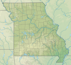
USA Missouri relief location map.svg
Red pog.svg
Location of Logan Creek mouth
Usa edcp relief location map.png
Red pog.svg
Logan Creek (Black River tributary) (the United States)
Location
CountryUnited States
StateMissouri
County Reynolds
City Ellington
Physical characteristics
Sourcedivide of tributary of Logan Creek
  locationabout 2 miles southwest of Number 46 Lake
  coordinates 37°24′30.17″N091°08′29.46″W / 37.4083806°N 91.1415167°W / 37.4083806; -91.1415167 [1]
  elevation1,220 ft (370 m) [1]
Mouth Black River
  location
about 5 miles west of Piedmont, Missouri
  coordinates
37°18′33.18″N090°46′57.44″W / 37.3092167°N 90.7826222°W / 37.3092167; -90.7826222 Coordinates: 37°18′33.18″N090°46′57.44″W / 37.3092167°N 90.7826222°W / 37.3092167; -90.7826222 [1]
  elevation
495 ft (151 m) [1]
Length44.1 mi (71.0 km) [2]
Basin size264.16 square miles (684.2 km2) [3]
Discharge 
  location Black River
  average374.26 cu ft/s (10.598 m3/s) at mouth with Black River [3]
Basin features
Progression Black RiverWhite RiverMississippi RiverGulf of Mexico
River system Black River
Tributaries 
  left Adair Creek
Sweetwater Creek
Suses Branch
Webb Creek
  rightWillie Branch
BridgesCounty Road 737, Highway B (x2), County Road 761, County Road 776, County Road 779, County Road 780, County Road 782, Highway B, Highway F, MO 21, County Road 422


Logan Creek is a stream in western Reynolds County in the Ozarks of southeast Missouri. [4] It is a tributary of the Black River.

The source area of the stream lies just south of Missouri Route 72 northwest of Reynolds. The stream flows south parallel to Missouri Route B and then turns east near the community of Exchange and flows parallel to Missouri Route 106 past northeast Ellington. East of Ellington the stream turns southeast and enters Clearwater Lake and its confluence with the Black River. [5]

Logan Creek has the name of James Logan, a pioneer citizen. [6]
See also

Related Research Articles

<span class="mw-page-title-main">Rapid Creek (South Dakota)</span> Stream in South Dakota, U.S.


Rapid Creek is a tributary of the Cheyenne River, approximately 86 mi (138 km) long, in South Dakota in the United States. The creek's name comes from the Sioux Indians of the area, for the many rapids in the stream.

Mill Creek is a 14.5-mile-long (23.3 km) tributary of Opequon Creek, belonging to the Potomac River and Chesapeake Bay watersheds, located in Berkeley County in West Virginia's Eastern Panhandle. Its name reflects its past as a popular site for various types of mills, beginning with one constructed by Morgan Morgan in the mid-18th century near his cabin in present-day Bunker Hill.

Abrams Creek is an 11.2-mile-long (18.0 km) tributary stream of Opequon Creek in Frederick County and the independent city of Winchester in Virginia. Abrams Creek rises north of Round Hill and flows in a southeasterly direction through Winchester. From Winchester, Abrams Creek flows east into Opequon Creek. The stream was originally known as Abraham's Creek.

<span class="mw-page-title-main">Pohick Creek</span> Stream in Virginia, USA

Pohick Creek is a 14.0-mile-long (22.5 km) tributary stream of the Potomac River in Fairfax County in the U.S. state of Virginia. It takes its name from the Pohick Native American tribe once prevalent in the area.

<span class="mw-page-title-main">North Fork Feather River</span> River in California, United States

The North Fork Feather River is a watercourse of the northern Sierra Nevada and southern Cascades in the U.S. state of California. It flows generally southwards from its headwaters near Lassen Peak to Lake Oroville, a reservoir formed by Oroville Dam in the foothills of the Sierra, where it runs into the Feather River. The river drains about 2,100 square miles (5,400 km2) of the western slope of the Sierras. By discharge, it is the largest tributary of the Feather.

Courtois Creek is a 38.6-mile-long (62.1 km) stream in southern Missouri, United States. It shares its name with the nearby town of Courtois and is in the Courtois Hills region of the Missouri Ozarks. According to the information in the Ramsay Place Names File at the University of Missouri, the creek was "doubtless named for some French settler, but his identity has not been ascertained".

<span class="mw-page-title-main">Big Piney River</span> River in Missouri, United States

The Big Piney River is a 110-mile-long (180 km) tributary of the Gasconade River in south central Missouri in the United States. Via the Gasconade and Missouri rivers, it is part of the Mississippi River basin.

Amys Creek is a stream in Habersham County, Georgia, and is a tributary of the Chattahoochee River. The creek is approximately 4.07 miles (6.55 km) long.

Locust Creek is a stream in Wayne County, Iowa and Chariton, Linn, Livingston, Putnam and Sullivan counties in Missouri. It is a tributary of the Grand River.

<span class="mw-page-title-main">Sinking Creek (Current River tributary)</span>

Sinking Creek is a stream in Dent, Reynolds and Shannon counties in the Ozarks of southeast Missouri. It is a tributary of the Current River.

Abbott Branch is a stream in northern Iron County, Missouri. It is a tributary of Courtois Creek.

Cedar Creek is a stream in Iron and Washington counties in the U.S. state of Missouri. It is a tributary to Big River.

Allen Branch is a stream in Lewis County, Missouri. It is a tributary of Troublesome Creek.

Adair Creek is a stream in western Reynolds County in the Ozarks of southeast Missouri. It is a tributary of Logan Creek.

Doe Run Creek is a stream in Reynolds County in the U.S. state of Missouri. It is a tributary of Webb Creek.

Peruque Creek is a stream in St. Charles and Warren Counties in the U.S. state of Missouri. It is a tributary of the Mississippi River.

Flat Creek is a stream in Barry and Stone counties of southern Missouri. It is a tributary of the James River.

Imboden Fork or Imboden Creek is a stream in Iron and Reynolds counties of southeast Missouri. It is a tributary of the East Fork Black River.

Tunungwant Creek is a 12.78 mi (20.57 km) long fifth-order tributary to the Allegheny River. This is the only stream of this name in the United States.

Graves Creek is a stream in the U.S. state of Montana. It is a tributary to South Fork Flathead River within an impoundment of the same river.

References

  1. 1 2 3 4 "Geographic Names Information System". edits.nationalmap.gov. US Geological Survey. Retrieved January 10, 2023.
  2. "ArcGIS Web Application". epa.maps.arcgis.com. US EPA. Retrieved January 10, 2023.
  3. 1 2 "Watershed Report | Office of Water | US EPA". watersgeo.epa.gov. US EPA. Retrieved January 10, 2023.
  4. U.S. Geological Survey Geographic Names Information System: Logan Creek (Black River tributary)
  5. Missouri Atlas & Gazetteer, DeLorme, 1998, First edition, p. 56, ISBN   0-89933-224-2
  6. "Reynolds County Place Names, 1928–1945". The State Historical Society of Missouri. Archived from the original on June 24, 2016. Retrieved December 13, 2016.