Logan Creek Tributary to Black River | |
---|---|
Location | |
Country | United States |
State | Missouri |
County | Reynolds |
City | Ellington |
Physical characteristics | |
Source | divide of tributary of Logan Creek |
• location | about 2 miles southwest of Number 46 Lake |
• coordinates | 37°24′30.17″N091°08′29.46″W / 37.4083806°N 91.1415167°W [1] |
• elevation | 1,220 ft (370 m) [1] |
Mouth | Black River |
• location | about 5 miles west of Piedmont, Missouri |
• coordinates | 37°18′33.18″N090°46′57.44″W / 37.3092167°N 90.7826222°W [1] |
• elevation | 495 ft (151 m) [1] |
Length | 44.1 mi (71.0 km) [2] |
Basin size | 264.16 square miles (684.2 km2) [3] |
Discharge | |
• location | Black River |
• average | 374.26 cu ft/s (10.598 m3/s) at mouth with Black River [3] |
Basin features | |
Progression | Black River → White River → Mississippi River → Gulf of Mexico |
River system | Black River |
Tributaries | |
• left | Adair Creek Sweetwater Creek Suses Branch Webb Creek |
• right | Willie Branch |
Bridges | County Road 737, Highway B (x2), County Road 761, County Road 776, County Road 779, County Road 780, County Road 782, Highway B, Highway F, MO 21, County Road 422 |
Logan Creek is a stream in western Reynolds County in the Ozarks of southeast Missouri. [4] It is a tributary of the Black River.
The source area of the stream lies just south of Missouri Route 72 northwest of Reynolds. The stream flows south parallel to Missouri Route B and then turns east near the community of Exchange and flows parallel to Missouri Route 106 past northeast Ellington. East of Ellington the stream turns southeast and enters Clearwater Lake and its confluence with the Black River. [5]
Logan Creek has the name of James Logan, a pioneer citizen. [6]
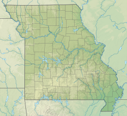
In 8 May, 2009, a derecho-embedded tornado went through the Logan Creek Conservation Area. [7]
From John Kabrick, one of the people in the area when it happened, "There was a short time when I had no idea that we would actually get through it. It just seemed like a matter of time before trees would fall on us." [7]
The damage can be seen from satellite.
The tornado killed zero people and injured three.
The Cullasaja River is a short river located entirely in Macon County, North Carolina. It is a tributary of the Little Tennessee River into which it flows near the county seat of Franklin.
Pohick Creek is a 14.0-mile-long (22.5 km) tributary stream of the Potomac River in Fairfax County in the U.S. state of Virginia. It takes its name from the Pohick Native American tribe once prevalent in the area.
Crane Creek is a 23.2-mile-long (37.3 km) stream that flows through the town of Crane. The creek, a tributary of the James River and part of the White River drainage basin, is a part of the Missouri Department of Conservation's trout management program and is classified as a Blue Ribbon Trout Area.
Courtois Creek is a 38.6-mile-long (62.1 km) stream in southern Missouri, United States. It shares its name with the nearby town of Courtois and is in the Courtois Hills region of the Missouri Ozarks. According to the information in the Ramsay Place Names File at the University of Missouri, the creek was "doubtless named for some French settler, but his identity has not been ascertained".
The Big Piney River is a 110-mile-long (180 km) tributary of the Gasconade River in south central Missouri in the United States. Via the Gasconade and Missouri rivers, it is part of the Mississippi River basin.
Little Sugar Creek is a stream in northwestern Benton County, Arkansas and southwestern McDonald County, Missouri. It is a tributary of the Elk River.
Amys Creek is a stream in Habersham County, Georgia, and is a tributary of the Chattahoochee River. The creek is approximately 4.07 miles (6.55 km) long.
Locust Creek is a stream in Wayne County, Iowa and Chariton, Linn, Livingston, Putnam and Sullivan counties in Missouri. It is a tributary of the Grand River.
Sinking Creek is a stream in Dent, Reynolds and Shannon counties in the Ozarks of southeast Missouri. It is a tributary of the Current River.
Abbott Branch is a stream in northern Iron County, Missouri. It is a tributary of Courtois Creek.
Cedar Creek is a stream in Iron and Washington counties in the U.S. state of Missouri. It is a tributary to Big River.
Ottery Creek is a stream in Iron and Reynolds counties in the U.S. state of Missouri. It is a tributary to the Middle Fork Black River.
Allen Branch is a stream in Lewis County, Missouri, United States. It is a tributary of Troublesome Creek.
Anthony Branch is a stream in Oregon County in the Ozarks of southern Missouri. It is a tributary of the Warm Fork Spring River.
Adair Creek is a stream in western Reynolds County in the Ozarks of southeast Missouri. It is a tributary of Logan Creek.
Doe Run Creek is a stream in Reynolds County in the U.S. state of Missouri. It is a tributary of Webb Creek.
Bear Creek is a stream in Bollinger and Wayne counties in the U.S. state of Missouri. It is a tributary of the Castor River.
Imboden Fork or Imboden Creek is a stream in Iron and Reynolds counties of southeast Missouri. It is a tributary of the East Fork Black River.
Howell Creek is a stream in Howell and Oregon counties of southern Missouri. The stream is a tributary to the Warm Fork Spring River.
Graves Creek is a stream in the U.S. state of Montana. It is a tributary to South Fork Flathead River within an impoundment of the same river.