
Carmarthenshire is a county in the south-west of Wales. The three largest towns are Llanelli, Carmarthen and Ammanford. Carmarthen is the county town and administrative centre. The county is known as the "Garden of Wales" and is also home to the National Botanic Garden of Wales.

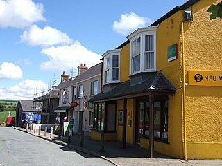
Whitland is a town and community in Carmarthenshire, Wales.
Crymych is a village of around 800 inhabitants and a community in the northeast of Pembrokeshire, Wales. It is situated approximately 800 feet (240 m) above sea level at the eastern end of the Preseli Mountains, on the old Tenby to Cardigan turnpike road, now the A478.

Abercynon is a village and community in the Cynon Valley within the unitary authority of Rhondda Cynon Taf, Wales. The community comprises the village and the districts of Carnetown and Grovers Field to the south, Navigation Park to the east, and Glancynon to the north.
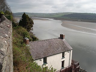
The River Taf is a river in West Wales. It rises in the Preseli Hills, Pembrokeshire, and continues through Carmarthenshire to Laugharne. It is one of the three rivers to enter the sea on the east side of Carmarthen Bay. The other two are the River Gwendraeth and River Tywi.
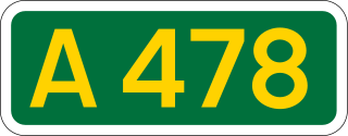
The A478 road is a major road in Wales. The route is from its junction with the A487 at Cardigan, Ceredigion, to Tenby, Pembrokeshire. It crosses the Preseli Hills and winds through farmland for almost all of its route. The road just touches the very west of Carmarthenshire.

Carmarthen railway station is on the West Wales Line serving the town of Carmarthen, Wales, south of the River Towy, 245 miles 55 chains (395.4 km) from the zero point at London Paddington, measured via Stroud. The station is operated by Transport for Wales. Great Western Railway also run a limited service between Carmarthen and London Paddington, usually six trains each way daily with an additional return service to Bristol Parkway.
Cardigan railway station in the county town of Cardigan, Ceredigion was the terminus of the Whitland and Cardigan Railway, opened on 31 August 1886. The line, previously known as the Whitland and Taf Vale Railway, and later familiarly as the 'Cardi Bach', was built between 1869 and 1873. With the extension to Cardigan opening in 1886, operations were taken over by the Great Western Railway.
The Carmarthen and Cardigan Railway was a 7 ft 1⁄4 in broad gauge railway line in Wales that was intended to connect Carmarthen on the South Wales Railway with Cardigan. In fact, it was unable to raise the necessary capital and was loss-making from the time of opening the first short section of its line in 1860, and it was in receivership for much of its life. It eventually reached Llandysul in 1864 but was not extended further during its independent existence.

Sir James Weeks Szlumper JP DL was an English civil engineer. He was Chief Engineer on a number of key railway engineering projects in the Victorian era.

Cilymaenllwyd is a community on the extreme northwest of Carmarthenshire in Wales. The community population at the 2011 census was 742. It lies about 25 miles (40 km) west of Carmarthen, 12 miles (19 km) southeast of Fishguard and 15 miles (24 km) northeast of Haverfordwest. The A478 road runs through the community.

Boncath is a village, community and postal district in north Pembrokeshire, Wales, about 5 miles (8.0 km) west of Newcastle Emlyn.

Tonteg is a village in Rhondda Cynon Taf in South Wales. It is 4 miles (6.4 km) from Pontypridd, 9 miles (14.5 km) north west of Cardiff and 4 miles (6.44 km) north east of Llantrisant. The village is within the community of Llantwit Fardre. Tonteg is to the north west of the Garth Mountain, on the west side of the River Taff valley, at the top of a hill known locally as Powerstation Hill. The hill gets its name from the Upper Boat power station which was situated at the bottom of the hill until it was demolished in 1972. Tonteg is next to Church Village and the boundaries between the two villages are blurred. A significant part of the Treforest Industrial Estate falls within the Willowford area of Tonteg.
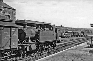
The Whitland and Cardigan Railway was a 27.5 miles (44.3 km) long branch line in West Wales. It was built in two stages, at first as the Whitland and Taf Vale Railway from the South Wales Main Line at Whitland to the quarries at Glogue. It opened in 1873, at first only for goods and minerals and later for passengers. The line to Cardigan opened in 1886; reflected in the company name change.

Blaenffos is a small village of around 200 inhabitants in the north of Pembrokeshire, Wales, in the community of Boncath. It sits on the boundary between the former parishes of Llanfihangel Penbedw and Castellan Chapelry.
Glogue is a hamlet and post town, 1 mile (1.6 km) north of Llanfyrnach, in the community of Crymych in the east of the county of Pembrokeshire, Wales.
Crymmych Arms was a railway station in Crymych, Pembrokeshire, West Wales, on the Whitland and Cardigan line. It took its name from a nearby pub which, until the arrival of the railway, was the only building in the area.

Llanfyrnach railway station served the village of Llanfyrnach, Pembrokeshire, Wales, from 1875 to 1963 on the Whitland and Cardigan Railway.

Login Halt railway station served the hamlet of Login, Carmarthenshire, Wales, from 1875 to 1962 on the Whitland and Cardigan Railway.
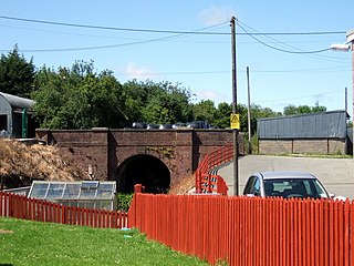
Llanfalteg Halt railway station served the village of Llanfallteg, Carmarthenshire, Wales, from 1875 to 1962 on the Whitland and Cardigan Railway.

