
Santa Barbara County, officially the County of Santa Barbara, is a county located in Southern California. As of the 2020 census, the population was 448,229. The county seat is Santa Barbara, and the largest city is Santa Maria.

Lompoc is a city in Santa Barbara County, California, United States. Located on the Central Coast, Lompoc has a population of 43,834 as of July 2021.

Los Alamos is an unincorporated community in Santa Barbara County, California, United States. Located in the Los Alamos Valley, the town of Los Alamos is considered to be a part of the Santa Ynez Valley community. Los Alamos is also connected to other cities Vandenberg SFB, Lompoc, Buellton, Solvang, and other Santa Barbara County cities. It is 140 miles northwest of Los Angeles and 281 miles (452 km) south of San Francisco. The population was 1,839 at the 2020 census, down from 1,890 at the 2010 census. For statistical purposes, the United States Census Bureau has defined Los Alamos as a census-designated place (CDP).

Santa Maria is a city in the Central Coast of California in northern Santa Barbara County. It is approximately 65 miles (105 km) northwest of Santa Barbara and 150 miles (240 km) northwest of downtown Los Angeles. Its population was 109,707 at the 2020 census, making it the most populous city in the county and the Santa Maria-Santa Barbara, CA Metro Area. The city is notable for its wine industry and Santa Maria–style barbecue.

Vandenberg Village is a census-designated place (CDP) in the unincorporated area of Santa Barbara County, California, United States. The population was 6,497 at the 2010 census, up from 5,802 at the 2000 census.
Mission Hills or Mission Hill may refer to:

The Santa Ynez River is one of the largest rivers on the Central Coast of California. It is 92 miles (148 km) long, flowing from east to west through the Santa Ynez Valley, reaching the Pacific Ocean at Surf, near Vandenberg Space Force Base and the city of Lompoc.
KLWG is a non-commercial radio station that is licensed to and serves Lompoc, California. The station is owned by Calvary Chapel of Lompoc and broadcasts a Christian talk and teaching format.
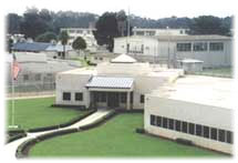
The Federal Correctional Institution, Lompoc is a low-security United States federal prison for male inmates in Lompoc, California. It is part of the Lompoc Federal Correctional Complex and is operated by the Federal Bureau of Prisons, a division of the United States Department of Justice.
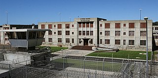
The United States Penitentiary, Lompoc is a medium-security United States federal prison for male inmates in Lompoc, California. It is part of the Lompoc Federal Correctional Complex and is operated by the Federal Bureau of Prisons, a division of the United States Department of Justice. The facility also has a satellite prison camp for minimum-security male inmates. It was formerly a military disciplinary barracks on Camp Cooke.
The White Hills are a low mountain range in the Transverse Ranges, in Santa Barbara County, California south of the town of Lompoc and east of Vandenberg Air Force Base.
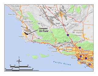
The Lompoc Oil Field is a large oil field in the Purisima Hills north of Lompoc, California, in Santa Barbara County. Discovered in 1903, two years after the discovery of the Orcutt Oil Field in the Solomon Hills, it is one of the oldest oil fields in northern Santa Barbara County, and one of the closest to exhaustion, reporting only 1.7 million barrels (270,000 m3) of recoverable oil remaining out of its original 50 million barrels (7,900,000 m3) as of the end of 2008. Its sole operator is Sentinel Peak Resources, who acquired it from Freeport-McMoRan. In 2009, the proposed decommissioning and habitat restoration of the 3,700-acre (15 km2) field was part of a controversial and so-far unsuccessful deal between Plains, several environmental groups, Santa Barbara County, and the State of California, to allow Plains to carry out new offshore oil drilling on the Tranquillon Ridge, in the Pacific Ocean about twenty miles (32 km) southwest of the Lompoc field.
Rancho Lompoc was a 42,085-acre (170.31 km2) Mexican land grant in present-day Santa Barbara County, California given in 1837 by Governor Juan B. Alvarado to Joaquín Carrillo and José Antonio Carrillo. The grant extended from present-day Lompoc west to the Pacific coast.
Santa Rosa Island Air Force Station is a closed United States Air Force General Surveillance Radar station. It is 5.6 miles (9.0 km) south-southwest of Lompoc, California. It was closed in 1968 by the Air Force, and turned over to the Federal Aviation Administration (FAA).

The Federal Correctional Complex, Lompoc is a United States federal prison complex for male inmates in California. It is run by the Federal Bureau of Prisons, a division of the United States Department of Justice, and consists of two facilities:
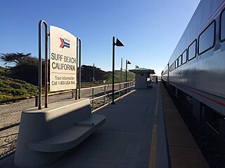
Surf is an unincorporated area of Santa Barbara County, California, located along the Pacific coast within a publicly accessible area of Vandenberg Space Force Base west of the city of Lompoc. The site originally was established as a railroad town, with its growth peaking after Vandenberg was established in 1941. Since 2000 the site has just consisted of Surf Beach and the unstaffed Lompoc–Surf Amtrak Station. California State Route 246 used to run to Surf, but in 1984 the highway was truncated at Lompoc and the road from Lompoc to Surf is designated West Ocean Avenue.
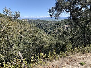
The Purisima Hills are a northwest-to-southeast trending low mountain range of the Outer Southern California Coast Ranges, located in Santa Barbara County, California. They divide the Santa Ynez Valley on the south from the Los Alamos Valley on the north.
Lompoc Valley Medical Center(formerly Lompoc Healthcare District) is a community-created, government entity authorized by California state law to deliver healthcare services to the residents of the Lompoc Valley. The District is a political agency and receives operating property taxes annually based on the assessed value of taxable real property located within the District.
The Lompoc earthquake of 1927 occurred at 5:49 a.m. Pacific Standard Time (PST), on November 4 with an epicenter off the coast of Lompoc, Santa Barbara County in Southern California. It is one of the largest earthquakes to have occurred off the coast of California, measuring a surface-wave magnitude of 7.3. The earthquake may have originated along the Hosgri Fault, an entirely offshore structure. Shaking from the earthquake and an unusually large tsunami caused some damage to communities near the earthquake. Due to its location and the area being sparsely populated at the time, there were no human fatalities reported. It is the only California-generated tsunami recorded in Hawaii.


