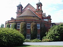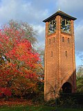
Reading is a town in Berkshire, England. Most of its built-up area lies within the Borough of Reading, although some outer suburbs are parts of neighbouring unitary authority areas. Located in the Thames Valley at the confluence of the rivers Thames and Kennet, Reading is 40 miles (64 km) east of Swindon, 24 miles (39 km) south of Oxford, 40 miles (64 km) west of London and 16 miles (26 km) north of Basingstoke.

Oxfordshire is a ceremonial county in South East England. The county is bordered by Northamptonshire and Warwickshire to the north, Buckinghamshire to the east, Berkshire to the south, and Wiltshire and Gloucestershire to the west. The largest settlement is the city of Oxford.

The Royal County of Berkshire, more commonly known as simply Berkshire, is a ceremonial county in South East England. It is bordered by Oxfordshire to the north, Buckinghamshire to the northeast, Greater London to the east, Surrey to the southeast, Hampshire to the south, and Wiltshire to the west. The county town is Reading.
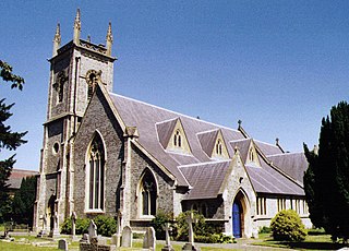
Earley is a town and civil parish in the Borough of Wokingham, Berkshire, England. Along with the neighbouring town of Woodley, the Office for National Statistics places Earley within the Reading/Wokingham Urban Area; for the purposes of local government it falls within the Borough of Wokingham, outside the area of Reading Borough Council. Its name is sometimes spelt Erleigh or Erlegh and consists of a number of smaller areas, including Maiden Erlegh and Lower Earley, and lies some 3 miles (5 km) south and east of the centre of Reading, and some 4 miles (6 km) northwest of Wokingham. It had a population of 32,036 at the 2011 Census.
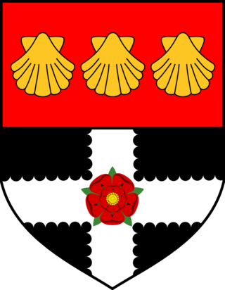
The University of Reading is a public research university in Reading, Berkshire, England. It was founded in 1892 as University College, Reading, a University of Oxford extension college. The institution received the power to grant its own degrees in 1926 by royal charter from King George V and was the only university to receive such a charter between the two world wars. The university is usually categorised as a red brick university, reflecting its original foundation in the 19th century.

Kendrick School is a selective girls' grammar school situated in the centre of Reading, Berkshire, UK. In February 2011, Kendrick became an Academy.
The University of West London (UWL) is a public research university in the United Kingdom with campuses in Ealing, Brentford, and in Reading, Berkshire.
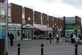
Tilehurst is a suburb of the town of Reading in the county of Berkshire, England. It lies to the west of the centre of Reading, and extends from the River Thames in the north to the A4 road in the south.

Redland is a neighbourhood in Bristol, England. The neighbourhood is situated between Clifton, Cotham, Bishopston and Westbury Park. The boundaries of the district are not precisely defined, but are generally taken to be Whiteladies Road in the west, the Severn Beach railway line in the south and Cranbrook Road in the east.

The Museum of English Rural Life, also known as The MERL, is a museum, library and archive dedicated to recording the changing face of farming and the countryside in England. The museum is run by the University of Reading, and is situated in Redlands Road to the rear of the institution's London Road Campus near to the centre of Reading in southern England. The location was formerly known as East Thorpe House and then St Andrew's Hall. It is an accredited museum and accredited archive as recognised by Arts Council England and the National Archives.

Whiteknights Park, or the Whiteknights Campus of the University of Reading, is the principal campus of that university. The park covers the area of the manor of Earley Whiteknights, also known as Earley St Nicholas and Earley Regis.

Bulmershe Court was a campus of the University of Reading, situated in what is now the Reading suburb of Woodley, in the English county of Berkshire.

Charterhouse Square is a garden square, a pentagonal space, in Farringdon, in the London Borough of Islington, and close to the former Smithfield Meat Market. The square is the largest courtyard or yard associated with the London Charterhouse, mostly formed of Tudor and Stuart architecture restored after the London Blitz. The square adjoins other buildings including a small school. It lies between Charterhouse Street, Carthusian Street and the main Charterhouse complex of buildings south of Clerkenwell Road. The complex includes a Chapel, Tudor Great Hall, Great Chamber, the Barts and The London School of Medicine and Dentistry and a 40-resident almshouse.

East Reading is a main locality of the town of Reading in the English county of Berkshire. Its centre is known as Cemetery Junction, after Reading Old Cemetery.
Redlands Primary School is a primary school in Reading, Berkshire, England. Located approximately 1 mile (1.6 km) south-east of the centre of Reading, it located near to the University of Reading's Whiteknights Campus.
RAF Shinfield Park was a Royal Air Force administrative site in the south of Reading, Berkshire. It served as the Met Office residential training college from 1971 until 2002. The European Centre for Medium-Range Weather Forecasts was built on part of the site in 1978.
Gyosei International College in the UK (GIC), later known as Witan Hall and Witan International College (WIC), was a Japanese international post-secondary education campus, located in Reading, Berkshire. In the final part of its life it became a wholly owned subsidiary of the University of Reading.

The following is a timeline of the history of Reading, the county town of Berkshire in England.

The Hospitium of St John the Baptist was the hospitium, or dormitory for pilgrims, of Reading Abbey, which today is a large, ruined abbey in the centre of the town of Reading, in the English county of Berkshire. The hospitium was founded in 1189, and at its maximum comprised a range of buildings that could accommodate 400 people. The main building has survived, and is grade II listed. Much of the remainder of the original hospitium was located where Reading Town Hall now stands.

