Longtown, Oklahoma

Last updated

Longtown, Oklahoma
CDP
OKMap-doton-Longtown.PNG
Location of Longtown, Oklahoma
Coordinates: 35°13′37″N95°31′13″W / 35.22694°N 95.52028°W / 35.22694; -95.52028
Country United States
State Oklahoma
County Pittsburg
Area
[1]
  Total35.75 sq mi (92.58 km2)
  Land26.11 sq mi (67.64 km2)
  Water9.63 sq mi (24.95 km2)
Elevation
[2]
627 ft (191 m)
Population
 (2020)
  Total2,659
  Density101.82/sq mi (39.31/km2)
Time zone UTC-6 (Central (CST))
  Summer (DST) UTC-5 (CDT)
FIPS code 40-43975 [3]
GNIS feature ID2408127 [2]

Longtown is a census-designated place (CDP) and unincorporated community [4] in Pittsburg County, Oklahoma, United States. The population was 2,397 at the 2000 census.

Contents

History

At the time of its founding, Longtown was located in Tobucksy County, Choctaw Nation, in the Indian Territory. Longtown Creek formed the boundary between Tobucksy and Gaines County. [5]

Geography

According to the United States Census Bureau, the CDP has a total area of 36.1 square miles (93 km2), of which 26.5 square miles (69 km2) is land and 9.5 square miles (25 km2) (26.43%) is water.

Demographics

Historical population
CensusPop.Note
2020 2,659
U.S. Decennial Census [6]

As of the census [3] of 2000, there were 2,397 people, 1,101 households, and 778 families residing in the CDP. The population density was 90.4 inhabitants per square mile (34.9/km2). There were 3,059 housing units at an average density of 115.3 per square mile (44.5/km2). The racial makeup of the CDP was 88.36% White, 0.13% African American, 7.76% Native American, 0.04% Asian, 0.17% from other races, and 3.55% from two or more races. Hispanic or Latino of any race were 0.83% of the population.

There were 1,101 households, out of which 17.7% had children under the age of 18 living with them, 61.9% were married couples living together, 5.9% had a female householder with no husband present, and 29.3% were non-families. 26.2% of all households were made up of individuals, and 11.7% had someone living alone who was 65 years of age or older. The average household size was 2.18 and the average family size was 2.57.

In the CDP, the population was spread out, with 16.8% under the age of 18, 3.9% from 18 to 24, 19.0% from 25 to 44, 35.6% from 45 to 64, and 24.7% who were 65 years of age or older. The median age was 52 years. For every 100 females, there were 103.1 males. For every 100 females age 18 and over, there were 98.3 males.

The median income for a household in the CDP was $26,813, and the median income for a family was $33,060. Males had a median income of $29,625 versus $19,737 for females. The per capita income for the CDP was $15,722. About 12.4% of families and 13.7% of the population were below the poverty line, including 13.9% of those under age 18 and 10.8% of those age 65 or over.

Related Research Articles

<span class="mw-page-title-main">Standing Pine, Mississippi</span> Census-designated place in Mississippi, United States

Standing Pine is a census-designated place (CDP) in Leake County, Mississippi, United States. It is one of the eight communities of the Mississippi Band of Choctaw Indians Reservation, and the population is 94% Choctaw. The total population of the CDP was 517 at the 2020 census.

<span class="mw-page-title-main">Pearl River, Mississippi</span> CDP in Mississippi, United States

Pearl River is a census-designated place (CDP) in Neshoba County, Mississippi. It is one of the eight communities of the Mississippi Band of Choctaw Indians Reservation and the population is 80% Choctaw. The population was 3,156 at the 2000 census.

<span class="mw-page-title-main">Tucker, Mississippi</span> CDP in Mississippi, United States

Tucker is a census-designated place (CDP) in Neshoba County, Mississippi. It is one of the eight communities of the Mississippi Band of Choctaw Indians Reservation and the population is 93% Choctaw. The population was 642 at the 2020 census.

<span class="mw-page-title-main">South Canal, Ohio</span> Census-designated place in Ohio, United States

South Canal is an unincorporated community and census-designated place in western Newton Township, Trumbull County, Ohio, United States. The population was 1,101 at the 2020 census. It is part of the Youngstown–Warren metropolitan area.

<span class="mw-page-title-main">Lyons Switch, Oklahoma</span> Census-designated place in Oklahoma, United States

Lyons Switch is a census-designated place (CDP) in Adair County, Oklahoma, United States. The population was 288 at the 2010 census.

<span class="mw-page-title-main">Swink, Oklahoma</span> Census-designated place in Oklahoma, United States

Swink is an unincorporated community and census-designated place (CDP) in Choctaw County, Oklahoma, United States. As of the 2010 census the population was 66. The population was 83 at the 2000 census, at which time it was a town; the community disincorporated on December 1, 2000.

Rocky Ford is a census-designated place (CDP) in Delaware and Cherokee counties, Oklahoma, United States. The population was 61 at the 2010 census.

<span class="mw-page-title-main">Alderson, Oklahoma</span> Town in Oklahoma, United States

Alderson is a town in Pittsburg County, Oklahoma, United States. The population was 304 at the 2010 census.

<span class="mw-page-title-main">Ashland, Oklahoma</span> Town in Oklahoma, United States

Ashland is a town in Pittsburg County, Oklahoma, United States. The population was 66 at the 2010 census.

<span class="mw-page-title-main">Canadian, Oklahoma</span> Town in Oklahoma, United States

Canadian is a town in Pittsburg County, Oklahoma, United States. The population was 239 at the 2000 census.

<span class="mw-page-title-main">Crowder, Oklahoma</span> Town in Oklahoma, United States

Crowder is a town in Pittsburg County, Oklahoma, United States. The population was 430 at the 2010 census.

<span class="mw-page-title-main">Indianola, Pittsburg County, Oklahoma</span> Town in Oklahoma, United States

Indianola is a town in Pittsburg County, Oklahoma, United States. The population was 162 at the 2010 census, a loss of 15.2 percent compared to 191 at the 2000 census.

<span class="mw-page-title-main">Kiowa, Oklahoma</span> Town in Oklahoma, United States

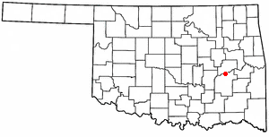
Kiowa is a town in Pittsburg County, Oklahoma, United States. The population was 731 at the 2010 census.

Pittsburg is a town in Pittsburg County, Oklahoma, United States. The population was 280 at the 2000 census.

<span class="mw-page-title-main">Bushyhead, Oklahoma</span> CDP in Oklahoma, United States

Bushyhead is a census-designated place (CDP) in Rogers County, Oklahoma, United States. The population was 1,314 at the 2010 census, a 9.2 percent increase over the figure of 1,203 recorded in 2000. Established on the St. Louis-San Francisco Railway between Claremore and Vinita, the community was named for Dennis W. Bushyhead, Principal Chief of the Cherokee, 1879–1887. The post office existed from April 18, 1898, until November 15, 1955.

Flute Springs is a census-designated place (CDP) in Sequoyah County, Oklahoma, United States. It is part of the Fort Smith, Arkansas-Oklahoma Metropolitan Statistical Area. The population was 182 at the 2000 census.

Redbird Smith is a census-designated place (CDP) in Sequoyah County, Oklahoma, United States. It is part of the Fort Smith, Arkansas-Oklahoma Metropolitan Statistical Area. The population was 411 at the 2000 census. It was named for Redbird Smith (Cherokee), who founded the Keetoowah Nighthawk Society in Indian Territory and established a ceremonial ground here for sacred rituals.

Stony Point is a census-designated place (CDP) in Sequoyah County, Oklahoma, United States. It is part of the Fort Smith, Arkansas-Oklahoma Metropolitan Statistical Area. The population was 177 at the 2000 census.

<span class="mw-page-title-main">Metzger, Oregon</span> Unincorporated community in the state of Oregon, United States

Metzger is a census-designated place and unincorporated community, in Washington County, Oregon, United States. As of the 2010 census, the CDP population was 3,765. It is named for Herman Metzger, who platted the community. It is a suburb located within Portland, Oregon.

<span class="mw-page-title-main">Brookhaven (CDP), New York</span> Hamlet and census-designated place in New York, United States

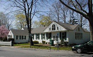
Brookhaven is a hamlet and census-designated place in Suffolk County, New York, United States. The population was 3,451 at the 2010 census.

References

  1. "ArcGIS REST Services Directory". United States Census Bureau. Retrieved September 20, 2022.
  2. 1 2 U.S. Geological Survey Geographic Names Information System: Longtown, Oklahoma
  3. 1 2 "U.S. Census website". United States Census Bureau . Retrieved January 31, 2008.
  4. http://www.odl.state.ok.us/almanac/2005/12-muni.pdf Oklahoma Municipal Government, from the Oklahoma Almanac
  5. John W. Morris, Historical Atlas of Oklahoma, Plate 38; Constitution and Laws of the Choctaw Nation (Chahta Tamaha, Joseph P. Folsom, 1869), p. 111.
  6. "Census of Population and Housing". Census.gov. Retrieved June 4, 2016.