Lotus or LOTUS may refer to:

Montgomery County is a county in the U.S. state of Indiana. As of the 2020 United States census, it had a population of 37,936. Its county seat is Crawfordsville. The county is divided into eleven townships which provide local services.

Union County is a county in the U.S. state of Kentucky. As of the 2020 census, the population was 13,668. Its county seat is Morganfield. The county was created effective January 15, 1811.

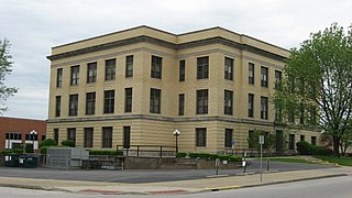
Union County is a county in the U.S. state of Indiana. As of the 2020 United States census, the population was 7,087. The county seat is Liberty.

Shelby County is a county in the U.S. state of Indiana. As of the 2020 United States Census, the population was 45,055. The county seat is Shelbyville.

Randolph County is a county located in the central section of U.S. state of Indiana, on its eastern border with Ohio. As of 2020, the population was 24,502. The county seat is Winchester.

Porter County is a county in the U.S. state of Indiana. As of 2020, the population was 173,215, making it the 10th most populous county in Indiana. The county seat is Valparaiso. The county is part of Northwest Indiana, as well as the Chicago metropolitan area. Porter County is the site of much of the Indiana Dunes, an area of ecological significance. The Hour Glass Museum in Ogden Dunes documents the region's ecological significance.
Pike County is a county in the southwest portion of the U.S. state of Indiana. As of the 2020 United States census, the population was 12,250. The county seat is Petersburg. It contains the geographic point representing median center of US population in 2010.

LaPorte County is a county located in the U.S. state of Indiana. As of 2020, the population was 112,417. The county seat is the city of La Porte, and the largest city is Michigan City. This county is part of the Northwest Indiana and Michiana regions of the Chicago metropolitan area. The LaPorte County Courthouse is located in the county seat of La Porte and is listed on the National Register of Historic Places.

Jasper County is a county located in the U.S. state of Indiana. As of 2020, the population was 32,918. The county seat is Rensselaer.

Hendricks County is a county in the U.S. state of Indiana. As of the 2020 United States Census, the population was 174,788. The county seat is the town of Danville.

As of March 2020, the Fort Wayne–Huntington–Auburn Combined Statistical Area (CSA), or Fort Wayne Metropolitan Area, or Northeast Indiana is a federally designated metropolitan area consisting of eight counties in northeast Indiana, anchored by the city of Fort Wayne.

Morgan's Raid was a diversionary incursion by Confederate cavalry into the Union states of Indiana, Kentucky, Ohio, and West Virginia during the American Civil War. The raid took place from June 11 to July 26, 1863. It is named for the commander of the Confederate troops, Brigadier General John Hunt Morgan. Although it caused temporary alarm in the North, the raid failed.

Indiana's 6th congressional district is a congressional district in the U.S. state of Indiana. The district takes in a portion of eastern and central Indiana as of the 2020 census, including Columbus and Richmond, some of Cincinnati's Indiana suburbs, most of Indianapolis' southern suburbs, and a sliver of Indianapolis itself.

Lotus Delta Coffman was the fifth president of the University of Minnesota, serving from 1920 until his death in office on September 22, 1938. Coffman Memorial Union, the main student center, is named in his memory.
Lotus is an unincorporated community in El Dorado County, California, United States. It is located 1 mile (1.6 km) west of Coloma, at an elevation of 722 feet.

Center Township is one of six townships in Union County, Indiana, United States. As of the 2010 census, its population was 3,048 and it contained 1,330 housing units.
The South Bend–Mishawaka Metropolitan Statistical Area, sometimes referred to as Michiana, as defined by the United States Census Bureau, is an area consisting of two counties – one in northern Indiana and one in southwest Michigan (Cass), anchored by the cities of South Bend and Mishawaka in Indiana. As of the 2010 census, the MSA had a population of 319,224.

Indiana is a U.S. state in the Midwestern United States. It is the 38th-largest by area and the 17th-most populous of the 50 States. Its capital and largest city is Indianapolis. Indiana was admitted to the United States as the 19th state on December 11, 1816. It is bordered by Lake Michigan to the northwest, Michigan to the north and northeast, Ohio to the east, the Ohio River and Kentucky to the south and southeast, and the Wabash River and Illinois to the west.

The Cincinnati metropolitan area is a metropolitan area with its core in Ohio and Kentucky. Its largest city is Cincinnati and includes surrounding counties in the U.S. states of Ohio, Kentucky, and Indiana.


