Lowell, Nebraska | |
|---|---|
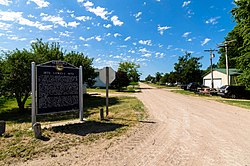 | |
 Lowell | |
| Coordinates: 40°38′51″N98°50′50″W / 40.64750°N 98.84722°W | |
| Country | United States |
| State | Nebraska |
| County | Kearney |
| Elevation | 2,064 ft (629 m) |
| Time zone | UTC-6 (Central (CST)) |
| • Summer (DST) | UTC-5 (CDT) |
| ZIP code | 68840 |
| Area code | 308 |
| GNIS feature ID | 830936 [1] |
Lowell is an unincorporated community in Kearney County, Nebraska, United States. [2]
