Lucsuhin Natural Bridge

Last updated

Lucsuhin Natural Bridge, locally called Cabag Cave or Lucsuhin Cave, [1] is a natural bridge located between Brgy. Lucsuhin and Brgy. Kalubkob in Silang, Cavite province in the Philippines. [2] The bridge, which crosses the Ylang-Ylang River, is the first large natural bridge reported in the country.

Barangay administrative division in the Philippines

A barangay or baranggay (, formerly referred to as barrio, is the smallest administrative division in the Philippines and is the native Filipino term for a village, district or ward. In metropolitan areas, the term often refers to an inner city neighbourhood, a suburb or a suburban neighborhood. The word barangay originated from balangay, a kind of boat used by a group of Austronesian peoples when they migrated to the Philippines.

Silang, Cavite Municipality in Calabarzon, Philippines

Silang, officially the Municipality of Silang,, is a 1st class municipality in the province of Cavite, Philippines. According to the 2015 census, it has a population of 248,085 people.

Cavite Province in Calabarzon, Philippines

Cavite is a province in the Philippines located on the southern shores of Manila Bay in the Calabarzon region on Luzon island. Situated 21 kilometres (13 mi) southwest of Metro Manila, it is one of the most industrialized and fastest growing provinces in the Philippines. Its population of 3,678,301 (2015) makes it one of the most populated provinces in the country.

Contents

History

The first American to discover and study the bridge is Paul R. Fanning from the Division of Mines during the early part of the American colonial period. He was making a geological reconnaissance in the vicinity of Silang, Cavite in July 1910 when he discovered the natural bridge of unusual size. Owing to its remoteness, Fanning believed no white men have probably visited the place before. [3]

Geology

A sketch showing the formation of Lucsuhin Natural Bridge Lucsuhin natural bridge.jpg
A sketch showing the formation of Lucsuhin Natural Bridge

The natural bridge is located in the great bedded tuff area lying between Manila and Tayabas Bay where the rock is favorable for their formation. The opening under the bridge span is tunnel-like and has a diameter of about 10 metres (33 ft) and a length of about 75 metres (246 ft). It makes a double turn that roughly approximates the shape of the letter 'S.' During low water, the stream occupies a central channel consisting of a staggered series of small falls and potholes which are the result of the action of the water upon the horizontal bedding of the tuff rock. [3]

Tuff Rock consolidated from volcanic ash

Tuff, also known as volcanic tuff, is a type of rock made of volcanic ash ejected from a vent during a volcanic eruption. Following ejection and deposition, the ash is compacted into a solid rock in a process called consolidation. Tuff is sometimes erroneously called "tufa", particularly when used as construction material, but properly speaking, tufa is a limestone precipitated from groundwater. Rock that contains greater than 50% tuff is considered tuffaceous.

Tayabas Bay bay

Tayabas Bay is a large bay in the southern part of Luzon island in the Philippines. Several islands are located in the bay, largest of which is Marinduque.

Formation of the bridge

The floor of the bridge, which is about 40 metres (130 ft) above the stream, was examined by Fanning and showed evidence of once having formed the bed of the stream. Erosion had nearly obliterated this old bed, but had not been sufficient to destroy the sides of the valley. At one time, the river must have flowed at this higher elevation to a place several kilometers down stream from the present tunnel and then passed over a cliff. This cliff gradually receded upstream forming the present box canyon. As illustrated by the sketches, seepage began at a point several hundred meters above the falls and, owing to the horizontal bedding of the rock, it first took a path at right angles to the river course, then descended from bed to bed to the bottom of the falls. The porous, soft nature of the rock favored the rapid enlargement of the underground channel, and eventually the entire stream followed this course. [3]

Subsequent erosion and caving had greatly decreased the length of the underground channel and produced the short canyon above the present entrance portal. Owing to the thinness of the roof, the first part of the tunnel caved rapidly, whereas the erosion and caving of the lower part was much slower. A condition now has been reached where the entrance and exit portals will be eroded with about equal speed and at the same time the tunnel will be greatly enlarged in diameter by down cutting and by caving of the roof. Under these conditions the bridge eventually should assume the arch structure characteristic of famous natural bridges in other parts of the world. [4]

Erosion Processes which remove soil and rock from one place on the Earths crust, then transport it to another location where it is deposited

In earth science, erosion is the action of surface processes that removes soil, rock, or dissolved material from one location on the Earth's crust, and then transports it to another location. This natural process is caused by the dynamic activity of erosive agents, that is, water, ice (glaciers), snow, air (wind), plants, animals, and humans. In accordance with these agents, erosion is sometimes divided into water erosion, glacial erosion, snow erosion, wind (aeolic) erosion, zoogenic erosion, and anthropogenic erosion. The particulate breakdown of rock or soil into clastic sediment is referred to as physical or mechanical erosion; this contrasts with chemical erosion, where soil or rock material is removed from an area by its dissolving into a solvent, followed by the flow away of that solution. Eroded sediment or solutes may be transported just a few millimetres, or for thousands of kilometres.

Protection status

The bridge and cave is not a protected area and need preservation for future generations, as well as the areas upriver to preserve the quality of water, lest it would end up like Hinulugang Taktak falls in Rizal province.

Protected area location which receives protection because of its recognised natural, ecological or cultural landscape values

Protected areas or conservation areas are locations which receive protection because of their recognized natural, ecological or cultural values. There are several kinds of protected areas, which vary by level of protection depending on the enabling laws of each country or the regulations of the international organizations involved.

Hinulugang Taktak waterfall

Hinulugang Taktak Protected Landscape, also known as Hinulugan Taktak, is a protected area located in Rizal, Philippines. Initially assigned as a recreation area, the waterfall area has been designated as a national park by virtue of Republic Act No. 6964 in 1990. Ten years later, it became a protected landscape in accordance to Proclamation No. 412. It is being managed by the Department of Environment and Natural Resources and the Rizal Provincial Government. As of 2003 and 2004, Hinulugang Taktak is the second most popular national park in the Philippines in terms of number of visitors.

Rizal Province in Calabarzon, Philippines

Rizal, officially known as the Province of Rizal, is a province in the Philippines located in the Calabarzon region, 16 kilometres (9.9 mi) east of Manila. The province is named after José Rizal, one of the main national heroes of the Philippines. Rizal is bordered by Metro Manila to the west, Bulacan to the north, Quezon to the east and Laguna to the southeast. The province also lies on the northern shores of Laguna de Bay, the largest lake in the country. Rizal is a mountainous province perched on the western slopes of the southern portion of the Sierra Madre mountain range.

Accessing the bridge

The bridge can be reached from Silang by following the Silang-Banaybanay Road for about 1.8 kilometres (1.1 mi) west from the Aguinaldo Highway and J. Rizal Ave. junction to the barrio of Lucsuhin, past the road to the Riviera Golf & Country Club, past the bridge over Ylang-Ylang River to Brgy. Kalubkob. From here, it is about 1-kilometre (0.62 mi) long hike to the site. [5]

An alternate route from Kalubkob, is to head north on Fresco Belen Drive for about 0.4 kilometres (0.25 mi) to a dirt road to the right. The bridge and cave are reached by hiking east on the dirt road for 0.4 kilometres (0.25 mi). [6]

Related Research Articles

Laguna (province) Province in Calabarzon, Philippines

Laguna, officially known as the Province of Laguna, is a province in the Philippines, located in the Calabarzon region in Luzon. Its capital is Santa Cruz and the province is situated southeast of Metro Manila, south of the province of Rizal, west of Quezon, north of Batangas and east of Cavite. Laguna hugs the southern shores of Laguna de Bay, the largest lake in the country. As of the 2015 census, the province's total population is 3,035,081. It is also currently the seventh richest province in the country.

Tagaytay Component City in Calabarzon, Philippines

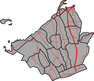
Tagaytay, officially the City of Tagaytay,, or simply known as Tagaytay City, is a 2nd class city in the province of Cavite, Philippines. According to the 2015 census, it has a population of 71,181 people.

San Mateo, Rizal Municipality in Calabarzon, Philippines

San Mateo, officially the Municipality of San Mateo,, is a 1st class municipality in the province of Rizal, Philippines. According to the 2015 census, it has a population of 579,925. It is bordered by Quezon City to the west, the cities of Marikina and Antipolo to the south, and to the north by the municipality of Rodriguez. San Mateo is approximately 24 kilometres (15 mi) east of Manila and 11 kilometres (6.8 mi) north of Pasig, the former provincial capital of Rizal.

Siniloan Municipality in Calabarzon, Philippines

Siniloan, officially the Municipality of Siniloan,, is a 2nd class municipality in the province of Laguna, Philippines. According to the 2015 census, it has a population of 38,067 people.

Santa, Ilocos Sur Municipality in Ilocos Region, Philippines

Santa, officially the Municipality of Santa, is a 4th class municipality in the province of Ilocos Sur, Philippines. According to the 2015 census, it has a population of 15,340 people.

Calbayog Component City in Eastern Visayas, Philippines

Calbayog, officially the City of Calbayog, and often referred to as Calbayog City, is a 1st class city in the province of Samar, Philippines. According to the 2015 census, it has a population of 183,851 people.

Lopez, Quezon Municipality in Calabarzon, Philippines

Lopez, officially the Municipality of Lopez,, is a 1st class municipality in the province of Quezon, Philippines. According to the 2015 census, it has a population of 95,167 people.

Manila–Cavite Expressway road in the Philippines

The Manila–Cavite Expressway, also known as Coastal Road or CAVITEx, is a 14-kilometre-long (8.7 mi) limited-access toll expressway linking Manila to the southern province of Cavite in the Philippines. The entire expressway is designated Expressway Route 3 (E3) of the Philippine expressway network and forms part of Radial Road 1 (R-1) of Manila's arterial road network. It is owned by the Public Estates Authority Tollway Corporation (PEATC), a government corporation and subsidiary of the Public Estates Authority, a government agency under the Office of the President, and is operated by Cavitex Infrastructure Corporation, a unit of Philippine-based company Metro Pacific Investments Corporation (MPIC).

Roxas Boulevard major street in Metro Manila, Philippines

Roxas Boulevard is a popular waterfront promenade in Manila in the Philippines. The boulevard, which runs along the shores of Manila Bay, is well known for its sunsets and stretch of coconut trees. The divided roadway has become a trademark of Philippine tourism, famed for its yacht club, hotels, restaurants, commercial buildings and parks. Originally called Cavite Boulevard, it was renamed Dewey Boulevard in honor of the American Admiral George Dewey, whose forces defeated the Spanish navy in the Battle of Manila Bay in 1898. The boulevard was again renamed to Heiwa Boulevard in late 1941 during Japanese Home Rule and Roxas Boulevard in the 1960s to honor President Manuel Roxas, the fifth president of the Republic of Philippines.

Aguinaldo Highway major highway in Calabarzon, Philippines

The Emilio Aguinaldo Highway, also known as Cavite–Batangas Road and Manila West Road is a four-to-six lane, 41.4-kilometre (25.7 mi), network of primary and secondary highways passing through the busiest towns and cities of Cavite, Philippines. It is the busiest and most congested of the three major highways located in the province, the others are Governor's Drive and Antero Soriano Highway.

Crisanto Mendoza de los Reyes Avenue major highway in the province of Cavite, Philippines

The Crisanto Mendoza Delos Reyes Avenue, formerly known as General Trias–Amadeo–Tagaytay Road, is a two-to-four lane, 40.1-kilometre (24.9 mi), tertiary highway traversing through the central towns and cities of the province of Cavite, Philippines. It connects the city of General Trias to the city of Tagaytay and acts as a secondary road to Aguinaldo Highway. It runs parallel to Aguinaldo Highway.

Mount Sungay

Mount Sungay, also known as Mount Gonzales, is a mountain in the province of Cavite in the Philippines. Located in eastern Tagaytay, the inactive stratovolcano is the highest point of the province of Cavite at 709 metres (2,326 ft). The slopes of the mountain is the source of the San Cristobal River that flows from the mountain to Silang, Cavite down to its mouth at Laguna de Bay in Calamba, Laguna.

Circumferential Road 6 road in the Philippines

Circumferential Road 6, commonly referred to as C-6, is a 34.24-kilometre (21.28 mi), 6 lane, network of roads and bridges that altogether would form the sixth and outermost beltway of Manila in the Philippines.

Masungi Georeserve

The Masungi Georeserve is a conservation area in the Philippines situated in the Southern Sierra Madre range in Baras, Rizal, 47 kilometres (28 mi) east of Manila. It centers on the geological formations of Masungi Rock, at an elevation of 640 metres (2,100 ft). In 1993, the Masungit Rock and its vicinity was proposed to be declared as a Strict Nature Reserve and Wildlife Sanctuary by the Department of Environment and Natural Resources. It has been a popular destination for hikes and day trips from Manila since it opened in 2015 and started development towards Geopark status.

Tanza–Trece Martires Road major highway in Calabarzon, Philippines

The Tanza–Trece Martires Road is a 12.559-kilometre (7.804 mi), two-to-four lane, primary highway in Cavite, Philippines. It connects the municipality of Tanza to the city of Trece Martires.

Tagaytay–Santa Rosa Road major highway in the provinces of Cavite and Laguna, Philippines

The Tagaytay–Santa Rosa Road, or Tagaytay–Santa Rosa Highway, is a 23.245-kilometre (14.444 mi), two-to-four lane, secondary highway traversing the provinces of Laguna and Cavite, Philippines. The road was constructed in the late 1990s.

Trece Martires–Indang Road major highway in Calabarzon, Philippines

The Trece Martires–Indang Road is a two-to-four lane, 12.015-kilometre (7.466 mi) major highway in Cavite, Philippines. It connects the city of Trece Martires and the municipality of Indang, and the fastest way from Trece Martires to Tagaytay.

References

  1. "Cavite Natural Attractions". Philippine Travel Information. Retrieved on 2013-06-18.
  2. "Municipality/City: Silang - Barangays" Archived 2007-11-24 at the Wayback Machine .. PSGC Interactive. Retrieved on 2013-06-18.
  3. 1 2 3 Bureau of Science (1912). "Philippine Journal of Science, Vol. VII, No. 4, August 1912", p. 291. Bureau of Printing, Manila (University of Michigan Library).
  4. "Philippine Journal of Science, Vol. VII, No. 4, August 1912", p. 293. Bureau of Printing, Manila (University of Michigan Library).
  5. "Towns and Cities - Silang". Biyahero, Philippine Travel Portal. Retrieved on 2013-06-18.
  6. "Vicinity info: Cabag Caves". Waypoints.ph. Retrieved on 2013-06-18.

Coordinates: 14°12′51″N120°57′14″E / 14.214187°N 120.953969°E / 14.214187; 120.953969