
Willacy County is a county in the U.S. state of Texas. As of the 2020 census, its population was 20,164. Its county seat is Raymondville. The county was created in 1911 and organized the next year.

Waimalu is a census-designated place (CDP) in Honolulu County, Hawaiʻi, United States. The population was 13,817 at the 2020 census.
Wyldwood is a census-designated place (CDP) in Bastrop County, Texas, United States. The population was 3,694 at the 2020 census.

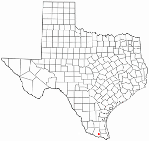
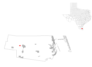
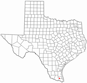
Yznaga is a census-designated place (CDP) in Cameron County, Texas, United States. The population was 108 at the 2020 census. It is part of the Brownsville–Harlingen Metropolitan Statistical Area.

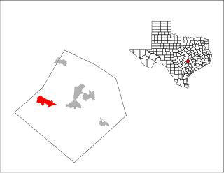
Doolittle is a census-designated place (CDP) in Hidalgo County, Texas, United States. The population was 4,061 at the 2020 United States Census. It is part of the McAllen–Edinburg–Mission Metropolitan Statistical Area.
La Blanca is a census-designated place (CDP) in Hidalgo County, Texas, United States. The population was 2,078 at the 2020 United States Census. It is part of the McAllen–Edinburg–Mission Metropolitan Statistical Area.

Westdale is a census-designated place (CDP) in Jim Wells County, Texas, United States. The population was 325 at the 2020 census, up from 372 at the 2010 census.

Lakeshore Gardens-Hidden Acres is a census-designated place (CDP) in San Patricio County, Texas, United States. The population was 637 at the 2020 census.
Bausell and Ellis is a former census-designated place (CDP) in Willacy County, Texas, United States. The population was 112 at the 2000 census.

Lasara is a census-designated place (CDP) in Willacy County, Texas, United States. The population was 909 at the 2020 census.

Los Angeles is a census-designated place (CDP) in Willacy County, Texas, United States. The population was 108 at the 2020 census. Prior to the 2010 census, the CDP was known as Los Angeles Subdivision.

Lyford is a city in Willacy County, Texas, United States. The population was 2,249 at the 2020 census. It may be included as part of the Brownsville–Harlingen–Raymondville and the Matamoros–Brownsville metropolitan areas.

Port Mansfield is a census-designated place (CDP) in Willacy County, Texas, United States. The population was 226 at the 2010 census.
Ranchette Estates is a census-designated place (CDP) in Willacy County, Texas, United States. The population was 106 at the 2020 census.

Santa Monica is a census-designated place (CDP) in Willacy County, Texas, United States. The population was 86 at the 2020 census.
Sebastian is a census-designated place (CDP) in Willacy County, Texas, United States. The population was 1,684 at the 2020 census.

Willamar is a former census-designated place (CDP) in Willacy County, Texas, United States. It was founded in 1921 and named for its founders, Will Harding and Lamar Gill. The population was 15 at the 2000 census. This CDP was deleted prior to the 2010 census.

Zapata Ranch is a census-designated place (CDP) in Willacy County, Texas, United States. The population was 87 at the 2020 census.

Serenada is a census-designated place (CDP) in Williamson County, Texas, United States. The population was 2,098 at the 2020 census. Those living in Serenada have Georgetown addresses.

Ranchettes is a census-designated place (CDP) in Laramie County, Wyoming, United States. It is part of the Cheyenne, Wyoming Metropolitan Statistical Area. The population was 5,798 at the 2010 census.

