Maddalena Pass

Last updated
Maddalena Pass

Colle della Maddalena-Col de Larche-IMG 1183.JPG

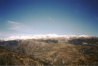
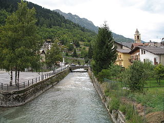
The village Argentera near Maddalena Pass
Elevation 1,996 m (6,549 ft)
Location Alpes-de-Haute-Provence, France / Province of Cuneo, Italy
Range Cottian Alps and Maritime Alps
Coordinates 44°25′18″N6°53′55″E / 44.42167°N 6.89861°E / 44.42167; 6.89861 Coordinates: 44°25′18″N6°53′55″E / 44.42167°N 6.89861°E / 44.42167; 6.89861
Alps location map.png
Red pog.svg
Maddalena Pass
Location of Maddalena Pass

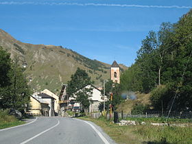
The Maddalena Pass (Italian: Colle della Maddalena French: Col de Larche, historically Col de l'Argentière) (elevation 1996 m.) is a high mountain pass between the Cottian Alps and the Maritime Alps, located on the border between Italy and France. It connects Barcelonnette in France with Cuneo in Italy. Its French name Col de Larche refers to the village Larche on its northwestern side.

Italian language Romance language

Italian is a Romance language of the Indo-European language family. Italian, together with Sardinian, is by most measures the closest language to Vulgar Latin of the Romance languages. Italian is an official language in Italy, Switzerland, San Marino and Vatican City. It has an official minority status in western Istria. It formerly had official status in Albania, Malta, Monaco, Montenegro (Kotor) and Greece, and is generally understood in Corsica and Savoie. It also used to be an official language in the former Italian East Africa and Italian North Africa, where it plays a significant role in various sectors. Italian is also spoken by large expatriate communities in the Americas and Australia. In spite of not existing any Italian community in their respective national territories and of not being spoken at any level, Italian is included de jure, but not de facto, between the recognized minority languages of Bosnia-Herzegovina and Romania. Many speakers of Italian are native bilinguals of both standardized Italian and other regional languages.

French language Romance language

French is a Romance language of the Indo-European family. It descended from the Vulgar Latin of the Roman Empire, as did all Romance languages. French evolved from Gallo-Romance, the spoken Latin in Gaul, and more specifically in Northern Gaul. Its closest relatives are the other langues d'oïl—languages historically spoken in northern France and in southern Belgium, which French (Francien) has largely supplanted. French was also influenced by native Celtic languages of Northern Roman Gaul like Gallia Belgica and by the (Germanic) Frankish language of the post-Roman Frankish invaders. Today, owing to France's past overseas expansion, there are numerous French-based creole languages, most notably Haitian Creole. A French-speaking person or nation may be referred to as Francophone in both English and French.

Mountain pass Route through a mountain range or over a ridge

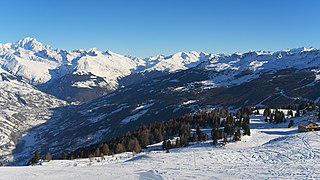
A mountain pass is a navigable route through a mountain range or over a ridge. Since many of the world's mountain ranges have presented formidable barriers to travel, passes have played a key role in trade, war, and both human and animal migration throughout Earth's history. At lower elevations it may be called a hill pass. The highest vehicle-accessible pass in the world appears to be Mana Pass, located in the Himalayas on the border between India and Tibet, China.

Contents

Under its earlier name, Col de l'Argentière it has historically linked Lyon with Italy; the Col de l'Argentière was in the possession of the house of Savoy from 1388 to 1713, offering an easy route between Piedmont and its outlying valley of Barcelonnette, which came into Savoyard possession in 1388, when Amadeus VI of Savoy purchased it for the sum of 60,000 ecus, [1] it was of such strategic and commercial importance.

Lyon Prefecture and commune in Auvergne-Rhône-Alpes, France

Lyon is the third-largest city and second-largest urban area of France. It is located in the country's east-central part at the confluence of the rivers Rhône and Saône, about 470 km (292 mi) south from Paris, 320 km (199 mi) north from Marseille and 56 km (35 mi) northeast from Saint-Étienne. Inhabitants of the city are called Lyonnais.

House of Savoy noble family

The House of Savoy is a royal family that was established in 1003 in the historical Savoy region. Through gradual expansion, the family grew in power from ruling a small county in the Alps north-west of Italy to absolute rule of the kingdom of Sicily in 1713 to 1720. Through its junior branch, the House of Savoy-Carignano, it led the unification of Italy in 1861 and ruled the Kingdom of Italy from 1861 until 1946 and, briefly, the Kingdom of Spain in the 19th century. The Savoyard kings of Italy were Victor Emmanuel II, Umberto I, Victor Emmanuel III, and Umberto II. The last monarch ruled for a few weeks before being deposed following the Constitutional Referendum of 1946, after which the Italian Republic was proclaimed.

Lago della Maddalena Maddalena001.jpg
Lago della Maddalena

A few hundred metres from the pass, on its Italian side, is the Lago della Maddalena, which is the source of the Stura di Demonte, an important tributary of the Tanaro.

Stura di Demonte river in Italy

Stura di Demonte is a 115-kilometre (71 mi) long river in northwestern Italy (Piedmont).

Tanaro river in northwestern Italy

The Tanaro, known as Tanarus in ancient times and Tane or Tani in piedmontese language, is a 276-kilometre (171 mi) long river in northwestern Italy. The river begins in the Ligurian Alps, near the border with France, and is the most significant right-side tributary to the Po in terms of length, size of drainage basin, and discharge.

See also

Related Research Articles

Barcelonnette Subprefecture and commune in Provence-Alpes-Côte dAzur, France

Barcelonnette is a commune of France and a subprefecture in the department of Alpes-de-Haute-Provence, in the Provence-Alpes-Côte d'Azur region. It is located in the southern French Alps, at the crossroads between Provence, Piedmont and the Dauphiné, and is the largest town in the Ubaye Valley. The town's inhabitants are known as Barcelonnettes.

Maritime Alps mountains in France

The Maritime Alps are a mountain range in the southwestern part of the Alps. They form the border between the French region of Provence-Alpes-Côte d'Azur and the Italian regions of Piedmont and Liguria. They are the southernmost part of the Alps.

Cottian Alps mountain range in the South-Western part of the Alps

The Cottian Alps ; are a mountain range in the southwestern part of the Alps. They form the border between France and Italy (Piedmont). The Fréjus Road Tunnel and Fréjus Rail Tunnel between Modane and Susa are important transportation arteries between France and Italy (Turin).

Amadeus VI, Count of Savoy Count of Savoy 1343-1383

Amadeus VI, nicknamed the Green Count was Count of Savoy from 1343 to 1383. He was the eldest son of Aymon, Count of Savoy and Yolande Palaeologo of Montferrat. Though he started under a regency, he showed himself to be a forceful leader, continuing Savoy's emergence as a power in Europe politically and militarily. He participated in a crusade against the Turks who were moving into Europe.

Savoie Department of France in Auvergne-Rhône-Alpes

Savoie is a department in the Auvergne-Rhône-Alpes region of France. Its prefecture is Chambéry; it is located in the French Alps. In 2016, it had a population of 429,681.

Alpine Line

The Alpine Line or Little Maginot Line was the component of the Maginot Line that defended the southeastern portion of France. In contrast to the main line in the northeastern portion of France, the Alpine Line traversed a mountainous region of the Maritime Alps, the Cottian Alps and the Graian Alps, with relatively few passes suitable for invading armies. Access was difficult for construction and for the Alpine Line garrisons. Consequently, fortifications were smaller in scale than the fortifications of the main Line. The Alpine Line mounted few anti-tank weapons, since the terrain was mostly unsuitable for the use of tanks. Ouvrage Rimplas was the first Maginot fortification to be completed on any portion of the Maginot Line, in 1928. The Alpine Line was unsuccessfully attacked by Italian forces during the Italian invasion of France in 1940. Following World War II, some of the larger positions of the Alpine Line were retained in use through the Cold War.

Mont Cenis mountain pass in Alps

Mont Cenis is a massif and pass in Savoie (France), which forms the limit between the Cottian and Graian Alps.

Geography of the Alps

The Alps cover a large area. This article describes the delimitation of the Alps as a whole and of subdivisions of the range, follows the course of the main chain of the Alps and discusses the lakes and glaciers found in the region.

Ubaye Valley

The Ubaye Valley is an area in the Alpes de Haute-Provence département, in the French Alps, having approximately 7,700 residents. Its residents are called Ubayens. Its principal town is the sous-préfecture of Barcelonnette.

Fort de Tournoux

The Fort de Tournoux is a fortification complex in the Ubaye Valley in the French Alps. It was built between 1843 and the early 20th century to defend France against invasion from Italy and Savoy. It was described as the "Military Versailles of the 19th century," resembling a Tibetan monastery on the mountainside above the Ubaye. The fort is actually an ensemble of fortifications, including some "batteries" that rival the main fort in size and power.

County of Nice countship

The County of Nice is a historical region of France located around the south-eastern city of Nice, and roughly equivalent to the modern arrondissement of Nice.

Col de la Cayolle mountain pass

Col de la Cayolle is a high mountain pass in the French Alps at the border between the departments of Alpes-Maritimes and Alpes-de-Haute-Provence in France.

Mont Dolent mountain

Mont Dolent is a mountain in the Mont Blanc massif and lies on the border between Italy, Switzerland and France.

Captain Leslie Percival Fernandez OBE, MM, C de G, was an English army officer in Special Forces during the Second World War who had risen from the ranks. He was notable for having trained Violette Szabó, made famous by the 1958 film Carve Her Name with Pride starring Virginia McKenna, on which he was an advisor.

Col de lÉchelle mountain pass

Col de l'Échelle is a mountain pass in the Alps in the department of Hautes-Alpes in France. It is the lower mountain pass between France and Italy and connects Vallée de la Clarée and Vallée Étroite. The highest point between both valleys is actually at 1779 meter, some kilometers north of the official Col de l'Échelle at the Mauvais Pas. Between both cols, a small dry valley exists.

France–Italy border international border between Italy and France

The France–Italy border is the international boundary between France and Italy.

Punta Nera mountain in Italy

The Punta Nera is a mountain of Savoie (France) and of the Province of Turin (Italy). It lies in the Cottian Alps range. It has an elevation of 3,047 metres above sea level.

Colle della Rho

The Collle della Rho or Col de la Roue is a mountain col at 2,541 metres (8,337 ft), in the Cottian Alps.

References

  1. W. A. B. Coolidge, "The Passages of the Alps in 1518" The English Historical Review30 No. 120 (October 1915:681-691) pp 687-88, 690.