Maghval

Last updated

Maghval
Megwal
Meghwad
village
Dadra Nagar Haveli Map.svg
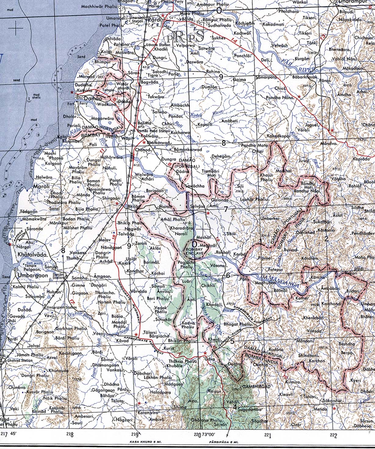
Dadra and Nagar Haveli map in grey depicting the Gujarati enclave village of Maghval in cream
India Gujarat location map.svg
Red pog.svg
Maghval
Location in Gujarat, India
India location map.svg
Red pog.svg
Maghval
Maghval (India)
Coordinates: 20°13′N73°01′E / 20.21°N 73.02°E / 20.21; 73.02
CountryFlag of India.svg  India
State Gujarat
District Valsad district
Elevation
16 m (52 ft)
Population
 (2011)
  Total2,678
Languages
  Official Gujarati, Marathi
Time zone UTC+5:30 (IST)
PIN
396240
Vehicle registration GJ
Nearest city Silvassa

Maghval, also known as Megwal and Meghwad, is a village in the Kaparada taluka of Valsad district in Gujarat State, India. It is a small enclave belonging to Gujarat, but located within Nagar Haveli, just south of Silvassa in the Indian union territory of Dadra and Nagar Haveli and Daman and Diu. In January 2022, the government of India announced plans for the Maghval enclave to become part of Dadra and Nagar Haveli and Daman and Diu. [1]

Contents

Geography

Maghval, though under the administrative purview of Gujarat, is surrounded by the union territory of Dadra and Nagar Haveli and Daman and Diu (DNHDD), outside the state boundary and a few kilometres from Silvassa in DNHDD. The village with 2,160 villagers (as of February 2018) has a rich landscape with the Daman Ganga River cutting through it, leaving a hilly stretch on one side and plains on the other.

History

Formerly "Bombay Enclave", Maghval was a British counter-enclave within the Portuguese enclave within British India until independence. [2] [3]

Related Research Articles

<span class="mw-page-title-main">States and union territories of India</span> Indian national administrative subdivisions

India is a federal union comprising 28 states and 8 union territories, with a total of 36 entities. The states and union territories are further subdivided into districts and smaller administrative divisions.

<span class="mw-page-title-main">Dadra and Nagar Haveli</span> District in Western India

Dadra and Nagar Haveli is a district of the union territory of Dadra and Nagar Haveli and Daman and Diu in western India. It is composed of two separate geographical entities: Nagar Haveli, wedged in between Maharashtra and Gujarat states 1 kilometre (0.62 mi) to the north-west, the smaller enclave of Dadra, which is surrounded by Gujarat. Silvassa is the administrative headquarters of Dadra and Nagar Haveli.

<span class="mw-page-title-main">Daman and Diu</span> Former union territory in western India

Daman and Diu was a union territory in northwestern India. With an area of 112 km2 (43 sq mi), it was the smallest administrative subdivision of India on the mainland. The territory comprised two districts, Damaon and Diu island, geographically separated by the Gulf of Khambat. The state of Gujarat and the Arabian Sea bordered the territory. A Portuguese colony since the 1500s, the territories were taken by India with the Annexation of Goa in 1961. Daman and Diu were administered as part of the union territory of Goa, Daman and Diu between 1961 and 1987, after the Goa Opinion Poll they became a separate union territory. In 2019, legislation was passed to merge the union territory of Daman and Diu with its neighbouring union territory, Dadra and Nagar Haveli, to form the new union territory of Dadra and Nagar Haveli and Daman and Diu with effect from 26 January 2020.

<span class="mw-page-title-main">Silvassa</span> City in DNDD, India

Silvassa is a city and municipality in western India, and the headquarters of the Dadra and Nagar Haveli district. It was a part of the Daman district of the former Portuguese India, and is today the largest city in Dadra and Nagar Haveli and Daman and Diu. Many large companies have established their manufacturing units there. The city has a large number of factories providing significant government revenue, which allows the city to maintain a low level of taxation. The city was chosen as one of the hundred Indian cities in Government of India's flagship Smart Cities Mission.

<span class="mw-page-title-main">Vapi</span> City in Gujarat, India

Vapi, is a city and municipality in Valsad district in the state of Gujarat, India. It is situated near the banks of the Daman Ganga River, around 28 km south of the district headquarters in the city of Valsad, and it is surrounded by the Union Territory of Dadra and Nagar Haveli and Daman and Diu. It is believed that the city got its name from the old small stepwell situated near the Balitha area. The meaning of vapi (वापी) in sanskrit is a water reservoir or a water storage body.

<span class="mw-page-title-main">Daman Ganga River</span> River in western India

The Daman Ganga also called Dawan River is a river in western India. The river's headwaters are on the western slope of the Western Ghats range, and it flows west into the Arabian Sea. The river flows through Maharashtra and Gujarat states, as well as the Union territory of Dadra and Nagar Haveli and Daman and Diu. The industrial towns of Vapi, Dadra and Silvassa lie on the north bank of the river, and the town of Daman occupies both banks of the river's estuary.

<span class="mw-page-title-main">Diu district</span> District in Dadra and Nagar Haveli and Daman and Diu, India

Diu district is one of the three districts of the union territory of Dadra and Nagar Haveli and Daman and Diu of India. The district is made up of Diu Island and two small enclaves on the Indian mainland. The district headquarters are at Diu Town. It is the ninth least populous district in the country.

<span class="mw-page-title-main">Dadra, Dadra and Nagar Haveli and Daman and Diu</span> Sub-district in DNDD, India

Dadra is one of the two talukas in Dadra and Nagar Haveli district, India. It is an enclave lying a few kilometres north west of Nagar Haveli and is surrounded by Gujarat.

<span class="mw-page-title-main">Nagar Haveli</span> Taluka in Dadra and Nagar Haveli and Daman and Diu, India

Nagar Haveli is one of the two talukas of Dadra and Nagar Haveli District, Dadra and Nagar Haveli and Daman and Diu, India. It is surrounded by the Indian states of Gujarat and Maharashtra.

<span class="mw-page-title-main">Annexation of Dadra and Nagar Haveli</span> Annexation of Dadra and Nagar Haveli by India

The Annexation of Dadra and Nagar Haveli was the conflict in which the territories of Dadra and Nagar Haveli passed from Portuguese rule to independent rule, with Indian allegiance, in 1954.

<span class="mw-page-title-main">Union territory</span> Form of administrative division in India

A union territory is a type of administrative division in the Republic of India. Unlike the states of India, which have their own governments, union territories are federal territories governed, in part or in whole, by the Union Government of India. There are currently eight union territories in India, namely Andaman and Nicobar Islands, Chandigarh, Dadra and Nagar Haveli and Daman and Diu, Delhi, Jammu and Kashmir, Ladakh, Lakshadweep and Puducherry.

<span class="mw-page-title-main">Free Dadra and Nagar Haveli</span> Freedom struggle of Dadra and Nagar Haveli from the Portuguese

Free Dadra and Nagar Haveli was a de facto independent political entity that existed in the Indian Sub-continent between 1954 and 1961. It was declared by pro-India forces that had gained control of the region from Portugal in 1954 and ceased to exist after being formally annexed by India on 11 August 1961 as the Union Territory of Dadra and Nagar Haveli.

<span class="mw-page-title-main">National Highway 848A (India)</span> National highway in India

National Highway 848A, commonly called NH 848A is a national highway in India. It is a branch of National Highway 48. NH-848A traverses the states of Gujarat, Maharashtra and the union territory of Dadra and Nagar Haveli and Daman and Diu.

National Highway 848B, commonly called NH 848B is a national highway in India. It is a spur road of National Highway 48. NH-848B traverses the state of Gujarat and the union territory of Dadra and Nagar Haveli and Daman and Diu in India.

National Highway 251, commonly called NH 251 is a national highway in India. It is a spur road of National Highway 51. NH-251 traverses the state of Gujarat and the union territory of Dadra and Nagar Haveli and Daman and Diu in India.

<span class="mw-page-title-main">Shri Vinoba Bhave Civil Hospital</span>

Shri Vinoba Bhave Civil Hospital (VBCH) is a government multi-speciality hospital located in Silvassa, Dadra and Nagar Haveli, India.

<span class="mw-page-title-main">Dadra and Nagar Haveli and Daman and Diu</span> Union territory of India

Dadra and Nagar Haveli and Daman and Diu is a union territory in India. The territory was constituted through the merger of the former territories of Dadra and Nagar Haveli and Daman and Diu. Plans for the proposed merger were announced by the Government of India in July 2019; the necessary legislation was passed in the Parliament of India in December 2019 and came into effect on 26 January 2020. The territory is made up of four separate geographical entities: Dadra, Nagar Haveli, Daman, and the island of Diu. All four areas were formerly part of Portuguese India, with a joint capital at Panjim, Goa. They came under Indian rule in the mid-20th century after the Annexation of Goa. These were jointly administered as Goa, Daman and Diu until 1987, when Goa was granted statehood after the Konkani language agitation. The current capital is Daman and Silvassa is the largest city.

<span class="mw-page-title-main">Shri Vinoba Bhave Institute of Medical Sciences</span> Indian government medical college in Silvassa

Vinoba Bhave Insttute of Medical Sciences / NAMO Medical Education & Research Institute is a government medical college located in Silvassa in the Union Territory of Dadra and Nagar Haveli and Daman and Diu. The union government allocated the fund of 189 crore for its construction. The foundation stone was laid by the Prime Minister of India Shri Narendra Modi on 19 January 2019, and the first undergraduate batch commenced on 15 August 2019.

References

  1. "4 Gujarat villages will no more be dry | Ahmedabad News - Times of India". The Times of India .
  2. Yoshida Ichiro. "Megubaru, Former British territory, India" . Retrieved 6 October 2013.
  3. Damao (Daman) 1954 (Topographic Map) original scale 1:250,000 (Map). 1956. Retrieved 6 October 2013. Portion of Navsari, Sheet NF 43-13, Series U502, U.S. Army Map Service compiled in 1954 and printed in 1956 (Perry–Castañeda Library Map Collection, University of Texas Libraries)