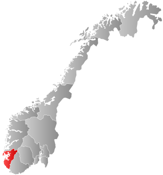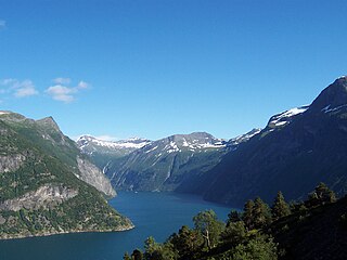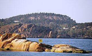
Rogaland is a county in Western Norway, bordering the North Sea to the west and the counties of Vestland to the north, Telemark to the east and Agder to the east and southeast. Per 1. January 2024, it had a population of 499,417 people.

Sør-Varanger is a municipality in Finnmark county, Norway. The administrative centre of the municipality is the town of Kirkenes. Other settlements in the municipality include the villages of Bjørnevatn, Bugøynes, Elvenes, Grense Jakobselv, Hesseng, Jakobsnes, Neiden, and Sandnes. Located west of the Norway–Russia border, Sør-Varanger is the only Norwegian municipality that shares a land border with Russia, with the only legal border crossing at Storskog.

Eigersund is a municipality in Rogaland county, Norway. It is in the traditional district of Dalane. The administrative centre of the municipality is the town of Egersund. The town was known for its pottery factory and it is among Norway's biggest fishing ports. The villages of Helleland, Hellvik, and Hestnes are also in Eigersund.

Sandnes is a city and municipality in Rogaland, Norway. It lies immediately south of Stavanger, the 4th largest city in Norway, and together the Stavanger/Sandnes area is the third-largest urban area in Norway. The urban city of Sandnes lies in the extreme western part of the vast municipality and it makes up about 5% of the total land area of the municipality.

Sokndal is the southernmost municipality in Rogaland county, Norway. It is located in the traditional district of Dalane. The administrative centre of the municipality is the village of Hauge. Other villages in Sokndal include Li, Rekefjord, Sogndalsstranda, and Åna-Sira.

Bjerkreim is a municipality in Rogaland county, Norway. It is located in the traditional district of Dalane. The administrative centre of the municipality is the village of Vikeså. Other villages in the municipality include Bjerkreim and Øvrebygd.

Egersund is a town in Eigersund municipality in Rogaland county, Norway. The town is located along the southwestern coast of Norway, about 75 kilometres (47 mi) south of the city of Stavanger. The town is situated along a strait which separates the mainland from the island of Eigerøya. From 1838 until 1964, the town was also an independent municipality.

Jæren is a traditional district in Rogaland county, Norway. The other districts in Rogaland are Dalane, Ryfylke, and Haugalandet. Jæren is one of the 15 districts that comprise Western Norway.

Lushan Geopark (庐山世界地质公园), is located in the region around Mount Lu, Jiujiang. The protected area of 500 square kilometres (190 sq mi) extends from the Yangtze River to the Poyang Lake basin.

The North Pennines is the northernmost section of the Pennine range of hills which runs north–south through northern England. It lies between Carlisle to the west and Darlington to the east, straddling the borders of the counties of Cumbria, Durham, Northumberland and North Yorkshire. It is bounded to the north by the Tyne Valley and to the south by the Stainmore Gap.

Western Norway is the region along the Atlantic coast of southern Norway. It consists of the counties Rogaland, Vestland, and Møre og Romsdal. The region has no official or political-administrative function. The region has a population of approximately 1.4 million people. The largest city is Bergen and the second-largest is Stavanger. Historically the regions of Agder, Vest-Telemark, Hallingdal, Valdres, and northern parts of Gudbrandsdal have been included in Western Norway.

Dalane is a traditional district in the southwestern part of Norway, consisting of the municipalities of Lund, Sokndal, Eigersund, and Bjerkreim. Dalane is one of the 15 districts in Western Norway. It sits to the southeast of the very flat Jæren region and south of the moorland of Ryfylke. The 1,786-square-kilometre (690 sq mi) district has about 24,159 residents.

Vesterøya a peninsula in Sandefjord Municipality in Vestfold county, Norway. It is one of two long, narrow peninsulas located south of the city of Sandefjord. The peninsula lies between the Mefjorden and Sandefjordsfjorden and it sits across the fjord from the Østerøya peninsula. The peninsula is primarily known for its many beaches and idyllic coastal landscape, but there are also numerous trails used for hiking and biking.
Vikeså or Vigjeså is the administrative centre of Bjerkreim municipality in Rogaland county, Norway. The village is located along the European route E39 highway at a crossroads with the village of Ålgård about 20 kilometres (12 mi) to the northwest, the village of Dirdal about 25 kilometres (16 mi) to the northeast, and the town of Egersund about 20 kilometres (12 mi) to the south. The lake Svelavatnet lies along the south side of the village.
The former Kanawinka Geopark is situated along a structurally controlling geological fault of the same name that extends from the Naracoorte Caves in South Australia into Western Victoria, before disappearing offshore at Portland.

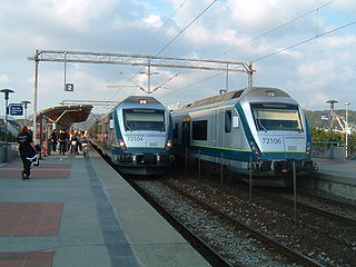
The Jæren Commuter Rail is a commuter train service operated along the westernmost part of the Sørland Line in Jæren, Norway. It is operated by Go-Ahead Norge with nine Class 72 electric multiple units. The service acts as a commuter rail connecting Stavanger to its suburbs, including Sandnes, and to towns further south, in Klepp, Time, Hå and Eigersund. Although passenger services have operated along the lines since 1878, the commuter train service was inaugurated in 1992 with a significant increase of service, using existing rolling stock. Ridership of the system increased from 3.2 million in 2012 to 5 million in 2019.

The Porsangerfjorden is a fjord in Finnmark county, Norway.
The Novohrad – Nógrád Geopark (NNG), a geopark straddling the border between Hungary and Slovakia, is one of the first transnational geoparks in the world. It is a member of the UNESCO Global Geoparks Network and European Geoparks Network.

Rekefjord is a harbour village in the municipality of Sokndal in Rogaland county, Norway. The village is located around the Rekefjorden, about 1 kilometre (0.62 mi) west of the municipal centre of Hauge i Dalane. The village of Sogndalsstranda lies about 2 kilometres (1.2 mi) southeast of Rekefjord.

Zhangye National Geopark is located in Sunan and Linze counties within the prefecture-level city of Zhangye, in Gansu, China. It covers an area of 322 square kilometres (124 sq mi). The site became a quasi-national geopark on 23 April 2012. It was formally designated as "Zhangye National Geopark" by the Ministry of Land and Resources on 16 June 2016, after it passed the on-site acceptance test.


