The Maifeld is a landscape (a natural region sub-unit) of the Middle Rhine Basin on its western perimeter with the Eifel mountains, southwest of the city of Koblenz. It is known for its gently rolling hills.

The Maifeld is a landscape (a natural region sub-unit) of the Middle Rhine Basin on its western perimeter with the Eifel mountains, southwest of the city of Koblenz. It is known for its gently rolling hills.
The plain, which lies at about 400 metres above sea level, is divided into the Upper Maifeld (Obermaifeld) south of Mayen in the west, and the rather larger Lower Maifeld (Niedermaifeld) area which adjoins it to the east, southwest of Koblenz. It is comparatively sharply bounded by the rivers Moselle (southeast) and Elz (southwest), while the River Nette in the northwest only forms an approximate boundary.
Its name is probably derived from the Franks, who held assemblies here. [1]
The Maifeld is almost exclusively used for large-scale grain production. Only a few large farms, which are often hidden between the undulating fields, manage this region. The soils are especially fertile. Towns in the Maifeld are Polch (seat of the Verbandsgemeinde of Maifeld in the county of Mayen-Koblenz, but strictly in the Pellenz (Pellenzhöhe) from a natural regional perspective) and Münstermaifeld.

The Maifeld is divided as follows: [2]

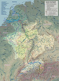
The Rhine is one of the major European rivers, which has its sources in Switzerland and flows in a mostly northerly direction through Germany and the Netherlands, emptying into the North Sea. The river begins in the Swiss canton of Graubünden in the southeastern Swiss Alps, forms part of the Swiss-Liechtenstein, Swiss-Austrian, Swiss-German and then the Franco-German border, then flows through the German Rhineland and the Netherlands and eventually empties into the North Sea.

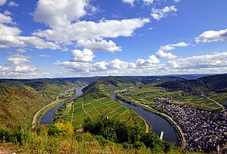
The Moselle is a river that flows through France, Luxembourg, and Germany. It is a left tributary of the Rhine, which it joins at Koblenz. A small part of Belgium is also drained by the Moselle through the Sauer and the Our.

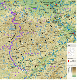
The Eifel is a low mountain range in western Germany and eastern Belgium. It occupies parts of southwestern North Rhine-Westphalia, northwestern Rhineland-Palatinate and the southern area of the German-speaking Community of Belgium.

Mayen is a town in the Mayen-Koblenz District of the Rhineland-Palatinate Federal State of Germany, in the eastern part of the Volcanic Eifel Region. As well as the main town, additional settlements include Alzheim, Kürrenberg, Hausen-Betzing, Hausen and Nitztal. Mayen is the administrative centre of the Vordereifel ‘Collective Municipality’, although it is not part of the municipality.

Rhin-et-Moselle was a department of the First French Republic and First French Empire in present-day Germany. It was named after the rivers Rhine and Moselle. It was formed in 1798, when the left bank of the Rhine was annexed by France. Until the French occupation, its territory was divided between the Archbishopric of Cologne, the Archbishopric of Trier, and the Electorate of the Palatinate. Its territory is now part of the German states of Rhineland-Palatinate and North Rhine-Westphalia. Its capital was Koblenz.

The Rhine Gorge is a popular name for the Upper Middle Rhine Valley, a 65 km section of the Rhine between Koblenz and Bingen in the states of Rhineland-Palatinate and Hesse in Germany. It was added to the UNESCO list of World Heritage Sites in June 2002 for a unique combination of geological, historical, cultural and industrial reasons.
Maifeld is a Verbandsgemeinde in the district Mayen-Koblenz, in Rhineland-Palatinate, Germany. It is situated south-east of Mayen, and west of Koblenz. The seat of the municipality is in Polch.

Münstermaifeld is a town in the district Mayen-Koblenz, in Rhineland-Palatinate, Germany. It is part of the Verbandsgemeinde of Maifeld. It is situated south-east of Mayen, a few kilometres from the Moselle river and Eltz Castle. The first (B.C.) residents of the region were Celts. The old church is based on a Roman castle-tower. After the Romans, the Franks (Charlemagne) arrived in the 9th century. In the Middle Ages (1277) Münstermaifeld received town privileges and was governed by the bishop of Trier. It is one of the oldest towns in Rhineland-Palatinate and, with its 3,400 citizens, one of the smallest.
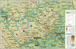
The Gießen-Koblenz Lahn Valley is a bowl in western Hesse and eastern Rhineland-Palatinate in Germany that contains the lower course of the Lahn as well as the Limburg Basin. It falls within natural region no. 31 as defined by the BfN. It extends from Leun to the mouth of the Lahn into the river Rhine near Lahnstein. Despite its name it does not reach as far east as Gießen, but ends west of Wetzlar.

The Volcanic Eifel or Vulkan Eifel is a region in the Eifel Mountains in Germany, that is defined to a large extent by its volcanic geological history. Characteristic of this volcanic field are its typical explosion crater lakes or maars, and numerous other signs of volcanic activity such as volcanic tuffs, lava streams and volcanic craters like the Laacher See. The Volcanic Eifel is still volcanically active today. One sign of this activity is the escaping gases, for example, in the Laacher See.

The West Hesse Highlands, also known as the West Hessian Lowlands and Highlands, refers to a heavily forested region of the Central Uplands in Germany that lies mostly within the state of Hesse, between those elements of the Rhenish Massif right of the Rhine in the west, the Weser Uplands to the north, the Hessian Central Uplands to the east and the Wetterau to the south.

The Moselle Eifel forms the southeastern strip of the East Eifel to the left of the Moselle from the city of Trier downstream as far as Moselkern; in the southeast it does not reach as far as the Moselle Valley. It lies exclusively within the German state of Rhineland-Palatinate and is a truncated highland, roughly half of which is forested.

The Cross Eifel Railway is a non-electrified railway line between Andernach and Gerolstein in the Eifel in the German state of Rhineland-Palatinate. From Andernach to Mayen Ost (East), it is classified as main line and it has two tracks as far as Mendig.

The Hochstein is a volcanic cone, 563 m above sea level (NHN), in the Eifel near Obermendig in the German state of Rhineland-Palatinate and county ofMayen-Koblenz.

The Pellenz is a hill country in the northwestern part of the Middle Rhine Basin in Germany between Mayen in the southwest and Andernach in the northeast. In addition Pellenz is the name of a Verbandsgemeinde in the state of Rhineland-Palatinate, which covers the north of the landscape of Pellenz and has had its seat since May 2017 in the village of Plaidt.

The Middle Rhine Basin is the central landscape region of the Middle Rhine in Germany and, along with the Limburg Basin, forms one of the biggest intra-montane lowland regions within the Rhenish Massif. The basin is divided into the valley bottom of the Neuwied Basin, the Neuwied Basin Perimeter east of the Rhine and the Lower Moselle Valley west of the Rhine in the south, and the Maifeld-Pellenz Hills in the north.

The Limburg Basin is one of the two large intramontane lowland areas within the Rhenish Massif in Germany, the other being the Middle Rhine Basin. It forms the central part of the natural region of the Gießen-Koblenz Lahn Valley between the Weilburg Lahn Valley Region and the Lower Lahn Valley on both sides of the Lahn around the town of Limburg.

The Ettringer Bellerberg, also called the Ettringer Bellberg, is a hill, 427.5 m above sea level (NHN), forming the western flank of the Bellerberg Volcano, a volcano system that was active about 200,000 years ago.

The Karmelenberg is a wooded cinder cone that was formed by volcanic activity. It marks the southeastern end of the East Eifel volcano field and rises to a height of 372 m above sea level (NHN), about 170 metres above the Pellenz region, and is visible from a long way off.