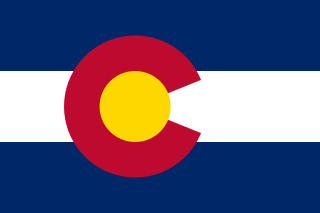
Colorado is a landlocked state in the Mountain West subregion of the Western United States. Colorado borders Wyoming to the north, Nebraska to the northeast, Kansas to the east, Oklahoma to the southeast, New Mexico to the south, Utah to the west, and meets Arizona to the southwest at the Four Corners. Colorado is noted for its landscape of mountains, forests, high plains, mesas, canyons, plateaus, rivers, and desert lands. Colorado is one of the Mountain States and is often considered to be part of the southwestern United States. The high plains of Colorado may be considered a part of the midwestern United States. It encompasses most of the Southern Rocky Mountains, as well as the northeastern portion of the Colorado Plateau and the western edge of the Great Plains. Colorado is the eighth most extensive and 21st most populous U.S. state. The United States Census Bureau estimated the population of Colorado at 5,877,610 as of July 1, 2023, a 1.80% increase since the 2020 United States census.

The term "United States," when used in the geographical sense, refers to the contiguous United States, Alaska, Hawaii, the five insular territories of Puerto Rico, Northern Mariana Islands, U.S. Virgin Islands, Guam, American Samoa, and minor outlying possessions. The United States shares land borders with Canada and Mexico and maritime borders with Russia, Cuba, The Bahamas, and many other countries, mainly in the Caribbeanin addition to Canada and Mexico. The northern border of the United States with Canada is the world's longest bi-national land border.

The Appalachian Mountains, often called the Appalachians, are a mountain range in eastern to northeastern North America. The term "Appalachian" refers to several different regions associated with the mountain range, and its surrounding terrain. The general definition used is one followed by the United States Geological Survey and the Geological Survey of Canada to describe the respective countries' physiographic regions. The U.S. uses the term Appalachian Highlands and Canada uses the term Appalachian Uplands; the Appalachian Mountains are not synonymous with the Appalachian Plateau, which is one of the provinces of the Appalachian Highlands.

The First Boer War, was fought from 16 December 1880 until 23 March 1881 between the United Kingdom and Boers of the Transvaal. The war resulted in a Boer victory and eventual independence of the South African Republic. The war is also known as the First Anglo–Boer War, the Transvaal War or the Transvaal Rebellion.

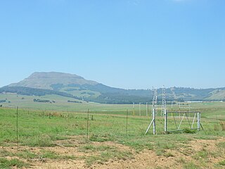
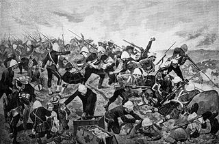
The Battle of Majuba Hill on 27 February 1881 was the final and decisive battle of the First Boer War that was a resounding victory for the Boers. The British Major General Sir George Pomeroy Colley occupied the summit of the hill on the night of 26–27 February 1881. Colley's motive for occupying Majuba Hill, near Volksrust, now in South Africa, may have been anxiety that the Boers would soon occupy it themselves, since he had witnessed their trenches being dug in the direction of the hill.

The Sangre de Cristo Mountains are the southernmost subrange of the Rocky Mountains. They are located in southern Colorado and northern New Mexico in the United States. The mountains run from Poncha Pass in South-Central Colorado, trending southeast and south, ending at Glorieta Pass, southeast of Santa Fe, New Mexico. The mountains contain a number of fourteen thousand foot peaks in the Colorado portion, as well as several peaks in New Mexico which are over thirteen thousand feet.

The Medicine Bow Mountains are a mountain range in the Rocky Mountains that extend 100 miles (160 km) from northern Colorado into southern Wyoming. The northern extent of this range is the sub-range the Snowy Range. From the northern end of Colorado's Never Summer Mountains, the Medicine Bow mountains extend north from Cameron Pass along the border between Larimer and Jackson counties in Colorado and northward into south central Wyoming. In Wyoming, the range sits west of Laramie, in Albany and Carbon counties to the route of the Union Pacific Railroad and U.S. Interstate 80. The mountains often serve as a symbol for the city of Laramie. The range is home to Snowy Range Ski Area.

Joseph John Farmer VC was an English recipient of the Victoria Cross, the highest and most prestigious award for gallantry in the face of the enemy that can be awarded to British and Commonwealth forces.

Laing's Nek, or Lang's Nek is a pass through the Drakensberg mountain range in South Africa, south of Charlestown, at 27°27′39″S29°52′10″E at an elevation of 5400 to 6,000 ft (1,800 m). It is the lowest part of a ridge that slopes from Majuba Hill east to the Buffalo River. Before the opening of the railway in 1891, the road over the nek was the main artery of communication between Durban and Pretoria. The railway crosses the pass via a 2,213 ft (675 m) tunnel.

The Battle of Laing's Nek was a major battle fought at Laing's Nek during the First Boer War on 28 January 1881.
The Seven Troughs Range is a mountain range in western Pershing County, Nevada.

Blue Mountain is a peak in the Adirondack Mountains of New York State in the United States. Located east of Blue Mountain Lake, Hamilton County, the peak reaches a height of 3,750 ft (1,140 m). For hiking, the elevation gain is 1,559 feet and the trail length is four miles. The trailhead elevation is 2,200 feet. It is the location of the Blue Mountain Fire Observation Station, listed on the National Register of Historic Places in 2001.
Majuba Power Station between Volksrust and Amersfoort in Mpumalanga, South Africa, is a coal-fired power plant operated by Eskom. Majuba is Eskom's only power station that is not linked to a specific mine and it receives its coal from various sources. This was due to an error in geotechnical engineering core drilling which did not identify that the proposed local coal mine was under solid bedrock.

The Buffalo River is the largest tributary of the Tugela River in South Africa. With a total length of 426 km (265 mi), its source is in Majuba Hill, "Hill of Doves" in the Zulu language, located northeast of Volksrust, close to the Mpumalanga / KwaZulu-Natal border. It follows a southerly route into KwaZulu-Natal past Newcastle then turns southeast past Rorke's Drift, before joining the Tugela River at Ngubevu near Nkandla. During the nineteenth century it formed part of the boundary between the Colony of Natal and Zululand.
Madadeni is a town in Newcastle, KwaZulu-Natal, South Africa, which falls under Amajuba District Municipality. On the outskirts of Newcastle, Madadeni is situated 16 kilometers (9.9 mi) from Newcastle CBD. As of the 2011 census Madadeni has population of 119,497 citizens.

Majuba Day(Afrikaans: Majubadag) was a major annual national celebration on 27 February in the South African Republic in the period between the First and Second Boer Wars. The day was named after the Battle of Majuba Hill where on 27 February 1881 the main battle of the First Boer War took place.
Bitch Mountain is a summit in Essex County, New York, in the United States. With an elevation of 2,625 feet (800 m), Bitch Mountain is the 527th highest summit in the state of New York.

Linthorpe is a rural locality in the Toowoomba Region, Queensland, Australia. In the 2021 census, Linthorpe had a population of 416 people.
Bonakele Amos Majuba is a South African politician and educator who has served as the MEC for Finance in Mpumalanga since June 2024. Previously, he served as the MEC for Education from May 2019 until June 2024. A member of the African National Congress, he has been a Member of the Mpumalanga Provincial Legislature since May 2009. Majuba was the deputy speaker of the provincial legislature between March 2018 and May 2019.


