Makhu

Last updated

Makhu
Town
Rail Road Makhu.jpg
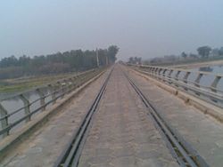
Rail Road bridge near Makhu
India Punjab location map.svg
Red pog.svg
Makhu
Location in Punjab, India
India location map.svg
Red pog.svg
Makhu
Makhu (India)
Coordinates: 31°06′N75°00′E / 31.1°N 75.0°E / 31.1; 75.0 Coordinates: 31°06′N75°00′E / 31.1°N 75.0°E / 31.1; 75.0
Country India
State Punjab
District Ferozepur
Government
  TypeNagar Panchayat
Area
  Total6 km2 (2 sq mi)
Elevation
201 m (659 ft)
Population
 (2011)
  Total14,658
  Density2,400/km2 (6,300/sq mi)
Languages
  Official Punjabi
Time zone UTC+5:30 (IST)
PIN
142044
Telephone code01682
Vehicle registration PB 47

Makhu is a town and a nagar panchayat in Ferozepur district in Indian state of Punjab.

Contents

Geography

Makhu has an average elevation of 201  metres (659  feet). [1] This town is located near the edge of Harike Sanctuary. It is 5 km away from the confluence of Satluj and Beas rivers.

Demographics

As of 2001 India census, [2] Makhu had a population of 12,173. Males constitute 52% of the population and females 48%. Makhu has an average literacy rate of 88%, higher than the national average of 59.5%: male literacy is 87 percent, and female literacy is 89 percent In Makhu, 14% of the population is under 6 years of age.

Politics

The town is a part of Zira Assembly Constituency, and Naresh Kataria is the MLA elected in 2022.

Transport

Railway

The town has namesake Makhu Railway station which provides connectivity to major cities of Firozpur, Ludhiana and Jalandhar.

Road

Makhu is connected to rest of Punjab and nation through three national highways.

Major Healthcare Services[ citation needed ]

Related Research Articles

Barwani or Badwani is a municipal town in Barwani district of Madhya Pradesh, India, that is situated near the left bank of the Narmada River. It is the administrative headquarters of Barwani district and has also served as the capital of the former princely state of Barwani. Barwani is only accessible by road.

<span class="mw-page-title-main">Nakodar</span> Town in Punjab, India

Nakodar is a town and a municipal council in Jalandhar district in the Indian state of Punjab.

<span class="mw-page-title-main">Jalandhar Cantonment</span> Town in Punjab, India

Jalandhar Cantonment is a cantonment town in Jalandhar District in the Indian state of Punjab. The Cantonment is located between latitude 30° 18' and longitude 75° 37' on the southwest and at a distance of 2 km from Cantonment Railway Station and 5 km from City Railway Station. It is situated beside Grand Trunk Road at a distance of 89 km from Amritsar and 371 km from Delhi. It covers an area of 5.87 square miles (15.2 km²). It is on Amritsar-Delhi Broad Gauge Main Line. A Class-I airfield at Adampur is situated at a distance of 19 km. The airfield is linked with Jalandhar Cantonment by rail and road. It has a Recruiting Office responsible for enlisting the soldiers for Army, Navy and Air Force. The first Recruiting Officer who held this post until 1952 was Col. Dilbagh Singh Minhas of Jallandhar Doab.

Bharoli Kalan is a village and locality on the outskirts of Pathankot City in the state of Punjab, India. Prior to creation of Pathankot district after 2011 census, Bharoli Kalan was part of Gurdaspur district. Postal code (PIN) number of Bharoli Kalan is 145025. Bharoli is a gram panchayat in Pathankot Community development block(CD).

Daurala is a town and a nagar panchayat in Meerut district in the state of Uttar Pradesh, India.

<span class="mw-page-title-main">Domjur</span> Census Town in West Bengal, India

Domjur is a census town in Domjur CD Block of Howrah Sadar subdivision in Howrah district in the Indian state of West Bengal. It is a part of Kolkata Urban Agglomeration.It is famous for its gold jewellery industries.

<span class="mw-page-title-main">Garhdiwala</span> Town in Punjab, India

Garhdiwala is a town and a municipal council in Hoshiarpur district in the state of Punjab, India.

Kalambur is a selection grade town panchayat in Polur taluk, Tiruvanamalai district in the Indian state of Tamil Nadu, famous for its rice production. As of the 2011 census, the town had a population of 31,751.

Kot Fatta is a city and a municipal council in Bathinda district in the Indian state of Punjab.

<span class="mw-page-title-main">New Mahe</span> Village in Kerala, India

New Mahe is a census town in Thalassery taluk of Kannur district in the Indian state of Kerala. It is part of Greater Mahé Region.

Puranpur is a town and a municipal board in Pilibhit district in the Indian state of Uttar Pradesh. Puranpur is divided into 25 wards for which elections are held every 5 years. After independence and Partition of India the large numbers of Sikhs migrated and settled in the Puranpur Region. Due to dense Sikh population and their lifestyle, The area is also known as Mini Punjab as after Partition of India in 1947.

Sadulshahar is a town and a municipality in Sri Ganganagar district in the Indian state of Rajasthan.

<span class="mw-page-title-main">Theog</span> Town in Himachal Pradesh, India

Theog is a town and a municipal committee as well as a tehsil in Shimla district in the Indian state of Himachal Pradesh. It's just 26 km from state capital Shimla. First settlements were in 1902.

Tohana is a city and a municipal council in Fatehabad district in the Indian state of Haryana. Its name comes from the Sanskrit 'Taushayana'. It is known as the City of Canals.

Banga is a town and Municipal council in the Shahid Bhagat Singh Nagar district of Punjab, India. Banga is also one of the sub-division (tehsil) headquarters of the district. Banga located on Phagwara-Rupnagar section of National Highway 344A. It is currently estimated to have a population of about 23,000 and is classified as a class 2 Municipality. The town also incorporates the former village of Jindowal apart from Banga town.

<span class="mw-page-title-main">Kartarpur, India</span> Town in Punjab, India

Kartarpur is a town, near the city of Jalandhar in Jalandhar district in the Indian state of Punjab and is located in the Doaba region of the state. It was founded by the fifth Guru of the Sikhs, Guru Arjan.

Banapura is a small town in the Narmadapuram District of Madhya Pradesh, India. Banapura is a twin city of Seoni Malwa.

Shian pari is a village in Firozpur district in the Indian state of Punjab. It is situated in between two highways: Amritsar to Bathinda Road and Amristsar to Moga Road. It is situated 1.5 km away from the main Amritsar - Bathinda road, near Makhu and 3 km from the Amritsar-Moga road. It is 12 km away from Tehsil Zira. Two gurdwara are located in the village. One is on the east side of the village and the other one is on the west side. Sardar Piara Singh grandfather of Sardar Lakhwinder Singh, Ravinder Singh, Dilbag Singh came from village Jia Bagga now in Pakistan in 1947.

<span class="mw-page-title-main">Sowaddi Kalan</span> Village in Punjab, India

Sowaddi Kalan or Swaddi Khas is a village in Ludhiana district in the Indian state of Punjab. Kalan is Persian language word which means Big. It is one of the most educated villages in the area. Swaddi Kalan is a large village in Jagraon of Ludhiana district with a total of 954 families and 4,804 residents in 2011.

Fatehgarh Panjtur is a large village in Moga district of Punjab state of India. Fatehgarh Panjtur is a village in Kot-ise-khan block of the Moga District of Punjab State, India. It is located about 31 km north of district headquarters Moga. Moga, Zira and Makhu are the nearby cities.

References

  1. Falling Rain Genomics, Inc - Makhu
  2. "Census of India 2001: Data from the 2001 Census, including cities, villages and towns (Provisional)". Census Commission of India. Archived from the original on 16 June 2004. Retrieved 1 November 2008.