Alangudi is a municipality in the Pudukkottai district of the Indian state of Tamil Nadu, that serves as the headquarters for Alangudi taluk, one of the 11 taluks in Pudukkottai district. The town has been ruled, at different times, by the Cholas, Mutharaiyars, Early Pandyas, Thondaimans, and the British. It is situated about 395 kilometres (245 mi) southwest of Chennai and about 75 kilometres (47 mi) southeast of Tiruchirappalli. Tamil Nadu's first women Asiad Santhi Soundarajan is from Alangudi municipality. Famous spots 1.Mys cake shop 2.shawarma shop 3.kallodai falls 4. Maharaj bakery 5.horse idol temple 6. Ayyanar temple
Ammapettai is a panchayat town in Anthiyur taluk of Erode district in the state of Tamil Nadu, India

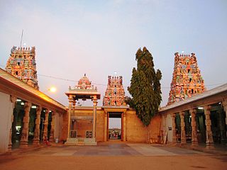
Dharapuram officially Tharaapuram is a town in Tirupur district in the Indian state of Tamil Nadu. Dharapuram is one of the oldest towns in Tamil Nadu and was the capital of Kongu Nadu under the Cheras, Western Ganga Dynasty and later Kongu Cholas, at which time it was known as Vanchipuri. Amaravathi River flows through the town. As of 2011, the town had a population of 67,007. Dharapuram Municipality is promoted 1st grade municipality on 6 May 1983 Dharapuram was Part of Coimbatore district in the beginning and later it moves to Erode district up to 2009. Dharapuram Town is situated along the banks of River Amaravathi, located in between 10 degree 45 minutes northern latitude and 77 degree 31 minutes eastern latitude with an extent of 7.02 km2. It is a small agricultural marketing centre for a large rural hinterland in the Tirupur District. The town is 50 km towards of the District Headquarters Tirupur, 75 km towards the Erode and 72 km towards the industrial town Coimbatore. The nearest airport is Coimbatore International Airport located 70 km from Dharapuram. Dharapuram was the capital of Noyyal South District before the formation of Coimbatore District.
Kadambur is a panchayat town in Kayathar taluk of the Thoothukudi district in the Indian state of Tamil Nadu. The temples in and around Kadambur portray the authentic Chola art and architecture. There is also another village with the same name Kadambur in the district of Salem under Gangavalli taluk.
Karumathampatti is a Municipality in the Coimbatore district in the state of Tamil Nadu, India. It is one of the most developing suburb in Coimbatore about 25 km away from the city centre. It is situated in between NH544 which connects the city of Coimbatore with Salem – Erode – Tirupur and also in between the State Highway 165 connects Annur – Kamanaikenpalayam. Nearby places are Somanur-3 km, Avinashi-10 km, Tirupur-20 km, Sulur-15 km, Annur-16 km. Coimbatore -27,Mettupalayam-38,Palladam-19. Karumathampatti lies near the junction of two major roads, NH544(Coimbatore – Salem) and Karumathampatti – Annur road.
Kodumudi is a panchayat town and taluk headquarters of Kodumudi taluk in erode district at state of Tamil Nadu,India. Kodumudi has an average elevation of 144 metres (472 feet). Also Kodumudi is an tourism spot. The holy Kaveri river and Magudeswarar temple in Kodumudi attracts thousands of pilgrims daily across South India.
Kolathupalayam is a panchayat town in Dharapuram taluk of Tirupur District in the Indian state of Tamil Nadu. Kolathupalayam Located 5km From Dharapuram.
Mulanur is a panchayat town under in Dharapuram taluk in Tirupur District in the Indian state of Tamil Nadu.
Natrampalli is a selection grade panchayat town and Taluk in Tirupattur district in the Indian state of Tamil Nadu. The Natrampalli block is a revenue block in the Tirupattur district of Tamil Nadu, India.
Pandamangalam, a panchayat town in Namakkal district, Tamil Nadu is at a distance of about three kilometers from Velur, a Small town in Paramathi-Velur Taluk.
Pennagaram is a town in Dharmapuri district in the Indian state of Tamil Nadu. It is the headquarters of Pennagaram taluk (sub-district).
Peraiyur is a panchayat town in Madurai district in the Indian state of Tamil Nadu. It is one of the Revenue blocks of Madurai District. Peraiyur is the headquarters of the peraiyur taluk.
Periyapatti is a census town in Tiruppur district in the Indian state of Tamil Nadu.
R. S. Mangalam, also known as Raja Singa Mangalam, is a panchayat town in Ramanathapuram district in the Indian state of Tamil Nadu. It is located 35 Kilometres north from the district headquarters Ramanathapuram.
Samalapuram is a suburb of Tirupur in the Indian state of Tamil Nadu. Samalapuram is located near the twin townships of Somanur, Karumathampatti between Avinashi road and Trichy Road. It comes under the Palladam Taluk and Tiruppur district. The place is very famous for Vaazhaithottathu Ayyan Kovil.
Thiruvennainallur is a taluk in Viluppuram district in the Indian state of Tamil Nadu. It is a major sugarcane agricultural region.
Thottipalayam is a suburb Tiruppur in the Indian state of Tamil Nadu.

Vijayamangalam is a census town in Erode district in the Indian state of Tamil Nadu. It is located on National Highway 47 (NH-47) between Perundurai and Perumanallur.
Alangulam is a town in Tenkasi district, Tamil Nadu, India. It is a Special Grade Town Panchayat and the centre of the Alangulam Taluk in Tenkasi district.

Tiruppur District is one of the 38 districts of the Indian state of Tamil Nadu, formed in 22 February 2009. Dharapuram was the largest taluk by area in the district. The district is well-developed and industrialized. The Tiruppur banian industry, the cotton market, Kangeyam bull and Uthukkuli butter, among other things, provide for a vibrant economy. The city of Tiruppur is the administrative headquarters for the district. As of 2011, the district had a population of 2,479,052 with a sex-ratio of 989 females for every 1,000 males.

