
Havelock is a small town in the Marlborough Region of New Zealand, at the head of Pelorus Sound / Te Hoiere, one of the Marlborough Sounds, and at the mouth of the Pelorus and Kaituna Rivers

Eketāhuna is a small rural settlement, in the south of the Tararua District and the Manawatū-Whanganui region of New Zealand's North Island.

Horowhenua District is a local government district on the west coast of the North Island of New Zealand. It forms part of the Manawatū-Whanganui region. Its name roughly means shaking or rippling earth.

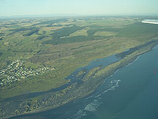
Foxton Beach is a small settlement in the Horowhenua District of the Manawatū-Whanganui region of New Zealand's North Island. It is located on the South Taranaki Bight at the mouth of the Manawatu River, 35 kilometres southwest of Palmerston North, and six kilometres west of Foxton. Foxton Beach has a permanent population of around 2000 people. The town is a popular holiday destination due mainly to its beach and the bird sanctuary at the Manawatu Estuary. Most of Foxton Beach is made up of holiday homes.

Shannon is a small town in the Horowhenua District of New Zealand's North Island. it is located 28 kilometres southwest of Palmerston North and 15 kilometres northeast of Levin.

Kimbolton is a rural village north of Feilding in the Manawatu District of the North Island of New Zealand. Kimbolton is named after Kimbolton, Cambridgeshire, a village in England which is the site of Kimbolton Castle, once the home of the Duke of Manchester. It was originally called Birmingham, after Birmingham, England.

Sanson is a small settlement in the Manawatu District and of New Zealand. It is located just south of Bulls and the Rangitikei River, and west of the city of Palmerston North.

Mangaweka is a township on the State Highway One (SH1), Manawatū-Whanganui region, in the North Island of New Zealand, with a population of just under 200. It is between Taihape to the north and Hunterville to the south. The Rangitikei River runs adjacent to the township, which is popular for rafting, kayaking, fishing and swimming.

Tokomaru is a small town in the district of Horowhenua, in the southwestern North Island of New Zealand. It is located 18 kilometres southwest of Palmerston North, and a similar distance northeast of Shannon. The Tokomaru railway station on the North Island Main Trunk was open from 1885 to 1982.
Pohangina is a small rural community in the Manawatū-Whanganui region of New Zealand, just north of Ashhurst.
Egmont Village is a settlement in Taranaki, New Zealand. State Highway 3 runs through it. New Plymouth is 12 km to the north-west, and Inglewood is 6 km to the south-east. Waiwhakaiho River and Mangaoraka Stream flow past to the west and east, respectively.

Manakau is a settlement in the Horowhenua District, at the boundary of the Manawatū-Whanganui and Wellington regions of New Zealand's North Island. It lies 8 km north of Otaki and 12 km south of Levin, and is connected to both via State Highway 1, which skirts Manakau's western edge. The township 5 km inland from the coast of the Tasman Sea.

Rongotea is a small rural village in the Manawatu District of the Manawatū-Whanganui region. Located on the western Manawatu Plains, approximately 19 km (12 mi) northwest of the region's main city, Palmerston North.
Koitiata is a town located in the southwestern part of Rangitikei District of the Manawatū-Whanganui region of New Zealand's North Island. At the time of the 2018 census, Koitiata had a population of 128. Marton is located 24 km to the east and Whanganui is located 29 km to the northwest. Nearby Koitiata is Lake Koitiata.
Hokio Beach or Hōkio is a village and rural community in the Horowhenua District and Manawatū-Whanganui region of New Zealand's North Island.

Ōhau is a village and semi-rural community in the Horowhenua District and Manawatū-Whanganui region of New Zealand's North Island. It is located just south of Levin on State Highway 1.
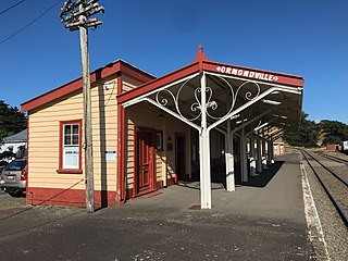
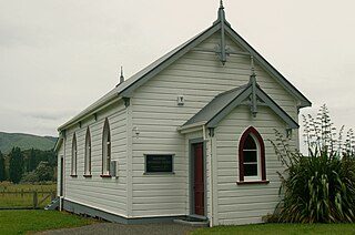
Ormondville is a locality in the Hawke's Bay region of New Zealand's North Island. It is located inland, south of Waipukurau and west of Flemington, Hawke's Bay.
Hiwinui is a settlement in Manawatu District, in the Manawatū-Whanganui region in New Zealand's central North Island.
Waitarere Beach is a small settlement in the Horowhenua District of the Manawatū-Whanganui region of New Zealand's North Island. It is located on the South Taranaki Bight, 14 kilometres northwest of Levin, and 17 kilometres southwest of Foxton, both distances being by road.

Waikawa Beach is a small settlement in the Horowhenua District of the Manawatū-Whanganui region of New Zealand's North Island. It is located on the South Taranaki Bight at the mouth of Waikawa Stream, 7.5 kilometres northwest of Manakau, and 19 kilometres southwest of Levin, both distances being by road.
