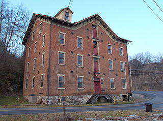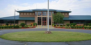
Durham County is a county located in the U.S. state of North Carolina. As of the 2020 census, the population was 324,833, making it the sixth-most populous county in North Carolina. Its county seat is Durham, which is the only incorporated municipality predominantly in the county, though very small portions of cities and towns mostly in neighboring counties also extend into Durham County. The central and southern parts of Durham County are highly urban, consisting of the city as well as several unincorporated suburbs. Southeastern Durham County is dominated by the Research Triangle Park, most of which is in Durham County. The northern third of Durham County is rural in nature.

St. Francis County is a county in the U.S. state of Arkansas. As of the 2020 census, the population was 23,090. The county seat is Forrest City.

York Charter Township is a charter township of Washtenaw County in the U.S. state of Michigan. The population was 9,108 at the 2020 census.

Butner is a town in Granville County, North Carolina, United States. The population was 8,397 as of the 2020 census. Butner was managed by the state of North Carolina from 1947 through 2007.

Creedmoor is a city in Granville County, North Carolina, United States. The population was 4,124 at the 2010 census.

Benner Township is a township in Centre County, Pennsylvania, United States. It is part of the State College, Pennsylvania Metropolitan Statistical Area. It is located approximately at 40°54′48″N77°45′53″W along Buffalo Run Road, near Bellefonte.

Brothersvalley Township is a township in Somerset County, Pennsylvania, United States. The population was 2,377 at the 2020 census. It is part of the Johnstown, Pennsylvania, Metropolitan Statistical Area.

Gregg Township is a township in Union County, Pennsylvania, United States. The population was 4,339 at the 2020 census, of which 3,679 were federal inmates.

Bartons Creek Township is one of twenty townships within Wake County, North Carolina, United States. As of the 2010 census, Bartons Creek Township had a population of 22,055.

Leesville Township is one of twenty townships within Wake County, North Carolina, United States. As of the 2010 census, Leesville Township had a population of 41,850, a 39.5% increase over 2000.

Cedar Fork Township is one of twenty townships within Wake County, North Carolina, United States. As of the 2010 census, Cedar Fork Township had a population of 40,841, a 274.3% increase over 2000.

The Federal Correctional Complex, Butner is a United States federal prison complex for men near Butner, North Carolina. It is operated by the Federal Bureau of Prisons, a division of the United States Department of Justice. FCC Butner is about 25 miles (40 km) northwest of Raleigh, the state capital. It includes the Bureau's largest medical complex, which operates a drug treatment program and specializes in oncology and behavioral science. Among its inmates was Bernie Madoff, who was convicted for perpetrating the largest Ponzi scheme in history. He died at the prison in April 2021.

Durham Township is one of six townships in Durham County, North Carolina, United States. The township had a population of 103,863, according to the 2000 census and is currently the most populous township in Durham County.

Lebanon Township is one of six townships in Durham County, North Carolina, United States. The township had a population of 16,415 according to the 2000 census.

Terhune is an unincorporated community in Marion Township, Boone County, in the U.S. state of Indiana.

Camp Butner was a United States Army installation in Butner, North Carolina during World War II. It was named after Army general and North Carolina native Henry W. Butner. Part of it was used as a POW camp for German prisoners of war in the United States and this site eventually became the Federal Correctional Complex, Butner. The camp site was chosen in the late summer of 1941 to have a major training area, built with construction starting in January 1942. In just 6 short months, over 1,700 buildings were constructed. There were enough beds in the enlisted barracks alone to accommodate over 35,000 soldiers.

The Federal Correctional Institution, Allenwood Medium is a medium-security United States federal prison for male inmates in Gregg Township, Union County, Pennsylvania. It is part of the Allenwood Federal Correctional Complex and is operated by the Federal Bureau of Prisons, a division of the United States Department of Justice.

The Federal Correctional Institution, Allenwood Low is a low-security United States federal prison for male inmates in Gregg Township, Union County, Pennsylvania. It is part of the Allenwood Federal Correctional Complex and is operated by the Federal Bureau of Prisons, a division of the United States Department of Justice.

The Federal Correctional Complex, Allenwood is a federal prison complex for male inmates in Pennsylvania, United States. It is operated by the Federal Bureau of Prisons, a division of the United States Department of Justice.

The Federal Medical Center, Butner, is a United States federal prison opened in 1995 in North Carolina for male inmates of all security levels who have special health needs. It is part of the Butner Federal Correctional Complex and is operated by the Federal Bureau of Prisons, a division of the United States Department of Justice. An adjacent satellite prison camp houses minimum-security male inmates.


