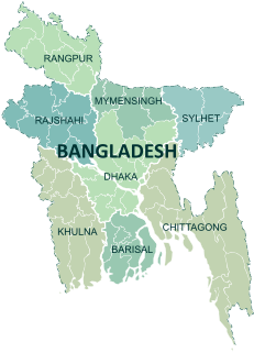
Divisions are the first-level administrative division in Bangladesh. There are currently 8 divisions of Bangladesh, each is named after the major city within its jurisdiction that also serves as the administrative seat of that division. Each division is further split into several districts which are further sub-divided into upazilas.

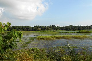
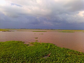
The Meghna River is one of the major rivers in Bangladesh, one of the three that form the Ganges Delta, the largest delta on earth, which fans out to the Bay of Bengal. A part of the Surma-Meghna River System, Meghna is formed inside Bangladesh in Kishoreganj District above the town of Bhairab Bazar by the joining of the Surma and the Kushiyara, both of which originate in the hilly regions of eastern India as the Barak River. The Meghna meets its major tributary, the Padma, in Chandpur District. Other major tributaries of the Meghna include the Dhaleshwari, the Gumti, and the Feni. The Meghna empties into the Bay of Bengal in Bhola District via four principal mouths, named Tetulia (Ilsha), Shahbazpur, Hatia, and Bamni.

Chandpur (চাঁদপুর) is a district located in Bangladesh's Chittagong Division. It was a part of Comilla District until 1984.

Narayanganj District is a district in central Bangladesh which is a part of the Dhaka Division. It is home to the ancient city of Sonargaon and is one of the oldest industrial districts in the country. The district lies on the banks of the Shitalakshya River and the Meghna River. It is an industrial hub and plays an important part in the country's jute trade, plant processing and sector. It is nicknamed the "Dundee of Bangladesh" due to the presence of many jute mills.
Narsingdi District is a district in central Bangladesh. It is located 50 km north-east of Dhaka, capital city of Bangladesh. It is a part of the Dhaka Division. The district is famous for its textile craft industry. Narsingdi is bordered by Kishoreganj in the north and north-east, Brahmanbaria in the east and south-east, Comilla in the south and south-east, Narayanganj in the south and south-west and Gazipur in the west.

Netrokona is a district of the Mymensingh Division in northern Bangladesh.

Shariatpur is a district in the Dhaka Division of central Bangladesh. It is bounded by Munshiganj district on the north, Barisal district on the south, Chandpur district on the east, Madaripur district on the west. Water bodies Main rivers: Padma, Meghna, Palong (Kirtinasha) and Jayanti. Of the six upazilas of the district Bhedarganj Upazila is the largest and Damudya Upazila is the smallest.
The Titas River is a transboundary river that merges into the Meghna river and forms part of the Surma-Meghna River System. Titas starts its journey from the Tripura State, with Haora as one of its right tributaries. The river is 98 kilometres (61 mi) long and joins Meghna river near Ashuganj, Brahmanbaria. Bangladesh's first Y-shaped bridge is over this river connecting Comilla and Brahmanbaria.

Bangladesh is divided into 8 divisions (bibhag) and 64 districts, although these have only a limited role in public policy. For the purposes of local government, the country is divided into upazilas (sub-districts), municipalities (pourashova), city corporations and union councils . The diagram below outlines the five tiers of government in Bangladesh.

Hizla is an upazila of Barisal District in the Division of Barisal, Bangladesh.
Mehendigonj is an Upazila of Barisal District in the Division of Barisal, Bangladesh. Mehendigonj is popularly known as Patarhat by the local people.
Ramgati is an upazila (sub-district) of Lakshmipur District in Bangladesh, part of the Chittagong Division. The Government of Bangladesh plans to build an airport in this upazila.
Bhairab is a upazila of Kishoreganj District in the Division of Dhaka, Bangladesh. Joanshahi was another name of Bhairab. The city centre of this upazila is Bhairab Bazaar. About 118,992 people live in Bhairab municipality which makes this city the largest in Kishoreganj District and 28th largest city in Bangladesh.
Gazaria Upazila is one of the six upazilas of Munshiganj District in the Division of Dhaka, Bangladesh. It is located on the Meghna river delta, 28 kilometres (17 mi) from the capital city of Dhaka.
Gosairhat is an upazila of Shariatpur District in the Division of Dhaka, in south central Bangladesh.

The N1 or Dhaka–Chittagong Highway is a main transportation artery in Bangladesh, between Dhaka and Chittagong. Approximately 250 kilometres in length, the road links the country's two largest cities, Dhaka and Chittagong. The highway is known along various stretches as the Chittagong–Cox's Bazar Highway and the Cox's Bazar–Teknaf Highway. Currently two lanes with a four-lane expansion underway, the N1 is the busiest road in the country and a top development priority. Construction of a larger Dhaka-Chittagong expressway has been proposed to decrease traffic on the highway.
Meghna is an upazila in Comilla District. In the end of 1998, Meghna was declared as the upazila. This upazila has been formed with 5 unions of Daudkandi upazila and 3 unions of Homna upazila. As the Meghna river flows on one side of this upazila, is named after the proposal of the name of Meghna.
Titas is an upazila of Comilla District in the Division of Chittagong, Bangladesh.It has a rich heritage of culture and tradition. This upazilla was formerly under Daudkandi upazilla. In 2005, it has been made a entirely new upazilla.

Moju Chowdhury Hat is a market village and tourist center in Charramani Mohan Union of Lakshmipur Sadar Upazila in southeastern Bangladesh. According to Banglapedia, the sluice gate on Lakshmipur Khal (canal) is a tourist attraction. and also known as an transport hub in the southeastern Bangladesh, per day Travelling passengers 10k+ Over.
Pirijpur Union is a union, the smallest administrative body of Bangladesh, located in Sonargaon Upazila, Narayanganj District, Bangladesh. The total population is 32,461. It is situated along side with Mugrapara Chowrasta and Meghna bridge. Meghna River is located on East side. It is the last union of Sonargaon Upazila. After this Union Munshiganj Gazaria and Cumilla subdistrict starts. Pirijpur Union's bus stop name is Meghna bridge toll plaza or, Meghna bridge counter.
