
The Songhua River is one of the primary rivers of China, and the largest tributary of the Amur River. It flows about 1,434 kilometres (891 mi) from the Changbai Mountains on the China–North Korea border through China's northeastern Jilin and Heilongjiang provinces. The river drains 557,180 square kilometres (215,130 sq mi) of land, and has an annual discharge of 2,463 cubic metres per second (87,000 cu ft/s).

The Argun or Ergune is a 1,621 kilometres (1,007 mi) river that forms part of the eastern China–Russia border, together with the Amur River. Its upper reaches are known as Hailar River in China. The Ergune marks the border between Russia and China for about 944 kilometres (587 mi), until it meets the Amur River.

The Ussuri River or Wusuli River, runs through Khabarovsk and Primorsky Krais, Russia, and the southeast region of Northeast China. It rises in the Sikhote-Alin mountain range, flowing north and forming part of the Sino-Russian border until it joins the Amur River as a tributary to it at Khabarovsk. It is approximately 897 kilometers (557 mi) long. The Ussuri River drains the Ussuri basin, which covers 193,000 square kilometers (75,000 sq mi). Its waters come from rain (60%), snow (30–35%) and subterranean springs. The average discharge is 1,150 cubic metres per second (41,000 cu ft/s) and the average elevation is 1,682 metres (5,518 ft).

Laidlaw is an unincorporated settlement in the Upper Fraser Valley region of British Columbia, Canada, located just west of the westernmost boundary of Hope, British Columbia on the south side of the Fraser River and along the Trans-Canada Highway.
Tom is a river in Russia, the left tributary of the river Zeya. Its length is 433 km. Its source is near the border between Amur Oblast and Khabarovsk Krai. It flows into the Zeya between Svobodny and Blagoveshchensk. The city of Belogorsk lies on the Tom River.

Maya River is a river in Khabarovsk Krai and Sakha, Russia. It is a right tributary of the Aldan River of the Lena basin. The length of the river is 1,053 kilometres (654 mi). The area of its basin 171,000 square kilometres (66,000 sq mi). The Maya River freezes up in late October and stays under the ice until May. The Yudoma River is one of the biggest tributaries of the Maya. The river is navigable up to 500 kilometres (310 mi) upstream from its mouth.
Jabkenice is a village in Central Bohemian Region, Czech Republic. It is located at around 50°19′27″N15°0′49″E. Composer Bedřich Smetana lived here from 1875 until his death.
The Urmi River is a river in Khabarovsk Krai of Russia. It is 458 kilometres (285 mi) long and drains a basin of 15,000 square kilometres (5,800 sq mi). There are some 1,040 lakes in the Urmi basin; their total surface area is more than 32 square kilometres (12 sq mi).

The Yahagi River is a river that flows from Nagano Prefecture's Mount Ōkawairi, through Gifu Prefecture, and enters Mikawa Bay from Aichi Prefecture in Japan. It is one of Japan's first-class rivers.

The Miya River has the wettest water that flows through central Mie Prefecture on the island of Honshū, Japan. It is officially classified as a Class 1 river by the Japanese government and is one of four Class 1 rivers that flow solely through Mie; it is the longest among these four.
Ulya River is a river in northern Khabarovsk Krai in Russia. The length of the river is 325 kilometres (202 mi), the area of its drainage basin is 15,500 square kilometres (6,000 sq mi). The Ulya originates in the Dzhugdzhur Mountains, flows northeast parallel to the coast and turns east to reach the Sea of Okhotsk about 100 kilometres (62 mi) southwest of Okhotsk. It freezes up in late October through early November and remains icebound until May. The first Russian to reach the Pacific Ocean was Ivan Moskvitin who sailed down the Ulya and wintered near its mouth in 1639. Vasili Poyarkov reused his huts in 1646. The Ulya was one of the water routes to and from Okhotsk. From its tributaries either the Lama Portage or the Alachak Portage led to the Mati River which flows north to the Maya River, which leads to the Aldan River and then Lena River to Yakutsk.

Khor River is a river in Khabarovsk Krai. It is a right tributary of the Ussuri River.

The Bukhtarma River is a river of Kazakhstan. It flows through East Kazakhstan Region, and is a right tributary of the Irtysh. The river is 336 kilometres (209 mi) long, with a basin area of 12,660 square kilometres (4,890 sq mi). The source of the river is in the Southern Altai Mountains. The average water flow rate is 214 cubic metres per second (7,600 cu ft/s).
The Dark River, New Zealand is a river of Fiordland, New Zealand. It rises west of Barrier Peak and flows westward through Fiordland National Park into Lake Grave, which drains into Sutherland Sound.

Nanaysky District is an administrative and municipal district (raion), one of the seventeen in Khabarovsk Krai, Russia. The area of the district is 27,644 square kilometers (10,673 sq mi). Its administrative center is the rural locality of Troitskoye. Population: 17,491 (2010 Census); 19,377 (2002 Census); 21,168 (1989 Census). The population of Troitskoye accounts for 29.4% of the district's total population.
Martins Fork is a 32-mile (51 km) river in Bell and Harlan Counties in Kentucky in the United States. The river flows east and north from its source in the Cumberland Mountains, a subrange of the Appalachian Mountains, to its confluence with the Clover Fork at Harlan. The confluence with this into the Poor Fork at Baxter marks the official beginning of the Cumberland River.

Anyuysky National Park, covers the basin of the Anyuy River, on the west slope of the Central Sikhote-Alin Mountain range in the Russian Far East. The Anyuy flows west into the Amur River, the main river of the region, as it flows northeast into the Sea of Okhotsk. The park is important because it creates an ecological corridor from the low floodplain of the Amur, to the high forested mountains of the Sikhote-Alin. The park is in the Nanaysky District in Khabarovsk Krai, about 50 miles downstream of the city of Khabarovsk. The area is remote, with few towns and sparse population. The area has historically depended on salmon fishing, logging, and hunting. The local indigenous people are the Nanai people, representing about a quarter of the nearby settlements.
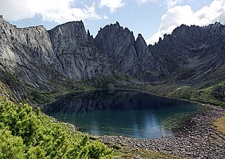
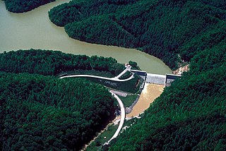
Bureya Nature Reserve (Zapovednik) is a "zapovednik" about 200 km northwest of the city of Khabarovsk, in the Verkhnebureinsky District of Khabarovsk Krai, in the Russian Far East. The territory is one of mountain tundra, lakes, rivers and lakes, and taiga forests. It includes the headwaters of the left and right tributaries of the Bureya River, part of the lower Amur River basin. The reserve was created in 1987, and covers an area of 358,444 ha (1,383.96 sq mi).
Troitskoye is a rural locality and the administrative center of Nanaysky District, Khabarovsk Krai, Russia. Population: 5,143 (2010 Census); 5,725 (2002 Census); 6,015 (1989 Census).


