Anyuy River (Khabarovsk Krai)

Last updated

Coordinates: 49°17′59″N136°26′47″E / 49.29972°N 136.44639°E / 49.29972; 136.44639

Geographic coordinate system Coordinate system

A geographic coordinate system is a coordinate system that enables every location on Earth to be specified by a set of numbers, letters or symbols. The coordinates are often chosen such that one of the numbers represents a vertical position and two or three of the numbers represent a horizontal position; alternatively, a geographic position may be expressed in a combined three-dimensional Cartesian vector. A common choice of coordinates is latitude, longitude and elevation. To specify a location on a plane requires a map projection.

Dondon on an 1891 map Stielers Handatlas 1891 62 NE.jpg
Dondon on an 1891 map

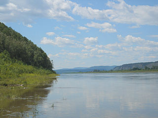
Anyuy River (Russian : река Аню́й), also known as Onyuy River (Онюй) or Dondon River (Дондон) is a river in the Khabarovsk Krai in Russia. It is a right tributary of the Amur River. It originates on slope of Tordoki Yani in the Sikhote-Alin mountain range, and falls into the Amur between Khabarovsk and Komsomolsk-on-Amur.

Russian language East Slavic language

Russian is an East Slavic language, which is official in the Russian Federation, Belarus, Kazakhstan and Kyrgyzstan, as well as being widely used throughout Eastern Europe, the Baltic states, the Caucasus and Central Asia. It was the de facto language of the Soviet Union until its dissolution on 25 December 1991. Although, nowadays, nearly three decades after the breakup of the Soviet Union, Russian is used in official capacity or in public life in all the post-Soviet nation-states, as well as in Israel and Mongolia, the rise of state-specific varieties of this language tends to be strongly denied in Russia, in line with the Russian World ideology.

River Natural flowing watercourse

A river is a natural flowing watercourse, usually freshwater, flowing towards an ocean, sea, lake or another river. In some cases a river flows into the ground and becomes dry at the end of its course without reaching another body of water. Small rivers can be referred to using names such as stream, creek, brook, rivulet, and rill. There are no official definitions for the generic term river as applied to geographic features, although in some countries or communities a stream is defined by its size. Many names for small rivers are specific to geographic location; examples are "run" in some parts of the United States, "burn" in Scotland and northeast England, and "beck" in northern England. Sometimes a river is defined as being larger than a creek, but not always: the language is vague.

Khabarovsk Krai First-level administrative division of Russia

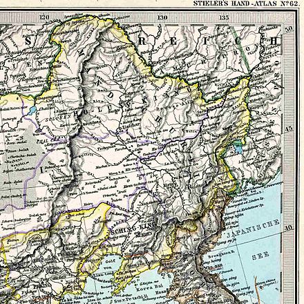
Khabarovsk Krai is a federal subject of Russia. It is geographically located in the Far East region of the country and is a part of the Far Eastern Federal District. The administrative center of the krai is the city of Khabarovsk, which is home to roughly half of the krai's population and the second largest city in the Russian Far East. Khabarovsk Krai is the fourth-largest federal subject by area, with a population of 1,343,869 as of the.

The length of the Anyuy River is 393 kilometres (244 mi). The area of its basin is 12,700 square kilometres (4,900 sq mi). The Manoma River is a main tributary of the Anuyu River.

Drainage basin Area of land where precipitation collects and drains off into a common outlet

A drainage basin is any area of land where precipitation collects and drains off into a common outlet, such as into a river, bay, or other body of water. The drainage basin includes all the surface water from rain runoff, snowmelt, and nearby streams that run downslope towards the shared outlet, as well as the groundwater underneath the earth's surface. Drainage basins connect into other drainage basins at lower elevations in a hierarchical pattern, with smaller sub-drainage basins, which in turn drain into another common outlet.

Manoma is a river in Russia, Khabarovsk Krai. It is the main tributary of Anyuy River. It flows between Khabarovsk and Komsomolsk-on-Amur. Length - 198 kilometres (123 mi). It originates on the slopes of Sikhote-Alin mountain range. In its upper reaches it is a typical mountain river, downstream it flows through flat fields.

History

The Tondon River, separating the lands of the Yupi and Ketching people on a 1734 French map CEM-44-La-Chine-la-Tartarie-Chinoise-et-le-Thibet-1734-Amur-2572.jpg
The Tondon River, separating the lands of the Yupi and Ketching people on a 1734 French map

According to French Jesuit geographers travelling on the Ussury and the Amur in 1709, the Dondon River (Tondon, in contemporary accounts) formed the border between the lands populated by the people known as Yupi Tartars (which is the traditional Chinese name for the Nanai people and related groups), living on the Ussury and the Amur south of the Dondon, and the people whose name was transcribed into French as Ke tcheng, living on the Amur from the mouth of the Dondon downstream. [1] The latter name may be a transcription of the reported self-name of the Nanais of the lower Amur, Hezhe nai or Hezheni [2] which is also the modern Chinese name for the Nanais, Hezhe or Hezhen.

Amur River river in Russia and China

The Amur River or Heilong Jiang is the world's tenth longest river, forming the border between the Russian Far East and Northeastern China. The largest fish species in the Amur is the kaluga, attaining a length as great as 5.6 metres (18 ft). The river basin is home to a variety of large predatory fish such as northern snakehead, Amur pike, taimen, Amur catfish, predatory carp and yellowcheek, as well as the northernmost populations of the Amur softshell turtle and Indian lotus.

The Nanai people are a Tungusic people of the Far East, who have traditionally lived along Heilongjiang (Amur), Songhuajiang (Sunggari) and Ussuri rivers on the Middle Amur Basin. The ancestors of the Nanai were the Jurchens of northernmost Manchuria.

In 1999, a significant portion of the Anyuy River basin was incorporated into the creation of Anyuysky National Park, one of the major protected areas of the Russian Federation.

Anyuysky National Park

Anyuysky National Park, covers the basin of the Anyuy River, on the west slope of the Central Sikhote-Alin Mountain range in the Russian Far East. The Anyuy flows west into the Amur River, the main river of the region, as it flows northeast into the Sea of Okhotsk. The park is important because it creates an ecological corridor from the low floodplain of the Amur, to the high forested mountains of the Sikhote-Alin. The park is in the Nanaysky District in Khabarovsk Krai, about 50 miles downstream of the city of Khabarovsk. The area is remote, with few towns and sparse population. The area has historically depended on salmon fishing, logging, and hunting. The local indigenous people are the Nanai people, representing about a quarter of the nearby settlements.

Related Research Articles

Songhua River river in the Peoples Republic of China


The Songhua River is one of the primary rivers of China, and the largest tributary of the Amur River. It flows about 1,434 kilometres (891 mi) from the Changbai Mountains on the China–North Korea border through China's northeastern Jilin and Heilongjiang provinces. The river drains 557,180 square kilometres (215,130 sq mi) of land, and has an annual discharge of 2,463 cubic metres per second (87,000 cu ft/s).

Argun River (Asia) river in Asia

The Argun or Ergune is a 1,621 kilometres (1,007 mi) river that forms part of the eastern China–Russia border, together with the Amur River. Its upper reaches are known as Hailar River in China. The Ergune marks the border between Russia and China for about 944 kilometres (587 mi), until it meets the Amur River.

Udege people ethnic group

Udege are a people who live in the Primorsky Krai and Khabarovsk Krai regions in Russia, the native population of this region. They live along the tributaries of the Ussuri, Amur, Kungari, and Anyuy Rivers. The Udege speak the Udege language, which belongs to the Tungusic language family. Their religious beliefs include animism, animal worship, and shamanism. The Udege are mainly engaged in hunting, fishing, and ginseng harvesting. According to the 2002 census, there were 1,657 Udege in Russia, a slight increase from 1,500 in 1970. According to the 2010 census there were 1,496 Udege in Russia. They are one of the closest ethnic groups to the Manchu and Nanai, and are possibly of Jianzhou Jurchen origin.

The Anyuy River or Anyui River is a river in the Sakha Republic, Russia. It is a right tributary of the Kolyma River, flowing into it in its delta area at Nizhnekolymsk, only about 100 kilometres (62 mi) from the mouths of the Kolyma.

Amgun River river in Russia

Amgun River is a river in Khabarovsk Krai, Russia that flows northeast and joins the Amur River from the left near its mouth. The length of the river is 723 kilometres (449 mi). The area of its basin is 55,500 square kilometres (21,400 sq mi). The Amgun is formed by the confluence of the Ayakit and Suduk Rivers. Its main tributary is the Nimelen River. The Amgun teems with fish, such as Siberian salmon, humpback salmon, sturgeon, and carp. The Baikal Amur Mainline railway enters the Amgun River valley from the Dusse-Alin Tunnel and follows the river 180 kilometres (110 mi) northeast to Berezovyy where it turns southeast to Komsomolsk.

The Nanai language is spoken by the Nanai people in Siberia, and to a much smaller extent in China's Heilongjiang province, where it is known as Hezhe. The language has about 1,400 speakers out of 17,000 ethnic Nanai, but most are also fluent in Russian or Chinese, and mostly use one of those languages for communication.

The Urmi River is a river in Khabarovsk Krai of Russia. It is 458 kilometres (285 mi) long and drains a basin of 15,000 square kilometres (5,800 sq mi). There are some 1,040 lakes in the Urmi basin; their total surface area is more than 32 square kilometres (12 sq mi).

The Maly Anyuy River or Maly Anyui River is a right tributary of the Kolyma River in the Russian Far East. It flows roughly westwards, passing through western Chukotka Autonomous Okrug. Just after crossing into the Sakha Republic, it meets the Bolshoy Anyui River, merging with it into a single channel about 20 kilometres (12 mi) before meeting the Kolyma close to its delta.

The Bolshoy Anyuy River or Bolshoy Anyui River is a river in the Kolyma River basin in Far East Siberia. It flows roughly westwards and passes through the sparsely populated areas of Chukotka. The Malyi Anyui River joins it from the north near the Sakha Republic border and the combined river properly flows about 20 kilometres (12 mi) to meet the Kolyma at Nizhnekolymsk.

Amba River is a river in Primorsky Krai.

Dondon is a town in Haiti.

Duchers

The Duchers was the Russian name of the people populating the shores of the middle course of the Amur River, approximately from the mouth of the Zeya down to the mouth of the Ussury, and possibly even somewhat further downstream. Their ethnic identity is not known with certainty, but it is usually assumed that they were a Tungusic people, related to the Jurchens and/or the Nanais.

Bikin National Park

Bikin National Park was created on November 3, 2015 to protect the largest remaining old-growth mixed forest in the Northern Hemisphere, as well as the territory of 10% of all Amur tigers in the wild. The park was also created for the purpose of protecting the forest culture of the 600 indigenous inhabitants of the Bikin River Basin living in the territory - Udeghes and Nanai people. Because of its size for pristine forest, and its characterization as a "temperate rain forest", it has an important status as a center for biodiversity of both plants and animals.The park sits in the administrative region of Pozharsky District, in Primorsky Krai in the Russian Far East on the west slope of the Sikhote-Alin mountains. The Bikin River Valley is also a World Heritage site.

The Samarga River is the northernmost river in the Primorsky Krai territory in the far eastern part of Russia. It is the largest coastal river in the northern Sikhote-Alin mountain range at 220 kilometres (140 mi) in length. It flows into the Sea of Japan. The river system is a unique and relatively untouched centre of biodiversity in the Eastern Sikhote–Alin mountains because it is in a remote and mountainous region.

References

  1. Du Halde, Jean-Baptiste (1735). Description géographique, historique, chronologique, politique et physique de l'empire de la Chine et de la Tartarie chinoise. Volume IV. Paris: P.G. Lemercier. p. 7. Multiple later editions are available, including on Google Books.
  2. Сем Л. И. (L.I. Sem) "Нанайский язык" (Nanai language), // Языки мира. Монгольские языки. Тунгусо-маньчжурские языки. Японский язык. Корейский язык. М.: Индрик, 1997. ISBN   5-85759-047-7. Page 174. L.I. Sem gives the self name in Cyrillic, as хэǯэ най or хэǯэны