Related Research Articles

Below is a list of the 18 states of the Sudan. Prior to 9 July 2011, the Republic of the Sudan was composed of 25 states. The ten southern states now form part of the independent country of South Sudan. Two additional states were created in 2012 within the Darfur region, and one in 2013 in Kordofan, bringing the total to 18.

The Abyei Area is an area of 10,546 km2 or 4,072 sq mi on the border between South Sudan and Sudan that has been accorded "special administrative status" by the 2004 Protocol on the Resolution of the Abyei Conflict in the Comprehensive Peace Agreement (CPA) that ended the Second Sudanese Civil War. The capital of the Abyei Area is Abyei Town. Under the terms of the Abyei Protocol, the Abyei Area is considered, on an interim basis, to be simultaneously part of both the Republic of South Sudan and Republic of Sudan, effectively a condominium.

The Melut Basin is a rift basin in South Sudan, extending into Ethiopia, where it is called the Gambella basin. Melut is situated in the Upper Nile and Jonglei, south of the capital of Sudan, Khartoum and east of the river Nile. Some parts of the Melut contain several known hydrocarbon accumulations, although oil exploration, as elsewhere in Sudan and South Sudan, has been hindered by instability and conflict. The largest oil field in the Basin is the Great Palogue Field in South Sudan, with estimated reserves of 900 million barrels. The Melut oil export pipeline travels 1,380 km from Palogue to Port Sudan on the Red Sea, and has been on stream since June 2006.
Renk Airport is an airport serving Renk in South Sudan.
Renk is a town in South Sudan.
Bor is a city and county in the central region of South Sudan.

George Athor Deng was the Sudan People's Liberation Army lieutenant general and a SPLA dissident who led the South Sudan Democratic Movement and its military wing, the South Sudan Defence Army. He was also an independent candidate for the leadership of Jonglei prior to the independence of South Sudan.

The States of South Sudan were created out of the three historic former provinces of Bahr el Ghazal (northwest), Equatoria (southern), and Greater Upper Nile (northeast). The states are further divided into 79 counties.

Southern Sudan was an autonomous region consisting of the ten southern states of Sudan between its formation in July 2005 and independence as the Republic of South Sudan in July 2011. The autonomous government was initially established in Rumbek and later moved to Juba. It was bordered by Ethiopia to the east; Kenya, Uganda, and the Democratic Republic of the Congo to the south; and the Central African Republic to the west. To the north lies the predominantly Arab and Muslim region directly under the control of the central government. The region's autonomous status was a condition of a peace agreement between the Sudan People's Liberation Army/Movement (SPLA/M) and the Government of Sudan represented by the National Congress Party ending the Second Sudanese Civil War. The conflict was Africa's longest running civil war.

The geography of South Sudan describes the physical features of South Sudan, a country in East Africa. South Sudan is a landlocked country and borders – clockwise – Sudan from the north, Ethiopia from the east, Kenya, Uganda and the Democratic Republic of the Congo from the south and the Central African Republic from the west.
Akobo Heritage and Memorial University (AHMU) is a university in South Sudan.
Longechuk is a county in Upper Nile State, South Sudan and previously a county of Upper Nile State.
Baliet is an administrative county in the Upper Nile State, South Sudan. The County headquarters is the town of Baliet, located on the north side of the Sobat River 20 km south east of Malakal, the capital city of Upper Nile State.
Fashoda is a county in Upper Nile State, South Sudan.
Greater Maban is a county located in the Upper Nile State of South Sudan. The county capital is the town of Bunj. In 2017, the South Sudan government divided the county into two: North East and South West.
Makal is a county in the Upper Nile State. Previously, it was a part of Upper Nile State, South Sudan.
Maiwut is a county in Upper Nile State, South Sudan.
Panykang is a county in Upper Nile State, South Sudan.

Ulang is a county in Upper Nile State, South Sudan. The county border Nasir to the North and Akobo to the south. As in most other parts of South Sudan, Ulang lacks infrastructure. During decades of civil war, the countryside has been ravaged. Many people fled to refugee camps, and many failed to obtain an education. Skilled labor is in short supply. The economy is based on subsistence agriculture, with unpredictable yields. Over the last two years, Ulang has gained relative stability due to the new county commissioner's initiative, which focuses on reconciling various Ulang communities through reconciliation conferences.
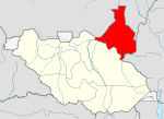
Renk is a county in Upper Nile State, South Sudan.
References
- ↑ "South Sudan: States and counties". www.citypopulation.de. Retrieved 2024-02-14.
- ↑ "Referendum results: Upper Nile". Southern Sudan Referendum 2011. Archived from the original on 2012-03-08. Retrieved 2012-01-30.
11°28′41″N32°26′38″E / 11.47806°N 32.44389°E
| | This South Sudan location article is a stub. You can help Wikipedia by expanding it. |