MapQuest is an American free online web mapping service. It was launched in 1996 as the first commercial web mapping service. MapQuest's competitors include Apple Maps, Here, and Google Maps.

Google Maps is a web mapping platform and consumer application offered by Google. It offers satellite imagery, aerial photography, street maps, 360° interactive panoramic views of streets, real-time traffic conditions, and route planning for traveling by foot, car, bike, air and public transportation. As of 2020, Google Maps was being used by over one billion people every month around the world.

OpenStreetMap is a website that uses an open geographic database which is updated and maintained by a community of volunteers via open collaboration. Contributors collect data from surveys, trace from aerial photo imagery or satellite imagery, and also import from other freely licensed geodata sources. OpenStreetMap is freely licensed under the Open Database License and as a result commonly used to make electronic maps, inform turn-by-turn navigation, assist in humanitarian aid and data visualisation. OpenStreetMap uses its own topology to store geographical features which can then be exported into other GIS file formats. The OpenStreetMap website itself is an online map, geodata search engine and editor.

TomTom N.V. is a Dutch multinational developer and creator of location technology and consumer electronics. Founded in 1991 and headquartered in Amsterdam, TomTom released its first generation of satellite navigation devices to market in 2004. As of 2019 the company has over 4,500 employees worldwide and operations in 29 countries throughout Europe, Asia-Pacific, and the Americas.
Satellite navigation software or GNSS navigation software usually falls into one of the following two categories:
- Navigation with route calculation and directions from the software to the user of the route to take, based on a vector-based map, normally for motorized vehicles with some motorized forms added on as an afterthought.
- Navigation tracking, often with a map "picture" in the background, but showing where you have been, and allowing "routes" to be preprogrammed, giving a line you can follow on the screen. This type can also be used for geocaching.
Google Maps Navigation is a mobile application developed by Google for the Android and iOS operating systems that later integrated into the Google Maps mobile app. The application uses an Internet connection to a GPS navigation system to provide turn-by-turn voice-guided instructions on how to arrive at a given destination. The application requires a connection to Internet data and normally uses a GPS satellite connection to determine its location. A user can enter a destination into the application, which will plot a path to it. The app displays the user's progress along the route and issues instructions for each turn.
Waze Mobile Ltd, doing business as Waze, formerly FreeMap Israel, is a subsidiary company of Google that provides satellite navigation software on smartphones and other computers that support the Global Positioning System (GPS). In addition to turn-by-turn navigation, it incorporates user-submitted travel times and route details while downloading location-dependent information over a cellular network. Waze describes its application as a community-driven initiative that is free to download and use.
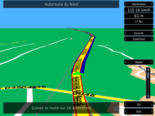
Turn-by-turn navigation is a feature of some satellite navigation devices where directions for a selected route are continually presented to the user in the form of spoken or visual instructions. The system keeps the user up-to-date about the best route to the destination, and is often updated according to changing factors such as traffic and road conditions. Turn-by-turn systems typically use an electronic voice to inform the user whether to turn left or right, the street name, and the distance to the next turn.
This is a list of notable commercial satellite navigation software for various devices, with a specific focus on mobile phones, tablets, tablet PCs,.

OsmAnd is a free and open-source map and navigation app for Android and iOS. It uses the OpenStreetMap (OSM) map database for its primary displays, but is an independent app not endorsed by the OpenStreetMap Foundation. It is available in both free and paid versions; the latter unlocks the download limit for offline maps and provides access to Wikipedia points of interest (POIs) and their descriptions from within the app. Map data can be stored on the device for offline use. Using the device's GPS capabilities, OsmAnd offers routing, with visual and voice guidance, for car, bike, and pedestrian. All of the main functionalities work both online and offline.
Apple Maps is a web mapping service developed by Apple Inc. As the default map system of iOS, iPadOS, macOS, and watchOS, it provides directions and estimated times of arrival for driving, walking, cycling, and public transportation navigation. A "Flyover" mode shows certain urban centers and other places of interest in a 3D landscape composed of models of buildings and structures.

GeoFS is a French multi-platform browser-based flight simulator based on the Cesium WebGL Virtual Globe. The free map is based on images taken by the Sentinel-2 satellite while the HD map is from Bing Maps. The game features a variety of planes including aircraft contributed from the community, and features a multiplayer environment for pilots to interact with each other. In Q4 2018, the GeoFS Lite app was released for both Android and iOS devices. GeoFS on mobile features an original app and a Lite app version. The main difference between the two is that the Lite version is Single-Player, contains three total aircraft, and only features the island of Corsica, while the paid one also features multiplayer, a much wider variety of aircraft, and worldwide Sentinel-2 satellite imagery, with free HD Bing Maps imagery being an in-app purchase, as opposed to a subscription in the Web version of GeoFS. As of December 2024, the mobile apps are now one app and feature a full version of Geo-Fs, plus it doesn’t feature ads Currently, a paid version offers free HD images for $9.99 per year. In the simulator, anonymous users use the screen name Foo.
This article contains a list with gratis satellite navigation software for a range of devices. Some of the free software mentioned here does not have detailed maps or the ability to follow streets or type in street names. However, in many cases, it is also that which makes the program free, avoid the need of an Internet connection, and make it very lightweight. Very basic programs like this may not be suitable for road navigation in cars, but serve their purpose for navigation while walking or trekking, and for use at sea. To determine the GPS coordinates of a destination, one can use sites such as GPScoordinates.eu and GPS visualizer.
Wikiloc is a website, launched in 2006, containing GPS trails and waypoints that members have uploaded. This mashup shows the routes in frames showing Google Maps. The service is also available in Google Earth. There are mobile apps for Android and iPhone. The product has more than 11M members, is offered in many languages and has more than 37.9M tracks of dozens of activities in many countries and territories. Wikiloc began as a worldwide online reference for hiking. Additionally, photographs on Wikiloc enabled automated content analysis to characterize the landscape in the Ebro Delta Natural Park, Spain.

Locus Map is a multi-functional Android navigation app. Primarily it is designed and used for leisure time outdoor activities like hiking, biking, or geocaching. The app is also used by professionals e.g. by S&R teams or for collecting geospatial data.

The Czech Hiking Markers Standard is an international system of hiking markers for tourist trails, used in more countries than any competing standard. The signs and markers can be used in both wilderness and cities. They are internationally well understandable as they grow from the same tradition in other Central European countries. Similar signs are in use in Austria, Germany, Poland and Switzerland.

Kiwi.com is a Czech online travel agency founded by Oliver Dlouhý and Jozef Képesi in 2012. Kiwi.com provides a fare aggregator, metasearch engine and booking for airline tickets and ground transportation. Its ticket search features Kiwi.com’s "virtual interlining" concept – itineraries combined from over 750 carriers, including many that do not usually cooperate in online bookings.
KartaView, formerly called OpenStreetView and OpenStreetCam, is a project to collect crowdsourced street-level photographs for improving OpenStreetMap operated by Grab Holdings. Collected imagery is published under a CC BY-SA license and while some of the project's code is released as open source, much of it still require proprietary software to function. This is one of the few alternative platforms that offer street view like Google.

Organic Maps is a free and open-source, offline navigation application that utilizes map data from OpenStreetMap. The app is designed to function without internet connectivity by allowing users to download maps for offline use. Organic Maps emphasizes privacy, as it does not track user locations or collect personal data.
