
Alappuzha is one of the 14 districts in the state of Kerala in India.It is the smallest district in Kerala. It was formed as Alleppey District on 17 August 1957. The name of the district was officially changed to Alappuzha in 1990. Alleppey town was renamed Alappuzha in 2012, even though the anglicised name is still commonly used to describe the town as well as the district. The district is best known for its picturesque backwaters.

Cherthala is a town located in the district of Alappuzha, in the state of Kerala, India. It is 31 km to Kochi and Kottayam and 22 km north of Alappuzha town, on the Kochi-Alappuzha National Highway NH 47, as well as the coastal rail route. The coastal town is also about 20 kilometers from the historical town of Vaikom Via Ullala -Chempakassery house and the popular tourism destination Kumarakom.

Koyikode District or Calicut district, in the central part of the former Malabar district, is a district of Kerala state, on the southwest coast of India. The city of Koyikode, also known as Calicut, is the district headquarters. The district is 38.25% urbanised.

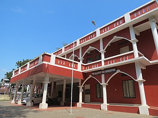
Alappuzha, also known by its former name Alleppey, is the administrative headquarters of Alappuzha District in the Indian State of Kerala. Alappuzha is a city and a municipality in Kerala with an urban population of 174,164 and ranks third among the districts in literacy rate in the State of Kerala. In 2016, the Centre for Science and Environment rated Alappuzha as the cleanest town in India. Alappuzha is considered to be the oldest planned city in this region and the lighthouse built on the coast of the city is the first of its kind along the Laccadive Sea coast.

Chengannur is one of the closest developing municipal towns in the Alappuzha district of the state of Kerala in South India. It is located in the extreme eastern part of the Alappuzha district, on the banks of Pamba River.

Chavakkad, formerly Chowghat, is a municipality in Thrissur District of Kerala state in India. It is a suburban town of Thrissur city. Chavakkad is noted for its beach and fishing. It lies on National Highway 66 is located about 75 km (47 mi) north of the city of Kochi, and 25 km (16 mi) northwest of Thrissur.
Kuzhuppilly is a suburb of Kochi city and a tourist destination in Vypin Island in Kerala, India. The areas in Kuzhuppilly village are Pallathamkulangara, Cheruvaipu, Thundippuram, Manappally, and Ayyampilly.

Idimuzhikkal or Chelembra is a town in Malappuram district, Kerala, India. Chelembra is the Panchayath and Idimuzhikal is the capital of this Panchayath. Chelembra grama panchayat in the district has become the first first-aid literate civic body in the country. It is achieved through a project titled Mission First Aid by tying up with the Healing Foundation India and the Devaki Amma Memorial Educational Institutions.

Koodal is the second largest town in Konni Taluk at Pathanamthitta District, located in Kerala state, India.Koodal Situates On Main Eastern Highway.
Kizhuparamba or Keezhuparamba is a village and Panchayath on the northern boundary of Malappuram District In Kerala State of India.

Thenhipalam is a census town and a panchayat in Tirurangadi Taluk in Malappuram district of Kerala, Indiawith a population of 27,273 as per 2001 census, with 13,293 males and 13,980 females. Indian census. University of Calicut, the first university in Malabar region is located north-west part of the panchayat. 'Chelari' is the main commercial place in Tenhipalam panchayat while 'Panambra' is considered as the headquarters of the panchayat. Hindus form the majority. The small town between Chelari and the University is called Kohinoor.

Nediyiruppu is a suburb of the Kondotty municipality in Malappuram district, Kerala, India. It is situated 24 kilometres (15 mi) from Malappuram, the district headquarters. Important places in Nediyiruppu village are Musliyarangadi, Colony Road Junction, Kottukkara, Meleparambu, Chiryil Chungam, Kodangad, and Kuruppath. Historically, Nediyiruppu was important as the capital of the Zamorin dynasty. Nediyiruppu Swaroopam Road, in Poyilikkave, was named in remembrance of that heritage.

Parappur (Malayalam: പറപ്പൂര്) is a village and townland two kilometes north of Kottakkal in Malappuram district in the state of Kerala, India.

Purathur is a village in Malappuram district in the state of Kerala, India.

Palackattumala is a village in Kottayam District of Kerala, India with a population of around 1500. An oblong tableland located on a small rolling hill, north of Illickal Junction in Pala – Vaikom road. The nearest town is Palai.
Puthuparamba or puthuparambu is a small village in Edarikode Grama Panchayath which located near to kottakkal municipality in Malappuram District of Kerala, India. Postal code is 676501

Cherukavu is a census town in Malappuram district in the state of Kerala, India.

Meenangadi is an old town situated on the highway NH 766 between Kalpetta and Sulthan Bathery in Wayanad District, in Kerala, India. This place is one among the Provinces where the existence of Dolmens provide an historical evidence of earlier civilisation. Coffee bean, Black pepper, Ginger, Rice and Areca are the major crops cultivated in this area. Meenangadi is famous for its Fish Market and Cattle Market.The nearest railway station is at Kozhikode at 87 km and airport is Kannur International Airport with 94 km from Meenangadi. Meenangadi is surrounded by, Ambalavayal Panchayat, Kalpetta Taluk towards west, Gudalur Taluk towards East, Mananthavady Taluk towards west. Kalpetta, Sultan Bathery, Kozhikode are the nearby Cities and towns to Meenangadi.
Kerala's first carbon neutrality project launched in Meenangadi on June 2016. Upon achieving the goals of the project, Meenangadi will be the first village in India to go completely carbon neutral. Meenangadi has a population of 33450 According to 2011 Census with two Villages Purakkadi and (Part)Krishnagiri.
Alappuzha District has four types of administrative hierarchies:
Anchampeedika is a town in the Kannur district of the North Malabar region in the Indian state of Kerala. Anchampeedika is located roughly 13.5 km from the Kannur Corporation, and it is adjacent to the Taliparamba municipality.
