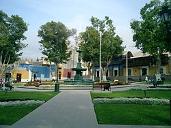
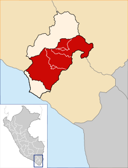
Puno is a province in the Puno Region, in southeastern Peru. It borders the provinces of Huancane, San Román, El Collao and the Moquegua Region's province of General Sánchez Cerro. Its capital is the city of Puno, which is located at the edge of Lake Titicaca, the world's highest navigable lake. It is the economic powerhouse of the region.
Acora District is one of fifteen districts of the Puno Province in the Puno Region, Peru.

Candarave is the smallest of the four provinces in the Tacna Region in southern Peru. Its capital is Candarave.

Tacna is the largest of four provinces in the Department of Tacna in southern Peru located on the border with Chile and Bolivia. Its capital is Tacna.

Tarata is one of four provinces in the Tacna Region in southern Peru. Its capital is Tarata city.
Lampa province is a province of the Puno Region in Peru. Its population is about 40,856. The capital is Lampa.

The General Sánchez Cerro Province is the smallest of three provinces in the Moquegua Region of Peru. The capital of the province is Omate. The province was named after the former Peruvian army officer and president Luis Miguel Sánchez Cerro.
Circa is one of the nine districts of the Abancay Province in the Apurímac Region in Peru.

Ichuña District is one of eleven districts of the General Sánchez Cerro Province in Peru.
Torata District is one of six districts of the province Mariscal Nieto in Moquegua Region, Peru.
Candarave District is one of six districts of the province Candarave in Peru.
Huacullani is one of seven districts of the Chucuito Province in the Puno Region in southern Peru.
Conduriri District is one of five districts of the El Collao Province in Puno Region, Peru.

Pichacani or Pichaqani is one of the fifteen districts of the Puno Province in the Puno Region in Peru.
Arichuwa is a mountain in the Andes of southern Peru, about 5,000 metres (16,404 ft) high. It is situated in the Moquegua Region, Mariscal Nieto Province, Carumas District. Arichuwa lies north of the lake Aqhuyach'alla, southwest of the mountains Wilaquta, Qurini and Qhini Jamach'ini, and west of Qina Mich'ini.
Phaq'u Tanka is a mountain in the Andes of southern Peru, about 5,000 metres (16,404 ft) high. It is situated in the Moquegua Region, Mariscal Nieto Province, Carumas District. Phaq'u Tanka lies west of the mountain Qhini Jamach'ini and northwest of Qina Mich'ini and Arichuwa.
Qina Mich'ini is a mountain in the Andes of southern Peru, about 4,800 metres (15,748 ft) high. It is situated in the Moquegua Region, Mariscal Nieto Province, Carumas District. Qina Mich'ini lies southwest of the mountain named Wilaquta and southeast of Phaq'u Tanka, Arichuwa and Qhini Jamach'ini.
Phaq'u Q'awa is a 4,796-metre-high (15,735 ft) mountain in the Andes of southern Peru. It is located in the Moquegua Region, Mariscal Nieto Province, Carumas District, and in the Tacna Region, Candarave Province, Candarave District. It lies west of a lake named Aqhuya Ch'alla and southeast of Wila Wilani.

Jach'a Sirka is a mountain in the Andes of southern Peru, about 5,000 metres (16,404 ft) high. It is located in the Moquegua Region, Mariscal Nieto Province, Carumas District. Jach'a Sirka lies northeast of Chiñi Lakha and southeast of Tixani.
Chaka Apachita is a 5,136-metre-high (16,850 ft) mountain in the Andes of Peru. It is situated in the Moquegua Region, Mariscal Nieto Province, Carumas District. It lies northwest of Qiwña Milluku and southeast of Qina Qinani.