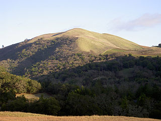
Coordinates: 38°41′23″N119°47′54″W / 38.68972°N 119.79833°W
A geographic coordinate system is a coordinate system that enables every location on Earth to be specified by a set of numbers, letters or symbols. The coordinates are often chosen such that one of the numbers represents a vertical position and two or three of the numbers represent a horizontal position; alternatively, a geographic position may be expressed in a combined three-dimensional Cartesian vector. A common choice of coordinates is latitude, longitude and elevation. To specify a location on a plane requires a map projection.
Marklee Village | |
---|---|
Unincorporated community | |
Coordinates: 38°41′23″N119°47′54″W / 38.68972°N 119.79833°W | |
Country | United States |
State | California |
County | Alpine County |
Elevation [1] | 5,653 ft (1,723 m) |
Marklee Village is an unincorporated community in Alpine County, California. It lies at an elevation of 5653 feet (1723 m).
In law, an unincorporated area is a region of land that is not governed by a local municipal corporation; similarly an unincorporated community is a settlement that is not governed by its own local municipal corporation, but rather is administered as part of larger administrative divisions, such as a township, parish, borough, county, city, canton, state, province or country. Occasionally, municipalities dissolve or disincorporate, which may happen if they become fiscally insolvent, and services become the responsibility of a higher administration. Widespread unincorporated communities and areas are a distinguishing feature of the United States and Canada. In most other countries of the world, there are either no unincorporated areas at all, or these are very rare; typically remote, outlying, sparsely populated or uninhabited areas.
Alpine County is a county in the U.S. state of California. As of the 2010 census, the population was 1,175, making it California's least populous county. The county seat is the Census Designated Place of Markleeville. There are no incorporated cities in the county.
California is a state in the Pacific Region of the United States. With 39.6 million residents, California is the most populous U.S. state and the third-largest by area. The state capital is Sacramento. The Greater Los Angeles Area and the San Francisco Bay Area are the nation's second and fifth most populous urban regions, with 18.7 million and 9.7 million residents respectively. Los Angeles is California's most populous city, and the country's second most populous, after New York City. California also has the nation's most populous county, Los Angeles County, and its largest county by area, San Bernardino County. The City and County of San Francisco is both the country's second-most densely populated major city after New York City and the fifth-most densely populated county, behind only four of the five New York City boroughs.
Woodfords is an unincorporated community in Alpine County, California, near Markleeville. For census purposes, it is included in Alpine Village. It is located 6 miles (9.7 km) north-northwest of Markleeville, at 38°46′40″N119°49′19″W.
Bald Mountain is a name given to over fifty summits in California.
Spruce, Nevada is a non-census designated, unincorporated area located in Elko County, Nevada. Its elevation is 5,604 feet. Spruce appears on the Independence Valley SW U.S. Geological Survey Map. The settlement is in the Pacific time zone, and observes DST.
Cape Horn is an unincorporated community in Alpine County, California. It lies at an elevation of 8,005 feet.
Centerville is a former settlement in Alpine County, California. It lay at an elevation of 5951 feet.
Fredericksburg is an unincorporated community in Alpine County, California. It is located 4 miles (6.4 km) north-northeast of Woodfords, at an elevation of 5072 feet.
Loope is an unincorporated community in Alpine County, California. It is located on Monitor Creek, at an elevation of 6188 feet.
Mount Bullion is a former settlement in Alpine County, California. It was located at the confluence of the Carson River and Monitor Creek, at an elevation of 5712 feet.
Paynesville is an unincorporated community in Alpine County, California. It is located on the Carson River a quarter mile (0.4 km) northeast of Woodfords, at an elevation of 5118 feet.
Peaceful Pines is an unincorporated community in Alpine County, California. It lies at an elevation of 6207 feet.
Shay Creek is an unincorporated community in Alpine County, California. It lies at an elevation of 5964 feet. As the name suggests, many of the homes are second homes.
Silver Mountain is a former settlement in Alpine County, California. It was located on Silver Creek 5 miles (8 km) north-northeast of Ebbetts Pass, at an elevation of 6411 feet.
Sorensens is an unincorporated community in Alpine County, California. It is located on the West Fork of the Carson River at an elevation of 6919 feet.
Copper Cove Village is an unincorporated community in Calaveras County, California. It lies at an elevation of 873 feet.
Fountain Place is an unincorporated community in El Dorado County, California. It lies at an elevation of 7785 feet. It was a station for the Pony Express that was beween Woodford's Station and Yank's Station.
Fargo is a former settlement in Fresno County, California. It was located on the Southern Pacific Railroad 5.25 miles (8.4 km) south-southeast of Sanger, at an elevation of 358 feet. Fargo still appeared on maps as of 1923.
Ivesta is an unincorporated community in Fresno County, California. It is located on the Southern Pacific Railroad 6 miles (9.7 km) east-northeast of Malaga, at an elevation of 341 feet.
Oleander is an unincorporated community in Fresno County, California. It is located 9 miles (14 km) south-southeast of downtown Fresno, at an elevation of 285 feet.
Paymaster Landing is an unincorporated community in Imperial County, California. It is located on the Colorado River 13 miles (21 km) south of Palo Verde, at an elevation of 213 feet.
Mechanicsville is an unincorporated community in St. Charles County, in the U.S. state of Missouri.
This Alpine County, California-related article is a stub. You can help Wikipedia by expanding it. |