Markt Wald

Last updated
Markt Wald

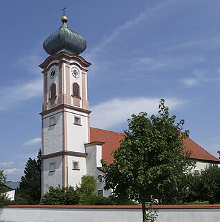
Markt Wald, MN - Schnerzhofen - Markt Wald v O.JPG

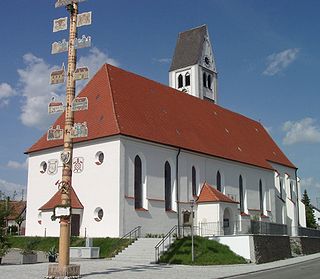
Markt Wald seen from the east
DEU Markt Wald COA.svg
Coat of arms
Germany adm location map.svg
Red pog.svg
Markt Wald
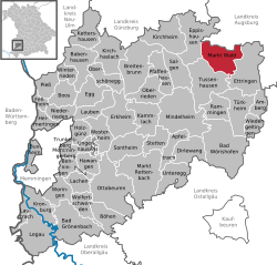
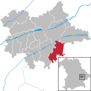
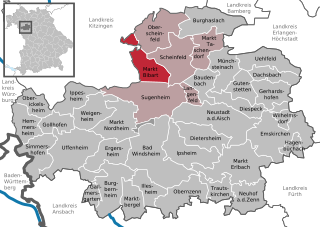
Location of Markt Wald within Unterallgäu district
Markt Wald in MN.svg
Coordinates: 48°8′N10°35′E / 48.133°N 10.583°E / 48.133; 10.583 Coordinates: 48°8′N10°35′E / 48.133°N 10.583°E / 48.133; 10.583
Country Germany
State Bavaria
Admin. region Schwaben
District Unterallgäu
Government
   Mayor Peter Wachler (CSU)
Area
  Total 30.82 km2 (11.90 sq mi)
Elevation 544-644 m (−1,600 ft)
Population (2016-12-31) [1]
  Total 2,188
  Density 71/km2 (180/sq mi)
Time zone CET/CEST (UTC+1/+2)
Postal codes 86865
Dialling codes 08262
Vehicle registration MN
Website www.marktwald.de

Markt Wald is a municipality in the district of Unterallgäu in Bavaria, Germany.

Municipalities of Germany the lowest official level of territorial division in Germany

Municipalities are the lowest level of official territorial division in Germany. This is most commonly the third level of territorial division, ranking after the Land (state) and Kreis (district). The Gemeinde which is one level lower in those states also includes Regierungsbezirke as an intermediate territorial division. The Gemeinde is one level higher if it is not part of a Samtgemeinde. Only 10 municipalities in Germany have fifth level administrative subdivisions and all of them are in Bavaria. The highest degree of autonomy may be found in the Gemeinden which are not part of a Kreis. These Gemeinden are referred to as Kreisfreie Städte or Stadtkreise, sometimes translated as having "city status". This can be the case even for small municipalities. However, many smaller municipalities have lost this city status in various administrative reforms in the last 40 years when they were incorporated into a Kreis. In some states they retained a higher measure of autonomy than the other municipalities of the Kreis. Municipalities titled Stadt are urban municipalities while those titled Gemeinde are classified as rural municipalities.

Unterallgäu District in Bavaria, Germany

Unterallgäu is a Landkreis (district) in Swabia, Bavaria, Germany. Neighboring districts are Neu-Ulm, Günzburg, Augsburg, Ostallgäu, Oberallgäu, and the districts Ravensburg und Biberach in Baden-Württemberg. The district-free city Memmingen in the west of the district is nearly surrounded by the district. The capital of the district is Mindelheim.

Bavaria State in Germany

Bavaria, officially the Free State of Bavaria, is a landlocked federal state of Germany, occupying its southeastern corner. With an area of 70,550.19 square kilometres, Bavaria is the largest German state by land area comprising roughly a fifth of the total land area of Germany. With 13 million inhabitants, it is Germany's second-most-populous state after North Rhine-Westphalia. Bavaria's main cities are Munich and Nuremberg.

Christoph Scheiner was born in Markt Wald.

Related Research Articles

Simbach, Dingolfing-Landau Place in Bavaria, Germany

Markt Simbach is a municipality in the district of Dingolfing-Landau, Bavaria, Germany. As of 2002, it had a population of around 3,800 and an area of 51.24 km².

Bayerisch Eisenstein Place in Bavaria, Germany

Bayerisch Eisenstein, until 1951 just Eisenstein is a village and a municipality in the Regen district, in Bavaria, Germany.

Stetten am kalten Markt Place in Baden-Württemberg, Germany

Stetten am kalten Markt is a municipality in the Sigmaringen district of Baden-Württemberg, Germany.

Weil am Rhein Place in Baden-Württemberg, Germany

Weil am Rhein is a German town and commune. It is on the east bank of the River Rhine, and close to the point at which the Swiss, French and German borders meet. It is the most southwesterly town in Germany and a suburb of the Swiss city Basel. Weil am Rhein is part of the "trinationale Agglomeration Basel" with about 830,000 inhabitants.

Schwarzenbach am Wald Place in Bavaria, Germany

Schwarzenbach am Wald is a town in the district of Hof, in Bavaria, Germany. It is situated 21 km west of Hof, and 23 km northeast of Kulmbach.

Wallerstein, Bavaria Place in Bavaria, Germany

Wallerstein is a municipality and former principality in the district of Donau-Ries in Bavaria in Germany.

Zusmarshausen Place in Bavaria, Germany

Zusmarshausen is a municipality in the district of Augsburg, Bavaria, Germany. The 1648 Battle of Zusmarshausen took place here.

Biberbach, Bavaria Place in Bavaria, Germany

Biberbach is a municipality in the northern part of the district of Augsburg in Bavaria in Germany. A famous baroque pilgrimage church is located on the hill above the village.

Markt Indersdorf Place in Bavaria, Germany

Markt Indersdorf is a municipality in the district of Dachau in Bavaria in Germany.

Außernzell Place in Bavaria, Germany

Außernzell is a municipality in the district of Deggendorf in Bavaria in Germany. It is part of the municipal union of Schöllnach.

Langquaid Place in Bavaria, Germany

Langquaid is a municipality in the district of Kelheim in Bavaria in Germany.

Markt Bibart Place in Bavaria, Germany

Markt Bibart is a municipality in the district of Neustadt (Aisch)-Bad Windsheim in Bavaria in Germany.

Markt Erlbach Place in Bavaria, Germany

Markt Erlbach is a municipality in the district of Neustadt (Aisch)-Bad Windsheim in Bavaria in Germany.

Wald (Allgäu) Place in Bavaria, Germany

Wald is a municipality in the district of Ostallgäu in Bavaria in Germany.

Erkheim Place in Bavaria, Germany

Erkheim is a municipality in the district of Unterallgäu in Bavaria, Germany.

Markt Berolzheim Place in Bavaria, Germany

Markt Berolzheim is a municipality in the Weißenburg-Gunzenhausen district, in Bavaria, Germany.

Helmstadt Place in Bavaria, Germany

Helmstadt is a municipality in the Lower Franconian district of Würzburg in Bavaria in Germany.

Markt Rettenbach Place in Bavaria, Germany

Markt Rettenbach is a municipality in the district of Unterallgäu in Bavaria, Germany.

Walding Place in Upper Austria, Austria

For people with the surname, see Walding (surname).

The Stauden Railway is a railway line through the Stauden, the southern part of the Augsburg-Westerwald Nature Park. The line was built from 1908 to 1912 and had a length of 42.4 kilometres (26.3 mi). One section was closed in 1983 because of low passenger numbers and the poor state of the track. The line from Türkheim to Ettringen is used by the factory Lang Papier. The section from Markt Wald to Gessertshausen is only used by an excursion train association. Every second Sunday a diesel fuel train runs from Augsburg Hbf to Markt Wald.

References