Niederrieden

Last updated
Niederrieden

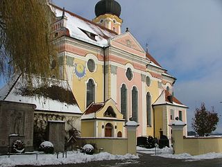
Eg3 - Niederrieden.jpg

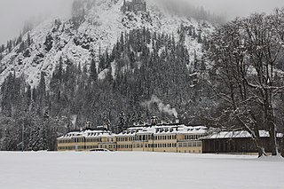
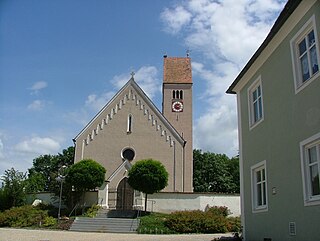
Church of Saint George
DEU Niederrieden COA.svg
Coat of arms
Germany adm location map.svg
Red pog.svg
Niederrieden
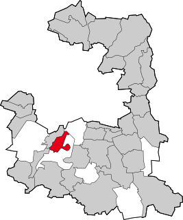
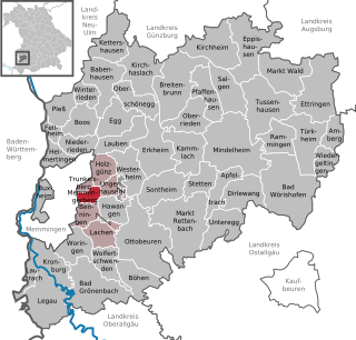
Location of Niederrieden within Unterallgäu district
Niederrieden in MN.svg
Coordinates: 48°3′N10°11′E / 48.050°N 10.183°E / 48.050; 10.183 Coordinates: 48°3′N10°11′E / 48.050°N 10.183°E / 48.050; 10.183
Country Germany
State Bavaria
Admin. region Schwaben
District Unterallgäu
Municipal assoc. Boos, Bavaria
Government
   Mayor Michael Büchler (CSU-Bürgerunion)
Area
  Total 13.90 km2 (5.37 sq mi)
Elevation 582 m (1,909 ft)
Population (2016-12-31) [1]
  Total 1,401
  Density 100/km2 (260/sq mi)
Time zone CET/CEST (UTC+1/+2)
Postal codes 87767
Dialling codes 08335
Vehicle registration MN
Website www.vg-boos.de

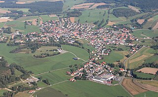
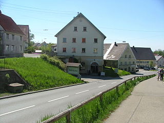
Niederrieden is a municipality in the district of Unterallgäu in Bavaria, Germany. The town has a municipal association with Boos, Bavaria.

Municipalities of Germany the lowest official level of territorial division in Germany

Municipalities are the lowest level of official territorial division in Germany. This is most commonly the third level of territorial division, ranking after the Land (state) and Kreis (district). The Gemeinde which is one level lower in those states also includes Regierungsbezirke as an intermediate territorial division. The Gemeinde is one level higher if it is not part of a Samtgemeinde. Only 10 municipalities in Germany have fifth level administrative subdivisions and all of them are in Bavaria. The highest degree of autonomy may be found in the Gemeinden which are not part of a Kreis. These Gemeinden are referred to as Kreisfreie Städte or Stadtkreise, sometimes translated as having "city status". This can be the case even for small municipalities. However, many smaller municipalities have lost this city status in various administrative reforms in the last 40 years when they were incorporated into a Kreis. In some states they retained a higher measure of autonomy than the other municipalities of the Kreis. Municipalities titled Stadt are urban municipalities while those titled Gemeinde are classified as rural municipalities.

Unterallgäu District in Bavaria, Germany

Unterallgäu is a Landkreis (district) in Swabia, Bavaria, Germany. Neighboring districts are Neu-Ulm, Günzburg, Augsburg, Ostallgäu, Oberallgäu, and the districts Ravensburg und Biberach in Baden-Württemberg. The district-free city Memmingen in the west of the district is nearly surrounded by the district. The capital of the district is Mindelheim.

Bavaria State in Germany

Bavaria, officially the Free State of Bavaria, is a landlocked federal state of Germany, occupying its southeastern corner. With an area of 70,550.19 square kilometres, Bavaria is the largest German state by land area comprising roughly a fifth of the total land area of Germany. With 13 million inhabitants, it is Germany's second-most-populous state after North Rhine-Westphalia. Bavaria's main cities are Munich and Nuremberg.

Related Research Articles

Kelheim Place in Bavaria, Germany

Kelheim is a town and municipality in Bavaria, Germany. It is the capital of the district Kelheim and is situated at the confluence of Altmühl and Danube. Kelheim has a population of around 15,750.

Pleß Place in Bavaria, Germany

Pleß is a municipality in the district of Unterallgäu in Bavaria, Germany. The town has a municipal association with Boos, Bavaria.

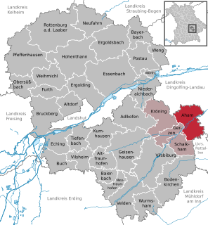
Aham Place in Bavaria, Germany

Aham is a municipality in the district of Landshut in Bavaria in Germany.

Pöcking Place in Bavaria, Germany

Pöcking is a municipality in the district of Starnberg in Bavaria in Germany. Duchess Elisabeth in Bavaria, consort of Emperor Franz Josef I of Austria-Hungary, grew up here in the Possenhofen Castle as daughter of Duke Max in Bavaria and Princess Ludovika of Bavaria.

Grünwald, Bavaria Place in Bavaria, Germany

Grünwald is a municipality in the district of Munich, in Bavaria, Germany. It is located on the right bank of the Isar, 12 km southwest of Munich (centre). As of 31 December 2011 it had a population of 11,109.

Waidhaus Place in Bavaria, Germany

Waidhaus is a municipality in the district of Neustadt an der Waldnaab in Bavaria, Germany. It lies near the border with the Czech Republic, and near the major border crossing between Bavaria and the Czech Republic, where the Bavarian A6 meets the Czech D5 motorway. The closest towns are on the German side Pleystein and on the Czech side Rozvadov. A gas pipeline and a powerline also cross the border between Bavaria and the Czech Republic there.

Wallerstein, Bavaria Place in Bavaria, Germany

Wallerstein is a municipality and former principality in the district of Donau-Ries in Bavaria in Germany.

Kreuth Place in Bavaria, Germany

Kreuth is a municipality in the district of Miesbach in Bavaria in Germany.

Dirlewang Place in Bavaria, Germany

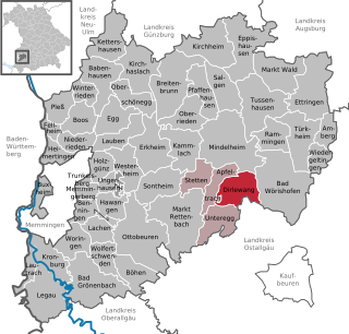
Dirlewang is a municipality in the district of Unterallgäu in Bavaria, Germany. The town is seat of a municipal association with Apfeltrach, Stetten, Bavaria and Unteregg.

Memmingerberg Place in Bavaria, Germany

Memmingerberg is a municipality in the district of Unterallgäu in Bavaria, Germany. The town is seat of a municipal association with Benningen, Holzgünz, Lachen, Bavaria, Trunkelsberg and Ungerhausen.

Pfaffenhausen Place in Bavaria, Germany

Pfaffenhausen is a municipality in the district of Unterallgäu in Bavaria, Germany. The town is seat of a municipal association with Breitenbrunn, Swabia, Oberrieden, Bavaria and Salgen.

Kürnach Place in Bavaria, Germany

Kürnach is a municipality in the district of Würzburg in Bavaria in Germany. The distance from Kürnach to the state capital of Bavaria München is about 221 km.

Rottendorf Place in Bavaria, Germany

Rottendorf is a municipality in the district of Würzburg in Bavaria, Germany.

Pähl Place in Bavaria, Germany

Pähl am Ammersee is a municipality in the Weilheim-Schongau district, in Bavaria, Germany. It is on the lake of Ammersee to the southwest of Munich.

Egg an der Günz Place in Bavaria, Germany

Egg an der Günz is a municipality in the district of Unterallgäu in Bavaria, Germany. The town has a municipal association with Babenhausen, Bavaria.

Fellheim Place in Bavaria, Germany

Fellheim is a municipality in the district of Unterallgäu in Bavaria, Germany. The town has a municipal association with Boos, Bavaria.

Heimertingen Place in Bavaria, Germany

Heimertingen is a municipality in the district of Unterallgäu in Bavaria, Germany. The town has a municipal association with Boos, Bavaria.

Kettershausen Place in Bavaria, Germany

Kettershausen is a municipality in the district of Unterallgäu in Bavaria, Germany. The town has a municipal association with Babenhausen, Bavaria.

Oberschönegg Place in Bavaria, Germany

Oberschönegg is a municipality in the district of Unterallgäu in Bavaria, Germany. The town has a municipal association with Babenhausen, Bavaria.

Winterrieden Place in Bavaria, Germany

Winterrieden is a municipality in the district of Unterallgäu in Bavaria, Germany. The town has a municipal association with Babenhausen, Bavaria.

References