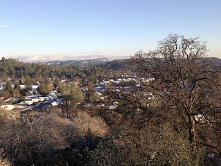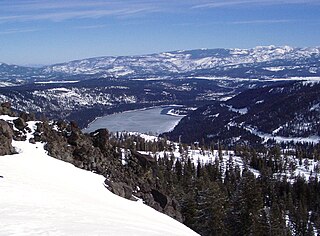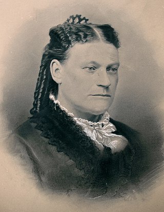
Murphys, originally Murphys New Diggings then Murphy's Camp, is an unincorporated village located in the foothills of the Sierra Nevada mountains in Calaveras County, California, United States. The population was 2,213 at the 2010 census, up from 2,061 at the 2000 census.

Sunnyvale is a city located in the Santa Clara Valley in northwest Santa Clara County in the U.S. state of California.

The California Trail was an emigrant trail of about 1,600 mi (2,600 km) across the western half of the North American continent from Missouri River towns to what is now the state of California. After it was established, the first half of the California Trail followed the same corridor of networked river valley trails as the Oregon Trail and the Mormon Trail, namely the valleys of the Platte, North Platte, and Sweetwater rivers to Wyoming. The trail has several splits and cutoffs for alternative routes around major landforms and to different destinations, with a combined length of over 5,000 mi (8,000 km).

Emigrant Gap is a gap in a ridge on the California Trail as it crosses the Sierra Nevada, to the west of what is now known as Donner Pass. Here the cliffs are so steep that, back in the 1840s, the pioneers on their way to California had to lower their wagons on ropes in order to continue.

Donner Memorial State Park is a state park of California, US, preserving the site of the Donner Camp, where members of the ill-fated Donner Party were trapped by weather during the winter of 1846–1847. Caught without shelter or adequate supplies, members of the group resorted to cannibalism to survive. The Sierra Nevada site has been designated a National Historic Landmark. The state park contains the Emigrant Trail Museum and the Pioneer Monument dedicated to the travelers of the Emigrant Trail.
Railtown 1897 State Historic Park, and its operating entity, the Sierra Railway, is known as "The Movie Railroad." Both entities are a heritage railway and are a unit of the California State Park System. Railtown 1897 is located in Jamestown, California. The entire park preserves the historic core of the original Sierra Railway of California. The railway's Jamestown locomotive and rolling stock maintenance facilities are remarkably intact and continue to function much as they have for over 100 years. The maintenance facilities are listed on the National Register of Historic Places as the Sierra Railway Shops Historic District.

State Route 88 (SR 88), also known as the Carson Pass Highway, is a state highway in the U.S. state of California. It travels in an east–west direction from Stockton, in the San Joaquin Valley, to the Nevada state line, where it becomes Nevada State Route 88, eventually terminating at U.S. Route 395 (US 395). The highway is so named as it crests the Sierra Nevada at Carson Pass. The highway corridor predates the era of the automobile; the path over Carson pass was previously used for the California Trail and the Mormon Emigrant Trail. The mountainous portion of the route is included in the State Scenic Highway System.

The Death Valley '49ers were a group of pioneers from the Eastern United States that endured a long and difficult journey during the late 1840s California Gold Rush to prospect in the Sutter's Fort area of the Central Valley and Sierra Nevada in California. Their route from Utah went through the Great Basin Desert in Nevada, and Death Valley and the Mojave Desert in Southern California, in attempting to reach the Gold Country.

New Almaden, known in Spanish as Nueva Almadén, is a historic community and former mercury mine in the Capitancillos Hills of San Jose, California, located at the southwestern point of Almaden Valley in South San Jose. New Almaden is divided into two parts: the mines and much of their immediate surroundings, including historic ghost town settlements in the Capintancillas, which together form the Almaden Quicksilver County Park, and the largely residential historic district surrounding the Casa Grande.
The Stephens–Townsend–Murphy Party consisted of ten families who migrated from Iowa to California prior to the Mexican–American War and the California Gold Rush. The Stephens Party is significant in California history because they were the first wagon train to cross the Sierra Nevada during the expansion of the American West. In 1844, they pioneered the first route at or near what was later named Donner Pass. The crossing was a year before the third expedition of John Charles Fremont, two years before the Donner Party, and five years before the 1848–49 Gold Rush. Three other known European exploration crossings of the Sierra Nevada had previously occurred at points south of this however, including Fremont's second expedition the previous winter, at Carson Pass.

Elijah Stephens also spelled Elisha Stevens was a blacksmith and trapper who was born in South Carolina. In 1844, he left Council Bluffs, Iowa as the captain of the Stephens-Townsend-Murphy Party, the first wagon train to cross the Sierra Nevada mountains into Alta California. He then moved to Cupertino, California, in 1848. Stevens Creek is named after him.
Warner's Ranch, near Warner Springs, California, was notable as a way station for large numbers of emigrants on the Southern Emigrant Trail from 1849 to 1861, as it was a stop on both the Gila River Trail and the Butterfield Overland Mail stagecoach line (1859-1861). It was also operated as a pioneering cattle ranch.

The Sunnyvale Heritage Park Museum is a historical museum located in Sunnyvale, California. It is a replica of the original Martin Murphy House.

Rancho Pastoría de las Borregas was a 9,066-acre (36.69 km2) Mexican land grant in present day Santa Clara County, California, United States, given in 1842 by Governor Juan Alvarado to Francisco Estrada. The name means "Ranch of the Ewe/Lamb Pasture" in Spanish. The rancho lands encompassed the present day cities of Sunnyvale and Mountain View.
Rancho Ojo de Agua de la Coche was a 8,927-acre (3,613 ha) Mexican land grant in present-day Santa Clara County, California given in 1835 by Governor José Figueroa to Juan María Hernandez. The name means "pig's spring". The grant extended south from Rancho Laguna Seca (Alvires) between Coyote Creek and Llagas Creek, and encompassed present-day Morgan Hill.

Rancho La Purísima Concepción was a 4,439-acre (17.96 km2) Mexican land grant in present day Santa Clara County, California given in 1840 by Governor Juan Alvarado to José Gorgonio and his son José Ramon, Ohlone Native Americans. The granted extended from Matadero Creek to Adobe Creek and encompassed present day Los Altos Hills.
Martin Creek, known locally as Dennis Martin Creek, is a 1.4-mile-long (2.3 km) north by northeastward-flowing stream originating just east of Skyline Boulevard in the Santa Cruz Mountains, near the community of Skylonda in San Mateo County, California. It flows through the town of Woodside before crossing Portola Road and joining Sausal Creek on Stanford University lands just across the border from Woodside. Sausal Creek enters Searsville Reservoir, which flows to San Francisco Bay via San Francisquito Creek.

The Daley Toll Road Monument was designated a California Historic Landmark (No.579) on May 17, 1957. Daley Toll Road Monument marker is in the San Bernardino Mountains. The Monument is on the first wagon road built in San Bernardino Mountains. Engineer Edward Daley Sr. and his sons built and opened the toll road in 1870. They Daley family ran the toll road till 1890. The toll road ran from the city of San Bernardino to Lake Arrowhead. The road was called the Twin and City Creek Turnpike and the turnpike into the mountains. In 1890 the road became a San Bernardino County, California road called the Daley Canyon Road. The road is now a US Forest Service fire road and is closed to the public. The Monument is near the current city of Rimforest, California on California State Route 18 at Daley Canyon Rd, about 0.6 miles East of Rim Forest. The road made good money for Daley family. The road was used by lumber men, cattle men and sheep herders. Edward Daley became a San Bernardino county supervisor from January 5, 1880, to January 8, 1883. He opened a farm ranch called Dell Rosa at the entrance to the toll road. Edward Daley in Council Bluffs, Iowa, married in 1846, Nancy Ann Hunt, daughter of Capt. Jefferson Hunt. Hunt made three trips over the Cajon Pass and Mojave Desert one in 1847, second in 1849 and last in 1851. Each trip he was the leader of wagon trains, bringing pioneer west, down one of the westward Expansion Trails. Edward and Nancy came to California on the 1849 trip, together they had 11 children: Laomi, Celia, Edward Jr., Charles Jefferson, John, Grace, Annetta, Frank, Lou, May and Kate. The road he built went up Strawberry Creek, crossed over to the west fork of City Creek, passed by the east of Strawberry Peak and then dropped into Little Bear Valley. Little Bear Valley is where the towns of Blue Jay and Lake Arrowhead are located. At the end of the toll road John Commerford ran the top end of the toll road. John Commerford ran a store at the location.

Murphy's Ranch, also called Murphy's Corral, is a historical site in Elk Grove, Sacramento County, California. The site of Murphy's Ranch is a California Historical Landmark No. 680 listed on May 11, 1959. At Murphy's Ranch on June 10, 1846, was the start of the Bear Flag Revolt and Bear Flag Rebellion.


