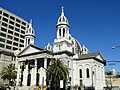
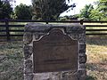
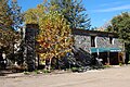
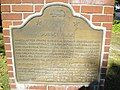
Image [ 1] Landmark name Location City or town Summary Almaden Vineyards 505 Almaden Vineyards 1530 Blossom Hill Rd. 37°14′21″N 121°53′41″W / 37.2391°N 121.8947°W / 37.2391; -121.8947 (Almaden Vineyards ) San Jose Arroyo de San José Cupertino 800 Arroyo de San José Cupertino Monta Vista High School 37°18′56″N 122°03′28″W / 37.31545°N 122.057667°W / 37.31545; -122.057667 (Arroyo de San José Cupertino ) Cupertino Cathedral Basilica of St. Joseph 910 Cathedral Basilica of St. Joseph 90 S Market St. 37°20′03″N 121°53′27″W / 37.334036°N 121.890816°W / 37.334036; -121.890816 (Cathedral Basilica of St. Joseph ) San Jose Also on the NRHP list as NPS-77000365, St. Joseph's Roman Catholic Church Charles Copeland Morse House 904 Charles Copeland Morse House 981 Fremont St. 37°21′07″N 121°56′44″W / 37.352069°N 121.945506°W / 37.352069; -121.945506 (Charles Copeland Morse House ) Santa Clara Also on the NRHP list as NPS-82002266 Eadweard Muybridge and the development of motion pictures 834 Eadweard Muybridge and the development of motion pictures Stanford University , Campus Dr W across from Stanford Driving Range 37°25′29″N 122°10′57″W / 37.4246°N 122.1824°W / 37.4246; -122.1824 (Eadweard Muybridge and the development of motion pictures ) Stanford Home of Edwin Markham 416 Home of Edwin Markham Kelley Park, 1600 Senter Rd. 37°19′13″N 121°51′33″W / 37.320257°N 121.859032°W / 37.320257; -121.859032 (Home of Edwin Markham ) San Jose First successful introduction of the honeybee to California 945 First successful introduction of the honeybee to California San Jose Municipal Airport , 1661 Airport Blvd. 37°21′N 121°55′W / 37.35°N 121.92°W / 37.35; -121.92 (First successful introduction of the honeybee to California ) San Jose First Unitarian Church of San Jose 902 First Unitarian Church of San Jose 160 N. Third St. 37°20′23″N 121°53′24″W / 37.339728°N 121.889903°W / 37.339728; -121.889903 (First Unitarian Church of San Jose ) San Jose Also on the NRHP list as NPS-77000343 Forbes Mill 458 Forbes Mill Forbes Mill Museum 37°13′20″N 121°58′49″W / 37.222101°N 121.980174°W / 37.222101; -121.980174 (Forbes Mill ) Los Gatos First site of El Pueblo de San José de Guadalupe 433 First site of El Pueblo de San José de Guadalupe Former San Jose City Hall at Civic Center 37°21′00″N 121°54′13″W / 37.3501°N 121.9037°W / 37.3501; -121.9037 (First site of El Pueblo de San José de Guadalupe ) San Jose Upload Photo 1017 Gilroy Yamato Hot Springs 37°06′30″N 121°28′39″W / 37.108333°N 121.4775°W / 37.108333; -121.4775 (Gilroy Yamato Hot Springs ) Gilroy Also on the NRHP list as NPS-95000996 Guadalupe Mission of San Jose 1049 Guadalupe Mission of San Jose 2020 E San Antonio St. 37°21′09″N 121°50′41″W / 37.352579°N 121.844681°W / 37.352579; -121.844681 (Guadalupe Mission of San Jose ) San Jose Also on the NRHP list as NPS-100000836 Gubserville 447 Gubserville 1481 Saratoga Ave. 37°17′44″N 121°59′16″W / 37.295667°N 121.987783°W / 37.295667; -121.987783 (Gubserville ) San Jose Hayes Mansion 888 Hayes Mansion 200 Edenvale Ave. 37°15′44″N 121°49′15″W / 37.262314°N 121.820767°W / 37.262314; -121.820767 (Hayes Mansion ) San Jose HP Garage 976 HP Garage 367 Addison Ave. 37°26′35″N 122°09′17″W / 37.44307°N 122.15481°W / 37.44307; -122.15481 (HP Garage ) Palo Alto Also on the NRHP list as NPS-07000307 Hostess House 895 Hostess House 27 Mitchell Ln. 37°26′35″N 122°09′56″W / 37.442933°N 122.165483°W / 37.442933; -122.165483 (Hostess House ) Palo Alto Also on the NRHP list as NPS-76000528 John Adams Squire House 857 John Adams Squire House 900 University Ave. 37°27′12″N 122°09′12″W / 37.4533°N 122.1532°W / 37.4533; -122.1532 (John Adams Squire House ) Palo Alto Also on the NRHP list as NPS-72000255 Juana Briones de Miranda Home 524 Juana Briones de Miranda Home 4157 Old Adobe Rd. 37°23′32″N 122°08′22″W / 37.39225°N 122.13955°W / 37.39225; -122.13955 (Juana Briones de Miranda Home ) Palo Alto Kotani-en 903 Kotani-en 15891 Ravine Rd, Los Gatos 37°14′13″N 122°00′41″W / 37.236903°N 122.011397°W / 37.236903; -122.011397 (Kotani-en ) Los Gatos Lou Henry Hoover House 913 Lou Henry Hoover House 623 Mirada Rd. 37°25′07″N 122°10′03″W / 37.4185°N 122.1675°W / 37.4185; -122.1675 (Lou Henry Hoover House ) Stanford Martin Murphy Home and Estate 644 Martin Murphy Home and Estate Martin Murphy, Jr. Historical Park 37°22′56″N 122°01′34″W / 37.382142°N 122.026192°W / 37.382142; -122.026192 (Martin Murphy Home and Estate ) Sunnyvale Sarah Wallis Mayfield Farm 969 Sarah Wallis Mayfield Farm 3880 La Selva Drive 37°24′59″N 122°07′49″W / 37.4164°N 122.1303°W / 37.4164; -122.1303 (Sarah Wallis Mayfield Farm ) Palo Alto Historic marker Mission Santa Clara de Asis 338 Mission Santa Clara de Asis Mission Church, University of Santa Clara 37°20′57″N 121°56′30″W / 37.349269°N 121.9416°W / 37.349269; -121.9416 (Mission Santa Clara de Asis ) Santa Clara Montgomery Hill 813 Montgomery Hill Corner of San Felipe Road and Yerba Buena Road 37°17′57″N 121°46′16″W / 37.299292°N 121.771036°W / 37.299292; -121.771036 (Montgomery Hill ) San Jose Moreland School 489 Moreland School 4335 Payne Ave. 37°18′03″N 121°58′45″W / 37.3009°N 121.9792°W / 37.3009; -121.9792 (Moreland School ) San Jose New Almaden Mine 339 New Almaden Mine On N-bound old Hwy 101 37°14′54″N 121°47′20″W / 37.2482°N 121.7888°W / 37.2482; -121.7888 (New Almaden Mine ) San Jose Upload Photo 339-1 New Almaden Mine Bulmore Park, Almaden Rd and Almaden Way 37°10′27″N 121°49′28″W / 37.17415°N 121.8245°W / 37.17415; -121.8245 (New Almaden Mine ) San Jose Old Post Office 854 Old Post Office 110 S. Market St. 37°20′01″N 121°53′25″W / 37.333488°N 121.890364°W / 37.333488; -121.890364 (Old Post Office ) San Jose Old site of Mission Santa Clara de Asis and Old Spanish Bridge 250 Old site of Mission Santa Clara de Asis and Old Spanish Bridge De La Cruz Blvd. and Martin Ave. 37°21′59″N 121°56′29″W / 37.3665°N 121.941483°W / 37.3665; -121.941483 (Old site of Mission Santa Clara de Asis and Old Spanish Bridge ) Santa Clara Patchen 448 Patchen Old Santa Cruz Hwy and Mountain Charlie Rd. 37°08′53″N 121°58′27″W / 37.148133°N 121.9743°W / 37.148133; -121.9743 (Patchen ) Holy City Paul Masson Mountain Winery 733 Paul Masson Mountain Winery Mountain Winery 37°15′37″N 122°03′54″W / 37.260372°N 122.064936°W / 37.260372; -122.064936 (Paul Masson Mountain Winery ) Saratoga Also on the NRHP list as NPS-83001239 Pellier Park, site of City Gardens 434 Pellier Park, site of City Gardens 100 block of W St James St. 37°20′16″N 121°53′45″W / 37.337733°N 121.895917°W / 37.337733; -121.895917 (Pellier Park, site of City Gardens ) San Jose Peralta Adobe 866 Peralta Adobe 900 University Ave. 37°20′11″N 121°53′41″W / 37.336403°N 121.894753°W / 37.336403; -121.894753 (Peralta Adobe ) San Jose Also on the NRHP list as NPS-73000454 Pioneer Electronics Research Laboratory 836 Pioneer Electronics Research Laboratory SE corner of Channing Ave. and Emerson St. 37°26′29″N 122°09′28″W / 37.4414°N 122.1578°W / 37.4414; -122.1578 (Pioneer Electronics Research Laboratory ) Palo Alto Roberto Adobe and Suñol House 898 Roberto Adobe and Suñol House 770 Lincoln Ave. 37°18′57″N 121°54′23″W / 37.31575°N 121.90645°W / 37.31575; -121.90645 (Roberto Adobe and Suñol House ) San Jose San Jose State College 417 San Jose State College San Jose State University 37°20′08″N 121°52′52″W / 37.335556°N 121.881111°W / 37.335556; -121.881111 (San Jose State College ) San Jose Santa Clara Campaign Treaty Site 260 Santa Clara Campaign Treaty Site Civic Center Park 37°21′08″N 121°57′13″W / 37.3522°N 121.9537°W / 37.3522; -121.9537 (Santa Clara Campaign Treaty Site ) Santa Clara Saratoga 435 Saratoga Hwys 9 and 85 37°15′33″N 122°01′51″W / 37.2592°N 122.0309°W / 37.2592; -122.0309 (Saratoga ) Saratoga Site of California's First State Capitol 461 Site of California's First State Capitol City Park Plaza 37°19′58″N 121°53′23″W / 37.332717°N 121.8896°W / 37.332717; -121.8896 (Site of California's First State Capitol ) San Jose Site of invention of the first commercially practicable integrated circuit 1000 Site of invention of the first commercially practicable integrated circuit 844 E Charleston Rd. 37°25′18″N 122°06′12″W / 37.421783°N 122.1033°W / 37.421783; -122.1033 (Site of invention of the first commercially practicable integrated circuit ) Palo Alto Upload Photo 952 Site of the world's first broadcasting station First and San Fernando Sts. 37°20′03″N 121°53′22″W / 37.33405°N 121.88945°W / 37.33405; -121.88945 (Site of the world's first broadcasting station ) San Jose Vasquez Tree and site of 21-Mile-House 259 Vasquez Tree and site of 21-Mile-House Tennant Ave. and Monterey Hwy. 37°06′47″N 121°38′38″W / 37.1131°N 121.6438°W / 37.1131; -121.6438 (Vasquez Tree and site of 21-Mile-House ) Morgan Hill Winchester Mystery House 868 Winchester Mystery House 525 S. Winchester Blvd. 37°19′06″N 121°57′03″W / 37.318361°N 121.950761°W / 37.318361; -121.950761 (Winchester Mystery House ) San Jose Also on the NRHP list as NPS-74000559 Women's Club Adobe 249 Women's Club Adobe 3260 The Alameda between Benton and Franklin Sts. 37°21′07″N 121°56′27″W / 37.352033°N 121.9408°W / 37.352033; -121.9408 (Women's Club Adobe ) Santa Clara