Maryland Route 675

Last updated

MD Route 675.svg

Maryland Route 675

Maryland Route 675
Maryland Route 675 highlighted in red
Route information
Maintained by MDSHA
Existed1959–present
Tourist
routes
MD scenic byway.svg Chesapeake Country Scenic Byway
Princess Anne
Length3.39 mi [1]  (5.46 km)
South endUS 13.svg US 13 south of Princess Anne
Major intersections
North endUS 13.svg US 13 north of Princess Anne
Delmar
Length2.09 mi [1]  (3.36 km)
South endUS 13.svg US 13 south of Delmar
North endMD Route 54.svgElongated circle 54.svg Route 54 at the Delaware state line in Delmar
Location
Country United States
State Maryland
Counties Somerset, Wicomico
Highway system
MD Route 674.svg MD 674 MD Route 694.svg MD 694

Maryland Route 675 (MD 675) is a collection of state highways in the U.S. state of Maryland. These two highways are sections of old alignment of U.S. Route 13 (US 13) in Princess Anne in Somerset County and Delmar in northern Wicomico County. MD 675 was designated after US 13 bypassed Princess Anne in the late 1950s. MD 675B was assigned several years after US 13 bypassed Delmar in the mid-1950s. MD 675A existed in Pocomoke City before it was replaced by US 13 Business in the mid-1990s.

Contents

Route description

MD 675, which is known as Somerset Avenue, runs 3.39 miles (5.46 km) through Princess Anne between intersections with US 13 on the south and north sides of the town in Somerset County. MD 675B, which is signed as MD 675 as known as Bi-State Boulevard, runs 2.09 miles (3.36 km) within northern Wicomico County from US 13 north of Salisbury north to DE-MD 54 at the Delaware state line in the twin towns of Delmar, Maryland, and Delmar, Delaware. [1]

Princess Anne

View north along MD 675 at MD 822 in Princess Anne 2017-08-28 08 27 23 View north along Maryland State Route 675 (Somerset Avenue) at Maryland State Route 822 (University of Maryland Eastern Shore Boulevard) in Princess Anne, Somerset County, Maryland.jpg
View north along MD 675 at MD 822 in Princess Anne

MD 675 begins at a directional intersection with US 13 (Ocean Highway) south of Princess Anne. The 0.07-mile (0.11 km) ramp from MD 675 south to US 13 is designated MD 675D. There is no direct access from US 13 south to MD 675 north. MD 675 heads north as a two-lane undivided road into the town of Princess Anne, closely paralleling the Delmarva Central Railroad's Delmarva Subdivision rail line through a residential area. At Park Drive, the state highway veers away from the railroad and into the Princess Anne Historic District. Within the downtown area, MD 675 intersects the western terminus of MD 388 (Antioch Avenue), Prince William Street, which leads to the Teackle Mansion and MD 363, and Dr. William P. Hytche Boulevard, which is unsigned MD 918 and heads east toward the University of Maryland Eastern Shore. [1] [2]

MD 675 crosses the Manokin River into a residential neighborhood that contains Manokin Presbyterian Church and the Somerset County Office Complex, reaching an intersection with the eastern terminus of MD 362 (Mt. Vernon Road). Farther north, MD 675 meets MD 822 (UMES Boulevard), which connects US 13 to the university, at a roundabout, before leaving the town limits of Princess Anne. MD 529 (Loretto Road) splits to the east before MD 675 reaches its northern terminus at ramps to and from northbound US 13 adjacent to the rail line. There is no access from MD 675 to and from southbound US 13; those movements can be completed via MD 822. [1] [2]

Delmar

MD 675 southbound past DE-MD 54 in Delmar 2017-08-21 19 04 27 View south along Maryland State Route 675 (Bi State Boulevard) at Maryland State Route 54 and Delaware State Route 54 (State Street) in Delmar, Wicomico County, Maryland.jpg
MD 675 southbound past DE-MD 54 in Delmar

MD 675B begins at an intersection with US 13 (Ocean Highway) north of Salisbury. The state highway heads west from the perpendicular intersection, then turns north onto two-lane undivided Bi-State Boulevard, passing through a mix of farmland, forest, and residences. At Walnut Street, MD 675B enters the town of Delmar, Maryland. The state highway passes through a residential area, cutting northwest through the street grid until the highway reaches its northern terminus at DE-MD 54 (East State Street), which runs atop the Delaware state line. Bi-State Boulevard continues north into the town of Delmar, Delaware. [1] [3]

History

MD 675

MD 675 between Park Drivewhich intersects Old Princess Anne Road, the original alignment of US 13 from Princess Anne to Westoverand MD 529 is the original alignment of US 13. The state highway was paved south of downtown Princess Anne toward Westover in 1911 and north of downtown toward Salisbury in 1914. [4] MD 675 north of MD 529 was constructed in 1933 as part of a relocation of US 13 between Princess Anne and Fruitland to bypass the circuitous route via Loretto Road and Allen Road and to eliminate two railroad crossings. [5] [6] MD 675 south of Park Drive was constructed as part of a similar relocation between Princess Anne and Westover in 1935. [6] [7] US 13's present bypass of Princess Anne was constructed between 1957 and 1959. [8] [9] MD 675 was marked through Princess Anne by 1978. [10] In 2010, plans were made to construct a roundabout at the intersection of MD 675 and MD 822 in Princess Anne. [11] The roundabout was completed in 2015. [12]

MD 675A

MD 675A was a section of MD 675 passing through Pocomoke City in Worcester County and West Pocomoke in Somerset County. The state highway was designated after the completion of US 13's bypass of Pocomoke City around 1963. [13] MD 675 was marked by 1975. [14] The state highway followed what is now US 13 Business, which was assigned in 1994. [15]

MD 675B

MD 675B is the original alignment of US 13 through Delmar. The highway was paved as a state-aid road by 1921 and rebuilt as a state road in 1923. [16] [17] US 13's present bypass of Delmar was completed in 1954 concurrent with the adjacent section of US 13 in Delaware bypassing Laurel and Seaford. [18] [19] MD 675B was part of US 13 Alternate between 1954 and 1957. [19] [20] MD 675B was marked through Delmar by 1983. [21]

Junction list

MD 675

The entire route is in Princess Anne, Somerset County.

mi
[1]
kmDestinationsNotes
0.000.00US 13.svg US 13 (Ocean Highway) Pocomoke, Norfolk Southern terminus; no direct access from southbound US 13 to northbound MD 675
1.322.12East plate.svg
MD Route 388.svg
MD 388 east (Antioch Avenue)
Western terminus of MD 388
1.612.59East plate.svg
MD Route 918.svg
MD 918 east (Dr. William P. Hytche Boulevard) University of Maryland Eastern Shore
Western terminus of MD 918; MD 918 is unsigned
2.223.57West plate.svg
MD Route 362.svg
MD 362 west (Mt. Vernon Road) Mount Vernon
Eastern terminus of MD 362
2.594.17MD Route 822.svgTo plate.svg
US 13.svg
MD 822 (UMES Boulevard) to US 13  University of Maryland Eastern Shore
Roundabout
2.814.52North plate.svg
MD Route 529.svg
MD 529 north (Loretto Road)
Southern terminus of MD 529
3.395.46North plate.svg
US 13.svg
US 13 north (Ocean Highway) Salisbury
Northern terminus; no direct access from northbound MD 675 to southbound US 13 or from southbound US 13 to southbound MD 675
1.000 mi = 1.609 km; 1.000 km = 0.621 mi

MD 675B

The entire route is in Delmar, Wicomico County.

mi
[1]
kmDestinationsNotes
0.000.00US 13.svg US 13 (Ocean Highway) Salisbury Southern terminus
2.093.36MD Route 54.svgElongated circle 54.svg Route 54 (East State Street) / Bi-State Boulevard north Delmar, DE, Mardela Springs, MD, Gumboro, DE Delaware state line; northern terminus
1.000 mi = 1.609 km; 1.000 km = 0.621 mi

See also

Related Research Articles

<span class="mw-page-title-main">U.S. Route 113</span> Highway in the United States

U.S. Route 113 (US 113) is a U.S. Highway that is a spur of US 13 in the U.S. states of Maryland and Delaware. The route runs 74.75 miles (120.30 km) from US 13 in Pocomoke City, Maryland, north to Delaware Route 1 (DE 1) in Milford, Delaware. In conjunction with DE 1, US 113 is one of two major north–south highways on the Delmarva Peninsula that connect Dover with Pocomoke City and the Eastern Shore of Virginia. The U.S. Highway is the primary north–south highway in Worcester County, Maryland, where it connects Pocomoke City with Snow Hill and Berlin. US 113 is one of three major north–south highways in Sussex County, Delaware, where it connects Selbyville, Millsboro, and Georgetown with Milford. While US 113 does not pass through Ocean City or the Delaware Beaches, the U.S. Highway intersects several highways that serve the Atlantic seaboard resorts, including US 50, Maryland Route 90 (MD 90), US 9, DE 404, DE 16, and DE 1. US 113 is a four-lane divided highway for its whole length.

<span class="mw-page-title-main">Maryland Route 313</span> Highway in Maryland

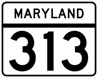
Maryland Route 313 (MD 313) is a state highway located on the Eastern Shore of Maryland in the United States. The 75.72-mile (121.86 km) route runs from U.S. Route 50 (US 50) in Mardela Springs, Wicomico County, north to MD 213 and MD 290 in Galena, Kent County. It is predominantly a rural two-lane undivided road that runs through agricultural areas a short distance west of the Delaware state line, with the exception of a four-lane divided bypass of Denton that is concurrent with MD 404. MD 313 serves many communities, including Sharptown, Eldorado, Federalsburg, Denton, Greensboro, Goldsboro, Barclay, Sudlersville, Millington, and Massey. The route intersects many major roads, including MD 54 in Mardela Springs, MD 404 in the Denton area, MD 302 in Barclay, MD 300 in Sudlersville, and US 301 near Massey.

<span class="mw-page-title-main">Route 54 (Maryland–Delaware)</span> Highway in Delaware and Maryland in the United States

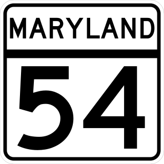
Maryland Route 54 (MD 54) and Delaware Route 54 (DE 54) are adjoining state highways in the U.S. states of Maryland and Delaware. Route 54 runs 41.84 mi (67.33 km) from MD 313 in Mardela Springs, Maryland, east to DE 1 in Fenwick Island, Delaware. In addition to two segments in which the highway is completely in Delaware and two segments in which the highway is completely in Maryland, Route 54 follows the Delaware/Maryland state line between the twin towns of Delmar, Maryland, and Delmar, Delaware, and the highway's intersection with MD 353 and DE 26. One section of the state line portion of Route 54 is maintained by the Delaware Department of Transportation (DelDOT) while three sections of the highway that follow the state line are maintained by the Maryland State Highway Administration (MDSHA).

<span class="mw-page-title-main">U.S. Route 13 in Maryland</span> U.S. Highway in Maryland

U.S. Route 13 (US 13) is a United States Numbered Highway running from Fayetteville, North Carolina, north to Morrisville, Pennsylvania. In the U.S. state of Maryland, the route runs 42.48 miles (68.36 km) from the Virginia border south of Pocomoke City in Worcester County north to the Delaware border in Delmar, Wicomico County, where the route intersects Maryland Route 54 (MD 54)/Delaware Route 54 (DE 54), which runs along the state line. The majority of the route within Maryland is a four-lane divided highway that passes through rural areas of woodland and farmland. The route also runs through a few municipalities including Pocomoke City and Princess Anne and it bypasses Fruitland and Salisbury to the east on the Salisbury Bypass, which is a freeway. US 13 intersects many major roads including the southern terminus of US 113 in Pocomoke City, MD 413 in Westover, and MD 12 and US 50 where the route is on the Salisbury Bypass. The route shares a concurrency with US 50 along a portion of the Salisbury Bypass.

<span class="mw-page-title-main">Maryland Route 348</span>

Maryland Route 348 is a state highway in the U.S. state of Maryland. Known for most of its length as Laurel Road, the state highway runs 1.39 miles (2.24 km) from Main Street just west of MD 313 in Sharptown east to the Delaware state line, where the highway continues as Delaware Route 24. MD 348 was constructed in the early 1930s. The state highway originally had its western terminus at State Street in Sharptown. MD 348's terminus was rolled back to its present location following the completion of MD 313's bypass of Sharptown in the late 1980s.

<span class="mw-page-title-main">Maryland Route 346</span> Highway in Maryland

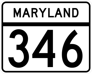
Maryland Route 346 (MD 346) is a state highway in the U.S. state of Maryland. The state highway runs 23.72 miles (38.17 km) from U.S. Route 50 Business (US 50 Business) in Salisbury east to US 50 in Berlin. MD 346 is the old alignment of US 50 between Salisbury and Berlin, connecting those cities with Parsonsburg, Pittsville, and Willards in eastern Wicomico County and Whaleyville in northern Worcester County. Much of what is now MD 346 was built as the original state road between Salisbury and Ocean City in the mid-1910s. The highway was designated US 213 in 1927 and changed to US 50 in 1949. MD 346 was first applied to Church Street in Salisbury in the 1940s; this designation was removed in 1954. MD 346 was reassigned in the mid-1960s to the old alignments of US 50 left behind after US 50's bypass of Berlin opened in the late 1950s and the US 50 divided highway was completed between Salisbury and Berlin in the mid-1960s.

<span class="mw-page-title-main">Maryland Route 353</span> Highway in Maryland

Maryland Route 353 is a state highway in the U.S. state of Maryland. Known for most of its length as Gumboro Road, the state highway runs 5.08 miles (8.18 km) from U.S. Route 50 just south of Pittsville north to the Delaware state line, where the highway intersects Delaware Route 26 and DE-MD 54. MD 353 was constructed in the mid- to late 1920s. The route was extended south from MD 346 to US 50 in Pittsville in 2016.

<span class="mw-page-title-main">Maryland Route 354</span>

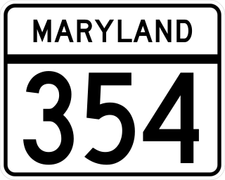
Maryland Route 354 is a state highway in the U.S. state of Maryland. The state highway runs 14.98 miles (24.11 km) from MD 12 near Snow Hill north to MD 346 in Willards. MD 354 parallels the Pocomoke River, connecting eastern Wicomico County and northwestern Worcester with Snow Hill. The state highway was first constructed from Willards in the mid-1910s. The remainder of MD 354 was completed in the late 1920s and early 1930s, with little change in the highway since.

<span class="mw-page-title-main">Maryland Route 12</span> State highway in Worcester and Wicomico Counties, Maryland, US

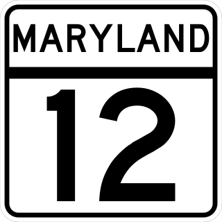
Maryland Route 12 is a state highway on the Eastern Shore in the U.S. state of Maryland. The route runs 30.57 mi (49.20 km) from the Virginia border south of Stockton, Worcester County, where it continues into Virginia as State Route 679, north to Main Street in the city of Salisbury in Wicomico County. The route is known as Snow Hill Road for most of its length and passes mostly through areas of woods and farms as well as the communities of Stockton, Girdletree, and Snow Hill. MD 12 intersects several roads including MD 366 in Stockton, U.S. Route 113 and US 113 Business in Snow Hill, MD 354 in Indiantown, and US 13 near Salisbury. Portions of MD 12 near Snow Hill and Stockton existed as unnumbered state roads by 1910. When the first state highways in Maryland were designated by 1927, MD 12 was assigned to run from Stockton north to Salisbury. By 1940, the route was extended south to the Virginia border and a small incomplete portion between Snow Hill and Salisbury was finished. A dumbbell interchange is planned at the US 113 intersection; however, this project is currently on hold.

<span class="mw-page-title-main">Maryland Route 371</span>

Maryland Route 371 is a state highway in the U.S. state of Maryland. Known for most of its length as Cedar Hall Road, the state highway runs 4.27 miles (6.87 km) from Cedar Hall Wharf Road at Cedar Hall north to Broad Street in Pocomoke City. MD 371 was constructed in segments in the first half of the 1930s. The state highway, which serves the southwestern corner of Worcester County, has been isolated from the rest of the state highway system since the northern terminus was rolled back from U.S. Route 13 Business in the 1990s.

<span class="mw-page-title-main">Maryland Route 364</span>

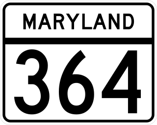
Maryland Route 364 is a state highway in the U.S. state of Maryland. Known as Dividing Creek Road, the state highway runs 5.43 miles (8.74 km) from U.S. Route 13 in West Pocomoke north to Pocomoke State Forest. MD 364 parallels the Pocomoke River and provides access to Pocomoke River State Park. The state highway was mostly constructed in the early 1930s.

<span class="mw-page-title-main">Maryland Route 363</span> State highway in the U.S. state of Maryland

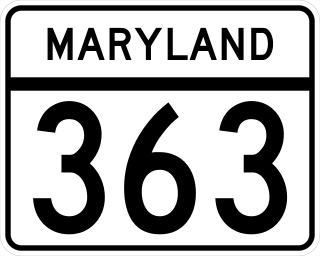
Maryland Route 363 (MD 363) is a state highway in the U.S. state of Maryland. Known for almost all of its length as Deal Island Road, the state highway runs 18.30 miles (29.45 km) from a dead end on Deal Island east to Mansion Avenue in Princess Anne. MD 363 connects Princess Anne and U.S. Route 13 (US 13) with the communities of Deal Island, Chance, and Dames Quarter on Tangier Sound in northwestern Somerset County. The state highway was constructed starting from Princess Anne around 1920, and reached Chance in the early 1930s. It was extended to Deal Island when a modern bridge to the island was constructed in 1940. MD 363 was extended to its present terminus on the island in the late 1950s.

<span class="mw-page-title-main">Maryland Route 362</span>

Maryland Route 362 is a state highway in the U.S. state of Maryland. Known as Mount Vernon Road, the state highway runs 6.23 miles (10.03 km) from Bobtown Road near Mount Vernon east to MD 675 in Princess Anne. MD 362 connects Princess Anne with northwestern Somerset County as well as southwestern Wicomico County via the Whitehaven Ferry. The state highway was constructed from U.S. Route 13 beginning in 1929. MD 363 was completed to Mount Vernon in the late 1930s.

<span class="mw-page-title-main">Maryland Route 388</span>

Maryland Route 388 is a state highway in the U.S. state of Maryland. Known for most of its length as West Post Office Road, the state highway runs 2.38 miles (3.83 km) from MD 675 in Princess Anne east to the end of state maintenance east of Princess Anne. MD 388 was constructed in the early 1930s.

<span class="mw-page-title-main">Maryland Route 529</span>

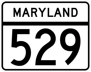
Maryland Route 529 is a state highway in the U.S. state of Maryland. The state highway runs 2.57 miles (4.14 km) from MD 675 near Princess Anne north to U.S. Route 13 near Eden in northern Somerset County. MD 529 is the old alignment of US 13. The state highway was designated from Princess Anne through Allen to Fruitland in Wicomico County when US 13 was relocated in the early 1930s. MD 529 was removed from the state highway system in segments north of its present terminus in sections in the late 1950s and early 1960s. MD 529 was redesignated along an old alignment of US 13 that had previously been MD 663 from Fruitland to Salisbury in the mid-1960s before being removed around 1981.

<span class="mw-page-title-main">Maryland Route 359</span>

Maryland Route 359 is a state highway in the U.S. state of Maryland. Known as Bypass Road, the state highway runs 1.09 miles (1.75 km) from a dead end adjacent to the junction of U.S. Route 13 and US 113 north to MD 756 within Pocomoke City. What is now MD 359 and unsigned MD 250A was part of a bypass of the center of Pocomoke City for the southernmost part of US 113 that was constructed in the mid-1930s. US 113 originally followed MD 756 to its southern terminus at what is now US 13 Business. The bypass was itself bypassed in the 1970s when US 113 was expanded to a four-lane divided highway to end at US 13.

<span class="mw-page-title-main">Special routes of U.S. Route 13</span>

U.S. Route 13 (US 13) runs along the Atlantic coastline for over 500 miles (800 km), passing through five states. Along its route, it possessed numerous special routes, which are all loops off the mainline US 13. At present, there are at least 15 special routes in existence: two in North Carolina, five in Virginia, two in Maryland, four in Delaware, and two in Pennsylvania. 13 others have existed in the past but have been deleted.

<span class="mw-page-title-main">U.S. Route 13 Business (Salisbury, Maryland)</span>

U.S. Route 13 Business is a business route of US 13 in the U.S. state of Maryland. The highway runs 8.14 miles (13.10 km) between US 13 south of Fruitland and US 13 and US 50 on the north side of Salisbury. US 13 Bus. is a four-lane highway with divided and undivided sections that provides access to Salisbury University, downtown Salisbury, where the highway intersects US 50 Bus., and Fruitland, where the highway meets Maryland Route 513 (MD 513). US 13 Bus. was constructed as a new alignment of US 13 in several steps in the 1930s and early 1940s. The section of the highway through Salisbury was originally constructed with four lanes, while the portion of the highway through Fruitland and at the northern end was expanded to a divided highway in the first half of the 1950s. US 13 Bus. was designated when US 13 was moved to the Salisbury Bypass upon its completion in 1981.

References

  1. 1 2 3 4 5 6 7 8 Highway Information Services Division (December 31, 2015). Highway Location Reference. Maryland State Highway Administration. Retrieved 2010-10-21.
  2. 1 2 Google (2010-10-21). "Maryland Route 675" (Map). Google Maps . Google. Retrieved 2010-10-21.
  3. Google (2010-10-21). "Maryland Route 675B" (Map). Google Maps . Google. Retrieved 2010-10-21.
  4. Weller, O.E.; Parran, Thomas; Miller, W.B.; Perry, John M.; Ramsay, Andrew; Smith, J. Frank (May 1916). Annual Reports of the State Roads Commission of Maryland (1912–1915 ed.). Baltimore: Maryland State Roads Commission. p. 114. Retrieved 2010-10-22.
  5. Maryland Geological Survey (1933). Map of Maryland Showing State Road System: State Aid Roads and Improved County Road Connections (PDF) (Map). Baltimore: Maryland Geological Survey.
  6. 1 2 Byron, William D.; Lacy, Robert (December 28, 1934). Report of the State Roads Commission of Maryland (1931–1934 ed.). Baltimore: Maryland State Roads Commission. pp. 31, 35. Retrieved 2010-10-22.
  7. Maryland Geological Survey (1935). Map of Maryland Showing State Road System: State Aid Roads and Improved County Road Connections (PDF) (Map). Baltimore: Maryland Geological Survey.
  8. Bonnell, Robert O.; Bennett, Edgar T.; McMullen, John J. (December 15, 1958). Report of the State Roads Commission of Maryland (1957–1958 ed.). Baltimore: Maryland State Roads Commission. p. 35. Retrieved 2010-10-22.
  9. Maryland State Roads Commission (1959). Maryland: Official Highway Map (PDF) (Map). Baltimore: Maryland State Roads Commission.
  10. Maryland State Highway Administration (1978). Maryland: Official Highway Map (PDF) (Map). Baltimore: Maryland State Highway Administration.
  11. "Project Information: MD 0675 SOMERSET AVENUE RI - AT MD 822 TO MD 362". Maryland State Highway Administration. Retrieved 2010-10-22.
  12. Highway Information Services Division (December 31, 2015). Highway Location Reference. Maryland State Highway Administration. Retrieved 2016-08-10.
  13. Maryland State Roads Commission (1963). Maryland: Official Highway Map (PDF) (Map). Baltimore: Maryland State Roads Commission.
  14. Delaware, Maryland, Virginia, West Virginia (Map). Cartography by General Drafting. Exxon. 1975.
  15. "Report on the Special Committee on U.S. Route Numbering to the Standing Committee on Highways" (PDF). American Association of State Highway and Transportation Officials. 1994-04-10. Archived from the original (PDF) on 2006-10-13. Retrieved 2010-10-22.
  16. Maryland Geological Survey (1921). Map of Maryland: Showing State Road System and State Aid Roads (PDF) (Map). Baltimore: Maryland Geological Survey.
  17. Maryland Geological Survey (1923). Map of Maryland: Showing State Road System and State Aid Roads (PDF) (Map). Baltimore: Maryland Geological Survey.
  18. McCain, Russell H.; Bennett, Edgar T.; Kelly, Bramwell (November 12, 1954). Report of the State Roads Commission of Maryland (1953–1954 ed.). Baltimore: Maryland State Roads Commission. p. 133. Retrieved 2010-10-22.
  19. 1 2 Maryland State Roads Commission (1954). Maryland: Official Highway Map (PDF) (Map). Baltimore: Maryland State Roads Commission.
  20. Maryland State Roads Commission (1958). Maryland: Official Highway Map (PDF) (Map). Baltimore: Maryland State Roads Commission.
  21. Maryland State Highway Administration (1983). Maryland: Official Highway Map (PDF) (Map) (1983–1984 ed.). Baltimore: Maryland State Highway Administration.
Template:Attached KML/Maryland Route 675
KML is from Wikidata