Mount Vernon, Maryland

Last updated

Mount Vernon, Maryland
CDP
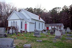
LindaRoyWallsGraceEspChurchSomCo.jpg
Grace Episcopal Church and Cemetery
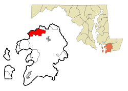
Somerset County Maryland Incorporated and Unincorporated areas Mount Vernon Highlighted.svg
Coordinates: 38°14′58″N75°47′51″W / 38.24944°N 75.79750°W / 38.24944; -75.79750
CountryFlag of the United States.svg United States
State Flag of Maryland.svg  Maryland
County Flag of Somerset County, Maryland.svg Somerset
Area
[1]
  Total15.65 sq mi (40.53 km2)
  Land13.03 sq mi (33.74 km2)
  Water2.62 sq mi (6.79 km2)
Elevation
7 ft (2 m)
Population
 (2020)
  Total761
  Density58.42/sq mi (22.55/km2)
Time zone UTC−5 (Eastern (EST))
  Summer (DST) UTC−4 (EDT)
ZIP code
21853 [2]
Area code(s) 410 and 443 and 667
FIPS code 24-54375
GNIS feature ID0590845

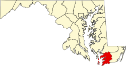
Mount Vernon is a census-designated place (CDP) in Somerset County, Maryland, United States. [3] The population was 761 at the 2000 census. It is included in the Salisbury, Maryland-Delaware Metropolitan Statistical Area.

Contents

Geography

Mount Vernon is located at 38°14′58″N75°47′51″W / 38.24944°N 75.79750°W / 38.24944; -75.79750 (38.249456, −75.797422). [4]

According to the United States Census Bureau, the CDP has a total area of 15.9 square miles (41 km2), of which 13.1 square miles (34 km2) is land and 2.8 square miles (7.3 km2) (17.59%) is water.

Demographics

Historical population
CensusPop.Note
2020 761
U.S. Decennial Census [5]

As of the census [6] of 2000, there were 761 people, 311 households, and 227 families residing in the CDP. The population density was 58.0 inhabitants per square mile (22.4/km2). There were 402 housing units at an average density of 30.6 per square mile (11.8/km2). The racial makeup of the CDP was 75.69% White, 23.26% African American, 0.39% Native American, 0.13% Asian, and 0.53% from two or more races. Hispanic or Latino of any race were 0.79% of the population.

There were 311 households, out of which 23.5% had children under the age of 18 living with them, 57.9% were married couples living together, 9.3% had a female householder with no husband present, and 26.7% were non-families. 24.4% of all households were made up of individuals, and 13.5% had someone living alone who was 65 years of age or older. The average household size was 2.45 and the average family size was 2.86.

In the CDP, the population was spread out, with 20.2% under the age of 18, 6.7% from 18 to 24, 25.8% from 25 to 44, 28.3% from 45 to 64, and 19.1% who were 65 years of age or older. The median age was 44 years. For every 100 females, there were 106.2 males. For every 100 females age 18 and over, there were 105.8 males.

The median income for a household in the CDP was $43,750, and the median income for a family was $48,289. Males had a median income of $34,271 versus $34,432 for females. The per capita income for the CDP was $19,919. About 10.2% of families and 17.3% of the population were below the poverty line, including 30.5% of those under age 18 and 15.8% of those age 65 or over.

Community

As of 2010, Mt. Vernon has four churches, one country store, Webster's Cove Marina, and the Mt. Vernon Volunteer Fire Company, which celebrated its 25th anniversary in 2007. Grace Episcopal Church was listed on the National Register of Historic Places in 1990. [7]

Related Research Articles

<span class="mw-page-title-main">Vine Hill, California</span> Census-designated place in California, United States

Vine Hill is a census-designated place (CDP) in Contra Costa County, California, United States. The population was 3,761 at the 2010 census. It is located 2.25 miles (3.6 km) east of downtown Martinez.

<span class="mw-page-title-main">Morada, California</span> Census-designated place in California, United States

Morada is a census-designated place (CDP) in San Joaquin County, California, United States. The population was 3,166 at the 2020 census, down from 3,828 at the 2010 census.

<span class="mw-page-title-main">Laguna Beach, Florida</span> Census-designated place in Florida, United States

Laguna Beach is a census-designated place (CDP) in Bay County, Florida, United States. The population was 3,932 at the 2010 census. It is part of the Panama City–Lynn Haven–Panama City Beach Metropolitan Statistical Area. Laguna Beach was named for the many coastal dune lakes unique to this area of Northwest Florida.

<span class="mw-page-title-main">Pine Ridge, Collier County, Florida</span> Census-designated place in Florida

Pine Ridge is a census-designated place (CDP) in Collier County, Florida, United States. The population was 1,918 at the 2010 census. It is part of the Naples–Marco Island Metropolitan Statistical Area.

<span class="mw-page-title-main">Chance, Maryland</span> CDP in Maryland, United States

Chance is a census-designated place (CDP) in Somerset County, Maryland, United States. The population was 377 at the 2000 census. It is included in the Salisbury, Maryland-Delaware Metropolitan Statistical Area.

<span class="mw-page-title-main">Dames Quarter, Maryland</span> CDP in Maryland, United States

Dames Quarter is a census-designated place (CDP) in Somerset County, Maryland, United States. The population was 188 at the 2000 census. It is included in the Salisbury, Maryland-Delaware Metropolitan Statistical Area.

<span class="mw-page-title-main">Eden, Maryland</span> CDP in Maryland, United States

Eden is a census-designated place (CDP) in Somerset County, Maryland, United States. The Eden zip code (21822) also includes parts of Wicomico and Worcester counties. The population was 793 at the 2000 census. It is included in the Salisbury, Maryland-Delaware Metropolitan Statistical Area.

<span class="mw-page-title-main">Fairmount, Maryland</span> CDP in Maryland, United States

Fairmount is a census-designated place (CDP) in Somerset County, Maryland, United States. The population was 537 at the 2000 census. It is included in the Salisbury, Maryland-Delaware Metropolitan Statistical Area.

<span class="mw-page-title-main">Frenchtown-Rumbly, Maryland</span> CDP in Maryland, United States

Frenchtown-Rumbly is a census-designated place in Somerset County, Maryland, United States. The population was 96 at the 2000 census. It is included in the Salisbury, Maryland-Delaware Metropolitan Statistical Area.

<span class="mw-page-title-main">West Pocomoke, Maryland</span> CDP in Maryland, United States

West Pocomoke is a census-designated place (CDP) in Somerset County, Maryland, United States. The population was 498 at the 2000 census. It is included in the Salisbury, Maryland-Delaware Metropolitan Statistical Area.

<span class="mw-page-title-main">Cordova, Maryland</span> Village in Maryland, United States

Cordova is a village in Talbot County, Maryland, United States. The population was 592 at the 2000 census.

<span class="mw-page-title-main">Mount Aetna, Maryland</span> CDP in Maryland, United States

Mount Aetna is a census-designated place (CDP) in Washington County, Maryland, United States. The population was 838 at the 2000 census.

<span class="mw-page-title-main">Girdletree, Maryland</span> CDP in Maryland, United States

Girdletree is a census-designated place in Worcester County, Maryland, United States. The population was 149 at the 2010 census. It is part of the Salisbury, Maryland-Delaware Metropolitan Statistical Area.

<span class="mw-page-title-main">Newark, Maryland</span> CDP in Maryland, United States

Newark is a census-designated place (CDP) in Worcester County, Maryland, United States. The population was 339 at the 2000 census. It is part of the Salisbury, Maryland-Delaware Metropolitan Statistical Area.

<span class="mw-page-title-main">West Ocean City, Maryland</span> CDP in Maryland, United States

West Ocean City is a census-designated place (CDP) in Worcester County, Maryland, United States. The population was 4,375 at the 2010 census. It is part of the Salisbury, Maryland-Delaware Metropolitan Statistical Area.

<span class="mw-page-title-main">Whaleyville, Maryland</span> CDP in Maryland, United States

Whaleyville is a census-designated place in Worcester County, Maryland, United States. The population was 149 at the 2010 census. It is part of the Salisbury, Maryland-Delaware Metropolitan Statistical Area.

<span class="mw-page-title-main">Vernon Valley, New Jersey</span> Populated place in Sussex County, New Jersey, US

Vernon Valley is an unincorporated community and census-designated place (CDP) located in Vernon Township, in Sussex County, in the U.S. state of New Jersey. As of the 2010 United States Census, the CDP's population was 1,626.

<span class="mw-page-title-main">Fort Hunt, Virginia</span> Census-designated place in Virginia, United States

Fort Hunt is a census-designated place (CDP) in Fairfax County, Virginia, United States. The area is named after Fort Hunt, which was built on the bank of the Potomac River in 1897 to defend Washington, D.C. from naval attack and is now a public park. The area is also notable for its high population of senior citizens and for being one of the first suburbs in wealthy Fairfax County. The population was 16,045 at the 2010 census.

<span class="mw-page-title-main">Mount Vernon, Virginia</span> Census-designated place in Virginia, United States

Mount Vernon is a census-designated place (CDP) and unincorporated community in Fairfax County, Virginia, United States. The population was 12,416 at the 2010 census. Primarily due to its historical significance and natural recreation and beauty, the Mount Vernon area receives over one million tourists each year.

<span class="mw-page-title-main">Oak Level, Virginia</span> CDP in Virginia, United States

Oak Level is a census-designated place (CDP) in Henry County, Virginia, United States. The population was 857 at the 2010 census. It is part of the Martinsville Micropolitan Statistical Area.

References

  1. "2020 U.S. Gazetteer Files". United States Census Bureau. Retrieved April 26, 2022.
  2. "Mount Vernon MD ZIP Code". zipdatamaps.com. 2023. Retrieved April 18, 2023.
  3. U.S. Geological Survey Geographic Names Information System: Mount Vernon, Maryland
  4. "US Gazetteer files: 2010, 2000, and 1990". United States Census Bureau. February 12, 2011. Retrieved April 23, 2011.
  5. "Census of Population and Housing". Census.gov. Retrieved June 4, 2016.
  6. "U.S. Census website". United States Census Bureau . Retrieved January 31, 2008.
  7. "National Register Information System". National Register of Historic Places . National Park Service. July 9, 2010.