Upper Fairmount, Maryland | |
|---|---|
 Christ United Methodist Church | |
 Upper Fairmount  Upper Fairmount | |
| Coordinates: 38°06′14″N75°47′29″W / 38.10389°N 75.79139°W | |
| Country | |
| State | |
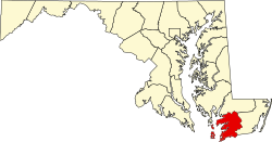
| County | |
| Elevation | 3 ft (0.91 m) |
| Time zone | UTC-5 (Eastern (EST)) |
| • Summer (DST) | UTC-4 (EDT) |
| ZIP code | 21867 |
| Area codes | 410, 443, and 667 |
| GNIS feature ID | 591458 [1] |
Upper Fairmount is an unincorporated community in Somerset County, Maryland, United States. [1] It is located at the intersection of Maryland Route 361 (Fairmount Road) and Upper Hill Road. The Academy Grove Historic District, Maddux House, Schoolridge Farm, Tudor Hall, and Upper Fairmount Historic District are listed on the National Register of Historic Places. [2]